|
 
|
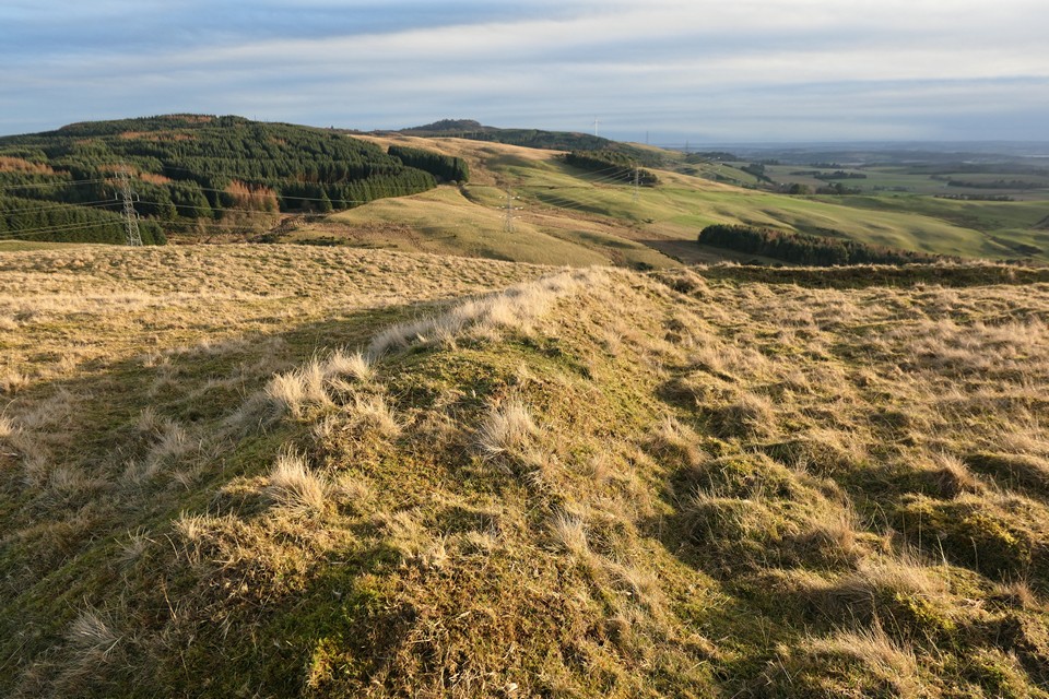
25/06/2022 – Ben Uarie, I’d been here back in 2010. I remembered it as a good walk but just one of a few that trip. I hadn’t forgotten about it though as on a clear day you can see it from Bennachie in Aberdeenshire some 118km away. I love seeing the big hills to the north from lovely Bennachie. Always makes me want to go on a trip.
Some years after our trip, Gladman posted about a cairn here and reading his notes and seeing the photos made me see the top anew. I made up my mind to revisit the hill if the chance arose and look again.
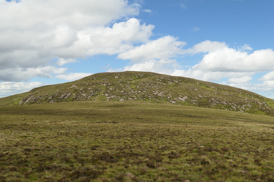
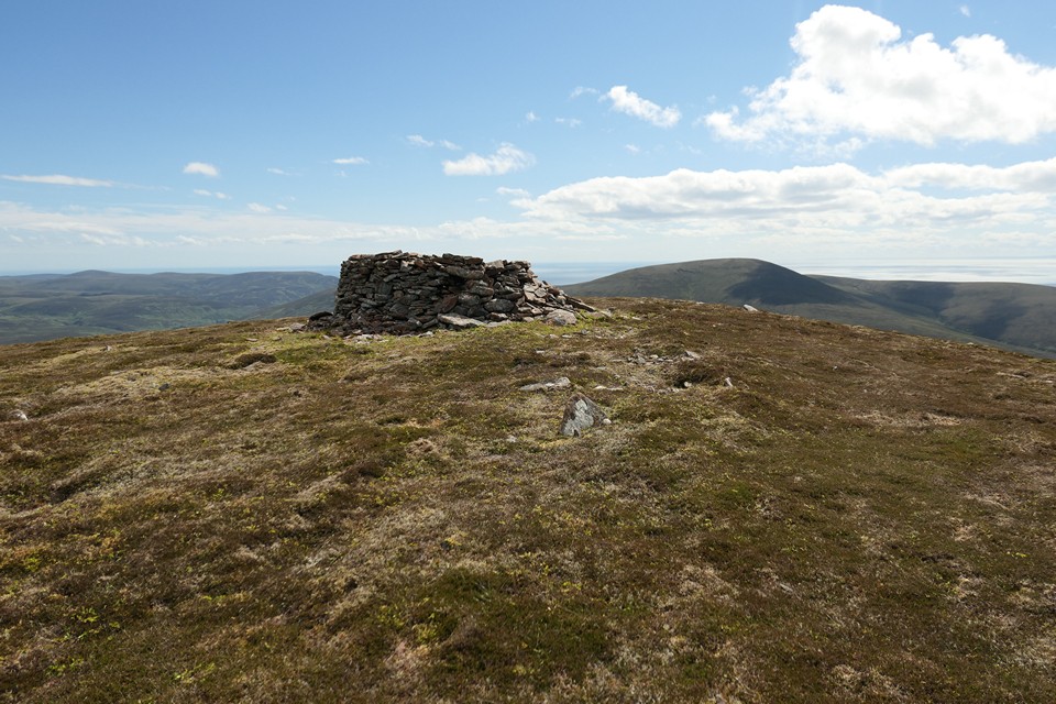
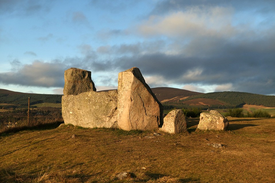
Last time it was a bob up and down from the high point on the road through Glen Loth. This time we decided to make a loop of the tops round Glen Sletdale. Good parking where Glen Sletdale meets Glen Loth. Starting here had the added bonus that we didn’t have to drive too far up the Glen Loth road thankfully, the memories from last time still haunt me! As single track roads go it’s beautiful but one you drive praying nothing’s coming the other way. Still grass growing up the middle but a few sections have been resurfaced. Starting here also meant we could visit the two standing stones overlooking the river. I really liked these two and what a lovely spot. From here it’s a good plod up the hill to Beinn Dhorain and then over to Ben Uarie. Weather was sunny though a little windy. I was tired by the time we reached the trigpoint. Unlike last time, we had a good look at the top. As Gladman mentions, the OS 1:25k map has cairn marked in antiquarian typeface. There did look to be a footprint beneath the trig and wind shelter. I liked the look of it as a probable cairn. The view from the top is very good, we found a spot a bit out of the wind for a sit and bite to eat. I was really happy to have made the trip back to this one. The top is an interesting mystery worth visiting.
This top is not the only one marked with a cairn in antiquarian typeface on the map. Some 2.5km to the west was our next destination on our walk round the glen, the top called The Craggan. Easy enough walk across. The Craggan is a great looking lump. The last bit is a bit steep but the top is soon reached. I’ll post a few photos of the top. There is a modern cairn but also something larger underneath. Not really like the one on Ben Uarie. I just couldn’t make my mind up about this one.
We continued on for the rest of the day on a lovely walk. It’s worth a visit here, very quiet, great views and two tops with something going on, maybe, just maybe.
|
    
|
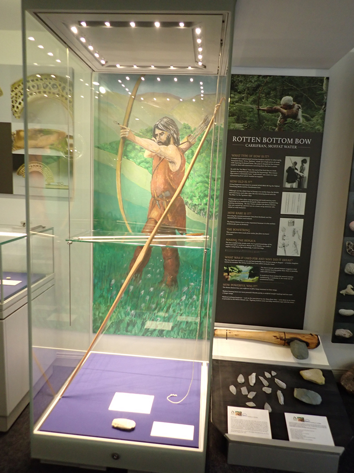
17/05/2022 & 02/06/2022 – The Quest for the Rotten Bottom Bow
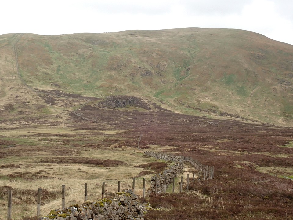
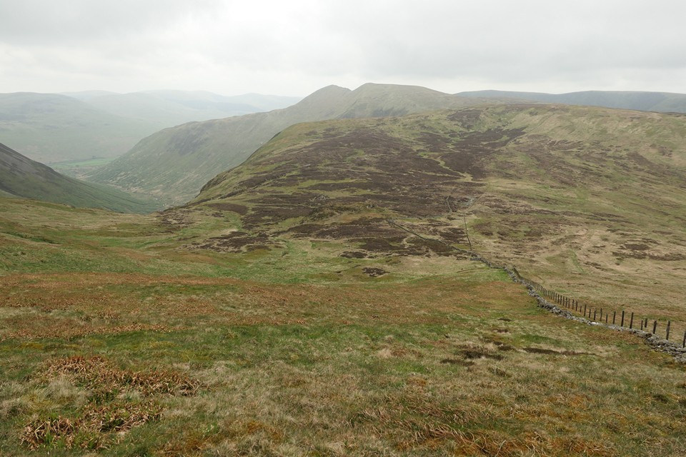
We were tired by the time we reached Rotten Bottom. We made our way over to Games Castle, a large outcrop there with a fine view, a perfect place to sit and have our sandwiches. Starting from Grey Mare’s Tail, a slow plod up to Loch Skeen then Lochcraig Head, across to White Coomb to look at the two small cairns and then a nice walk to here, Rotten Bottom on the way to Saddle Yoke. It’s a good day and this in-between place was quiet.
After a much needed rest it was time to carry on across Rotten Bottom. It’s such a good name for this place, a large flat area above the steep drop down to Carrrifran Burn. After a short distance we gave up trying to keep the boots dry, the ground was so soft and very wet. Not a good place to walk but it was here in 1990, at the base of a peat hag (about 660m) that the Rotten Bottom Bow was found.
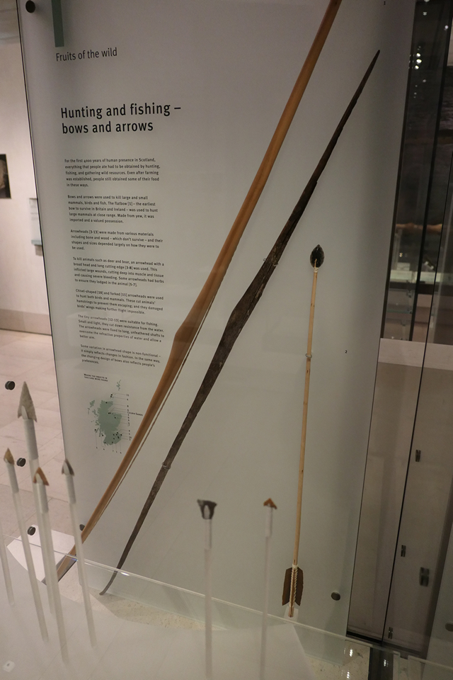
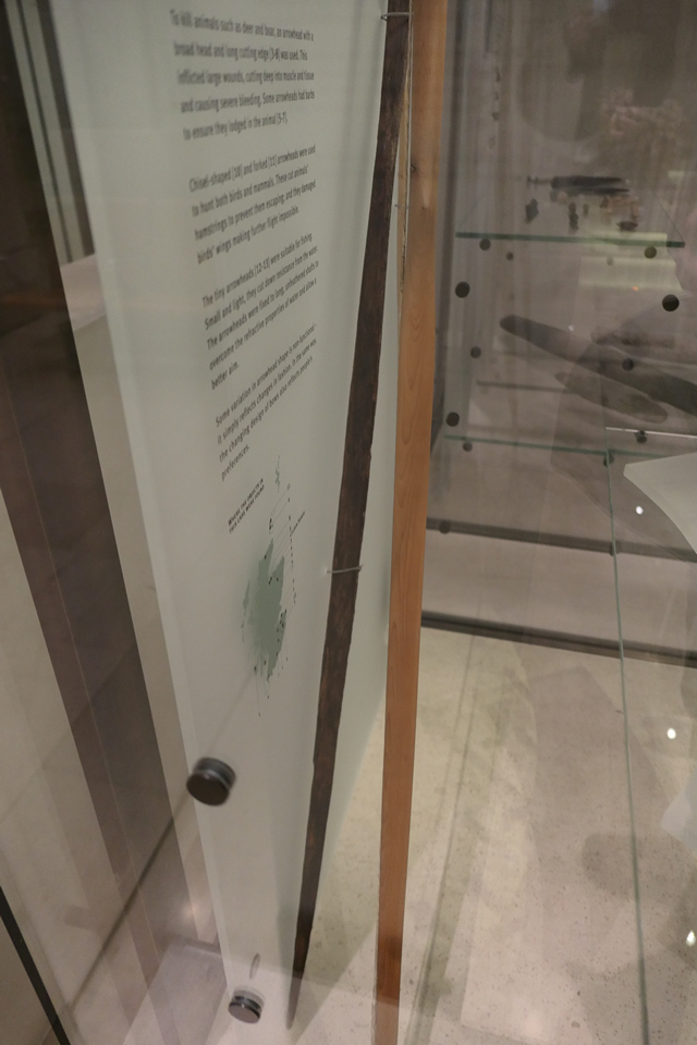
The flat bow was found broken but still 1.36m in length (original length 1.74m). Radiocarbon dated to 4040–3640 BC, placing it in the Early Neolithic and at 6000 years the oldest bow found in Britain and Ireland. Made from yew, not local as yew didn’t grow round this area at the time. How such a fine bow ended up here in this out of the way place is anyone’s guess. Someone out hunting and discarded it when it broke maybe.
We talked about the bow and who it might have belonged to as we walked. It was not long until we had made up our minds to seek out this bow, the Quest for the Rotten Bottom Bow had begun.
We were staying in Moffat that week so a few days later popped by the small Moffat Museum. The re-opening of the Museum in 2013 took place by shooting a replica of the Rotten Bottom Bow. It’s nice inside with interesting history about the Moffat area. There is a fine replica of the bow too. We learnt that the original was now in the National Museum of Scotland.
The week after we were back home from Moffat and with a long weekend coming up, we decided to continue our quest and head for Edinburgh. Last minute hotels were a bit pricey in the capital so we went for Stirling as a base instead (never been to the castle there before so that was a bonus). Thursday morning, 16 days after our walk to Rotten Bottom, we were on the early train to Edinburgh. The National Museum of Scotland really is a wonderful place, busy but worth putting up with all the people just to see all the amazing stuff. I like the Pre-history section. It’s kind of tucked away at the side, down a flight of stairs. Also one of the quieter areas in the Museum. I’d been here before but didn’t remember the bow. Making our way past objects I normally would have stopped by and looked at, we continued on, it’s a bit of a maze down there, but the end of our quest felt close. Soon I spotted arrow heads in a display case, rounding a corner, there it was. Tucked away at the back with little fanfare was the oldest found bow in Britain and Ireland. It deserved more but I liked it’s low key style, find me but only if you want to. At first the bow seems nothing much to look at but I was really taken with it. It was quite narrow and elegant. There is a seat nearby so we sat and gazed across, catching our breath. It was a warm day outside, it felt good to rest in the dark and cooler place. Maybe we had walked a bit quicker than normal to get here. The excitement getting to us. Such a good adventure and just great to see the bow after our trip to Rotten Bottom a few weeks back.
Our quest to find the Rotten Bottom Bow had come to a successful end, it was time to go find a coffee and bit of cake to celebrate.
|
Video of shooting of a replica of the Rotten Bottom Bow at the re-opening of the Museum in 2013.
|

Nice article about the Rotten Bottom Row
|
Site record for Rotten Bottom Bow
|
     
|
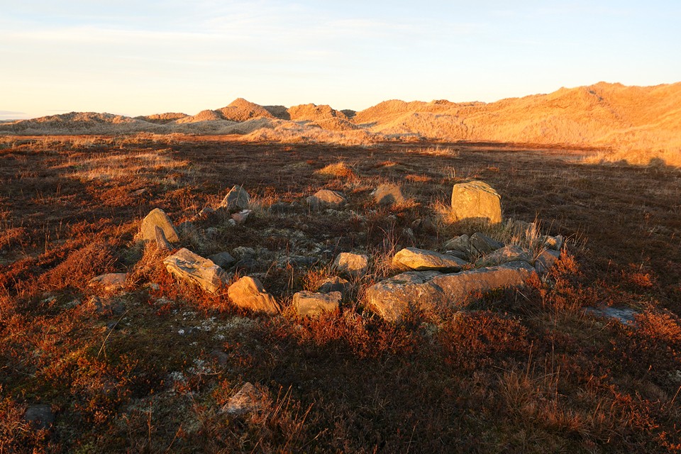
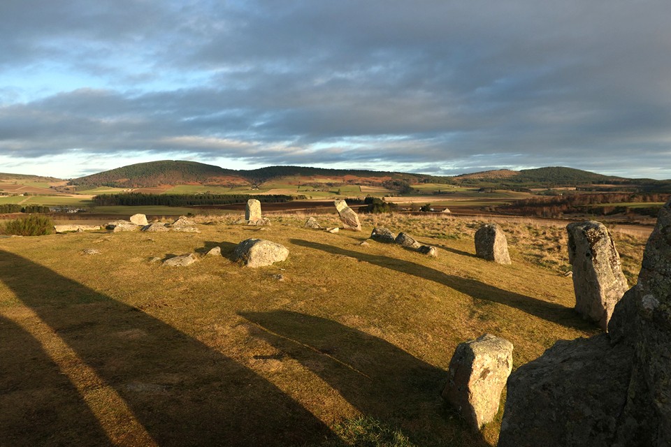
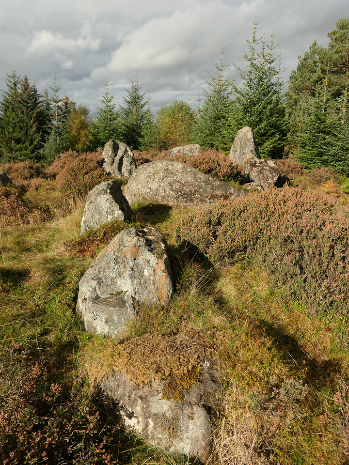
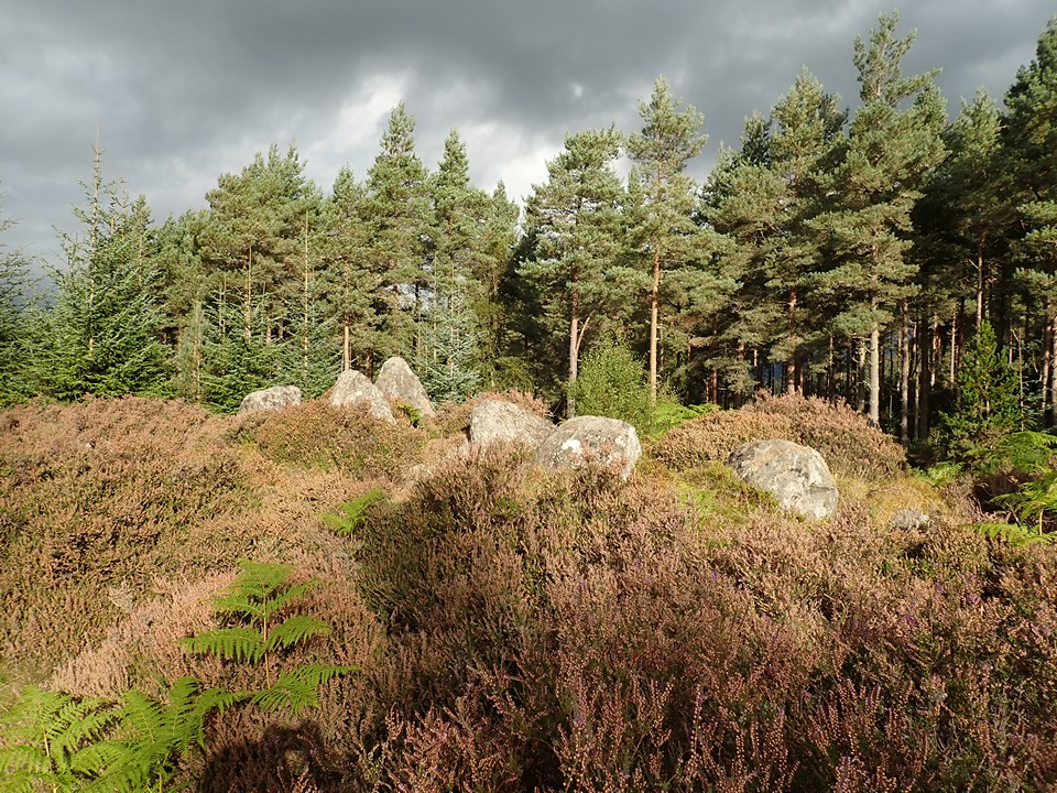
17/05/2022 - Two cairns approx 100m apart sit on the summit of White Coomb. They are on Canmore and written in italics on the OS map. Both have a good sized footprint, 9.0m or so in diameter. Low in height and grassed over. There is a small modern cairn on one to mark the top of the hill. They are nothing flash but I liked them. The view and feeling of space is very good here.
We started from the car park at Grey Mare's Tail. Up to Loch Skeen then Lochcraig Head, White Coomb, Rotten Bottom and Saddle Yoke. Down to the road to walk back to the car. Good day out. It's nice round here.
|

|
 
|
|
12/02/2022 – I need the quiet places more with each passing year. Early starts or late to avoid folk. Everywhere seems so busy at the moment. Heading out round sunset has been a bit of a life saver over winter. We were thinking of heading more inland today but the wind wasn’t great so decided to go to Tap o’ Noth. Got there about 30 mins before sunset. Empty car park so we had the hill to ourselves. Starting our walk in lovely late sunshine, it’s less than an hour to the top. We looped round east on the way up instead of the normal climb from the west. The Sun had gone to bed by the time we reached the hillfort. Twilight, I love these next two hours. The wind was cold as we walked to the trigpoint and the top just beyond, a really good lump of vitrified wall. We ducked out of the wind and plonked ourselves down inside the fort to have our tea. The walls of the hillfort shut out all the lights from down below, leaving just us and the emerging stars as the sky started to darken. Just a few days to full moon so no need for headtorches. The fort was now gently lit by moonlight. I’ve been trying to remember better the names of constellations recently instead of pointing and saying to Mrs T, ‘What’s that one called again?’ all the time. I’m pretty hopeless at it. Why can’t they all be easy like Orion. I stood up after a bit as I had been sitting cross legged for a while, which is always comfy until it isn’t. Sticking my head up over the walls, the wind reminded me quickly why we were sitting where we were. It felt colder in the dark. I didn’t stand long on the walls and soon hurried back to the sanctuary inside the fort and another warm brew. Last time we were here in the dark, I didn’t have a great feeling but this evening the fort felt safe and from inside the walls, the sky looked a perfect planetarium. We stayed as long as we could but the cold was getting into my hands so it was time to go. The walk down was by moonlight and we only needed our torches when we reached the trees. Tap o’ Noth is a fantastic place and wonderful hillfort. Just a lovely trip there today, away from the busy world.
|

|
 
|
 
|
04/01/2022 – Early morning start. Good parking at Balkello Community Woodland. It can get busy here so if you like a quiet walk go early. Lots of tracks through the wood but really just head north. The track for the hill is soon reached. It’s a short climb up Auchterhouse Hill. Nice tree covered top. Partial multivallate hillfort with 5 ramparts on the SE side. The path goes through these. Very good views from the top. We were there for sunrise. Really worth a visit to this one.
We continued on east over the tops via Craigowl Hill (trigpoint sits on a big lump, would love to know if this is an old cairn?) to Ironside Hill and then back to the car via Coldstream. Nice day out, cold wind and it snowed a bit but lovely sunshine too. Auchterhouse Hill hillfort was a nice way to start the day.
|
  
|
03/01/2022 – From Kinpurney Hill we headed east to visit Henderston Hill. Not one of my better ideas as the windblow on the top was terrible. We made it back to East Kinpurney Hill in one piece thankfully. We stopped here as it looked a good place for a sit and our sandwiches. The view is very good and it’s peacefully away from the fort on Kinpurney Hill which can get a little busy. Quick check on the internet I noticed we were sitting about 90m from a cairn so we took the short stroll over to have a look.
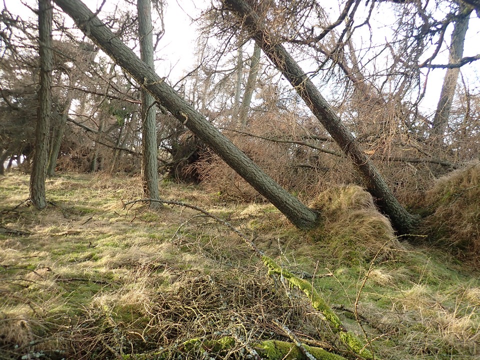
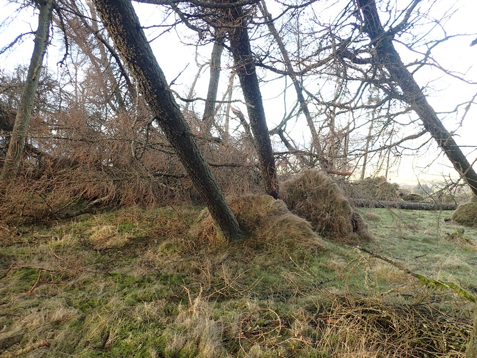
The cairn is a scheduled monument. 6m in diameter, 0.4m in height and there is a faint ditch of about 2m wide surrounding it. It’s in a small copse of trees though sadly a lot of them have not survived the storm at the end of last November. The cairn is pretty non-existent. Very hard to make anything out. The ditch round it was there. There are two trees on it which are proper leaning now. Looking at the ground that’s been exposed it didn’t look much like cairn material.
The area is nice for a walk.
|
     
|
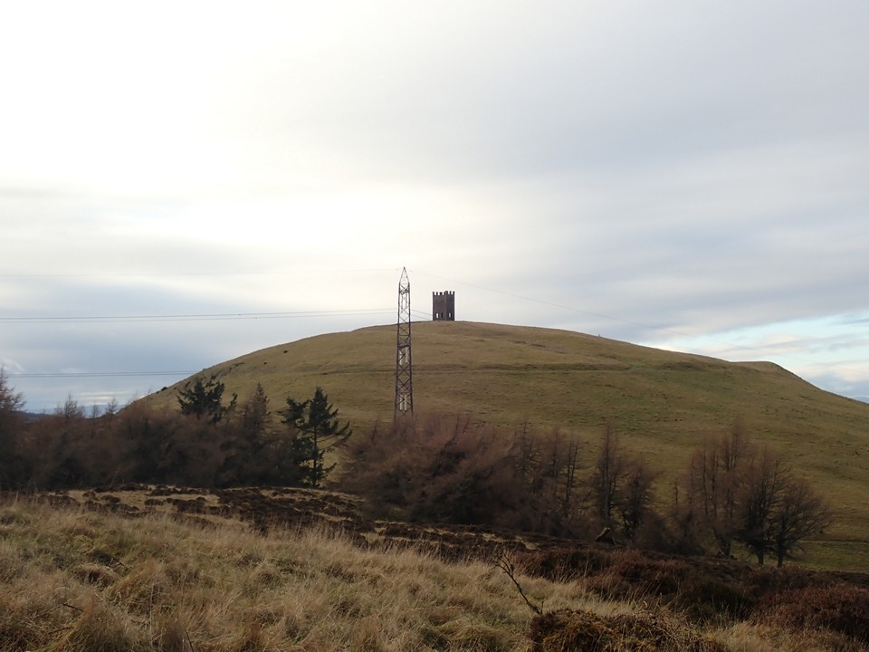
03/01/2022 – Start of a new year, hopefully this one turns out a bit more ‘normal’. A few days of walking in the Sidlaw Hills sounded as good a way to kick off the year as any. Kinpurney Hill is a fine hill. Good parking in Newtyle. Walked down road to Denend and then took the sign posted path up the Den. This is a lovely, wooded walk by a stream, bit muddy but very pretty. Coming out of the trees, the path heads up the hill. Bit steep and a little slippy in places but nothing too bad.
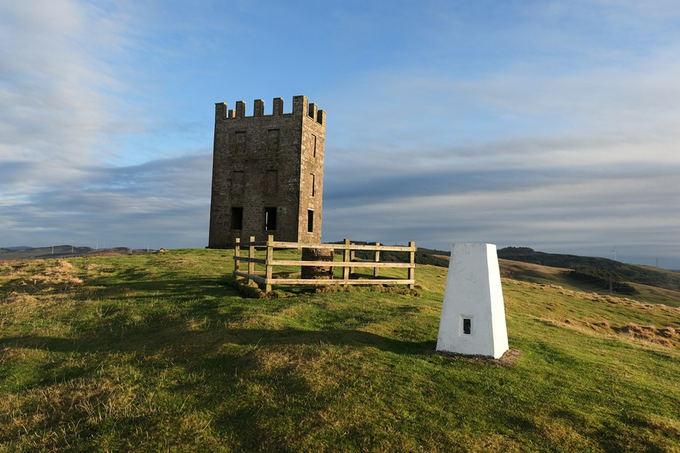
The fort is enclosed by a single rampart and ditch. It’s a fair-sized interior, area of 6.6ha making this the largest hillfort in Angus. Kinpurney Hill is probably better known for the tower on top. It’s an observatory, built 1774. There is a low grass bank surrounding the tower, probably unrelated to the hillfort.
Some have this hillfort as 'unfinished'. Also maybe vitrified, but probably not as the rocks are volcanic (best seen at base of tower).
Really worth the walk up. The views are fantastic from the top. The big snowy hills to the west and north looked great.
|
    
|
|
26/09/2021 – A fine walk today. Starting from Strathpeffer, first up to the trig on Cnoc Mor, then a nice visit to Bealachnancorr chambered cairn (liked this one very much). Next we headed over the top of Cnoc a' Mhuilinn-Thairbh to see if we could find this chambered cairn in Brahan Wood. The wood is really lovely and on a sunny day like today the stroll between the two cairns was very nice indeed. There are lots of tracks in this area so take a map, easy to get a bit lost. The cairn is in a quiet area of the wood. Not too hard to find. There is not much left of the cairn, like Bealachnancorr, just the remaining stones of the chamber. Not really that tall, hiding away a little in the grass and moss. What I first thought was the passage looked too wide and more like a second chamber. This could have been a big old cairn back in the day. There’s a big stone between the two chambers and another large stone lying just outside. The cairn sits on a small terrace and would have had a wonderful view out across the land I think. It’s within a wood now and on a sunny day just looked fantastic. We plonked ourselves down beside the cairn to have our sandwiches and a brew. Bit tired as the day was warm and humid. Such a peaceful vibe to the place. Soon felt a bit sleepy. The tall grasses picking up the light from the sun, the tree tops gently moving with the light breeze, just wonderful. The ground was full of life. We daydreamed a bit and watched spiders and bugs go about their daily business. Up and over our socks and on past our discarded boots to some important destination only known to them. Even the odd wasp that went by seemed pretty chilled out today. We really had such a lovely time here. There are better cairns around but today this one and its setting felt pretty perfect to us. Finally we left to walk the quiet road round Loch Ussie to visit the wonderful vitrified fort on Knock Farril. Then back to Strathpeffer via the very nice Touchstone Maze (built in the 90's using rocks from all over Scotland. It's really well done with lots of alignments for summer, winter etc). Top day out.
|
 
|
26/09/2021 – Scotland has a great access code but sometimes it can be tricky finding the best path to take out of a village or town. The start of a walk can be the hardest part I think. Core paths are a great help for this. Link below to map in case it’s of use to anyone.
Map of core paths in Scotland
https://www.nature.scot/enjoying-outdoors/routes-explore/local-path-networks
Straight up signposted core path from Strathpeffer to first head for Cnoc Mor then paths heading down to the chambered cairn. Route was pretty overgrown and finding the site was fun. Lots of twisty paths through the trees.
The cairn is really nice. Just the stones of the passage and chamber left. The location is good and very peaceful. We stayed for a good bit, waiting on the sun to shine. It was playing hide and seek behind the clouds this morning.
Really glad we went looking for this one. Good stones with a nice vibe. I do like an Orkney-Cromarty cairn. Missed it last time we visited the trig on Cnoc Mor. The area is fine for walking, short stroll or a full day out. Like most places, best on a sunny day, take your time if you go.
|
We travel the Spaceways
Snaps of the stuff we see along the way
https://www.flickr.com/photos/spaceways/
https://toot.community/@Spaceways
|
|