The Modern Antiquarian
Log in
|
Register
Home
Latest Posts
Forums
Maps
Help
Browse Sites
News
Blog
Contributors
The Books
Select
-
Belgium
Denmark
Eire
France
Germany
Greece
Italy
The Netherlands
Norway
Portugal
Republic of Malta
Spain
Sweden
Switzerland
United Kingdom
County Westmeath
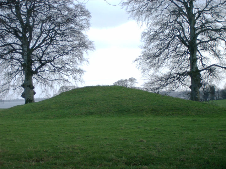
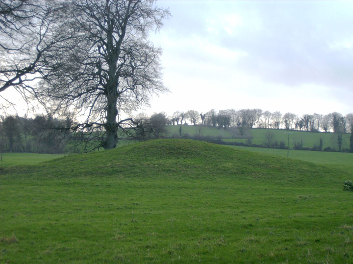
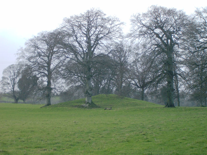
Portloman
Round Barrow(s)
Portloman (Round Barrow(s)) on The Modern Antiquarian, the UK & Ireland's most popular megalithic community website. 3 images, plus information on many more ancient sites nearby and across the UK & Ireland.
Image © Alan Lee
Nearest Town:
Mullingar (7km SE)
OS Ref (IE):
N389580 /
Sheet: 41
Latitude:
53° 34' 13.6" N
Longitude:
7° 24' 45.94" W
Added by
Alan Lee
Images (3)
0 discussions
Start a topic
Show |
Hide
Web searches for Portloman
Flickr
Google
Google Images
The Megalithic Portal
Bing
Stone Pages
Wikipedia
Show map
(inline Google Map)
- Sites within 20 km -
-
Portloman (0.36km E) (4 posts)
Coolnahay (4.59km SW) (4 posts)
Tuitestown (5.76km SSW) (4 posts)
Tannenhausen (7.26km SW) (14 posts)
School Boy (9.06km SE) (0 posts)
Ballinlug (9.65km WSW) (4 posts)
Tullanisky (10.42km SE) (0 posts)
Loughan (10.42km WSW) (5 posts)
Ballymorin (12.14km WSW) (4 posts)
Corbally (12.25km ESE) (0 posts)
Glomerstown (12.55km SSW) (0 posts)
Taghboyne (12.81km SW) (0 posts)
Mweelra (12.91km SW) (2 posts)
Rathnew (13.12km SW) (7 posts)
Hill of Uisneach Cairn (13.27km SW) (5 posts)
Ushnagh Hill (13.27km SW) (0 posts)
Cappaghjuan (13.33km WSW) (3 posts)
Lalistown/Rathnew (13.33km SW) (0 posts)
Ushnagh Hill (13.54km SW) (1 post)
Ushnagh Hill (13.54km SW) (2 posts)
Aill na Mireann (13.68km SW) (8 posts)
Kellybrook (13.69km SW) (0 posts)
Lalistown (13.79km SW) (0 posts)
Lilliput (14.02km S) (0 posts)
Dunboden Park (14.34km SE) (0 posts)
Kileen (14.61km SSW) (0 posts)
St. Brigid's Well (14.63km SW) (2 posts)
Beggstown (14.82km SE) (0 posts)
Gibbonstown (15.49km SE) (0 posts)
Calverstown (15.94km SSE) (0 posts)
Lakill and Moortown (16.04km NE) (12 posts)
Lakill and Moortown (16.1km NE) (0 posts)
Rathskeagh Upper (16.5km WSW) (0 posts)
Killulagh (17.38km ENE) (2 posts)
Fore (17.7km NE) (4 posts)
Lickbla (18.04km NNE) (10 posts)
Sarsfieldstown/Rathwire Upper (18.04km E) (4 posts)
Christianstown (18.5km NE) (5 posts)
Greenan (18.73km E) (1 post)
Curry (18.87km NNE) (0 posts)
Pass of Kilbride (19.04km ESE) (5 posts)
Balrath North (19.28km E) (2 posts)
Glenidan (19.34km NE) (2 posts)
Bigwood (19.5km NNE) (7 posts)
Boolies (19.58km E) (0 posts)
- Add -
-
Add news
Add an image
Add fieldnotes
Add folklore
Add miscellaneous
Add a link
-
Add a site
Add a nearby facility
Add an alternative name/spelling
Images
(click to view fullsize)
Add an image
 Image © Alan Lee