|
|

|
|
Pilsdon PenHillfort
|
||||||||||||||||||||||||
|
|
|
Images (click to view fullsize) |
|
Photographs: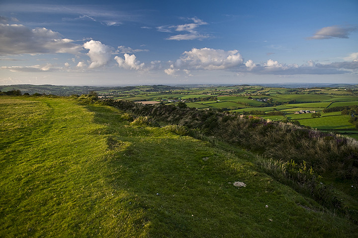
 Maps / Plans / Diagrams:
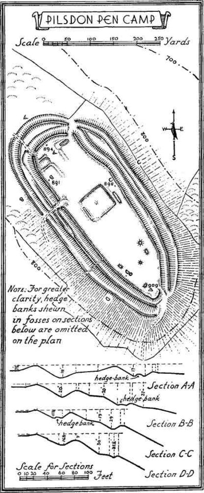
|
Fieldnotes |
|
|
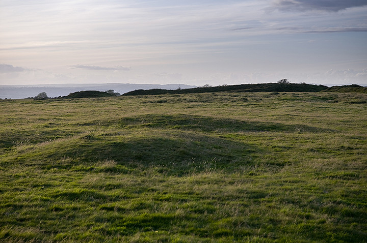
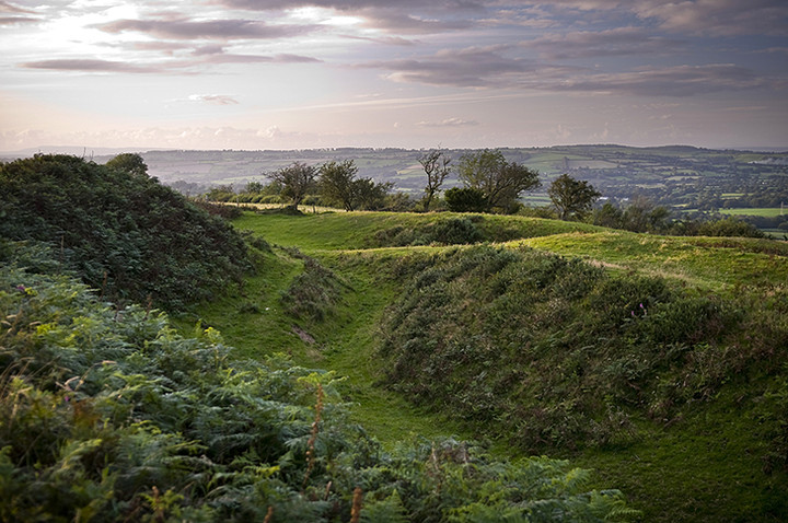
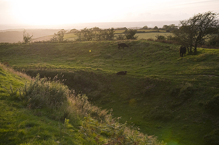
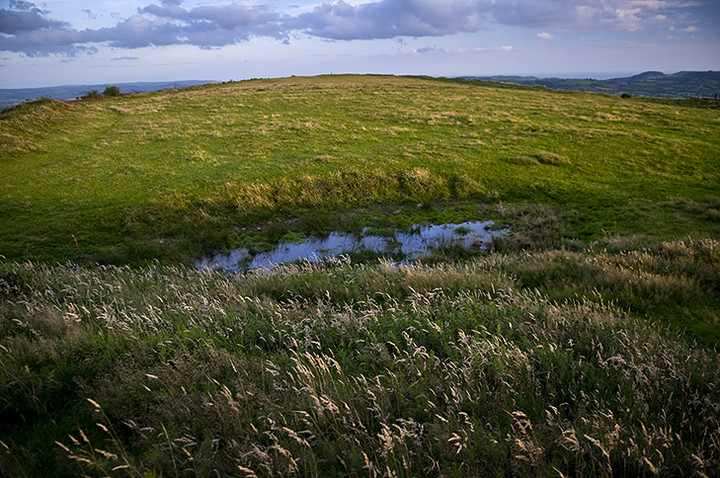
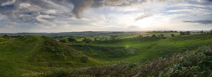
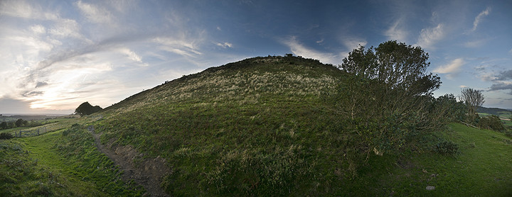
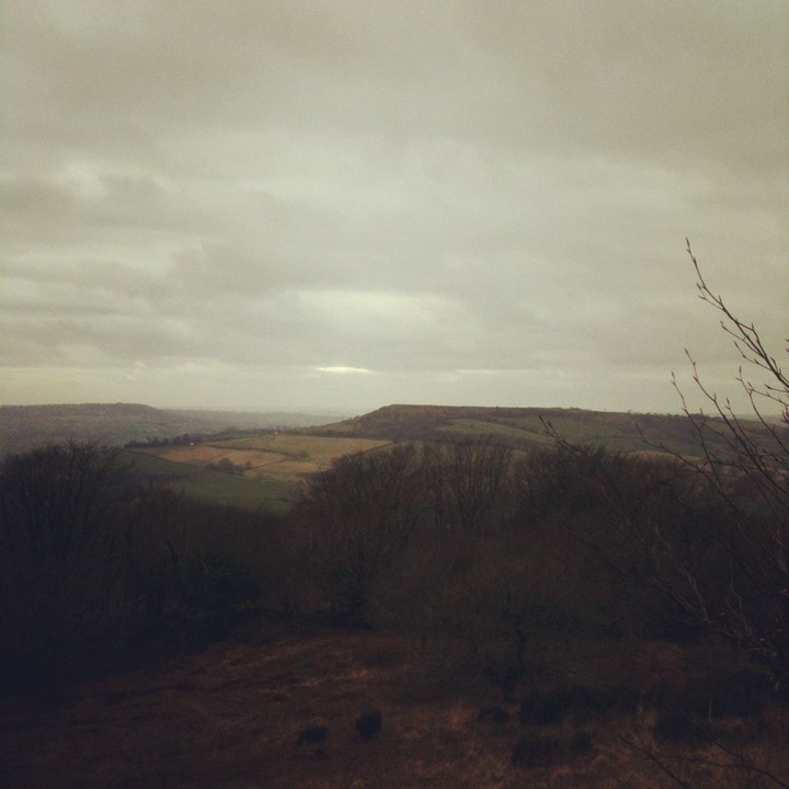
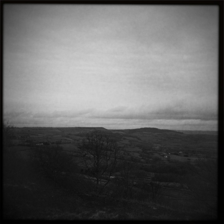
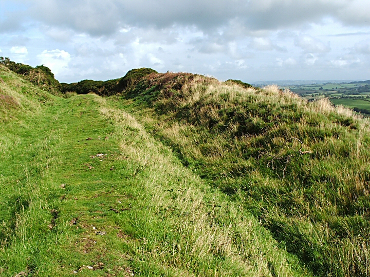
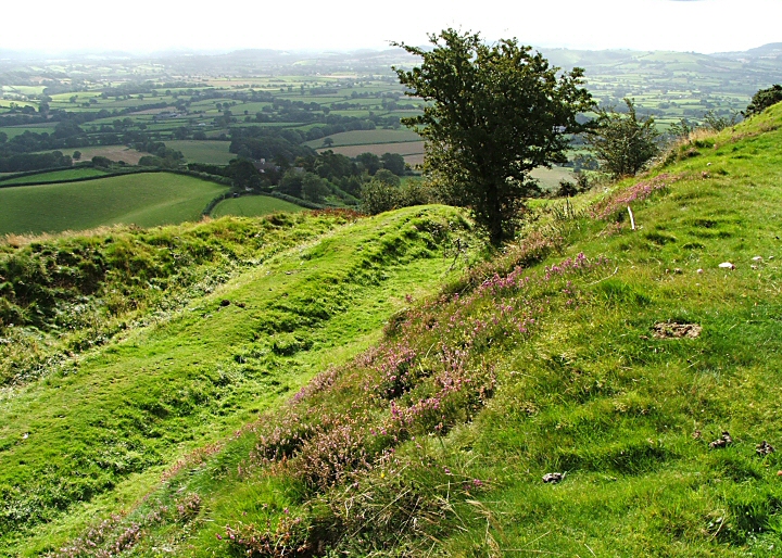
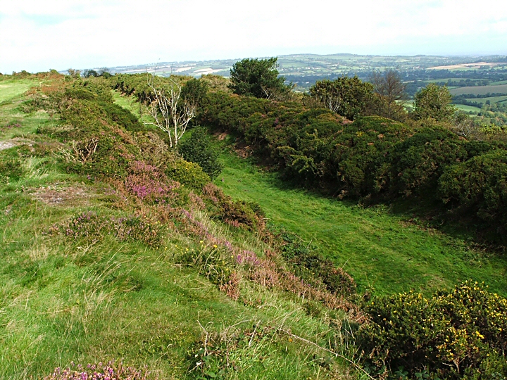
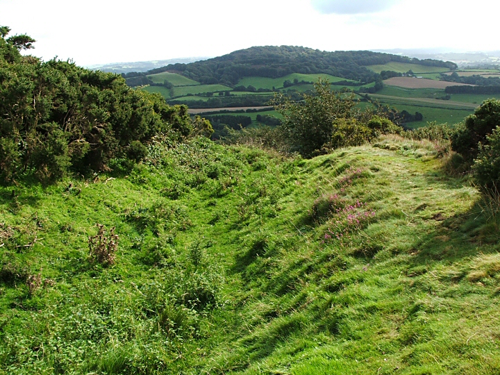
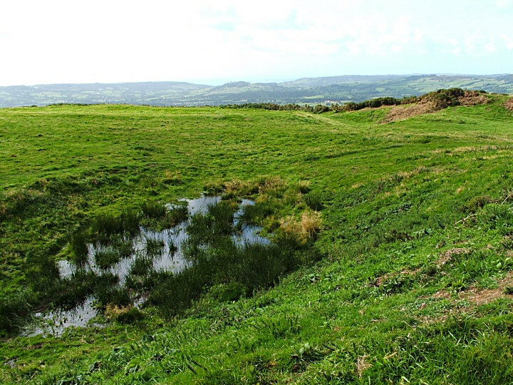
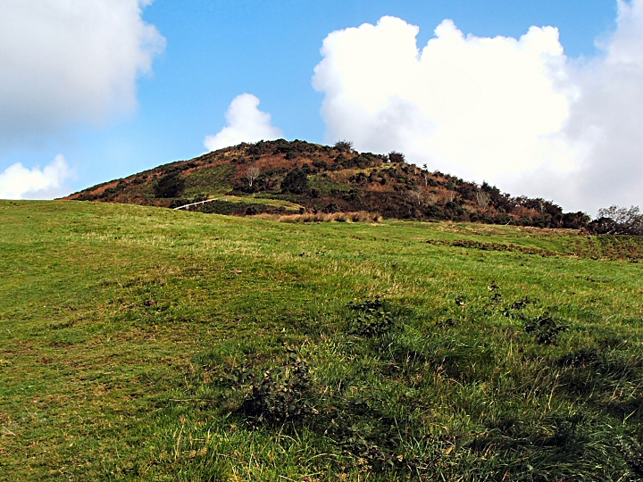
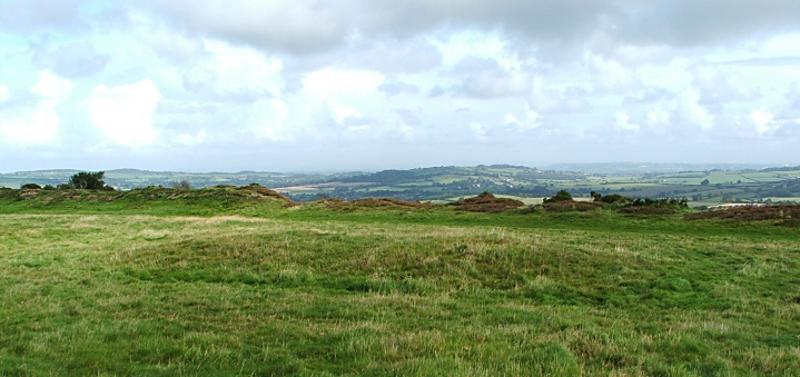
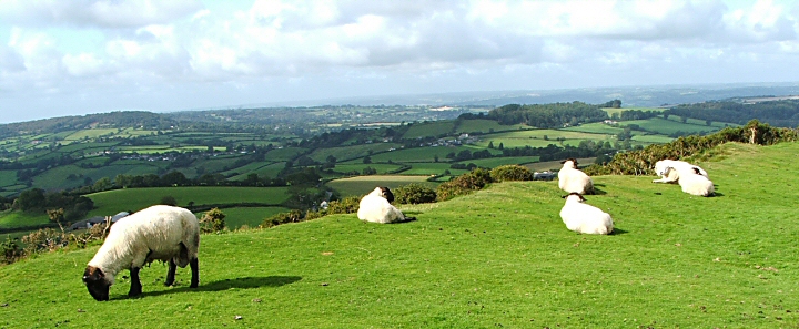
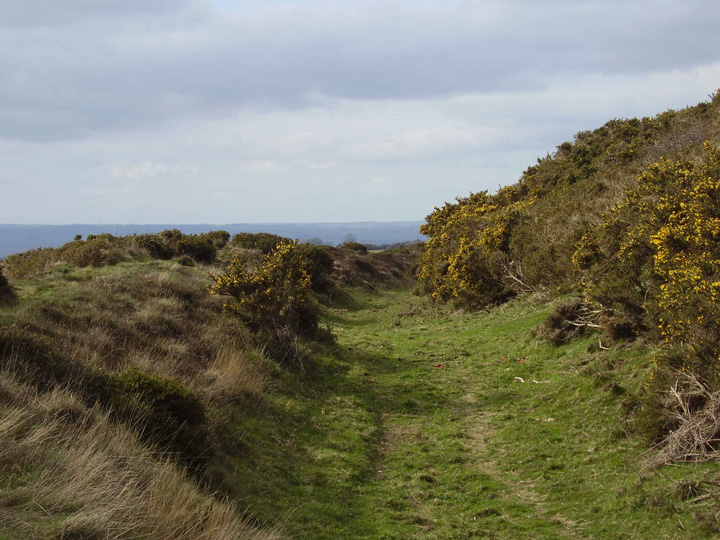
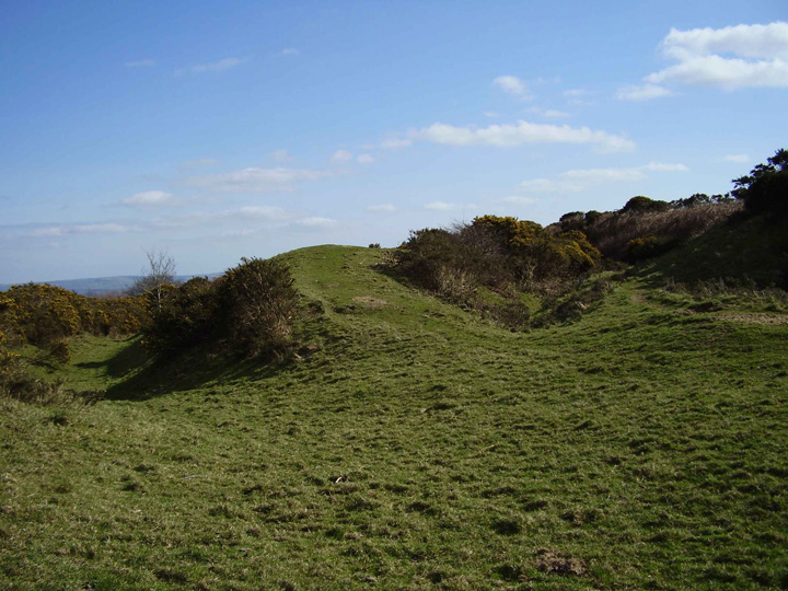
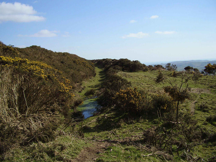
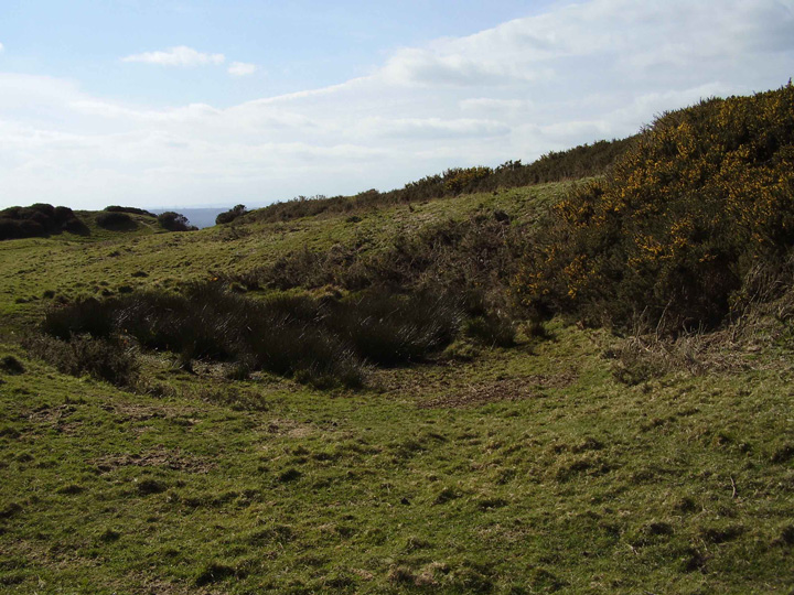
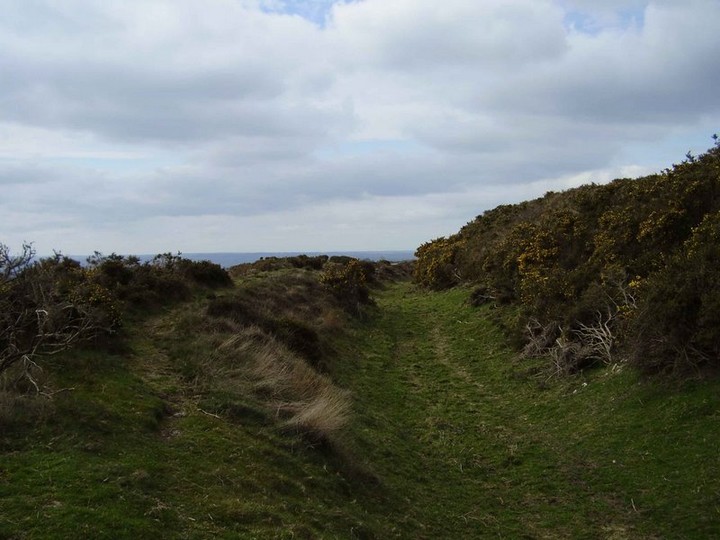
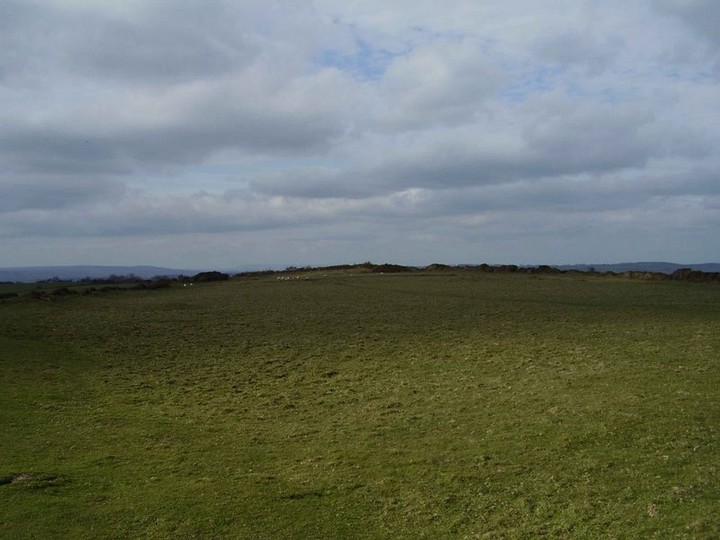
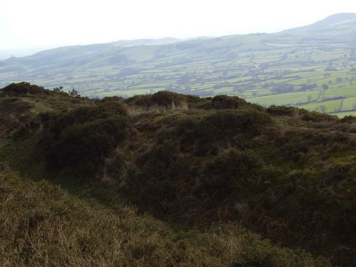
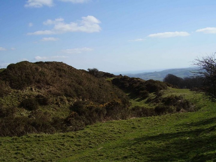
A stiff but shortish climb to the top but any pauses are worthwhile for the views to the south. The southern "entrance" is a bit of a puzzle. The notice board says that the main entrance is in the NE quadrant where the banks and ditches are much larger and deeper as the spur levels off here. At the southern "entrance" the banks and ditches peter out on either side which seems curious as, although the hillside is steep, it seems odd that this part is less defended. The hill is capped with a layer of clay-with-flints and I just wonder if there has been a slippage down the hill, destroying the banks and ditches. The tumulus and the pillow mounds are easily visible and the possible dew pond certainly had water in it when I visited. A great place to visit (in good weather) with buzzards wheeling overhead, sheep peacefully grazing and stupendous 360 degree views. |
 Posted by jimit
2nd October 2008ce |
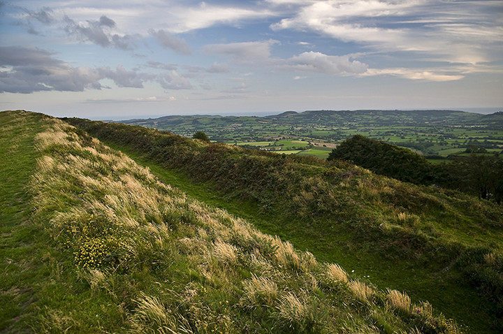
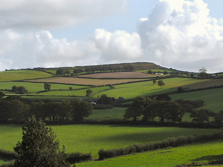
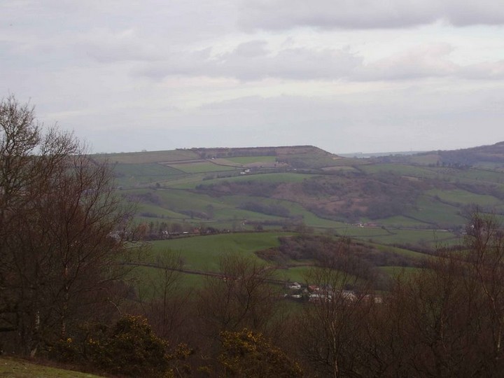
| You really have to want to see this hillfort, it's quite a climb, but utterly worth the effort. It's a large multivallate Durotrigian hillfort, which being built on the highest hill in Dorset is an obvious site for a defensive position. The 360 degree panorama affords views of nearby Lamberts castle, Coneys castle,Lewesdon Hill and the more distant Abbotsbury castle. Today I can see Portland which is about 35 miles away , the last time I was here visibility was about 35 feet. |
 Posted by formicaant
16th March 2007ce Edited 27th March 2010ce |
Folklore |
|
Pillesdon Pen is a remarkably high hill, a mile north from the village. On its easter limit, near the turnpike road leading from Broad Windsor to Furzemoor Gate and Lambart's Castle, is a large and very strong Entrenchment, encompassed with a triple rampart and ditches, excepting on the eastern summit, where the natural ascent is so steep, as to have rendered the camp inaccessible. The form of this Camp is nearly oval, being adapted to the shape of the hill on which it stands.From p525 in The Beauties of England and Wales, Or, Delineations, Topographical, Historical, and Descriptive of each County. Vol 4. John Britton and Edward Wedlake Brayley, 1803. Online at Google Books. |
 Posted by Rhiannon
18th March 2007ce Edited 18th March 2007ce |
|
It's thought perhaps that the famous 'Screaming Skull' of Bettiscombe Manor is the remains of one of the original (prehistoric) inhabitants of Pilsdon Pen. You can read more at Castle of Spirits. or get the lowdown from Mr Udal here: http://www.archive.org/stream/proceedings31dorsuoft#page/176/mode/1up * Janet and Colin Bord (in Prehistoric Britain from the Air) describe how inside one of the excavated huts on Pilsdon was a crucible, with beads of gold still attached: a goldsmith's workshop. |
Posted by Rhiannon 29th April 2004ce Edited 28th October 2009ce |
Miscellaneous |
|
|
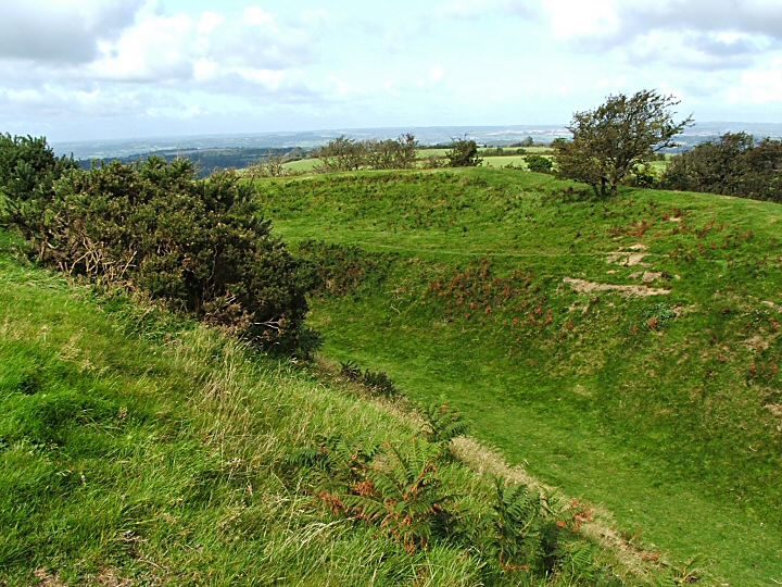
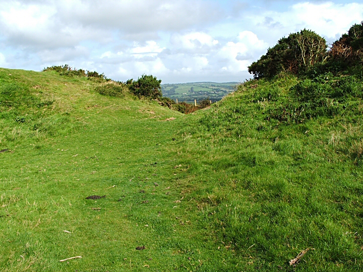
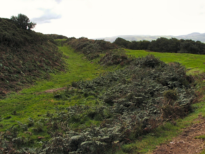
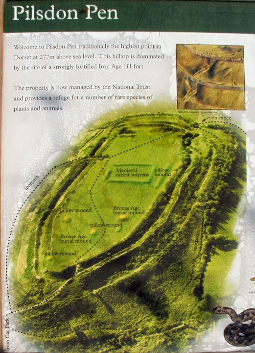
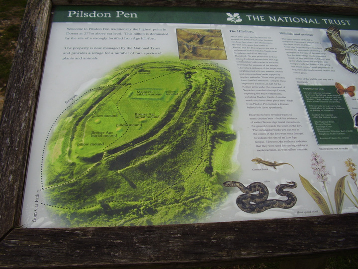
(3) Pilsdon Pen Camp, hill-fort (Plate 71), occupies the S.E. end of Pilsdon Pen (909 ft. above O.D.), 1 m. N. of the church. The work consists of an irregularly shaped oval enclosure of 7¾ acres defended, along the contour, by two lines of ramparts and ditches usually with counterscarp-banks. Where the slope is less steep or absent there is an interval between the inner and the outer systems. The lines of the inner ditch on the N.E. side and of the outer ditch on the S.W. side are mutilated by hedge-banks. Except at the N.W. end of the enclosure where there is no appreciable natural fall, the inner rampart would never appear to have been of any great height above the level of the enclosure, in fact the inner scarp is now entirely absent in some portions. There are now four entrances to the camp exclusive of one or two obviously modern paths over the ramparts. The entrance at the S.E. end, in which the outer defences are set back some distance on each side of the opening, would appear to have been an original entrance. The entrance on the S.W. side has a platform between the inner and outer systems on its S.E. flank. The other two entrances are both at the N. end. The more westerly is modern, but the more easterly is ancient and is masked by a convergence of the defences on both flanks. At the N. end of the enclosure are two roughly rectangular sinkings with traces of a slight bank running S.E. from the S.E. side of each. It is possible that these sinkings represent an earlier main ditch at this end, the present system being perhaps a remodelling similar to that noted at Abbotsbury. In this connection it may be noted that the main rampart on the N.E. side changes direction sharply opposite these sinkings; on the other hand the outer system, by ignoring this change of direction, would seem to belong to the reconstruction. Near the middle of the fort is a square enclosure surrounded by a slight bank approximately 25 ft. wide at its base and with traces of a slight external ditch. The bank on the S.W. is apparently formed by a preexisting pillow-mound. Near the middle of this enclosure earlier investigators of the O.S. plainly show a mound. There is now just a suggestion of a very slight circular rise of perhaps about 23 ft. in diam. Immediately to the E. of this enclosure is a second pillow-mound 107 ft. by 24 ft. There are similar but smaller mounds towards the S.E. end of the enclosure, one 15 yards N.W. of O.S. point 909 ft. is 38 ft. by 21 ft. and 1½ ft. high; the second is 80 yards N.W. of the same point and is 42½ ft. by 22 ft. and 2 ft. high; the third, 80 yards N. of the O.S. point, is 48 ft. by 21 ft. and 2 ft. high. There are also two circular mounds, probably barrows, one 20 yards N.W. of the mound last described and about 49 ft. in diam. and 3 ft. high and the other 40 yards to the S. and 26 ft. in diam. and 1 ft. high. About 55 yards N.W. of O.S. point 909 ft. is a slight circular sinking about 12 ft. in diam. 'Pilsdon', in An Inventory of the Historical Monuments in Dorset, Volume 1, West (London, 1952), pp. 179-180. British History Online http://www.british-history.ac.uk/rchme/dorset/vol1/pp179-180 [accessed 19 March 2016]. |
 Posted by Chance
29th March 2016ce |
|
Details of Hill Fort on Pastscape (ST 412013) Camp (NR) (1) Pilsdon Pen hill-fort consists of an irregularly shaped oval enclosure of 7 3/4 acres, defended by two lines of ramparts and ditches usually with counter-scarp banks. When the slope is less steep or absent there is an interval between the inner and outer defences. The lines of the inner ditch on the north-east side and of the outer ditch on the south-west side are mutilated by hedge-banks. Except at the north-west end of the enclosure when there is no appreciable natural fall, the inner rampart appears to have been of no great height above the level of the interior, and in some places is entirely absent. There are now four entrances to the camp. That at the south-east end, where the defences are set back on each side of the opening, appears to be original. The entrance on the south-west side has a platform between the inner and outer systems on its south-east flank. The more westerly of the two entrances at the north end appears to be modern, but the more easterly is ancient and is masked by a convergence of the defences on both flanks. Two roughly rectangular sinkings at the north end of the camp, with slight banks running from them, possibly represent an earlier line of defences at this end. Near the middle of the fort is a square enclosure surrounded by a slight bank about 25ft. wide with traces of an external ditch. On the south-west the bank is apparently formed by a pre-existing pillow-mound (For tumuli and pillow-mounds within the fort area, ST 40 SW 27 and 28). Near the middle of the square enclosure is a slight circular rise about 23 feet in diameter. (2-3) The hillfort consists of a series of strong banks and ditches as shown on 1:2500 plan herewith and is situated in a commanding position with level ground only at the north west end. The description given by the Royal Commission is correct except that a slight inner slope to the inner bank may be traced throughout its course. The rectangular enclosure is surrounded by a bank 10 metres wide and 0.5 metres high with a vague inner and outer quarry ditch. The whole of the south-west side has been destroyed by a later pillow mound ('G' on plan). Of the original entrances (K, L, M) both 'L' and 'M' are approached by strong causeways. North-west entrance 'N' has a modern causeway across the ditch. (4) Excavations initiated and supported by the owners of the site, Mr. and Mrs. Pinney of Bettiscombe Manor, were carried out at Pilsdon Pen by P.S. Gelling from 1964 to 1971. Work was concentrated in three areas:- (1). Earthworks on north-west. These were found to be the remains of abortive defences that were never completed, including a central entrance, a double rampart and a ditch 6 feet deep. It was surmised that they were probably built shortly before the main defences, for which they were a first attempt. A small Roman sherd was found near the gateway. (2). Occupation Site. On the south side of the camp, opposite the square enclosure, two typical Iron Age round huts were excavated. Finds included a considerable amount of domestic refuse and a fragment of a crucible to which were adhering minute specks of gold. (3). Square Enclosure. Excavations revealed that there were originally circular huts on the site of the square enclosure. These were replaced by by a timber structure which measured about 180 feet along its north-west side. The beam slots for this building were rectangular in section (unlike the usual U-shaped Iron Age gullies) and seemed to suggest an aisled structure surrounding a central courtyard. Associated with it were two huts of horse-shoe shaped plan with similar sleeper beam slots. Within one of the huts was found a gold coin of Gallo-Belgic XV type, but there was very little domestic debris and no trace of hearths. The rectilinear structure appears to have been demolished after a few decades, and replaced by low banks. Some cobbling was laid in the interior, upon which was found a Roman ballista bolt. On top of the bank was a pit containing nearly 1000 slingstones. The mound shown by the Royal Commission (and O.S. plans) in the centre of the square may represent the south end of a diagonal mound clearly visible on air photographs but not satisfactorily identified during the excavation. It is suggested that the rectilinear and horseshoe structures represent a temple extant between about 80 BC and 40 BC, and ranking as one of the outstanding structures in later British prehistory. The low banks which replaced it about 40 BC are regarded as the token demarcation of a temenos area. The importance of the site is confirmed by the evidence of gold-working. (6-8) Excavation and Mesolithic flints found. (9-10) ST 412 013. Pilsdon Pen. Listed in gazetteer as a multivallate hillfort covering 3.2ha. (11) Centred ST 41200130. Pilsdon Pen Hillfort, a well-preserved multivallate fort of Iron Age date. Partially excavated 1964-1971 by P S Gelling: early defences concluded to be unfinished, hut foundations found in interior, site of temenos discovered (d). Re-excavated and reinstated 1982. Temenous reinterpreted as rabbit warren (e). (12) A small multivallate Iron Age hillfort located at the southern end of Pilsdon Pen ridge 650 metres south west of Higher Newnham Farm. One of 4 hillforts overlooking the western end of the Marshwood Vale within 10 kilometres, the nearest being 2.5 kilometres east. Within the hillfort are the remains of 2 Late Neolithic to Bronze Age burial mounds, a Medieval cultivation system and a post Medieval rabbit warren. Scheduled. (13) |
Posted by Chance 29th March 2016ce |
|
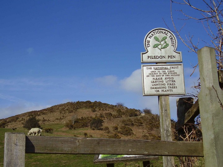
The National Trust booklet 'The Cerne Giant & Dorset Hill-Forts' (2000) which is definately available at the Kingston Lacy house and might be available at other Dorset properties, gives the following directions to the hill fort at Pilsdon Pen, "Take the B3164 west out of Broadwindsor. This winding road skirts the northern edge of the Marshwood Vale. After 4km you will see the ramparts and ditches of Pilsdon Pen hill-fort come into view at the southern end of a high flat topped ridge. Park in the lay-by just after the turning to the hamlets of Pilsdon and Bettiscombe. Cross the road and walk up the steep slope". It adds that the name 'Pilsdon' is Old English for a hill with a peak. The earliest documented reference to the place name dates from the Domesday Book in 1086. |
 Posted by pure joy
12th April 2004ce |
|
An Iron Age hillfort which it is thought to have been abandoned after the Roman conquest like other hill-forts in Dorset. Excavations have been carried out in the early '60s and from 1964 to 1971 |
Posted by phil 28th December 2001ce Edited 24th March 2013ce |
Links |
|
Francesca Radcliffe - Aerial ArchaeologyNice aerial picture, and a little bit of info. |
Posted by pure joy 24th November 2002ce |
Dorset Walksaccording to this website.... Pilsdon Pen (the name is a part Celtic name, pen being well known to all walkers in Wales as the local name there for a hill) is the highest hill of Dorset, standing 277m - that is 908 feet above the sea, 92 feet short of being a mountain!? |
Posted by phil 27th August 2002ce |