The Modern Antiquarian
Log in
|
Register
Home
Latest Posts
Forums
Maps
Help
Browse Sites
News
Blog
Contributors
The Books
Select
-
Belgium
Denmark
Eire
France
Germany
Greece
Italy
The Netherlands
Norway
Portugal
Republic of Malta
Spain
Sweden
Switzerland
United Kingdom
Scotland
Perth and Kinross
Shian Burn
Stone Circle
Shian Burn (Stone Circle) on The Modern Antiquarian, the UK & Ireland's most popular megalithic community website. 3 images, plus information on many more ancient sites nearby and across the UK & Ireland.
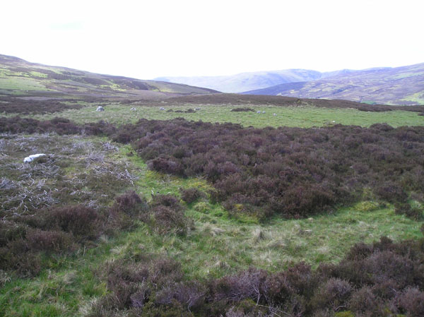
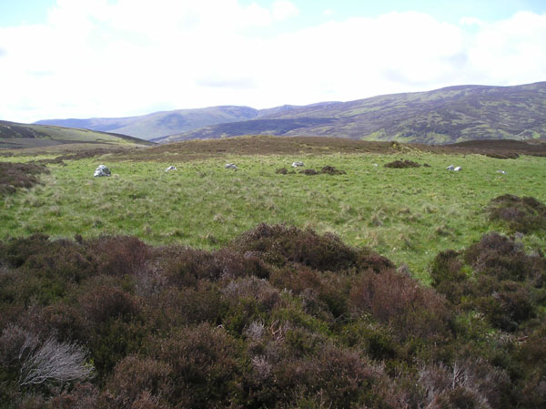
Image © tiompan
Nearest Town:
Aberfeldy (7km N)
OS Ref (GB):
NN845413 /
Sheet: 52
Latitude:
56° 32' 57.96" N
Longitude:
3° 52' 44.29" W
Added by
tiompan
Images (3)
0 discussions
Start a topic
Show |
Hide
Web searches for Shian Burn
Flickr
Google
Google Images
MAGIC
The Megalithic Portal
Bing
Stone Pages
Streetmap.co.uk
Wikipedia
Show map
(inline Google Map)
- Sites within 20 km -
-
Shian Burn (0.14km NE) (0 posts)
Turrerich (1.53km ESE) (9 posts)
Garrow (2.26km SW) (4 posts)
Pitmackie (3.97km WSW) (6 posts)
Loch Freuchie (4.15km SE) (6 posts)
Wester Kinloch (4.57km ESE) (10 posts)
Craig Hill (4.75km WNW) (59 posts)
Black Burn (4.92km NW) (46 posts)
Coilleaichur (5.09km N) (5 posts)
Urlar Burn (5.44km N) (2 posts)
An Torr (5.89km NNW) (11 posts)
White Cairn (5.98km E) (6 posts)
Tombuie Cottage (6.11km W) (4 posts)
Braes of Balloch (6.34km W) (8 posts)
Remony Burn (6.6km W) (13 posts)
Remain Rock (6.8km WNW) (5 posts)
Tullichuil (7.01km WNW) (4 posts)
Braes of Taymouth (7.1km W) (4 posts)
Innercochill (7.13km E) (3 posts)
Ballinreigh (7.28km E) (1 post)
Newhall Bridge Two Poster (7.48km WNW) (31 posts)
Balmacnaughton (7.53km W) (10 posts)
Croft Moraig (7.66km WNW) (75 posts)
Corrymuckloch (7.77km ESE) (19 posts)
Falls of Acharn Stone Circle (7.86km W) (55 posts)
Castle Menzies Cursus (8.12km NNW) (1 post)
Carse Farm II (8.28km WNW) (11 posts)
Balhomais (8.35km NW) (17 posts)
Kenmore Church (8.39km W) (2 posts)
River Almond (8.5km S) (24 posts)
Nether Tullicro (8.51km NW) (0 posts)
Acharn Burn (8.52km W) (8 posts)
Carse Farm I (8.54km WNW) (26 posts)
Comrie Bridge (8.63km WNW) (7 posts)
Clach na Tiompan (8.63km S) (3 posts)
Clach na Tiompan (8.63km S) (23 posts)
Clach na Tiompan (8.71km S) (26 posts)
Knoc-Na-Eaglais (8.75km NNE) (2 posts)
The Appin of Dull (8.88km WNW) (12 posts)
Corrody Burn (9.36km E) (11 posts)
Cuigeal-Mairi (9.42km W) (1 post)
Lundin (9.53km NNE) (5 posts)
Carn Tulach (9.63km NNE) (8 posts)
Croftmartaig (9.67km W) (1 post)
Grantully Hill (9.8km NE) (2 posts)
Tom-an-Droighne (9.95km NNE) (0 posts)
Lundin Farm (9.99km NNE) (43 posts)
Craig Tombane (10.06km ENE) (4 posts)
Glassie (10.13km N) (8 posts)
Boltachan Burn (10.28km NNW) (0 posts)
Clachan Aoradh (10.32km E) (14 posts)
Little Tombane (10.72km E) (3 posts)
Glengoulandie (11.39km WNW) (21 posts)
Fortingall (11.42km W) (44 posts)
Drumcharry (11.47km W) (11 posts)
Wester Litigan (11.63km WNW) (1 post)
Meikle Findowie (11.67km E) (23 posts)
Carn na Marbh (11.77km W) (8 posts)
Lurgan Farm (11.78km NNE) (6 posts)
Clach Ossian (11.79km SE) (21 posts)
Fortingall Churchyard (11.82km W) (15 posts)
Middleton of Derculich (11.9km NNE) (6 posts)
Jock's Cairn (11.97km SE) (16 posts)
Airlich Hill (12.11km E) (3 posts)
Finduie Wood (12.31km W) (7 posts)
Garth Estate III (12.36km WNW) (1 post)
Bridge of Lyon Cairn (12.44km W) (18 posts)
Bridge of Lyon Standing Stones (12.44km W) (21 posts)
Oakbank Crannog (12.52km W) (4 posts)
Garth Bothy (12.55km WNW) (1 post)
Garth Cottage (12.57km WNW) (1 post)
Dun Mor (12.62km ESE) (7 posts)
Bridge of Lyon (12.67km W) (10 posts)
Clach a' Mhoid (12.7km E) (1 post)
Cromrar (12.76km W) (8 posts)
Ballinloan (12.77km E) (5 posts)
Balendune (12.79km NNE) (7 posts)
Clach an Tuirc (12.8km W) (4 posts)
Cairn Coinneachan (12.82km S) (25 posts)
Garth Lodge (12.84km WNW) (4 posts)
Garth Lodge (12.84km WNW) (1 post)
Giant's Grave Cairn (13.03km SE) (8 posts)
Clach-na-Cruich (13.05km W) (3 posts)
Giant's Grave (Sma' Glen) (13.12km SE) (12 posts)
Meikle Logie (13.75km ENE) (6 posts)
Pitcastle (13.94km NNE) (3 posts)
Creagan Fheadaire (13.94km NNE) (4 posts)
Haugh of Grandtully Farm (14.03km NE) (15 posts)
Pitnacree (14.56km NE) (22 posts)
Clach Na Buidseach (14.61km NNE) (3 posts)
Tullypowrie (14.61km NNE) (8 posts)
Connachan (14.67km SE) (5 posts)
Clach Na Croiche (14.75km NE) (24 posts)
Coille Dhubh (14.84km W) (2 posts)
Little Trochry (15.1km E) (16 posts)
Creag Na Larach (15.17km ENE) (4 posts)
Cloanlawers (15.5km W) (30 posts)
Sack Stone (15.7km E) (6 posts)
Tullich Hill (15.79km WSW) (3 posts)
Stroness Hill (15.8km ESE) (3 posts)
Dundonnachie (16.14km ENE) (5 posts)
Monzievaird (16.19km SSE) (0 posts)
Buchanty Hill (16.27km SE) (6 posts)
Machuim (16.28km WSW) (48 posts)
Clachan An Diridh (16.48km NNE) (65 posts)
Braco (16.56km E) (4 posts)
Tombreck (16.63km NW) (1 post)
Buchanty Hill (16.66km SE) (5 posts)
Braes of Foss (16.77km WNW) (24 posts)
Clachan More (16.79km ENE) (8 posts)
Dunkeld Park Stone (16.92km ENE) (7 posts)
The Kor Stone (17.02km ESE) (5 posts)
Clach Glas (17.04km ENE) (8 posts)
Milquhanzie Hill Fort (17.06km SE) (4 posts)
St. Anne's Well (17.09km ENE) (1 post)
Tombreck (17.1km NW) (0 posts)
Carroglen (17.16km SSW) (10 posts)
Balmuick (17.18km SSW) (21 posts)
Kindallachan (17.21km ENE) (8 posts)
Haugh Cottages (17.28km ENE) (2 posts)
Balnasuim (17.3km WSW) (12 posts)
Witches Stone (Monzie) (17.3km SSE) (26 posts)
Milquhanzie Hill (17.42km SE) (3 posts)
Easter Croftintygan Farm (17.44km WSW) (5 posts)
Ochtertyre (17.48km SSE) (1 post)
Tullybeagles Moor (17.49km E) (7 posts)
Monzie Circle (17.54km SE) (30 posts)
Monzie Rock Art (17.54km SE) (24 posts)
Craig Kynachan (17.71km WNW) (4 posts)
St Serf's Water (17.83km SSE) (1 post)
Tigh Na Ruaich (17.93km NE) (33 posts)
Craig Obney (17.94km E) (5 posts)
Braes of Fowlis (18.16km SE) (49 posts)
Clathick House (18.37km S) (0 posts)
Cultoquhey (18.37km SE) (4 posts)
Kilmorich (18.65km ENE) (14 posts)
Cradle Stone (18.66km SSE) (7 posts)
Dunfallandy (18.68km NE) (6 posts)
Craigbea (18.78km NE) (3 posts)
Queen's View (18.85km N) (5 posts)
Crieff Golf Course / Ferntower (18.89km SSE) (31 posts)
Fowlis Wester Standing Stones (18.94km SE) (48 posts)
Lawers (19.18km S) (23 posts)
Birnam Hill (19.19km E) (10 posts)
Allt A' Choire Chireinich (19.2km WSW) (5 posts)
Lurgan (19.24km NNW) (42 posts)
Balnabodach (19.27km NNW) (11 posts)
Craggantoul (19.31km WSW) (7 posts)
Tomintianda (19.47km NNW) (4 posts)
Faskally - Pitlochry (19.55km NNE) (34 posts)
Tombreck 1-2 (19.66km WSW) (0 posts)
Fowlis Wester Cairn (19.73km SE) (42 posts)
Tulliemet (19.78km NE) (2 posts)
Coire Cireineach (19.82km WSW) (7 posts)
Cnoc Dubh (19.88km NNE) (2 posts)
Newtyle Two Poster (19.93km ENE) (13 posts)
Witch's Stone (19.99km E) (11 posts)
- Facilities within 20 km -
-
The Scottish Crannog C... (Museum: 6.8 km WSW)
Breadalbane Arms Hotel (Pub: 7.8 km N)
Black Watch Inn (Pub: 7.9 km N)
Kenmore Hotel (Hotel: 8.3 km WNW)
House of Menzies (Cafe: 8.4 km NNW)
Fortingall Hotel (Hotel: 10.9 km WNW)
Famous Grouse Experience (Restaurant: 17.9 km SSE)
Taybank Hotel (Hotel: 18.2 km ENE)
Robert Menzies delicat... (Cafe: 18.3 km ENE)
Loch Tummel Inn (Pub: 19.1 km NNW)
Pitlochry Backpackers ... (Youth Hostel: 19.3 km NNE)
- Add -
-
Add news
Add an image
Add fieldnotes
Add folklore
Add miscellaneous
Add a link
-
Add a site
Add a nearby facility
Add an alternative name/spelling
Images
(click to view fullsize)
Add an image
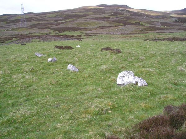
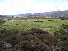 Image © tiompan