The Modern Antiquarian
Log in
|
Register
Home
Latest Posts
Forums
Maps
Help
Browse Sites
News
Blog
Contributors
The Books
Select
-
Belgium
Denmark
Eire
France
Germany
Greece
Italy
The Netherlands
Norway
Portugal
Republic of Malta
Spain
Sweden
Switzerland
United Kingdom
Scotland
Stirling
Broadgate Farm
Standing Stone / Menhir
Broadgate Farm (Standing Stone / Menhir) on The Modern Antiquarian, the UK & Ireland's most popular megalithic community website. 4 images, 2 fieldnotes, plus information on many more ancient sites nearby and across the UK & Ireland.
Image © greywether
Nearest Town:
Milngavie (4km S)
OS Ref (GB):
NS569794 /
Sheet: 64
Latitude:
55° 59' 9.98" N
Longitude:
4° 17' 38.7" W
Added by
greywether
Images (4)
Fieldnotes (2)
0 discussions
Start a topic
Show |
Hide
Web searches for Broadgate Farm
Flickr
Google
Google Images
MAGIC
The Megalithic Portal
Bing
Stone Pages
Streetmap.co.uk
Wikipedia
Show map
(inline Google Map)
- Sites within 20 km -
-
Strathblane (0.5km WSW) (7 posts)
The Auld Wifes Lifts (3.35km SE) (24 posts)
Craigmaddie Muir (3.44km ESE) (6 posts)
Dumgoyach Stones (3.81km W) (9 posts)
Dunmore (7.85km NNE) (12 posts)
Cairnhowit (8.11km WSW) (5 posts)
Dunbeg (8.27km NNE) (6 posts)
Whitehill (8.41km SW) (11 posts)
The Cochno Stone (8.41km SW) (25 posts)
Stockie Muir (9.14km W) (15 posts)
Waterhead Standing Stones (9.85km ENE) (8 posts)
Broughmore Wood (10.6km N) (6 posts)
Shiels of Gartlea (11.13km W) (5 posts)
Lang Cairn (11.33km W) (17 posts)
Stronend (11.64km NNE) (6 posts)
Auchentorlie (removed) (14.28km WSW) (5 posts)
Greenland 3 (14.28km WSW) (5 posts)
Sheep Hill (14.34km WSW) (6 posts)
Buchlyvie (14.93km N) (1 post)
Dumbuck Hill (15.32km WSW) (4 posts)
St Mirren's Well (15.36km ENE) (8 posts)
Carleatheran (17.07km NE) (5 posts)
Corrie (17.23km NW) (6 posts)
Camphill (17.29km SSE) (3 posts)
Ghost's Knowe (18.82km ENE) (2 posts)
Leckie Broch Carving 1 & 2 (19.07km NE) (2 posts)
Craigie (19.08km W) (0 posts)
Leckie (19.08km NE) (2 posts)
Blarnaboard (19.47km NW) (15 posts)
Cameron Farm (19.91km W) (4 posts)
- Facilities within 20 km -
-
Kelvingrove Museum (Museum: 13.2 km S)
Balmaha Bunkhouse Lodge (Youth Hostel: 18.6 km WNW)
The Highland Way Hotel (Pub: 18.6 km WNW)
- Add -
-
Add news
Add an image
Add fieldnotes
Add folklore
Add miscellaneous
Add a link
-
Add a site
Add a nearby facility
Add an alternative name/spelling
Images
(click to view fullsize)
Add an image
Fieldnotes
Add fieldnotes
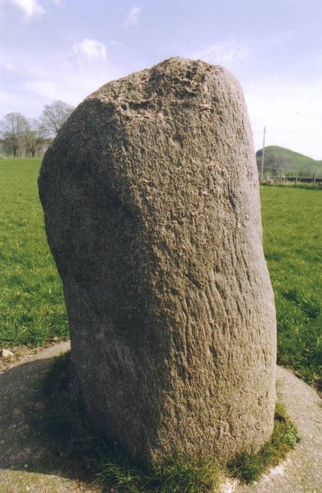
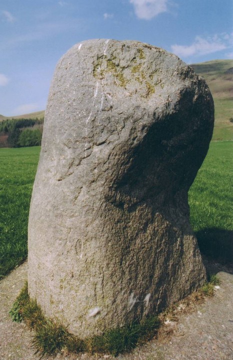
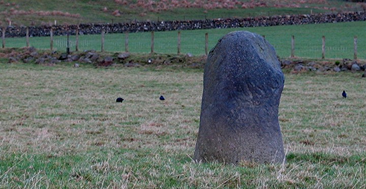
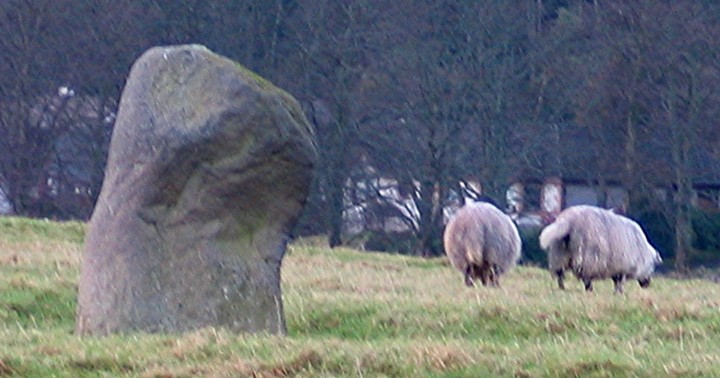
You know how some stones just get you and some stones just don't? This is the latter.
It has been secured into the ground with a neat ring of concrete and exhibits itself more like a farm implement than a stone of wonder.
How sad!
Great location though, with the the ridge of the Campsie Fells creating its northern horizon.
Comments (0)
|
Add a comment
|
Permalink
Posted by
follow that cow
21st April 2005ce
A 1.2m high stone clearly visible from the A891.
A cremation urn was found at its base when the stone was re-erected in 1982.
Visited 15 December 2004
Comments (0)
|
Add a comment
|
Permalink
Posted by
greywether
21st December 2004ce