The Modern Antiquarian
Log in
|
Register
Home
Latest Posts
Forums
Maps
Help
Browse Sites
News
Blog
Contributors
The Books
Select
-
Belgium
Denmark
Eire
France
Germany
Greece
Italy
The Netherlands
Norway
Portugal
Republic of Malta
Spain
Sweden
Switzerland
United Kingdom
County Kerry
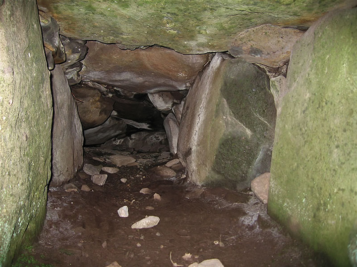
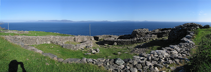
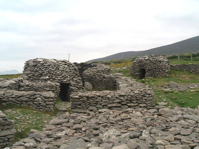
Caher Conor
Stone Fort / Dun
Caher Conor (Stone Fort / Dun) on The Modern Antiquarian, the UK & Ireland's most popular megalithic community website. 4 images, plus information on many more ancient sites nearby and across the UK & Ireland.
Image © Bert Timmermans
Nearest Town:
Cahershiveen (22km SE)
OS Ref (IE):
V341971 /
Sheet: 70
Latitude:
52° 6' 3.8" N
Longitude:
10° 25' 17.36" W
Added by
megaman
Images (4)
0 discussions
Start a topic
Show |
Hide
Web searches for Caher Conor
Flickr
Google
Google Images
The Megalithic Portal
Bing
Stone Pages
Wikipedia
Show map
(inline Google Map)
- Sites within 20 km -
-
Dunbeg (0.82km ENE) (26 posts)
Dunmore (3.65km W) (5 posts)
Caherard (6.33km NE) (6 posts)
Ballinrannig (8.94km NNE) (7 posts)
Milltown (9.24km ENE) (4 posts)
Fallen stones near Milltown Milestone (9.68km ENE) (7 posts)
Milltown (9.72km ENE) (5 posts)
Milltown (9.72km ENE) (4 posts)
Caherdorgan North (10.29km NE) (1 post)
Cnoc an Bhróigín Thiar (10.33km NE) (1 post)
Caherdorgan North (10.33km NE) (6 posts)
Kilmalkedar (10.97km NNE) (3 posts)
Kilmalkedar (11.05km NNE) (3 posts)
Dingle (11.21km ENE) (6 posts)
Corr Aille Spiral (12.06km NE) (4 posts)
Gallaunmore (14.19km ENE) (2 posts)
Kinard East (15.68km ENE) (2 posts)
Cathair na bhFionnúrach (16.26km NNE) (6 posts)
Foheraghmore (16.33km ENE) (4 posts)
Aghacaribble 1 (17.11km ENE) (8 posts)
Ardamore (18.26km ENE) (5 posts)
Ardamore (18.26km ENE) (14 posts)
Doonmanagh (Puicin an Chairn) (18.37km ENE) (12 posts)
Minard (18.68km ENE) (4 posts)
Keeltrasna (19.06km ESE) (3 posts)
Graigue (19.11km ENE) (11 posts)
Leacanabuile (19.29km ESE) (6 posts)
Cahergal (19.62km ESE) (8 posts)
- Add -
-
Add news
Add an image
Add fieldnotes
Add folklore
Add miscellaneous
Add a link
-
Add a site
Add a nearby facility
Add an alternative name/spelling
Images
(click to view fullsize)
Add an image
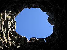 Image © Bert Timmermans