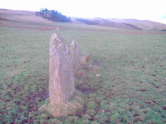
The Modern Antiquarian
Log in
|
Register
Home
Latest Posts
Forums
Maps
Help
Browse Sites
News
Blog
Contributors
The Books
Select
-
Belgium
Denmark
Eire
France
Germany
Greece
Italy
The Netherlands
Norway
Portugal
Republic of Malta
Spain
Sweden
Switzerland
United Kingdom
County Tipperary
Shanballyedmond
Court Tomb
Shanballyedmond (Court Tomb) on The Modern Antiquarian, the UK & Ireland's most popular megalithic community website. 17 images, plus information on many more ancient sites nearby and across the UK & Ireland.
Image © McGlen
Nearest Town:
Cappamore (10km SSW)
OS Ref (IE):
R842587 /
Sheet: 66
Latitude:
52° 40' 45.55" N
Longitude:
8° 14' 1.08" W
Added by
FourWinds
Images (17)
0 discussions
Start a topic
Show |
Hide
Web searches for Shanballyedmond
Flickr
Google
Google Images
The Megalithic Portal
Bing
Stone Pages
Wikipedia
Show map
(inline Google Map)
- Sites within 20 km -
-
Baurnadomeeny (1.39km NNE) (38 posts)
Reardnogy More (1.58km NW) (3 posts)
Baurnadomeeny (1.65km N) (6 posts)
Baurnadomeeny (1.89km NNE) (4 posts)
Goulmore (2.35km NE) (4 posts)
Aughsullish SW (3.72km E) (6 posts)
Knockshanbrittas (A) (3.77km E) (6 posts)
Aughsullish NW (3.78km E) (1 post)
Foilycleara (3.96km ESE) (3 posts)
Mauherslieve (4.51km NE) (1 post)
Mauherslieve (4.51km NE) (6 posts)
Lackanagoneeny (5.41km S) (4 posts)
Loughbrack (6.49km ENE) (11 posts)
Garracummer (6.58km E) (8 posts)
Gortnageragh (6.68km SSE) (2 posts)
Cureeny Commons (7.02km NNE) (17 posts)
Knocknabansha (7.08km ENE) (5 posts)
Reisk (7.6km ENE) (1 post)
Blackstairs (8.34km E) (3 posts)
Blackstairs (8.34km E) (4 posts)
Knockmaroe (8.44km ENE) (3 posts)
Kilmoylan Upper (8.92km S) (3 posts)
Garranbane (9.37km WSW) (5 posts)
Scraggeen (9.48km W) (2 posts)
Bauraglanna (9.6km NNW) (9 posts)
Knockcurraghbola Crowlands (west) (9.8km ENE) (8 posts)
Knockcurraghbola Crowlands (central) (9.89km ENE) (2 posts)
Knockcurraghbola Crowlands (east) (10.08km ENE) (2 posts)
Knockcurraghbola Crowlands (10.09km ENE) (1 post)
Foilnamuck (10.12km NE) (5 posts)
Cooneen (10.23km NE) (3 posts)
Knockcurraghbola Crowlands standing stone (10.29km ENE) (3 posts)
Cahernahallia (10.38km SSE) (2 posts)
Cahernahallia (10.38km SSE) (1 post)
Foilnamuck (10.42km NNE) (10 posts)
Foilaclug (10.73km ESE) (3 posts)
Graniera (10.96km ENE) (3 posts)
Knockcurraghbola Commons (11.2km ENE) (22 posts)
Cooneen (11.35km NE) (8 posts)
Doonglara (Glenbrohane) (11.48km WSW) (1 post)
Glastrigan (11.56km ENE) (13 posts)
Tuogh (11.66km SW) (0 posts)
Toorfiba (11.88km ENE) (3 posts)
Glencarbry (11.98km E) (1 post)
Clonalough (12.13km WNW) (2 posts)
Shevry (12.58km ENE) (8 posts)
Shevry (12.59km ENE) (1 post)
Ballinahinch (12.98km WNW) (2 posts)
Ballinahinch (13.13km WNW) (1 post)
Garruan (13.17km WNW) (1 post)
Garraun (13.17km WNW) (3 posts)
Ballinahinch (13.2km WNW) (1 post)
Cooga (13.56km ENE) (4 posts)
Cooga (13.56km ENE) (2 posts)
Ballinacurra (13.83km NE) (1 post)
Liseen (14.34km SW) (3 posts)
Ballyard (14.41km W) (3 posts)
Ballynahinch (14.63km WNW) (2 posts)
Ballynahinch (14.63km WNW) (3 posts)
Ballynahinch (14.67km WNW) (1 post)
Cappadine (14.83km WNW) (5 posts)
Knocksefin (15.22km SSW) (1 post)
Knocsefin (16.19km SW) (3 posts)
Knockeen (16.62km WSW) (1 post)
Cnoc Greine (16.69km SW) (3 posts)
Birdhill (17.4km W) (6 posts)
Burgesbeg (17.5km NW) (1 post)
Ballina (17.68km WNW) (1 post)
Longstone (17.73km SW) (2 posts)
Burgesbeg (18.47km NW) (6 posts)
Carrigeen (18.64km NW) (7 posts)
Tullahedy (18.88km NNW) (2 posts)
Roolagh (18.91km WNW) (5 posts)
Coumroe (18.91km NW) (4 posts)
Ballymalone More (19.01km WNW) (2 posts)
Pallas Upper (19.02km ENE) (4 posts)
Sarsfields Rock (19.16km SSW) (3 posts)
Killaloe (19.61km WNW) (4 posts)
Rathneaveen (19.94km SE) (2 posts)
Garrangrena Lower (19.96km ENE) (2 posts)
Longstone (19.98km S) (3 posts)
Longstone (19.98km S) (1 post)
Longstone (19.98km S) (8 posts)
- Add -
-
Add news
Add an image
Add fieldnotes
Add folklore
Add miscellaneous
Add a link
-
Add a site
Add a nearby facility
Add an alternative name/spelling
Images
(click to view fullsize)
Add an image