The Modern Antiquarian
Log in
|
Register
Home
Latest Posts
Forums
Maps
Help
Browse Sites
News
Blog
Contributors
The Books
Select
-
Belgium
Denmark
Eire
France
Germany
Greece
Italy
The Netherlands
Norway
Portugal
Republic of Malta
Spain
Sweden
Switzerland
United Kingdom
Northern Ireland
County Fermanagh
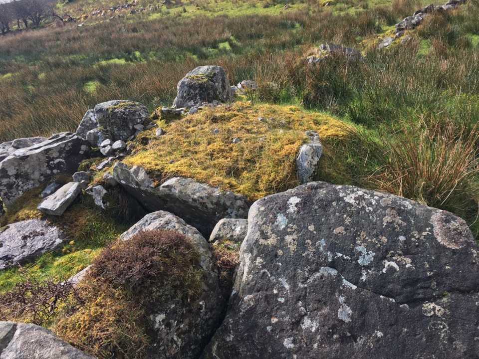
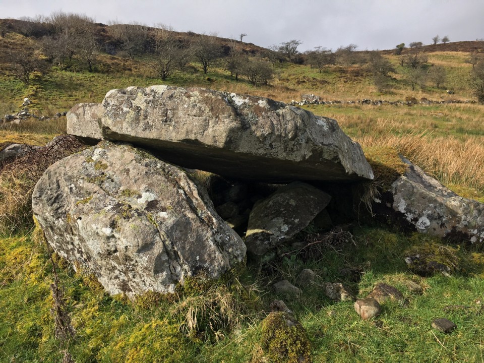
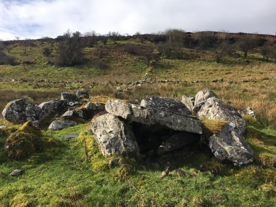
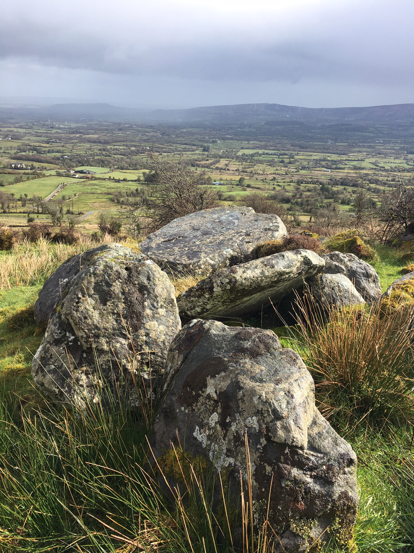
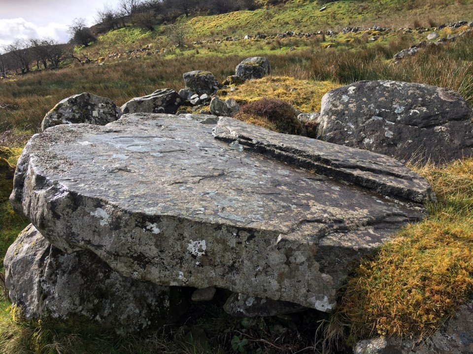
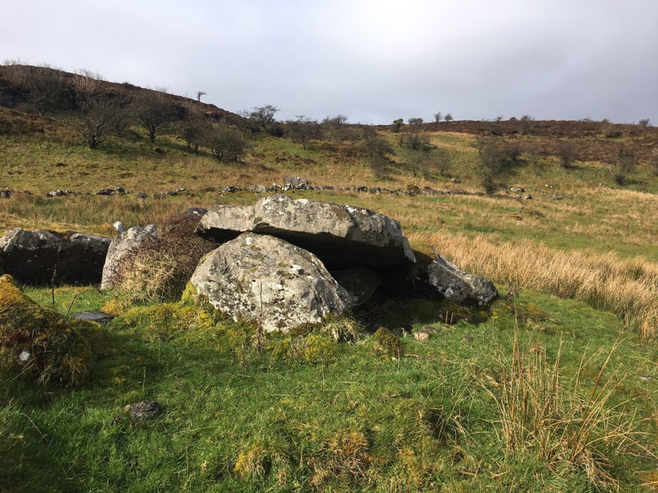
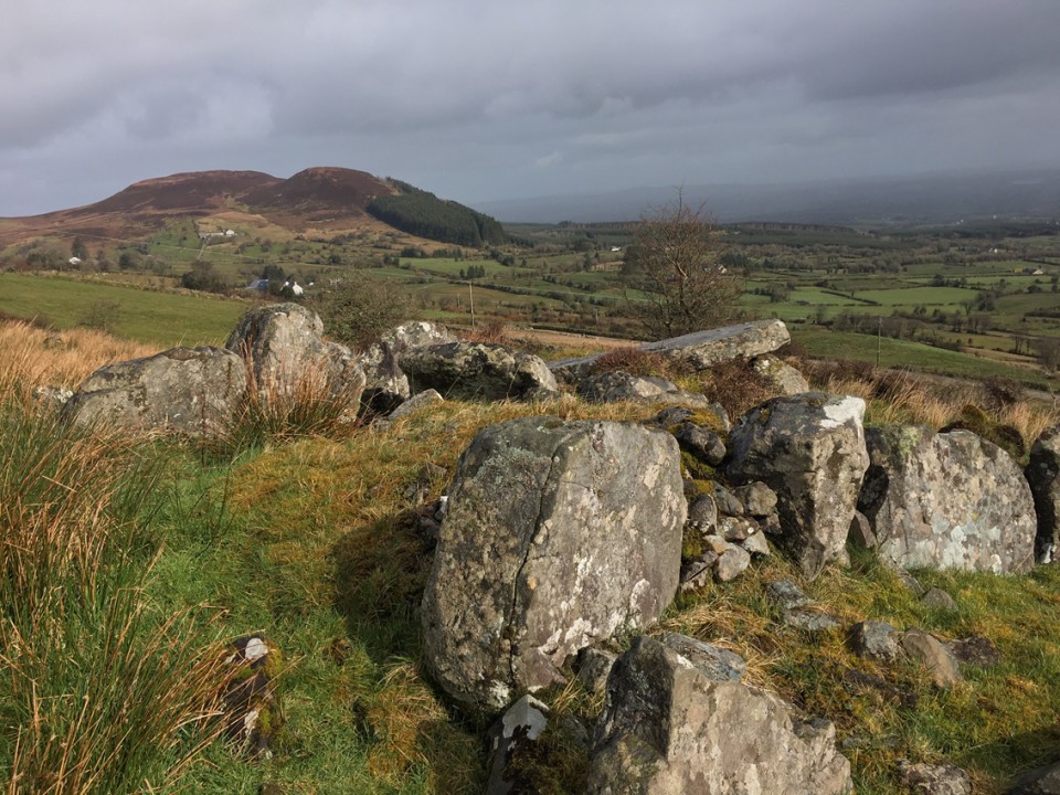
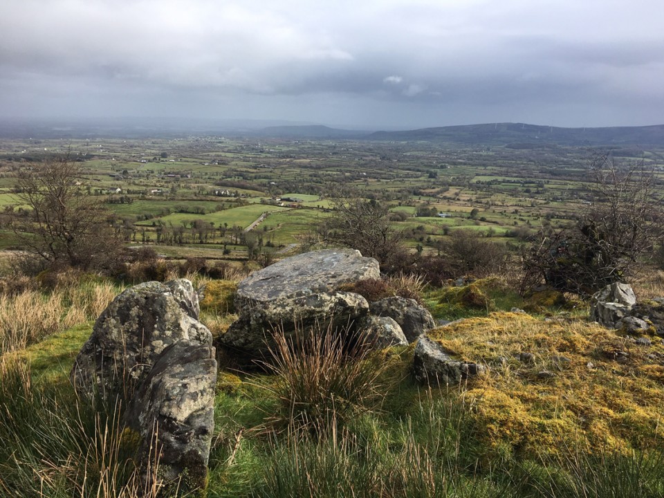
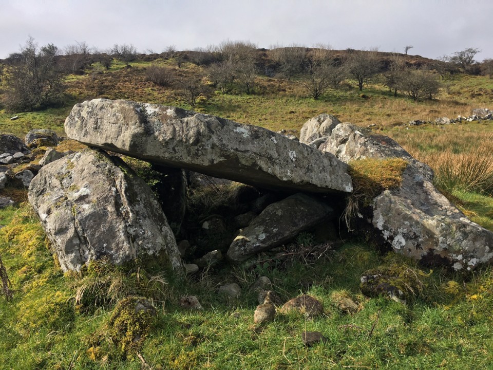
Greenan
Wedge Tomb
Greenan (Wedge Tomb) on The Modern Antiquarian, the UK & Ireland's most popular megalithic community website. 9 images, plus information on many more ancient sites nearby and across the UK & Ireland.
Image © ryaner
OS Ref (GB):
H172293 /
Sheets: 26, 27
Latitude:
54° 12' 44.05" N
Longitude:
7° 44' 10.82" W
Added by
FourWinds
Images (9)
0 discussions
Start a topic
Show |
Hide
Web searches for Greenan
Flickr
Google
Google Images
Megalithomania
Bing
Stone Pages
Streetmap.co.uk
Wikipedia
Show map
(inline Google Map)
- Sites within 20 km -
-
Aghnacally (7.23km ESE) (9 posts)
Clyhannagh (9.01km WNW) (12 posts)
Kilnameel (9.38km W) (0 posts)
Manragh Upper (9.57km W) (0 posts)
Duckfield (9.71km W) (4 posts)
Garvagh (9.94km W) (0 posts)
Manragh Upper (10.3km W) (1 post)
Garvagh (10.39km W) (4 posts)
Legalough (10.53km W) (4 posts)
Legalough (10.53km W) (4 posts)
Legalough (10.54km W) (2 posts)
The Rocking Stone (10.88km W) (1 post)
Mullaghboy (10.93km W) (3 posts)
Burren (E) (10.98km W) (24 posts)
Cullentragh (11.04km WNW) (5 posts)
Lanliss (11.05km W) (12 posts)
Burren (SW) (11.14km W) (9 posts)
Burren Central (III) (11.16km W) (3 posts)
Burren (SW) RA (11.19km W) (2 posts)
Burren (N) (11.23km W) (2 posts)
Rausker (11.28km ESE) (4 posts)
Burren (Central) (11.32km W) (12 posts)
Burren (Central II) (11.37km W) (8 posts)
Burren (Central II) RA (11.37km W) (4 posts)
Burren (Central, W) (11.45km W) (13 posts)
Carrickmacsparrow (11.79km NW) (6 posts)
Templenaffrin (11.9km WNW) (6 posts)
The Shannon Pot (12.09km W) (3 posts)
Moneygashel (12.1km W) (6 posts)
Moneygashel (12.16km W) (7 posts)
Killinagh (14.14km WNW) (10 posts)
Rushin (14.15km WNW) (2 posts)
Cavancarragh (14.15km WNW) (5 posts)
Doon (14.23km ESE) (6 posts)
Lissanover (14.42km SE) (5 posts)
Lissanover (14.46km SE) (2 posts)
Killycluggin (14.86km SE) (0 posts)
Kilnavert (15.02km SE) (5 posts)
Kilnavert (15.11km SE) (1 post)
Kiltyhugh (15.31km S) (1 post)
Kilrooskagh (15.37km WNW) (5 posts)
Aghanaglack (16.07km NW) (16 posts)
Cloghcor (16.59km NE) (0 posts)
Dromore (16.64km S) (1 post)
Cranaghan (Slieve Russel Hotel, present location) (17.22km ESE) (9 posts)
Carrickbrannan (17.25km WSW) (5 posts)
Brockagh Lower (17.87km W) (2 posts)
Reyfad (17.9km NW) (14 posts)
Creevy (18.28km SSW) (3 posts)
Creevy (18.44km SSW) (2 posts)
Druminalass (18.97km WSW) (1 post)
Mountdrum (19.27km NE) (6 posts)
Mountdrum (19.47km NE) (7 posts)
Creevy (19.85km SSW) (3 posts)
Gortaloughan (19.85km NNE) (2 posts)
Coolbuck (19.98km NE) (7 posts)
- Add -
-
Add news
Add an image
Add fieldnotes
Add folklore
Add miscellaneous
Add a link
-
Add a site
Add a nearby facility
Add an alternative name/spelling
Images
(click to view fullsize)
Add an image
 Image © ryaner