I'd read PureJoys's fieldnotes and visited this site expecting only a view from the outside. I was pleased to find that the public do have access to the "hillfort" (I've heard it called a "lowland fort") via permissive paths. Lately Hampshire County Council have been busy with fencing, gates and general tidying up. The field to the south of the fort has many "kissing gate" entrances, the only difficulty is finding a place to park.
The unwelcoming signs are just to stop people driving down what is a public footpath (and private access) that runs to the north of the fort: do not be put off by them. There are two private properties occupying the western side of the fort.
This is a fairly unique fort: firstly theres the fact that its so close to sea-level. Secondly, its got a very rectangular shape for an Iron Age fort. Thirdly, half the eastern flank is gaping open as a result of an over-enthusiastic 18th century farmer's levelling.
Just east of the site (between the ramparts and the railway line) is a huge hollow, utilised by the local BMX youths. Probably just as well that the ramparts and ditches are fenced off to prevent them being used as ramps etc. Drove past later and an ambulance was picking up one of the budding bike-stuntmen.
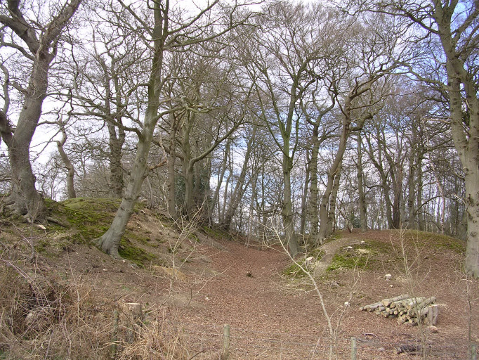
It’s a funny old hillfort this, because it’s barely 30-35 metres above sea level, and not surprisingly is not on much of a hill at all. Does this qualify as the lowest hillfort in Britain?
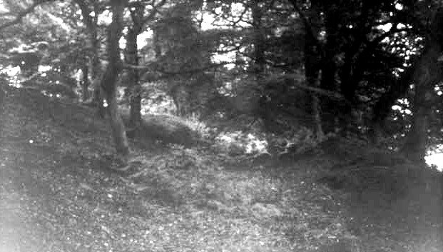
It also all seems to be on private land and with no friendly ‘welcome’ signs around. Two houses (‘Little Rings’ and ‘Buckland Rings Cottage’ – I think, didn’t write it down…oops) seem to have its roadside part. The driveway and woods up to ‘Little Rings’ contains the ramparts of the north-east corner. I walked along the road side (which has a clear gap in the trees near this north-east corner but also has a ‘private’ sign) to the south-west corner where I made my way through the trees to sneak a peak and some piccies of the southern ramparts.
This hillfort lies on the outskirts of Lymington, but it's pretty well preserved. A smaller fort (Ampress) 1/2mile to the east has got partly swallowed up by Industry - that was on the confluence of the two rivers here. Buckland Rings has three banks and two ditches as defence (except on the East side, where a farmer flattened them to gain access to the interior).
New Forest District Council's description of the Buckland conservation area, which includes the Buckland Rings ancient site. You can download a large scale map of the site which shows the earthworks very clearly.

 Posted by tjj
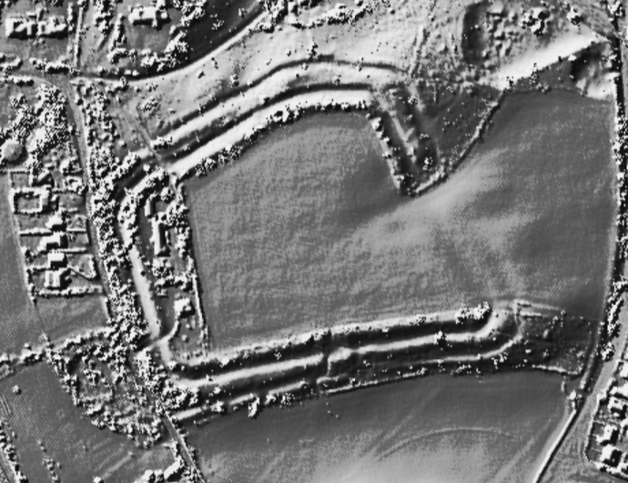

 Posted by TreeHouse
 Posted by pure joy
 Posted by Rhiannon