The Modern Antiquarian
Log in
|
Register
Home
Latest Posts
Forums
Maps
Help
Browse Sites
News
Blog
Contributors
The Books
Select
-
Belgium
Denmark
Eire
France
Germany
Greece
Italy
The Netherlands
Norway
Portugal
Republic of Malta
Spain
Sweden
Switzerland
United Kingdom
Scotland
Perth and Kinross
Carroglen
Cup and Ring Marks / Rock Art
Carroglen (Cup and Ring Marks / Rock Art) on The Modern Antiquarian, the UK & Ireland's most popular megalithic community website. 9 images, 1 fieldnote, plus information on many more ancient sites nearby and across the UK & Ireland.
Image © tiompan
Nearest Town:
Crieff (11km ESE)
OS Ref (GB):
NN7626726205 /
Sheets: 51, 52
Latitude:
56° 24' 42.45" N
Longitude:
4° 0' 20.35" W
Added by
tiompan
Images (9)
Fieldnotes (1)
0 discussions
Start a topic
Show |
Hide
Web searches for Carroglen
Flickr
Google
Google Images
MAGIC
The Megalithic Portal
Bing
Stone Pages
Streetmap.co.uk
Wikipedia
Show map
(inline Google Map)
- Sites within 20 km -
-
Balmuick (2.35km E) (21 posts)
Druim Na Cille (3.25km SW) (2 posts)
Twenty Schilling Wood (3.79km S) (36 posts)
Tom na Chessaig (4.26km SSE) (7 posts)
Kindrochet (5.08km SW) (18 posts)
Dalginross (5.19km SE) (33 posts)
Lawers (5.25km ESE) (23 posts)
Craggish (5.39km SSE) (1 post)
Wester Cowden Farm (5.71km SE) (28 posts)
Clathick House (5.76km E) (0 posts)
Cultybraggan (5.81km SSE) (12 posts)
Dundurn (6.22km WSW) (19 posts)
Cairn Coinneachan (6.23km ENE) (25 posts)
Auchingarrich Farm (7.02km SE) (23 posts)
Dun Caoch (7.56km WSW) (10 posts)
Strowan Cairn (7.86km ESE) (3 posts)
Glascorrie (8.11km ESE) (53 posts)
St Serf's Water (9.01km E) (1 post)
Ochtertyre (9.02km E) (1 post)
Monzievaird (9.07km E) (0 posts)
River Almond (9.26km NE) (24 posts)
Clach na Tiompan (9.33km NE) (3 posts)
Clach na Tiompan (9.33km NE) (23 posts)
Clach na Tiompan (9.33km NE) (26 posts)
Glen Tarken (9.35km WSW) (11 posts)
Dunruchan (9.45km SE) (85 posts)
Rottenreoch (9.71km E) (3 posts)
Cradle Stone (10.81km E) (7 posts)
Crieff (11.37km E) (8 posts)
Concraig (11.37km E) (8 posts)
Duchlage (11.62km E) (1 post)
Crieff Golf Course / Ferntower (11.66km E) (31 posts)
Dalchirla (11.74km ESE) (13 posts)
Witches Stone (Monzie) (11.74km E) (26 posts)
Connachan (11.85km ENE) (5 posts)
Broich (11.9km E) (1 post)
Dalchirla (11.96km ESE) (13 posts)
Monzie Rock Art (11.97km E) (24 posts)
Monzie Circle (11.97km E) (30 posts)
Tullich Hill (12.04km WNW) (3 posts)
Bennybeg Cursus (12.48km E) (2 posts)
Cultoquhey (13.16km E) (4 posts)
Milquhanzie Hill Fort (13.18km E) (4 posts)
Jock's Cairn (13.28km ENE) (16 posts)
Milquhanzie Hill (13.52km E) (3 posts)
Clach Ossian (13.89km ENE) (21 posts)
Millhills (14.03km E) (1 post)
Ardveich (14.39km WSW) (12 posts)
Giant's Grave (Sma' Glen) (14.58km ENE) (12 posts)
Giant's Grave Cairn (14.6km ENE) (8 posts)
Buchanty Hill (14.8km ENE) (5 posts)
Pitmackie (14.91km NNE) (6 posts)
Loch Freuchie (15km NE) (6 posts)
Garrow (15.01km NNE) (4 posts)
Dun Mor (15.02km ENE) (7 posts)
Craggantoul (15.13km WNW) (7 posts)
Balnasuim (15.3km WNW) (12 posts)
Fingal's Putting Stone (15.4km SSW) (4 posts)
Buchanty Hill (15.67km ENE) (6 posts)
Wester Kinloch (15.75km NE) (10 posts)
Remony Burn (15.75km N) (13 posts)
Uamh Bheag (15.88km SSW) (8 posts)
Fowlis Wester Standing Stones (15.94km E) (48 posts)
Easter Croftintygan Farm (16.03km WNW) (5 posts)
Machuim (16.12km WNW) (48 posts)
Braes of Fowlis (16.12km E) (49 posts)
Falls of Acharn Stone Circle (16.27km NNW) (55 posts)
Corrymuckloch (16.29km ENE) (19 posts)
Tomour (16.3km WNW) (22 posts)
Turrerich (16.37km NE) (9 posts)
Stroness Hill (16.39km ENE) (3 posts)
Tombreck 1-2 (16.48km WNW) (0 posts)
Cloichran (16.55km W) (26 posts)
Fowlis Wester Cairn (16.62km E) (42 posts)
Acharn Burn (16.67km NNW) (8 posts)
Kiltyrie (16.74km WNW) (13 posts)
Greenacre (16.88km W) (0 posts)
Kiltyrie (16.96km WNW) (3 posts)
Shian Burn (17.16km NNE) (3 posts)
Carie (17.24km WNW) (8 posts)
Allt A' Choire Chireinich (17.27km WNW) (5 posts)
Shian Burn (17.29km NNE) (0 posts)
Balmacnaughton (17.39km N) (10 posts)
Croftmartaig (17.5km NNW) (1 post)
Blarliargan (17.86km W) (1 post)
Cloanlawers (17.99km NW) (30 posts)
Ballinreigh (18.41km NE) (1 post)
Oakbank Crannog (18.49km NW) (4 posts)
Braes of Taymouth (18.67km N) (4 posts)
Tombuie Cottage (18.72km N) (4 posts)
Cuigeal-Mairi (18.77km NNW) (1 post)
Innercochill (18.8km NE) (3 posts)
Clach-na-Cruich (19.01km NW) (3 posts)
Fuaran na Druidh Chasad (19.09km W) (1 post)
Coire Cireineach (19.11km WNW) (7 posts)
Braes of Balloch (19.12km N) (8 posts)
Clach an Tuirc (19.19km NW) (4 posts)
Allt an Airgid (19.2km W) (1 post)
Tir Artair (19.27km W) (3 posts)
Kenmore Church (19.28km N) (2 posts)
Edinchip Chambered Cairn (19.3km WSW) (35 posts)
Cromrar (19.37km NW) (8 posts)
Bracklin Burn (19.47km SSE) (9 posts)
Craig Hill (19.47km NNE) (59 posts)
Kinnell of Killin (19.6km W) (59 posts)
The Belted Stane (19.96km E) (1 post)
- Facilities within 20 km -
-
Famous Grouse Experience (Restaurant: 9.6 km E)
Ardeonaig Hotel & ... (Hotel: 14.8 km WNW)
The Scottish Crannog C... (Museum: 14.9 km N)
Cruachan Farm (Camping Site: 17.9 km WNW)
Kenmore Hotel (Hotel: 19.3 km N)
- Add -
-
Add news
Add an image
Add fieldnotes
Add folklore
Add miscellaneous
Add a link
-
Add a site
Add a nearby facility
Add an alternative name/spelling
Images
(click to view fullsize)
Add an image
Fieldnotes
Add fieldnotes
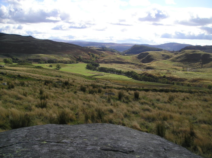
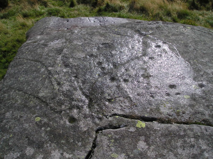
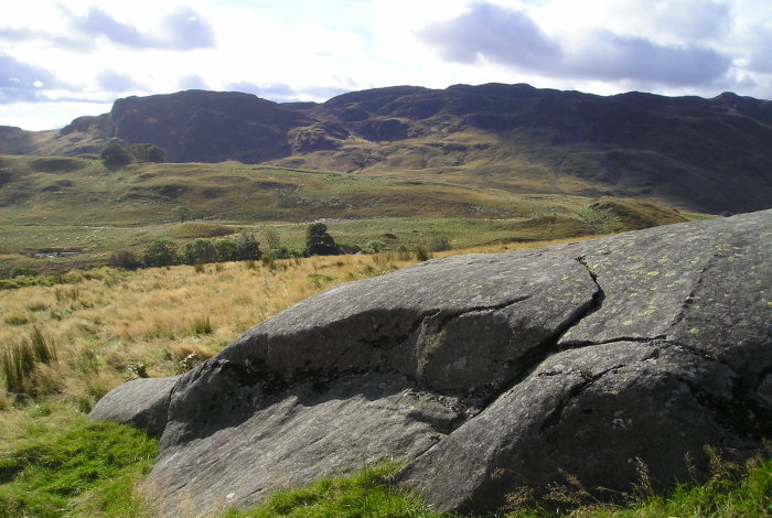
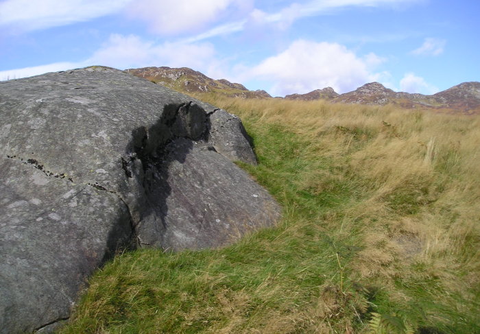
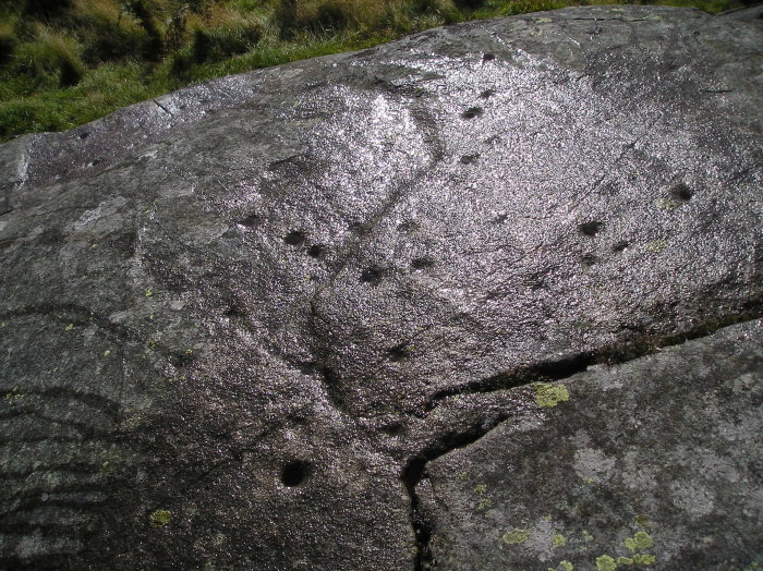
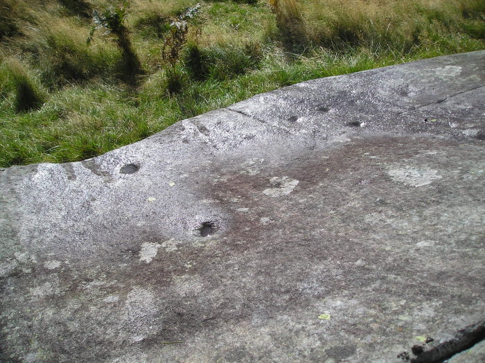
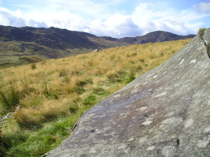
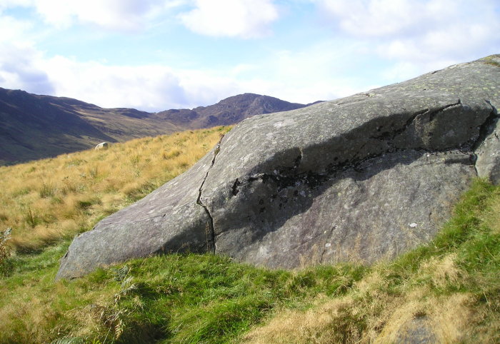
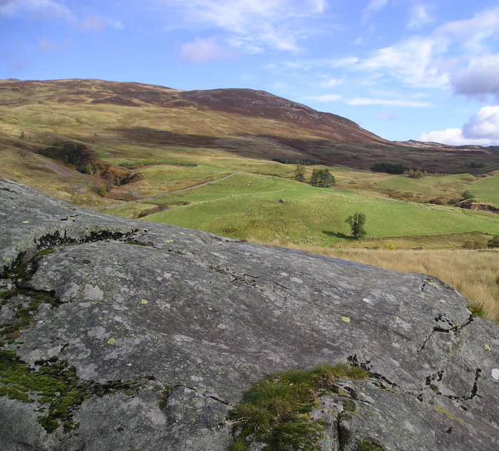
Found a couple of days ago ,the rock bears at least 40 cup marks .There's a group of eight cairns ,almost certainly not clearance , on the same terrace 60 metres to the west .
Comments (0)
|
Add a comment
|
Permalink
Posted by
tiompan
8th October 2012ce

 Posted by tiompan