Log in
|
Register
Home
Latest Posts
Forums
Maps
Help
Browse Sites
News
Blog
Contributors
The Books
Select
-
Belgium
Denmark
Eire
France
Greece
Italy
The Netherlands
Norway
Portugal
Republic of Malta
Spain
Sweden
Switzerland
United Kingdom
England
Southern England
Hampshire
Dunwood Camp
Hillfort
Dunwood Camp (Hillfort) on The Modern Antiquarian, the UK & Ireland's most popular megalithic community website. The site also contains a vast wealth of information on many more ancient sites across the UK & Ireland.
No image available
Nearest Town:
Romsey (4km SE)
OS Ref (GB):
SU313230 /
Sheet: 185
Latitude:
51° 0' 17.83" N
Longitude:
1° 33' 13.85" W
Added by
ginger tt
Miscellaneous (1)
0 discussions
Start a topic
Show |
Hide
Web searches for Dunwood Camp
Flash Earth
Flickr
Google
Google Images
MAGIC
The Megalithic Portal
Multimap 1:25000
Stone Pages
Streetmap.co.uk
Wikipedia
Show map
(inline Google Map)
- Sites within 20 km -
-
Lockerley Camp (3.03km NW) (1 post)
Stagsbury Hill (7.53km SSW) (1 post)
Money Hills (7.91km SSE) (2 posts)
Toothill Fort (8.08km ESE) (3 posts)
Dirty Mount (8.48km NE) (4 posts)
Tatchbury Mount (8.76km SSE) (1 post)
Testwood Lakes (9.61km SE) (1 post)
Black Bush Plain (9.76km SW) (1 post)
The Turret (9.94km NNW) (2 posts)
Whiteshoot Hill (10.13km NNW) (2 posts)
Withering Corner Barrows. (10.2km NE) (6 posts)
Farley Mount Enclosure (10.68km NE) (8 posts)
Jacob's Barrow (11.19km WSW) (4 posts)
Merdon Castle (11.32km ENE) (1 post)
Malwood Castle (11.47km SSW) (1 post)
The Butt (11.48km SW) (1 post)
Chilworth Ring (11.63km E) (1 post)
West Wood (11.79km ENE) (7 posts)
Pheasant Hotel (12.23km WNW) (1 post)
The Butts (12.33km SW) (1 post)
Cobhill Barrow (12.94km WNW) (1 post)
Ashleys Copse (12.99km NW) (2 posts)
Woolbury (14.04km NNE) (10 posts)
Danebury Long Barrows (14.73km N) (6 posts)
Danebury (14.73km N) (39 posts)
Texas Barrows (14.78km ENE) (4 posts)
Easton Down (15km NW) (1 post)
The Giant's Chair (Downton) (15.06km WSW) (2 posts)
Giant's Grave (Downton) (15.15km WSW) (2 posts)
Oliver's Battery (15.32km ENE) (6 posts)
Fussell's Lodge (15.35km WNW) (5 posts)
North Yew Tree Heath Barrows (15.89km SE) (1 post)
Clearbury Ring (16.1km W) (1 post)
Slap Bottom (16.12km SW) (2 posts)
Figsbury Ring (16.48km WNW) (33 posts)
Frankenbury Camp (16.51km WSW) (1 post)
Martin's Clump (16.62km NW) (1 post)
St Mary's Church, Twyford (16.87km ENE) (5 posts)
Flowerdown Barrows (17.11km ENE) (13 posts)
Bratley Plain (17.2km SW) (6 posts)
Marchwood Inclosure (17.25km SE) (4 posts)
Breamore Down (17.37km WSW) (3 posts)
Littleton House Bowl Barrow (17.57km NE) (2 posts)
Giant's Grave (17.7km WSW) (6 posts)
Love Lane (17.71km ENE) (3 posts)
St Catherine's Hill (17.75km ENE) (21 posts)
CastlePiece (18.1km SW) (1 post)
Twyford Pumping Station Barrows (18.22km ENE) (3 posts)
Dibden Bottom (18.26km SE) (5 posts)
Crawley Clump West Barrows (18.29km NE) (3 posts)
Crawley Clump East Barrows (18.52km NE) (2 posts)
lbsley Common (18.65km SW) (1 post)
Whitsbury Castle Ditches (18.75km WSW) (7 posts)
South Wonston South-west Long Barrow (18.79km NE) (4 posts)
Gorley Hill (18.88km SW) (1 post)
Moody's Down (19.65km NE) (1 post)
Magdalen Hill Down Barrows (19.7km ENE) (10 posts)
Quarley Hill (19.92km NNW) (4 posts)
- Facilities within 20 km -
-
Salisbury (Youth Hostel: 17.8 km WNW)
Wyndham Arms (Pub: 18.1 km WNW)
Salisbury and South Wi... (Museum: 18.4 km W)
The Camping and Carava... (Camping Site: 19.5 km WNW)
- Add -
-
Add news
Add an image
Add fieldnotes
Add folklore
Add miscellaneous
Add a link
-
Add a site
Add a nearby facility
Add an alternative name/spelling
Miscellaneous
Add miscellaneous
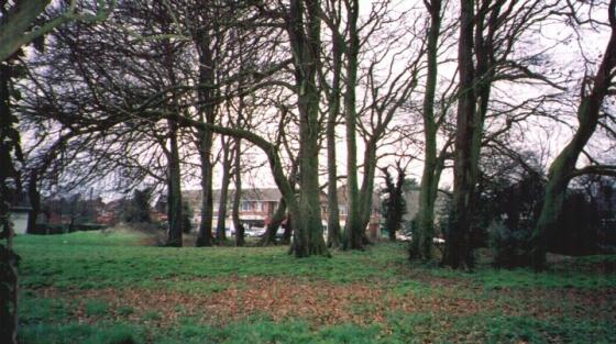
Iron Age hillfort Dunwood Camp. Occupies the summit of a sandy hill. It has a single rampart but no definite indication of a ditch and it is possible that this earthwork was never completed.
Comments (0)
|
Add a comment
|
Permalink
Posted by
ginger tt
26th October 2009ce