|
|

|
pure joy’s TMA Blog |
|
A day on the Commons
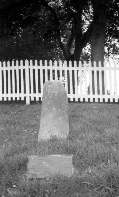
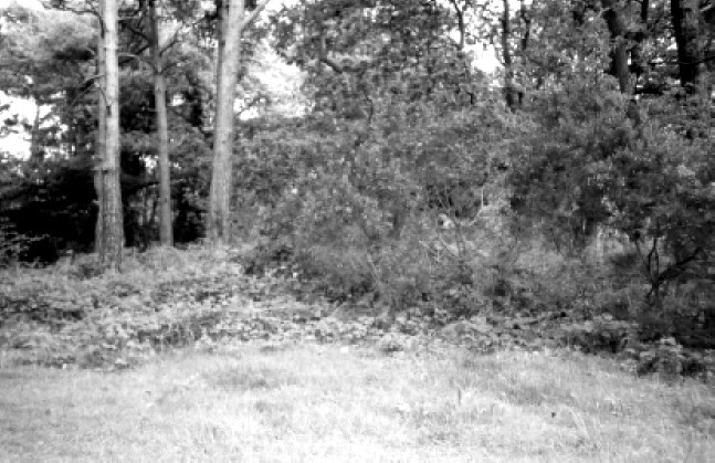
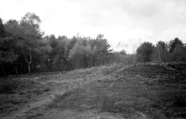
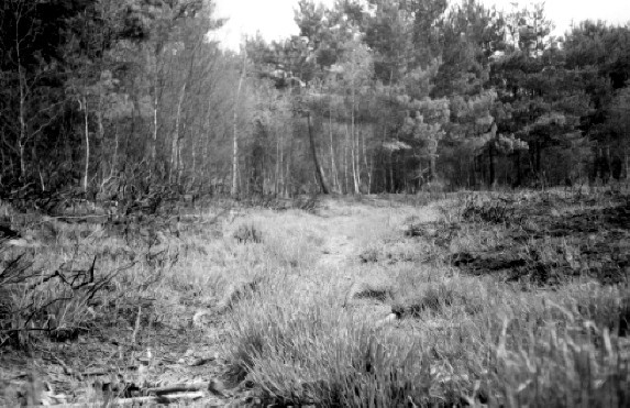
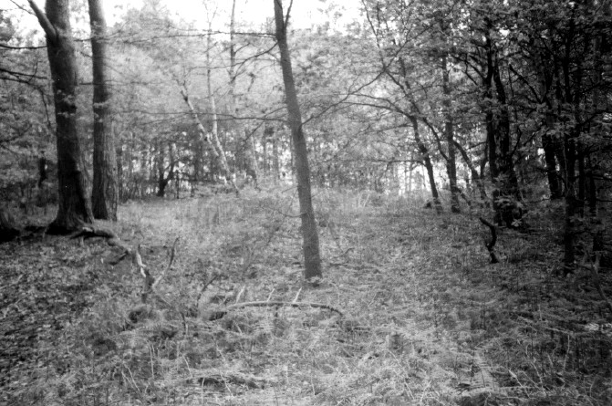
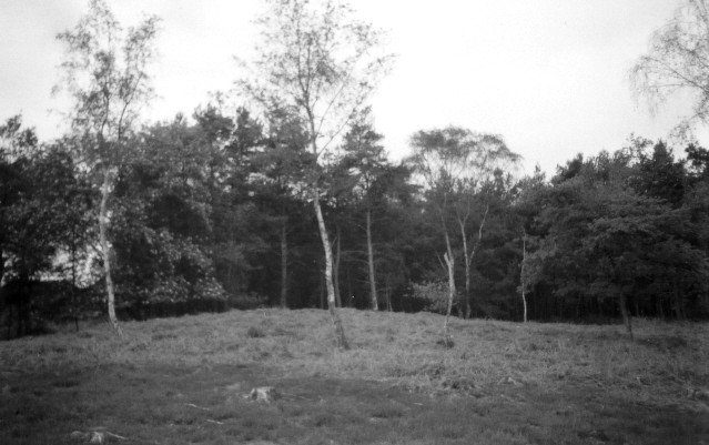
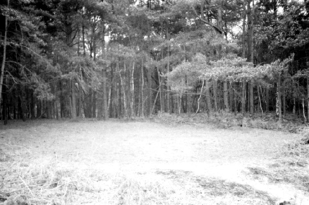
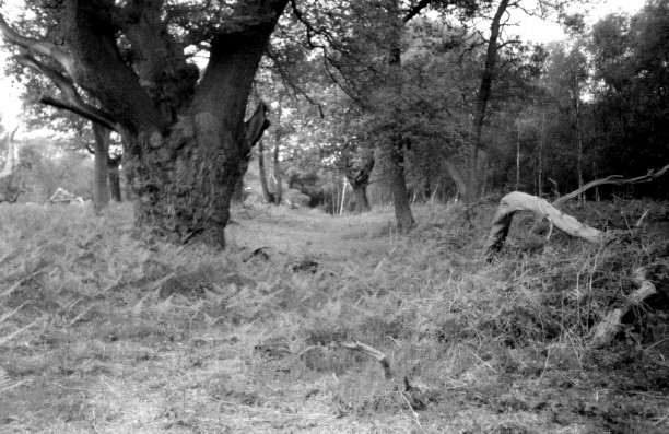
| The alternative title is ‘The A3’. But that’s not very sexy and makes it sound like I didn’t get out of the car all day. Anyway, whilst browsing the OS maps for Guildford/Farnham (Explorer 145) and London South (Explorer 161) I found a couple of places to explore, plus a few already on the TMA website, and all of them were vaguely close to the A3/M25 in Surrey. Later I realised that the one thing most of them shared in common (no pun intended) was that they were on common land, which may seem like a rarity so close to London and the stockbroker belt, but there are actually some fantastic places to wander in the M25 area. The other thing most of them shared in common was lots of litter. And condoms – well, not quite the last one but I guessed the area near the car park at Oakham Common must be a favourite cruising area for some nocturnal action. Later I looked it up on the web and it said ‘A Good Place To Go!!!!’ ‘Sometimes there are over two hundred cars here at night...", but also that “a young prostitute's body was found in the woods here in 1999” ……….I’ll get my coat. So, I explored a barrow and mound at Wisley Common, the sad little Pyrford Stone – overshadowed by its mega rich neighbours and their white picket fences (reminded me of the film ’Blue Velvet’ - I half expected to find a severed ear in the grass), the Horsell Common barrows, one of which is huge and a very good example of a bell barrow, and finished with a real woodland mystery walk to either find the Ashtead Common Earthwork and possible barrows, or to die at the hands of some southern rednecks hiding in the woods – squeal little piggy squeal. Wisley Common Bell Barrow — Fieldnotes11.05.03ceWisley Common Barrow - 11.5.2003 The easiest way to get to the Cockcrow Hill area of Wisley Common, where the barrow and mound are, is to start at the car park / visitors centre for Wisley and Oakham Commons (840 acres in all!) at TQ079587. The visitor’s centre consists of toilets, a small shop and a little local info (nothing about the ancient sites though). You can’t turn in towards the car park if you are coming from the south-west (i.e. if driving towards London) – you have to go up the M25 junction and return. Just to the right of the visitors centre, take a path (marked ‘Horse Riders’) up and over Curries Clump, which is strewn with condom wrappers and tissues. I guess this area is a perfect woodland cruising spot or something, being so close to the junction of the A3/M25? As you come down the clump the footbridge over the huge A3 is on your left. As you get to the other side you are now in Wisley Common, where some maps and info are pined up on a board and say that both the mound and barrow are Scheduled Ancient Monuments. The easiest way to get to the barrow is to follow the woodland road around to its end, close to the A3. The huge barrow is then on your left, about 40 metres in diameter and 5 - 6m high I’d guess. There are lots of smaller mounds around the area, but I presume it’s this big beastie that is the barrow. Wisley Common Bowl Barrow — Fieldnotes11.05.03ceWisley Common Bowl Barrow - 11.5.2003 From the Wisley Common Bell Barrow, the barrow is just 300 m west. Walk back up the woodland road for 100 m towards where it bends sharply and there is a metal barrier. Either walk straight ahead, up a woodland track, where the mound can be seen on the edge of the clearing to your right, or pass past the metal barrier, walk 40 metres up the sandy path and look across the clearing, where you will see the mound 100 metres or so to the west. The barrow is called a 'mound' on the map, but the info on English Heritage’s record of scheduled monuments (see link below) says it is a bowl barrow. The mound is not particularly high but from the top you can clearly see that there is nothing else like it in the vicinity. The mound is mainly covered in woodland ferns (tinder dry when I was there) but several trees are scattered around it towards the outside of the mound, especially at the south and west edges. Just to the west of the mound there is an interesting circle / ditch on the ground about 10m in diameter. It is totally clear of vegetation, unlike everything around it and looks strangely like a small bell barrow without the middle barrow part. Pyrford Stone — Fieldnotes11.05.03cePyrford Stone - 11.5.2003 Yep, the grid ref is spot on Rhiannon. However the grass verge where the stone lies is actually directly opposite Upshott Lane. And yes that verge is part of the ridiculously Big Brother-ish entrance to ‘Pyrford Court’, littered with signs saying ‘Private Property – No Turning – No Parking’ and warned you of CCTV cameras. To put it politely, fuck that! No Turning? Umm, why? What harm does that do? And do they fail to see the irony of what the stone’s plaque says about it being “on this corner since time immemorial”? The stone is tiny (85cm x 40cm) and eerily smooth with a sharp-ish edge on its east side. It is extremely small to be a possible ancient standing stone, however the top is flat as if maybe it was larger before and had been broken? The plaque reads “This boundary stone dates from before the Norman Conquest and is possibly a prehistoric standing stone. Situated on this corner since time immemorial, it was moved to its present position during road widening. This plaque was donated by local residents in 1976” Horsell Common — Fieldnotes11.05.03ceHorsell Common Barrows – 11.5.2003 If you are approaching this from the south, drive slowly over the charming canal bridge (with bright white pillars and jet black railings) just after the railway bridge because the only car park in the area is immediately on your right after the canal bridge and is not signposted (it’s just opposite ‘Britannia Wharf’). I missed it and had to drive up to the large roundabout and return – there was no parking off the road elsewhere. I think the easterly barrow is just to the right of the car park entrance. I parked, looked ahead and there was this large mound complete with classic hollowed top, trees and litter! It’s hard to tell the size of it due to the trees and brambles, but I’d guess about 20 m diameter and 1- 1.5m high. The westerly barrow is reached by crossing the road and following a path for about 200 metres through woodland until you come to a clearing and the enormous bowl barrow is slap bang in front of you (the path actually goes up and over it). It’s a pretty dramatic setting, in this clearing surrounded by pine and birch trees. I reckon it’s about 35-40 m in diameter and 1.5-2 m high. It is an excellent example of a bowl barrow, especially so close to London; the outer ditch and bank can clearly be seen all the way around, rising to a maximum of about 60cm high for the bank and about 30cm deep for the ditch. When I visited the bracken had been totally burnt off. I’d guess it wasn’t deliberate environmental management because the trees to the west (mainly young silver birch’s) were also burnt, as were some of the trees to the east (i.e. back towards the main road) Ashtead Common Earthwork — Fieldnotes11.05.03ceAshtead Common Earthwork - 11.5.2003 The obvious place to start is the Epsom Common car park at TQ183611, which is clearly shown on the OS map but isn’t signposted from the road. I then took a path south where you will come to a ‘path junction’ with three choices. Take the one to the south-west towards a large Corporation Of London sign / info board, which marks the start of Ashtead Common. The Corporation Of London owns and manages 200 hectares of Ashtead Common, which was declared a National Nature Reserve in 1995. The bridleway then skirts the privately owned Newton Wood and a lovely herd of Jersey cows were grazing the farmland to the North. Someone has rightly questioned one of the Newton Wood signs that say ‘Private – No Right of Way’ by adding ‘why not?’ on it – it seems strange that this wood is private when all around is open access. Soon you’ll come to another info board, which marked the start of my epic attempt to find the earthwork and two other things that looked like barrows on the OS map. The common is pretty dense woodland and very confusing. There are a lot more paths than are marked on the map and although I think I found everything I was trying to find I honestly couldn’t say accurately how I found them or how to get to them! After taking the path south from the info board at TQ178606 to try to find the earthworks, and finding it difficult to find, I would actually suggest that an easier way might be to take the path from TQ176605, which should lead directly to the edge of the earthwork and close to the two possible barrows. I’m pretty sure I found the earthwork (which incidentally is a scheduled Ancient Monument) in the jumble of paths and woodland. Well I certainly found a large area of land at the brow of the hill with irregular banks and ditches around it. I would love to know more about it. Incidentally a notice at one of the info boards previously mentioned said that they would be clearing trees on an around the earthwork in September 2003 – call 01372 279083 for more info. There are two ‘star’ symbols on the OS map just north of the earthwork that usually signify barrows, but the usual word ‘tumuli’ isn’t present. Anyway I did find two things that look like barrows but I’m hesitant to post details up because when I got home I couldn’t find any reference on the internet and I found a large scale map of the common on the Corporation Of London website, which makes no mention of the barrows, but does place the site of a Roman Villa in the area…..hmmm? Anyway, a very lovely walk in a beautiful, if dis-orientating, place! Corporation Of London — Links12.05.03ceIncludes the larger scale map I mention in my fieldnotes - which would have been useful to have before I visited Wisley Common Bell Barrow — Miscellaneous12.05.03ceI found a this on the web....."This was excavated in the early part of the 20th century and signs found of a cremation that had taken place thousands of years before, There were signs also of an excavation that is believed to have been made during the 18th century, during a search for iron ore; and certainly the parallel trenches which cut across the common were also made in the search for iron." Pyrford Stone — Images06.06.03ce
Horsell Common — Images06.06.03ce
Wisley Common Bell Barrow — Images06.06.03ce
Wisley Common Bowl Barrow — Images06.06.03ce
Ashtead Common Earthwork — Images09.06.03ce
|
 Posted by pure joy
11th May 2003ce Edited 12th May 2003ce
pure joy's TMA Blog
Latest TMA Blog Posts
|
Comments (0) |
|
| You must be logged in to add a comment | |