|
|

|
nickbrand’s TMA Blog |
|
Stravaiging round Comrie
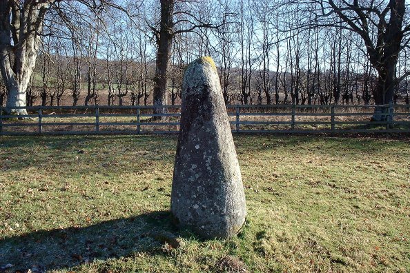
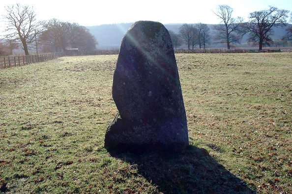
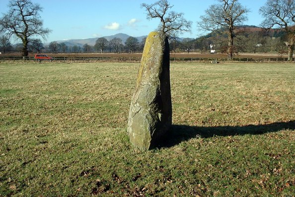
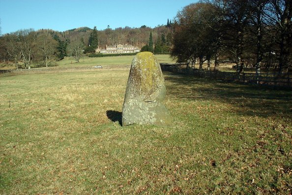
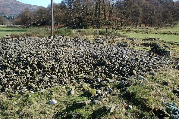
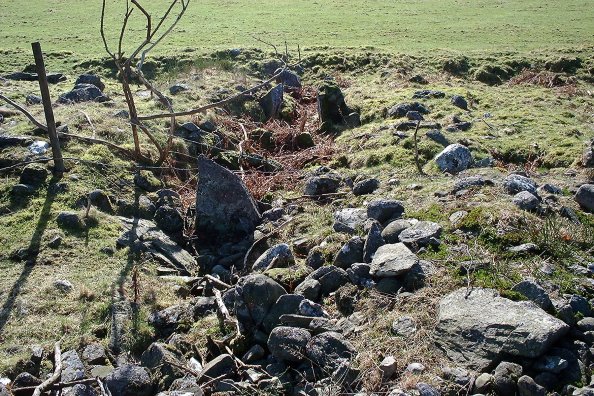
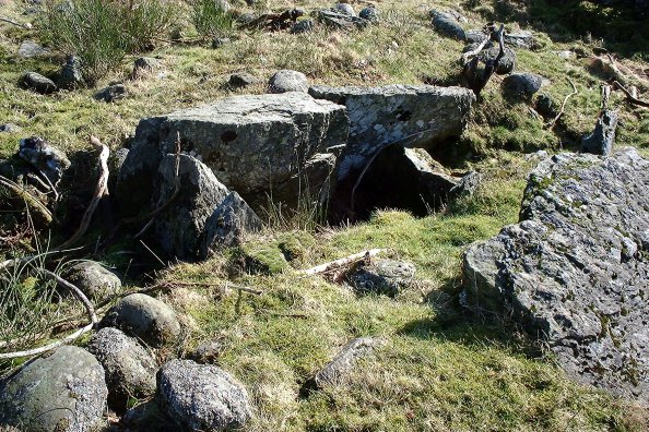
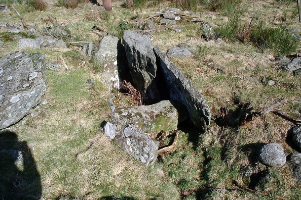
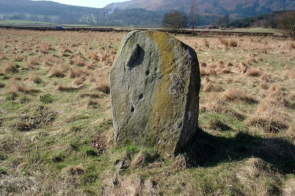
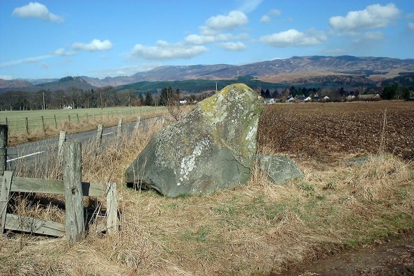
| I returned from offshore Wednesday determined to spend the following day getting out and about, having done a bit of research into sites in the Comrie area. So first thing Thursday morning I packed the maps, camera, a flask and some sandwiches and headed off into Perthshire on a beautiful sunny spring morning. First stop was the stone called Lawers, just off the A85 Crieff to Lochearnhead road, in a field with a couple of rather friendly horses in it. Parked down the track beside the field, and spoke to the horses before jumping over the fence to take some photographs. You have no idea how long it took to persuade the horses to stay out of the way whilst I was doing this! Then it was on to Dundurn, where I took a couple of pictures of the hill. This is the site of an Iron Age fort and then a Pictish settlement, comparable in some ways to Dunadd or Traprain. I didn't climb the hill, however, as there isn't a lot to see up there and I had been on the top several years ago. Just below the hill is Easter Dundurn Farm, where there is supposed to be a cup-marked rock built into a wall at Dun Fhalein farmhouse. Nobody was in when I called, and despite looking around, I couldn't see this rock. So I headed back down the track towards Kindrochet, where there is a chambered cairn. The way was blocked by a large gate warning that a bull was loose, so I turned back... Not much luck so far! Heading back down the road I drove across the small bridge into Kindrochet itself (all two cottages of it) and got lucky at the second cottage. The occupant showed me how to get across the fields to the cairn, and the route to take to avoid the one with the bull in it. This was more like it! Kindrochet Chambered Cairn is now in considerable disarray, but still well worth a look. Measuring around 130 feet by 30 feet, many of the internal features are still discernible even amongs the scatter of rubble and field clearance. The view to the west showed Dundurn hill clearly in the background, and it was easy to see why this site had been chosen. I took a number of photographs, but none of them really gives a great impression of this very peaceful place. A lovely spot, I sat for a while looking round before heading back to the cottages, where I was greeted by a Labrador carrying a stick, a less than subtle hint which I took, and spent 10 minutes keeping him amused... From here I trundled down the road a couple of miles east to Wester Tullybannocher, where two stones sit just inside the field beside the road. The western stone has at least four cup-marks on it. This is another very scenic site, with good views across Glen Earn. I sat here for a while and had a sandwich and a cup of tea, there was a good bit of warmth in the sun and virtually no wind at all. Next stop was the village of Comrie, where in the southern area known as Dalginross there are two sites worth a look. The first is the Dalginross four-poster, which very much reminded me of Burl's comment about Sandy Road, Scone - "An ideal site for the slothful, as it can be viewed from one's car..."! There is a circular platform, raised about 2 feet above the general level, just at the edge of a small wood. The four-poster sits central in this, with a tree-stump in the middle of the group. Only one stone is now erect, and it appears to have a couple of cup-marks just on the top - which was covered in moss. On just down the road to the stone known as the Roman Stone or Western Cowden Farm stones, a strange little setting, consisting of one very large stone, with a pronounced eastern lean, which is known locally as the Roman Stone, a smaller one just beside it then 6 feet east a stone which has at least 20 cup-marks on it. I splashed water on this in order to be able to photograph it better (handy hint for those of you who don't know it already - always carry a flask of water for the stones!). This is yet another site where the lazy need not ever leave the car! Heading on down the B827, I took the un-numbered road for Muthill and less than a kilometre down this is the site of the Shillinghill or Dunruchan stone group. These stones require a bit of hiking, though the first is situated just inside a field beside the road. Parking can be awkward here, so be careful, and ask permission at Craigneich Farm - readily enough granted. The stones are numbered A to F in CANMORE, and stone F is the four-sided 6 foot+ stone in the field beside the road, at NN79221787. Entering the field on the south side of the road, I wandered slowly through knee-high heather uphill to Stone B (NN79201743) which stands about 5 feet tall and around 8 feet wide. From here you can see stone A away over to the east, and stone C (NN79101714) to the SSW, about 200m away. Stone C is another steady plod uphill, and stands about 9 feet vertically, though with a pronounced southern tilt (see the photographs). On to D (NN79031689), another tall one, being about 8-1/2 feet, which stands on a bit of a platform with a lot of smaller stones (probably field clearance), leaning north. From the hoof-marks around, a favourite rubbing spot for the sheep! Stone E is very close by here (NN78981682), nearly seven feet tall, and looking NW you can see A, C and D quite clearly. The views from here are absolutely magnificent, and there was not a breath of wind. I stayed here for some time, just looking at the views. Then I headed off to the largest stone of this group, A (NN79541739), which is a wee hike away and rough going at first through heather and some marshy bits. This stone is a real cracker, over 11 feet tall. I was just setting up to take some photographs when I noticed two jet con-trails in the sky making a perfect saltire against the blue... so, hoping it would come out I shot almost into the sun for the perfect Scottish stone setting! It came out not too bad! This is an amazing group, and well worth a visit if you are in the vicinity. On a day like today the views alone are worth the effort. There are no discernible markings on any of the stones. Finally I headed on down to Dalchirla, where there are two sites - a single standing stone, over 9 feet in height, in a field, surrounded by many field-clearance boulders, and in the field opposite, a pair of stones, one 8 feet tall and the other around 4-1/2 feet. The smaller of these has two cup-marks on the inner surface. Permission to enter the fields is readily given by the farmer. All in all, not a bad day out. Several interesting sites and the benefit of a fine spring day. Lawers — Fieldnotes13.03.03ceThis stone is situated in a field to the south of the A85 Crieff to Lochearnhead road, near the village of Comrie. There is a small track down the side of the field and you can park here as long as you don't block the road. The stone itself is around 6-1/2 feet tall, with no discernible markings on it. There were a couple of friendly horses in the field when I visited today, which made photographing the stone rather interesting! Lawers — Images13.03.03ce
Dundurn — Images13.03.03ce
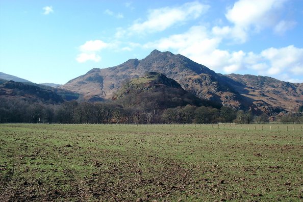
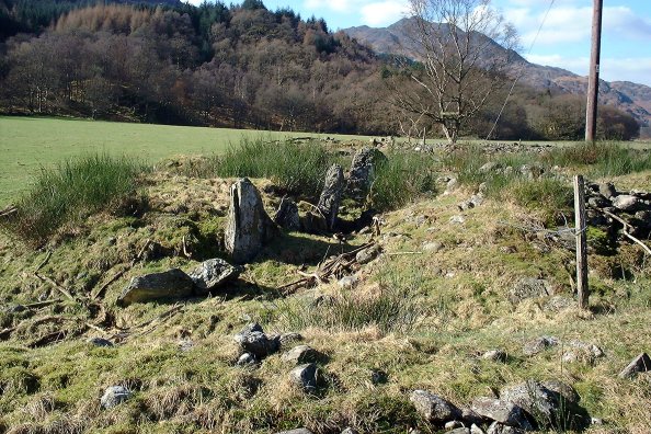
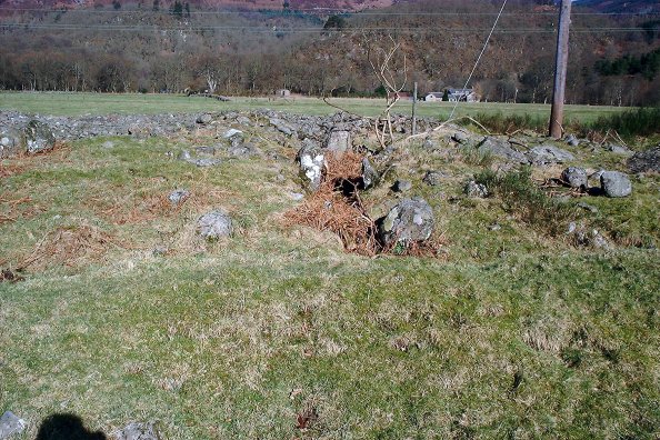
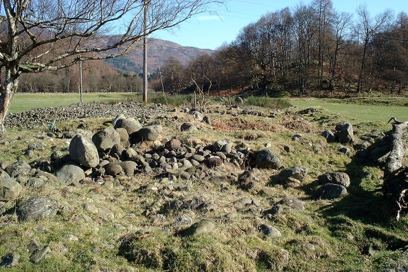
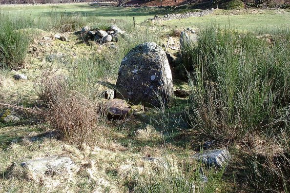
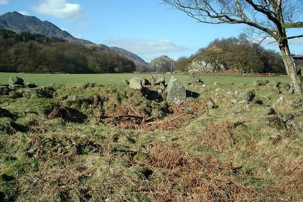
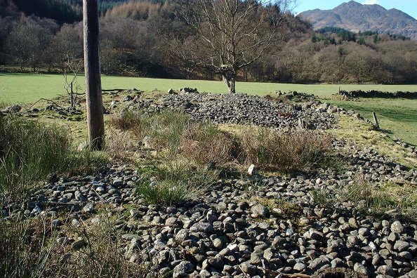
Dundurn — Miscellaneous08.03.03ceAccording to Canmore, this fort is presumed to be the place mentioned in the Annals of Ulster as being under siege in 683, and to have been a principal Pictish stronghold; it may have originated in the Iron Age. Certainly the eastern equivalent of Dunadd. Kindrochet — Fieldnotes13.03.03ceAmazing site - very robbed-out but several central chambers still in situ, and it measures a good 130 feet by 30 feet or so. Unfortunately there's a telegraph pole planted in the middle and the remains of a fence running through it.... but a very fine situation and well worth a visit. Park beside the two cottages at Kindrochet, and ask at the second cottage - the man who lives there is very friendly (as are his dogs!) and will explain how to approach it if the bull is in a nearby field. Approaching from Dundurn farm is more difficult. The photographs really don't show the atmosphere of the place. Looking west along the length of the cairn gives a clear view of Dundurn hill fort. Kindrochet — Images13.03.03ce
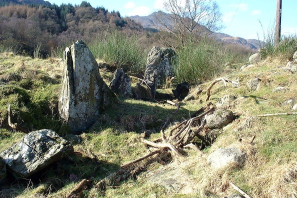
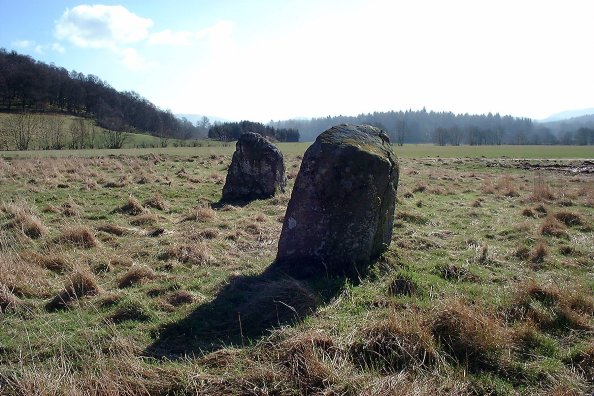
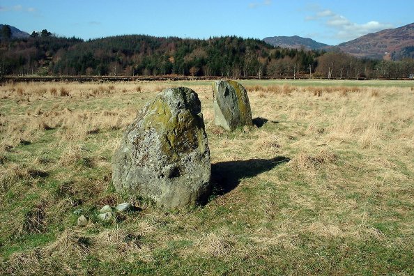
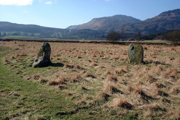
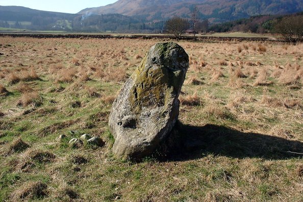
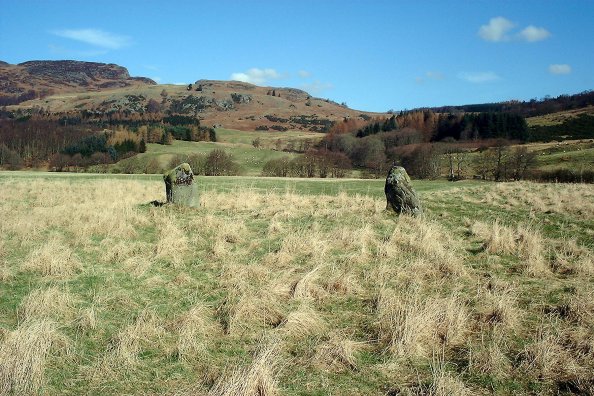
Twenty Schilling Wood — Fieldnotes13.03.03ceNo sign of any other stones which may have formed a circle, I think this is just a pair myself. The western stone has four distinct cup-marks on it which show up quite well in one of the photographs. Twenty Schilling Wood — Images13.03.03ce
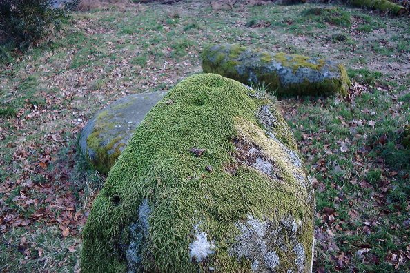
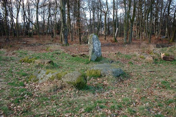
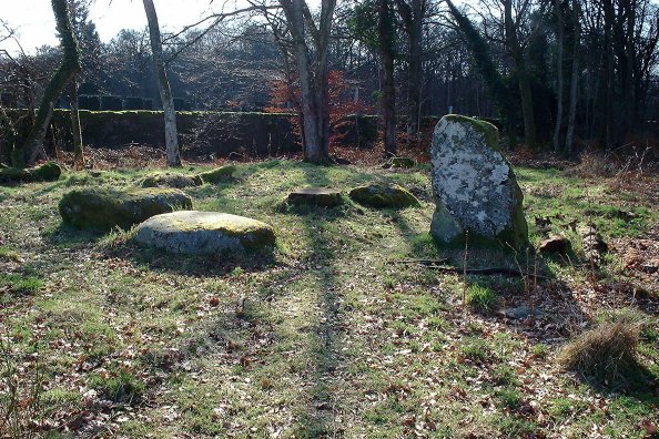
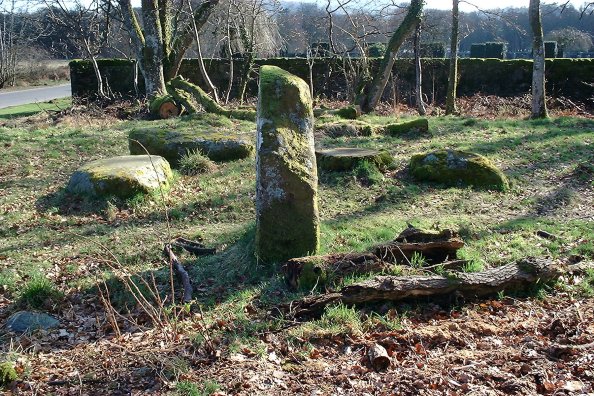
Dalginross — Fieldnotes13.03.03ceAccording to CANMORE, the alternative name for this site, Dunmoid, means 'Hill of Judgement'. This is unconfirmed. Around 1876, a stone kist was found in front of one of the slabs, and also an urn filled with ashes. Only one stone is now upright, and it appears to have two cup-marks on the upper surface - take a look at the photograph and see what you think. It was covered in moss, but the indentations felt fairly regular on tentative exploration! Dalginross — Images13.03.03ce
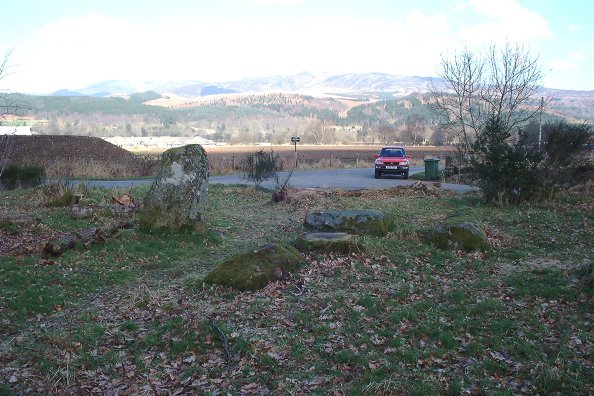
Wester Cowden Farm — Fieldnotes13.03.03ceThe main stone, a large block which leans markedly east, is the Roman Stone itself. Beside it is a small block, and six feet east a larger flat rock with over 20 cup-marks on its surface. Wester Cowden Farm — Images13.03.03ce
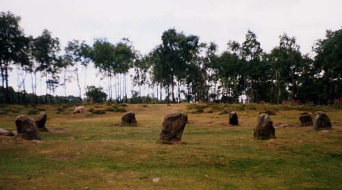
Nine Ladies of Stanton Moor — Images24.08.01ce
|
 Posted by nickbrand
13th March 2003ce Edited 14th March 2003ce
nickbrand's TMA Blog
Latest TMA Blog Posts
|


Comments (0) |
|
| You must be logged in to add a comment | |