Chance

Chance

All posts expand_more 751-800 of 2,683 posts

Miscellaneous

Creech Barrow
Round Barrow(s)

Details of barrow on Pastscape

(SY 92108233) Tumulus (NR). (1) A bowl barrow, large and ditched, hollow in centre. On Creech Barrow, but the name almost certainly refers to the hill and not to the barrow on the hill.(2) This barrow has been badly mutilated by excavation in the North East quadrant and a hollow measuring 8.0m long, 5.0m wide and 1.3m deep remains. It has also been mutilated by a modern boundary bank and ditch C-D. The barrow is 22.0m A-B and 19.0m C-D and has a maximum height of 3.0m. It has a ditch in the South-East quadrant 2.5m wide and 0.3m deep. Bowl Barrow. (3)

Miscellaneous

Stoborough Heath Barrow
Round Barrow(s)

Details of barrow on Pastscape

(SY 92188468) Tumulus (NR) (1) Bell Barrow. Rather small with sloping narrow berm.Surrounded by tree-ring. (2)
This barrow has a diameter of 21.0m and a height of 2.2m and is surrounded by a modern bank with outer ditch. It has a vague berm. It is flat topped and is heather covered. There are no visible traces of it having been excavated. Bell Barrow. (3)

Miscellaneous

Stone Hill Down
Long Barrow

Details of site on Pastscape

An oval-shaped mound on Stonehill Down, extant as an earthwork, has been variously described as an oval barrow, a long barrow and a bell barrow. RCHME field investigation for the Dorset Inventory described it as being 96 feet long, 64 feet wide and up to 9 feet high, surrounded by a sloping berm and then a ditch, the latter 1 foot deep and up to 20 feet wide. The ditch is interrupted by a causeway at each end. Since then it has suffered some plough damage but is still substantially extant. Classification remains a problem. Scheduled.

Miscellaneous

Ferny Barrows
Round Barrow(s)

Details of barrows on Pastscape

The ‘Ferny Barrows’ situated on the summit of a slight rise consist of:
‘A’ – (38) – SY 86648165. Bowl barrow, 48ft. diameter and 5ft. high. Disturbed near centre.
‘B’ – (39) – SY 86668261. Bowl barrow, 75ft. diameter and 6ft. high. Damaged on north and disturbed in centre. (2)
Both barrows are in an arable field but have not been ploughed over.

Miscellaneous

Baylea Farm Barrow
Barrow / Cairn Cemetery

Details of barrow on Pastscape

(SY 86768559) Tumulus (NR) (1) A large bowl barrow with a ditch. (2) This mound has a diameter of 20.0 metres and a height of 1.8 metres. There is no trace of a berm, but the ditch averages 1.5 metres in width and 0.4 metres deep. The centre and southern portion of this bowl barrow has been mutilated by a large excavation, possibly for military reasons. A cutting 7.0 metres wide and 1.5 metres deep extends from the south edge to beyond the centre of the barrow, for a total distance of 11.0 metres Much of the upcast from this cutting has been thrown into the south quadrant of the ditch, filling a length of about 12.0 metres. The sides of this bowl barrow are covered with small trees and some coarse grass. No surface finds were made in the area during field investigation. (3)

Miscellaneous

Five Barrow Hill
Barrow / Cairn Cemetery

Details of barrow on Pastscape

(Centred SY 876840) Five Barrows (NR) (1)
Five Barrow Hill Group of six round barrows, including three bells in an almost straight line along the summit of a slight ridge: (2)
‘A’-(36) SY 87598410. Bell barrow, about 90ft diameter and 5ft high with berm about 12ft wide and ditch 12ft wide and up to 2 1/2 ft deep.
‘B’-(35)-SY 87608405. Bell barrow, about 100ft diameter and 7ft high with berm 12ft wide and ditch 12ft wide and up to 2 1/2ft deep.
‘C’-(34) SY 87618400. Bell barrow, 105ft diameter including sloping berm and 6ft high, with recently recut ditch 12ft wide and up to 3 1/2ft deep.
‘D’-(32)-SY 87638393. Bowl barrow, 62ft diameter and 4 1/2ft high.
‘E’-(31)-SY 87628390. Bowl (?) barrow, about 42ft diameter and about 4ft high. Destroyed.
‘F’-(33)-SY 87638397. Bowl (?) barrow, about 30ft diameter and 1ft high. (Authy 2). (3)

Miscellaneous

Arne Hill Barrow
Round Barrow(s)

Details of barrow on Pastscape

Bronze age bowl barrow and the levelled remains of a bowl barrow situated on Arne Hill in the Isle of Purbeck. The bowl barrow located at NGR SY96928816 has a mound composed of earth, sand and turf with a maximum diameter of 25 metres and a maximum height of circa 2.5 metres. The top of the mound has two small trenches likely to represent World War II dug-outs. Surrounding the mound is a ditch from which material was quarried during the construction of the monument. This survives as an earthwork 3 metres wide and circa 0.75 metres deep and is flanked by an outer bank 2.25 metres wide and circa 0.5 metres high. The levelled barrow located at NGR SY97168806 had a small mound composed of earth, sand and turf. This was reduced during World War II. The quarry ditch surrounding the mound has become infilled over the years and survives as a buried feature. Scheduled.

Miscellaneous

Godlingston Hill Barrow
Round Barrow(s)

Details of barrow on Pastscape

A bowl barrow situated on the upper south east facing slope of Godlingston Hill. The barrow is one of three recorded on Godlingston Hill. The barrow has a mound composed of earth, flint and chalk, with maximum dimensions of 13.5 metres in diameter and about 0.75 metres in height. This is surrounded by an infilled quarry ditch which survives as a buried feature 1.5 metres wide. Two small quarry holes situated to the north west and south east of the barrow could also relate to the construction of the monument, as similar features are known to be associated with other barrows nearby. During the 19th century, the barrow was partially excavated by WA Miles and, later, by JH Austen. The investigations identified a cremation burial lying between two horizontal stones. Scheduled.

Miscellaneous

Giant's Grave and Giant's Trencher
Round Barrow(s)

Details of Giant’s Trencher barrow on Pastscape

(SZ 01258107) Giant’s Trencher (NAT) Tumulus (NR) (1) Dug by J. H. Austen 1851. Nothing found. Bowl barrow. Diam. 9 paces. Height 2ft. (2) A circular mound with a diameter of 8.0m. and a height of 0.5m. with no ditch, berm or visible traces of mutilation. Situated at the bottom of a re-entrant. Gorse and turf-covered bowl barrow. (3)

Miscellaneous

Giant's Grave and Giant's Trencher
Round Barrow(s)

Details of Giant’s Grave barrow on Pastscape

(SZ 01228106) Giant’s Grave (NAT) Tumulus (NR) (1)
Dug by J. H. Austen 1851. Nothing found. An oblong mound, 12 x 5 paces 1 1/2ft high. (2)
An oblong mound which measures 10.0m. East-West and 4.0m. North-South with no ditch or traces of mutilation. Heavily overgrown with bramble bushes. Situated at the bottom of a re-entrant. ?Barrow. (3)

Miscellaneous

Upton Great Barrow
Round Barrow(s)

Details of barrows on Pastscape

(ST 95554230) Upton Great Barrow (GT) (1) Upton Great Barrow was described and planned by Hoare and is identified by Grinsell as a bell-barrow with outer bank, the mound 78 feet in diameter and 10 feet high, with a berm 6 feet wide, now almost overspread and a ditch 21 feet wide and a foot deep. The bank is 21 feet wide and six inches high. It was opened by a labourer digging flints, prior to 1812, who found bones and ashes. Cunnington dug it and found a shallow grave containing a primary cremation accompanied by a necklace of faience, lignite and amber beads. Cunnington made several sections of the mound, finding potsherds, stag’s horns, animal bones and vast quantities of ashes and charred wood. (2-3)
Upton Great Barrow now has the appearance of a bowl barrow with a ditch and outer bank; all traces of the berm have disappeared. The central mound is 2.5 m high, the ditch about 0.8 m deep, and the surrounding bank 0.2 m high.A short length of the outer bank has been destroyed by a trackway on the southern side of the barrow.

Miscellaneous

Weasenham All Saints / Lyngs
Barrow / Cairn Cemetery

Details of barrow on Pastscape

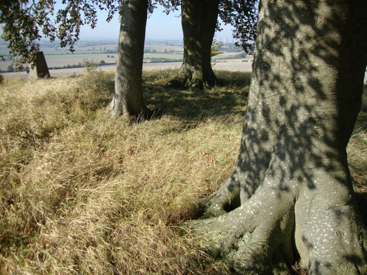
A bell barrow, known as Great Barrow, located on Weasenham Lyngs. It is part of a wider, dispersed round barrow cemetery and was formerly part of a more extensive grouping, including two bowl barrows which were located between 100m-200m south of the Great Barrow. The two bowl barrows were archaeologically excavated in 1972 and are now destroyed.

The bell barrow is visible as an earthen mound surrounded by a ditch with an internal and external bank. The mound, measuring 30m in diameter and standing up to 2m high, is situated on a roughly circular platform which measures about 47m north west-south east by 42.5m. The berm, between the edge of the mound and the internal bank, measures between 3m to 5m in width. The slight internal bank, up to 1.5m wide, stands at the edge of the platform, bordering the inner edge of the ditch except on the south side of the barrow where the ground appears level. The ditch measures up to 3m wide and 0.5m deep and is, in turn, enclosed by an external bank measuring up to 3.5m in width and up to 0.5m high. There is a slight depression in the centre of the mound and a shallow, semicircular depression on its east side.

This monument class is rare in Norfolk, and the bell barrow is of unusual form in that it includes an external bank.

Miscellaneous

Dane John Mound
Round Barrow(s)

Details of barrows on Pastscape

Roman barrow cemetery with possible Bronze Age origins. Only one survives as an earthwork. This was enlarged for use as a medieval motte and bailey and a windmill mound. It was also used as a Civil War gun emplacement and incorporated into a public garden after 1790.

A – TR 1477 5736: Danejohn Mound [NR]. (1)
B – TR 1469 5726 :
C – TR 1486 5732 :
D – TR 1504 5753
Sited from map (4) full description and history. (2)
Four Roman barrows (3), called Dungil Hills, or Dane John of which only one, the Danejohn (A) remains in a mutilated state (known 17th -18th century as Donjon: Dungeon: Dungil). In 1790, when the area was turned into a public park, this was smoothed and rounded and raised 18 feet in height. A ditch, which was filled in, encircled two-thirds of the base and suggests a possible adaption as a Norman motte. During the Civil War the mound was a gun platform and at one time a windmill stood on it . (4) A late Bronze Age socketed axe was found in barrow ‘B’. Apart from this all the finds from these barrows appear to be Roman or later. Scheduled. (5)

Miscellaneous

Broomhill and Bere Wood
Barrow / Cairn Cemetery

Details of Broomhill Barrows group on Pastscape

Four bowl barrows situated on a ridge known as Broomhill. The barrows each have a mound composed of earth, sand and turf, with maximum dimensions of between 13 metres to 17 metres in diameter and between circa 1.2 metres to 1.8 metres in height. Each mound is surrounded by a quarry ditch which survive as buried features circa 1.5 metres to 2 metres wide. Scheduled.
The Broomhill Group of four, tree covered and damaged bowl barrows in an irregular line on the crest of a spur.
‘A’ – (84) SY 86329508. 30ft diameter and 4ft high.
‘B’ – (85) SY 86359509. 40ft diameter and 5ft high.
‘C’ – (86) SY 86389509. 53ft diameter and 7 1/2ft high.
‘D’ – (87) SY 86419506. 45ft diameter and 5ft high. (4)

Miscellaneous

Broomhill and Bere Wood
Barrow / Cairn Cemetery

Details of Dungeon Barrow on Pastscape(SY 86139538)

A bowl barrow with a mound composed of earth, flint and chalk with maximum dimensions of 21 metres in diameter and circa 2.2 metres in height. The mound is surrounded by a quarry ditch which has become infilled over the years, but will survive as a buried feature circa 2 metres wide. Scheduled.

Miscellaneous

Woodbury Hill
Hillfort

Details of hillfort on Pastscape

Woodbury (SY 856948) is a contour hill-fort which occupies the entire flat top of the gravel-capped spur called Woodbury Hill 360ft above OD, 1/2 mile E of the parish church. The area enclosed is about 12 acres. The defences, though now much broken down, consist of a main inner rampart, at best 40ft wide and 19ft high above a single ditch, 5ft deep and 30ft wide, and a relatively massive counterscarp bank up to 26ft across, beyond which the ground falls steeply on the E side and greater part of the S side. On the NW there is a sloping shelf between the ramparts and the steep face of the hill. On this shelf is a series of rather flat-topped parallel ridges 1ft high, 10 yds or so wide and about 50 yds long, divided by furrows about 4ft wide. These are more likely to be connected with the annual sheep fairs once held in the hill-fort (Hutchins I, 135) than with agriculture. To the N a gently dipping but fairly narrow saddle connects the spur with the main ridge. At this vulnerable point the outer bank seems to have been thrust about 70 yds forward from the main rampart but the remains have been heavily ploughed. In the lane to the NE is a double fall which might mark the line of a ditch but this cannot be confirmed.

The present road in from the SW probably follows the line of an original entrance, and possibly does that at the NE; but all the other breaks in the defences seem to be secondry. The surface of the interior is uneven in many places but it is impossible to detect anything certainly ancient. The chapel shown on the plan certainly existed in the early 15th century and its footings were still traceable in the late 18th century (Hutchins, ibid). The nearby well was traditionally associated with it.

Miscellaneous

Black Hill
Round Barrow(s)

Details of Hundred Barrow on Pastscape

(SY 8446 9377) Hundred Barrow (Tumulus) (NR) (1)
This barrow has a diameter of 18.0 metres and a height of 2.6 metres. It has no surrounding ditch and is covered with thorn bushes, brambles and ferns. No visible trace of mutilation. A bowl barrow. (3) SY 8446 9378. Hundred Barrow, bowl barrow, 58ft diameter and 7ft high damaged by rabbits on summit of small spur. (4) Hundred Barrow was the meeting place of the old Domesday hundred of Bere. In the 12th century, a smaller hundred named after the barrow, i.e. Barrow (or Hundreds Barrow) was created out of the original Bere hundred. (5)

Miscellaneous

The Great Barrow
Artificial Mound

Details of barrow on Pastscape

A large round barrow or mound, part of a major monument complex at Knowlton and of probable Late Neolithic or Early Bronze Age date. Described in the RCHME Dorset Inventory as comprising a mound 135 feet in diameter and 21 feet high, surrounded by two concentric ditches, both largely levelled by ploughing. The inner ditch is separated from the base of the mound by a berm circa 15 feet across. The outer ditch is around 400 feet in diameter and about 35 feet wide. The air photo published by RCHME appears to show a distinct entrance causeway through the outer ditch on the northeast, althuogh the transcription shows it as a continuous feature. A pipe trench cut in July 1958 ran in a southwest-northeast direction, passing southeast of the mound but cutting across the outer ditch in two places. The pipe trench was fairly shallow in relation to the ditch, so a trial trench was excavated beside the pipe trench at the point where the latter crossed the south-southwest part of the barrow ditch. Constraints of time and space appear to have prevented a complete section being excavated. However, the ditch was shown to be 5.5 feet deep below the modern ground surface, and to be flat-bottomed. A sequence of fills was described briefly by the excavator. No artefacts were recovered. The barrow has been mapped from aerial photographs by EH’s Knowlton Circles Project.

Miscellaneous

Knowlton Henges
Henge

Details of site on Pastscape

A cluster of Neolithic and Bronze Age monuments near Knowlton. The principal features are the henge monuments and the Great Barrow, while a number of round barrows and ring ditches are also focused on the area. Until recently, little fieldwork has been undertaken in the area. Some stray finds of Neolithic date have been reported, while some flint scatters have been examined on the opposite side of the Allen Valley to the monuments. A research programme undertaken by Bournemouth University in 1993-5 included geophysical survey on various monuments in the area as well as some trial excavation at the southern henge (SU 01 SW 101). The monuments in this group are visible on aerial photographs and have been been mapped by EH’s Knowlton Circles Project. See child and associated monument records for details about individual sites. The core of the site is in the care of English Heritage.

Miscellaneous

Bul Barrow
Round Barrow(s)

Details of barrow on Pastscape

‘Bul Barrow’, a ditched bowl barrow, 18 paces diameter and 4ft high with a hollow centre. A sharpened bone of a deer ‘from Bull Barrow’ (a) may equally refer to the Bull Barrow in Holt parish (see SU 00 SE 1). (2) As described in Authy 2 although gorse and bramble-covered. The top of the barrow is entirely scooped out and there is a spoil heap adjoining the mound on the north-west. (3) The barrow called Bulbarrow in Woolland parish was formerly a beacon, and in 1625 the hundreds of Redlane, Brownshull, Sturminster Newton and Buckland were obliged to find watchmen. (4)

Miscellaneous

Poole Iron Age Port

Details of site on Pastscape

Remains previously thought to be a causeway were investigated by the The Poole Harbour Heritage Project. Two stone structures were uncovered 70 metres apart: one was 160 metres long and 8-10 metres wide running out from Cleavel Point on the mainland, the other 55 metres long projecting out from Green Island. Investigations suggested that the stone structures were in fact the remains of two harbour piers. Timbers recovered from the mainland pier have been radiocarbon dated to circa 300 BC (Iron Age), making it the oldest constructed port in North West Europe, and matching the radiocarbon date on the Poole Harbour log boat.

Miscellaneous

Brownsea Island
Ancient Village / Settlement / Misc. Earthwork

Monument No. 457515

Details of log boat on Pastscape

A log boat was dredged from Poole Harbour, east of Brownsea Island in 1964. Two large fragments of the boat were discovered, and it was reconstructed to provide a vessel of just over 10 metres in length and 1.52 metres in width. The wood has been radiocarbon dated to circa 300 cal BC, giving it a firm Iron Age date. It is believed that the boat is associated with two nearby Iron Age jetties, nationally significant and thought to relate to cross-continental trading which took place on Green Island in Poole Harbour.
The boat was submerged in a tank for approximately 30 years after its discovery. When Poole Museum was moved to a new site a programme of conservation was entered into regarding the boat. British Sugar Company provided a sucrose solution, something which had proved effective in the past at stabilising oak samples.
The conservation programme is now successfully completed and the logboat is on permanent display in Poole Museum.

Miscellaneous

Three Barrows
Round Barrow(s)

Details of barrows on Pastscape

Tumulus (NR) (Three times) (A – SY 93078481 : B – SY 9307 8465 : C – SY 92988449). (1) Three Bowl Barrows. (2)
‘A’ is a rather poorly shaped bowl barrow with diameter of 17.0m and a height of 1.5m with no surrounding ditch. Heather covered with no apparent signs of mutilation. ‘B’ has a diameter of 22.0m and a max height of 2.4m. and has no surrounding ditch. A hollow in the top has a diameter of 3.0m and is 0.4m deep. A small portion at the Eastern base has been cut away.
A heather and gorse covered Bowl Barrow. ‘C’ Is a badly mutilated bowl barrow. A trench in the East measures 4.0m long and 1.8m wide and appears to have been cut for soil extractions and not excavation. It is badly pitted all over and now serves as a rubbish dump. The barrow has a diameter of 16.5m and is 1.4m high and has no surrounding ditch.

Miscellaneous

Nine Barrows Down
Barrow / Cairn Cemetery

Details of barrows on Pastscape

A group of 18 Bronze Age bowl barrows (and one Neolithic long barrow, recorded separately as SY 98 SE 14) on Ailwood Down. The barrows form a fairly compact cluster within an area also containing a number of pit-like depressions. These latter may represent quarrying or could alternatively be natural features. The barrows vary in size, and only a few definitely have surrounding ditches. In one case the ditch is interrupted by four causeways. Only one episode of excavation is known (during the 19th century), one of the barrows containing a cremation. See descriptive text for details about each barrow. The cemetery was last visited by RCHME in 1986. All barrows in the group are scheduled.

Miscellaneous

Nine Barrows Down Long Barrow
Long Barrow

Details of barrow on Pastscape

A Neolithic long barrow on Ailwood Down, immediately adjacent to the round barrow group SY 98 SE 5. The barrow is extant as an earthwork mound 32 metres long and up to 12 metres wide. It is 0.5 metres high on the uphill northern side, and 2 metres high on the downhill southern side. It is orientated roughly northwest-southeast. During RCHME field investigation in 1986 a narrow shallow ditch was evident around the eastern part of the mound but could not be traced around the western part. Previously, slight depressions had been noted on the east, south and western sides. One of the round barrows appears to impinge on the ditch. Scheduled.

Miscellaneous

Rempstone Stone Circle
Stone Circle

Details of Stone circle on Pastscape

Stone circle located at the foot of Nine Barrow Down. RCHME field investigation in the mid-20th century noted that the surviving stones formed an arc which, if originally part of a complete circle, would have been about 80 feet in diameter. At the time, 12 stones stood on or near their original setting. 5 stood to a height of 2 to 3.75 feet, while the other seven were prone. Some of these latter had clearly been moved. Nine other stones were noted piled together some 80 feet to the east. In 1957, JB Calkin referred to two parallel rows of stones, about 9 feet apart and located circa half a mile west of the circle, but apparently aligned a little to the north of it. He suggested that they may have formed a processional way leading to the circle. RCHME field investigation in 1986 noted that only 10 of the stones belonging to Rempstone Circle were still visible. The field investigator added that “nothing of the supposed stone row(s) survives”.

Miscellaneous

Godlingston Heath
Round Barrow(s)

Details of barrows on Pastscape

(’A’, ‘B’,’C’ – Centred SZ 007820) Tumuli (NR) (1)
Three bell barrows, ‘A’ – SZ 00678200; ‘B’-SZ 00728196; ‘C’-SZ 00718193, on Godlingston Heath (see illustration card for measurements and profile of each barrow). A possible bowl barrow, ‘D’-SZ 00698199, Impinges on the ditch of bell barrow ‘A‘
‘A’-(33) – SZ 00688200. Bell (?)barrow, unusually irregular- shaped probably due to its position on a small natural knoll. The diameter is 52ft and 4 1/2ft high with irregular berm 25ft wide on the north; 15ft wide on the south and almost absent on the east. The ditch is 14th wide and 6 inches to 2ft deep on the west, but absent on the south where its line is interrupted by barrow ‘D’.

Miscellaneous

Fishing Barrow
Round Barrow(s)

Details of barrow on Pastscape

(SZ 01818210) Fishing Barrow (Tumulus) (NR) (1) A very large bell barrow with a well marked ditch, narrow berm almost overspread. (2) Inside ditch to inside ditch this barrow has a diameter of 32.0m. The completely encircling ditch has been an average width of 3.5m. and an average depth of 0.7m. The height from the top of the mound to the bottom of the ditch is 3.2.m. on the south quadrant. It is heavily overgrown with gorse and heather except for the top which is flat and serves as a golfing tee. It is surmounted by a flagstaff.

Miscellaneous

Ulwell Barrow
Round Barrow(s)

Details of barrow on Pastscape

(SZ 02238132) Tumulus (NR) (1)
A turf covered bowl barrow, 23.0m. diameter and 1.9m high in the west. There are evident traces of a ditch in the eastern quadrant which are only slight elsewhere. Square hollow on top. (2)
SZ 02238132. Ulwell Barrow, ditched bowl barrow, 74ft diameter and 6ft high with ditch 12ft wide, on the west end of Ballard Down. There is an excavation hollow in top and the barrow is cut by a hedge-bank on the north. On the south qhere crossed by the parish boundary is a collapsed obelisk dated 1892 (shown) on OS 6”). Excavated by Austen in 1857 who found a primary contracted inhumation, the skull surrounded by flat stones, in a chalk-cut grave 8ft x 5ft, associated with a handled cup of fine red ware; antler fragments occurred in the grave filling. Near the centre of the mound were disarticulated inhumation with urn fragments and, slightly higher, a cremation under a flat stone with more urn fragments. In the top of the mound were Iron Age and/or Romano British debris and many flint chippings. (3,4) The obelisk which stands on the south slope of the barrow was reerected in 1972 and stands to its full height. (Not an antiquity) 4/89 Surveyed at 1:2500. (6) Both inhumations were made, the intrusive one being Anglo-Saxon. (7)

Miscellaneous

The King Barrow
Round Barrow(s)

Details of barrow on Pastscape

(SZ 04608203) King Barrow (Tumulus) (NR) (1) Bowl Barrow, covered with trees ploughed to edge. 13 paces diameter x 3 1/2ft high. (2) This area is so heavily overgrown with brambles, thornbushes and netttles as to be impenetrable. It was possible to ascertain that the barrow has not been levelled. (3) SZ 04618202. King Barrow, bowl barrow, 43ft diameter and 4ft high situated on top of natural knoll. (4)

Miscellaneous

King’s Barrow
Round Barrow(s)

Details of barrow on Pastscape

King’s Barrow, bowl (?) (SY 92048572). Now in a garden and covered with trees and shrubs. Diam. uncertain, ht. about 5 1/2ft. In 1767 said to be 100ft in diam. 12ft high and apparently constructed of turves. In centre on sandy buried surface was primary inhumation (probably Wessex culture) without skull, wrapped in stiched animal skins, within a hollowed oak tree coffin 10ft long by 4ft wide by 3ft deep orientated NW-SE. Attached to one skin was ‘gold lace’ 4ins. by 2 1/2 ins. with ‘bits of wire’ in it. Near the SE end of the coffin was a small cup, now lost, 2ins high, and decorated with incised lines. Though described as of oak, it was more probably made of Kimmeridge shale. (Salisbury Journal 9th March 1767; Gentleman’s Magazine XXVII (1767), 53-4 Hutchins I, 100, 563; W. A. M. XLIV (1928), 101-5 ad 111-17; PPS xv (1949), 101-6).(2)

Miscellaneous

Thorn Barrow
Round Barrow(s)

Details of barrow on Pastscape

A bowl barrow known as Thorn Barrow, situated on a high upland ridge overlooking the valley of a tributary of the River Wolf. The barrow survives as an oval mound which measures 49.5 metres north to south and 42.9 metres east to west and is up to 1.6 metres high. The surrounding quarry ditch is preserved as a buried feature which measures up to 5 metres wide. The profile of the mound is very uneven, and is slightly lower in the south western quadrant. There is also evidence of old excavations in the form of an oval depression in the summit on the north eastern side. Scheduled.

Miscellaneous

Sheep Down Long Barrow
Long Barrow

Details of the long barrow on Pastscape

Long barrow (SY 60438836) lies on Sheep Down, about 580 ft above OD, on the side of a long arable slope falling north-east from Black Down. On a bearing of 124x, it is 174 ft long, 70 ft wide at the north-west end and 88 ft at the south-east, where it rises to its maximum height of 6 ft. It was probably incorporated in a ‘Celtic” field lay-out (SY68 NW 36); plough soil is piled against the south side and a lynchet meets the east end at right angles from the south. The whole has been heavily ploughed in recent times. (2,3) SY 60438835. Long barrow, generally as described by RCHM (2); overall length 54.0m. and maximum height 2.0m. Now under permanent grass but ploughed in the past, no visible evidence of side ditches remains. The lynchet at the E end has been ploughed out. Re-surveyed at 1:2500 on M.S.D. (4)
The long barrow on Sheep Down lies at the head of a dry valley which runs NE into the South Winterbourne valley. The site comprises a substantial rectangular mound, orientated NW-SE and 55m long. The mound tapers in width from the southeast end (34m) to the northwest end (26m). The mound is highest at the southeast (3m) and drops to 2m high at the northwest, with a step down roughly half way along the mound. The field has evidently been ploughed in the recent past, although it was not enclosed until 1863 (Winterbourne Steepleton Enclosure Award and Map, DRO Inclosure 81) (5).
The site was surveyed using differential GPS and EDM at a scale of 1: 500 as part of a survey of the long barrows on the South Dorset Ridgeway carried out by English Heritage and the Ridgeway Survey Group (6).
The geophysical surveys carried out by the EH Geophysics Team and the Ridgeway Survey Group on Sheep Down showed some rather surprising results (7). Both the magnetometry and the resistivity surveys failed to locate the presence of buried flanking ditches. The resistivity survey showed a high resistance, curvilinear response around the base of the barrow mound, indicating the presence of a retaining wall. There was also an area of increased resistance across the mound, with an area of high resistance towards the southeast end, perhaps indicating the presence of a collapsed stone chamber. The geophysical survey suggests that the long barrow on Sheep Down was originally a chambered long barrow, like the Grey Mare and Her Colts to the south (SY 58 NE 19). The absence of flanking ditches is problematic. It may be the result of the local geology: the barrow lies on an area of pebbly and sandy clay (Older Head, British Geological Survey, sheet 326). The mound material may have been obtained locally from the sand and clay deposits just to the north, where there are extensive quarries.

Miscellaneous

Longlands
Round Barrow(s)

Details of the barrow cemetery on Pastscape

(`A` – SY 59988976; `B` – SY 60008977) Tumuli (NR) (`C` – SY 60038979; `D` – SY 60188993; `E` – SY 60478995)
Tumulus (NR) (three times). (`F` – SY 60439004) Long Barrow (NR). (1)

Group of barrows at Longlands, including one possible bell, four in a rough alignment south west-north east along spine of spur, with possible long barrow at north east end. The three south west barrows are just above the 500 ft contour and the others above 400 ft. All damaged. Near foot of steep slope to north immediately south of the main road three further barrows at 60449020, 60519025 and 60559018 are shown on OS (1811) but there is now no sign of them.
`A` Bowl in Dry Wood, now only irregular rise about 9 ins high.
`B` Bowl 25 yds north east of `A`, also in Dry Wood. Diam 48 ft, ht 3 1/2 ft.
`C` Ditched bowl 40 yds north east of `B`. Mound about 65 ft diam and 1 1/2 ft high, within oval ditch about 150 ft (north west-south east) by 90 ft (VAP CPE/UK 1934, 5098). Almost ploughed out.
`D` Bowl 220 yds north east to `C`. Diam 52 ft, ht 14 ft though base steepened by ploughing.
`E` Bell 307 yds east north east of `D`. Diam about 94 ft, ht 5 ft, with ditch about 105 ft in diam, separated from mound by narrow berm (VAP CPE/UK 1934, 5092).
`F` Oval barrow, long barrow (?) is sited about 450 ft above OD on a gentle north east facing slope just below the crest of a broad ridge. It has been much ploughed and is now only about1 1/2 ft high and measures 70 ft (east-west) by 40 ft. Under plough it showed only earth and flints as in the surrounding field. (2-3)

Miscellaneous

Tinker’s Barrow
Round Barrow(s)

Details of the barrow on Pastscape

(SY 77908785) Tinker’s Barrow (NR). (1)
Tinkers’ Barrow, ditched bowl (SY 77918785). In plantation on top of S slope. Diameter 44ft, height 4ft, with ditch 9ft wide.
Large excavation on top. (2,3) Tinker’s Barrow (name in local use). A bowl-barrow, diameter 13.5m, height 1.2m, a silted outer ditch 3.3m wide and 0.3m deep. Covered by dense rhododendrons.

Miscellaneous

Tadnoll Barrow
Round Barrow(s)

Details of the barrow on Pastscape

(SY 79148747) Tadnoll Barrow (NR). (1)
Tadnoll Barrow, bowl (?) (SY 79148747). On slight knoll in heathland and cut by parish boundary with Moreton, E of which road has destroyed two-thirds of site. Diam about 56 ft, ht about 5 ft; around, and 3 ft from it on W, is a probable tree-clump enclosure, about 75 ft in diameter. (2,3) Tadnoll Barrow (name not confirmed) a severely mutilated probable bowl barrow, is generally as described by RCHM (2).
The probable tree-clump enclosure survives on the east and west sides of the road, as a broad bank 4.5m wide and 0.5m high, with an outer ditch 2.0m wide and 0.3m deep, about 30.0m in overall diameter. A clump of mature conifers covers the site.

Miscellaneous

Brightwell Barrow
Round Barrow(s)

Details of the barrow on Pastscape

A Bronze Age bowl barrow, later utilised as a tree clump mound, situated 350 metres north of Highlands Farm.
Scheduled Monument 238160 Oxfordshire Parish of Brightwell-cun-Sotwell SU 59 SE 54 Location SU 5748 9184 The barrow mound survives, despite part reduction by cultivation, as an upstanding earthwork measuring 30 metres in diameter and standing up to 0.3 metres high. The mound is surrounded by a quarry ditch from which material was obtained during its construction. This has become infilled over the years and now lies beneath the edge of the spread mound. This ditch will survive as a buried feature to its original width of 3 metres. The barrow is believed to have been reused as a tree clump mound between 1800-1840 and it still has a ring of mature beech trees around it. During ploughing the surrounding field has produced Iron Age and early Roman pottery sherds although the nature of the activity and its relationship to the barrow is not fully understood. There are cropmarks of two other single ditched round barrows to the west of Brightwell Barrow. One is calculated at 29m dia. and can be seen on air photos at SU 5744 9179 and the other, of 26m Dia. at SU 5754 9187
‘A’ [SU 5761 9190] Brightwell Barrow [T.U.] (1) Brightwell Barrow a circular mound, 20 paces in diameter and 1 1/2 feet high, tree-covered, at Sinodun Hills, Brightwell. It has been surrounded by two tree rings, one perhaps c. 1800, the other in 1843. Opened by Dr. H. Watts in 1923, E.I.A. pottery (in British Museum) and animal bones found. No human remains detected (2). ‘B’[SU 5744 9179] Barrow (3a). (2-3) ‘A’ is a circular tree covered mound 0.3m. high. Although rather small and ploughed down, it is almost certainly a barrow and is ideally situated on the top of a hill. No trace of the tree rings survive, or of barrow ‘B’ which is under young crops. Published survey (1/2500) revised. (4) Excavations across the site of the circular crop mark in a. above, by Dr.s Watts and Girling in 1938 showed no evidence of disturbance below ground level and nothing was visible above ground. Subsequent enquiries ascertained that a corn rick had been standing on this spot prior to the air photograph being taken by Major Allen. (5) (SU 57449179). The barrow is visible on air photographs. (6)
Cropmark remains of two single ditched round barrows at SU 5744 9179 and SU 5754 9187 mapped at 1:10,000 scale as part of the RCHME: Thames Valley NMP. The former barrow has a diameter of 29m and corresponds with barrow (B) referred to in sources 2 & 3 above. The second barrow lies 100m to the east and has a diameter of 26m. Both lie to the west of the site of the tree covered Brightwell Barrow. (Morph No. TG.377.10.1-2). (7)

Miscellaneous

Black Barrow
Round Barrow(s)

Details of the barrow on Pastscape

(Approximately SX 02836310) Black Barrow (NAT) (1)
‘Black Barrow’ is one of five barrows shown on the Tithe Map (see also SX 06 SW 9 and 18). (2)
A slight elevation (in field number 1512 on OS 25”) is said to now mark its position. (3)
It is presumably the “Black Barrow, diameter 60ft recorded by Thomas on the N side of the new turnpike road, about 1 1/2 mile SW of the (Lanivet) church”. (4)

Miscellaneous

Lord’s Barrow
Round Barrow(s)

Details of the barrow on Pastscape

(SY 77918414) Tumulus (NR) (1) Lord’s Barrow, a round (bowl?) barrow 58ft diameter x 7ft high, situated on the crest of a ridge 400 ft above OD. Excavated and much damaged. A probable barrow of? bowl-type at SY 77918415 situated in the hedge line on the parish boundary is about 36ft diameter x 1 1/2ft high. (2,3)
A: SY 77778412 Lord’s Barrow (name not confirmed) is truncated on the east by road. Its present diameter is 22.0m. and its
height 3.2m There is no visible ditch.
B: SY 77918414. The remains of a barrow, almost destroyed, now part of a hedgebank. It measures 11.0m. by 4.0m., with a height of 0.8m. No visible ditch.

Miscellaneous

Robins Barrow
Round Barrow(s)

Details of the barrow on Pastscape

(SY 7241 9463). Robin’s Barrow (Tumulus) (NR). (1) Tumulus located and surveyed. (2) SY 7241 9462. Robin’s Barrow, a bowl barrow 14 paces diameter and 1ft high, apparently almost entirely removed for a water tank since 1939. (3) SY 7241 9463. Robin’s Barrow, a bowl barrow formerly 47ft diameter and 4 1/2 ft high, has been severely mutilated by the insertion of a water tank, and its outline is very irregular. (4)

Miscellaneous

Huck Barrow
Round Barrow(s)

Details of the barrow on Pastscape

(SY 74948841) Huck Barrow (NR) (1)
Huck Barrow, a ditch bowl barrow on an almost level site, is 52ft in diameter by 8ft high with a ditch about 10ft wide. It has been damaged, and is covered by trees. (2,3)

Miscellaneous

The Rainbarrows
Round Barrow(s)

Details of the barrows on Pastscape

Three Bronze Age bowl barrows on Duddle Heath. The barrows are between 17m and 25m in diameter and 1.25m-1.6m high. The two most northerly barrows have a hollow in the centre. This possibly marks the sot of the excavations in 1887. This found a cremation burial and three bucket urns containing cremations. The southern most barrow also has a hollow but this probably marks the site of a military observation post. Remains of ditches are visible at various points 2m wide and 0.25m deep. Scheduled.