

Visited 07.02.19
About 1 mile out of Sheffield on the B3315 towards St Buryan there is a crossroads. Trevelloe farm is on the left and Trevelloe House is on the right. Turn right down a farm track until you can see Trevelloe house on the right. There is a parallel private drive which is tarmacked. The Trevelloe Carn is visible within the grounds of Trevelloe House. It seems to have been incorporated into the garden. It does not seem that public access is encouraged so I settled for a distant view.


Visited 06.02.19
Head for Land’s End on the A30. Around 3 miles from Land’s End turn right towards the airport on the B3306. Go past the airport and through Kelynack village. Bosavern House is around 0.5 mile on the right with public parking on the left for a footpath. If you walk right towards St Just you will see Tom Thumb Rock on your left at the edge of the field. Walk to the edge of the field and follow the hedge down to the rock. The massive stone egg-shaped rock measures c. 20x10x5 feet. Two large basins on the edge of the rock have been eroded to form seats.


Visited 07.02.19
Rosemorran Farm is on a minor road off the B3311 at the edge of Penzance. The narrow lane is enclosed by a dyke at Rosemorran Farm. The top of the standing stone can be clearly seen above the dyke at SW4752532552. The stone is on the first corner after the farm. The menhir has been hemmed in by the wall but retains its own character. Around 25 yards towards the farm there is a suspiciously stone like inclusion in the wall though it is much smaller.


Visited 08.02.19
If you park at Lamorna Cove the SWCP goes past Kemyal Crease. Kemyel 2 is a menhir 200 yards SE of Kemyel Menhir in an adjacent field towards the sea. It can’t be seen due to the high dykes until you are in the enclosed field. It is just under 6 feet high and rounder than its neighbour. It is situated at SW4579524577.
There was a gatepost at SW4570524137 which looked like a re-purposed menhir at least if not an original menhir. Is it Keymel 3?


Visited 08.02.19
If you park at Lamorna Cove the SWCP runs past Kemyel Crease farm. The menhir is situated at SW4569024667 around 200 yards south of Kemyel Crease farm. It is around 6 feet tall and pointed. The menhir is not marked on the OS Explorer map.

Bullaun stone in N Bank of Castallack Round
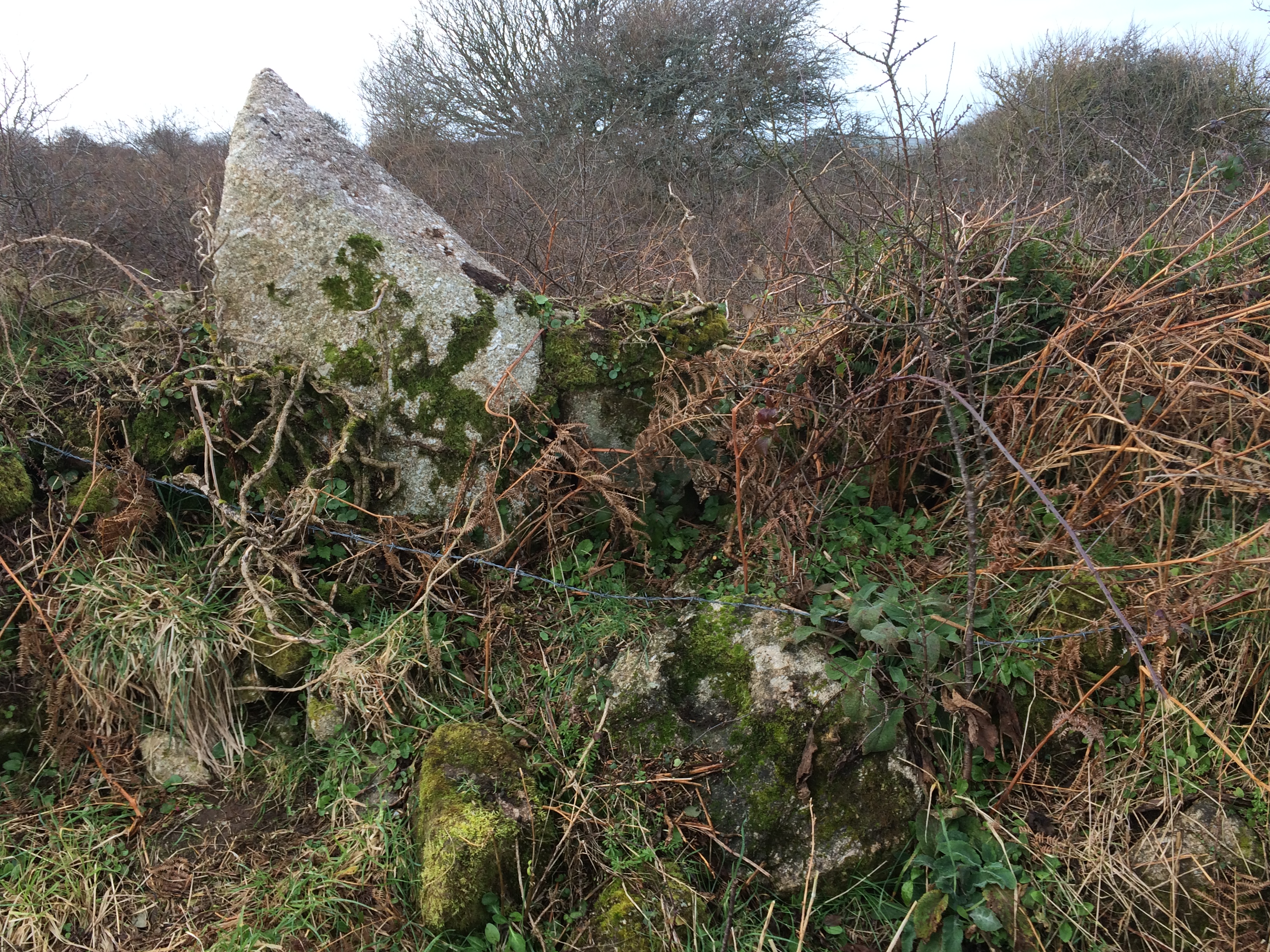
Castallack Round Dyke Menhir and Bullaun stone in N Bank of Castallack Round.

Interior of Castallack Round viewed from SE.
Visited 07.0219
I parked up in Castallack and walked up the muddy bridle path to Castallack Round at SW44852539, at a right angle in the path. The grass in the field was short however there was no sign of a hut circle. On the OS Explorer map the hut circle is just north of the round in an impossibly overgrown area.
At the northern edge of the round this a pointed menhir wedged in the dyke and a Bullaun stone a few feet away. A Bullaun stone is a stone with a deep hemispheric depression which often collects water.


Visited 08.02.19
I followed the right of way path and found the large menhir in the middle of some cabbages. I skirted round the field to find the other menhir incorporated into the hedge at SW 42765 23920. I was convinced that the hedge was built round this standing stone. The second stone is around 60 yards WSW of the visible stone. There is an interesting capstone shaped stone at SW 42814 24011 on the eastern edge of the field, around 75 yards north of the visible menhir.


Visited 17/01/19
Drummore Castle is situated 300m South of Drummore Stone Circle up the slope, obscured by trees. Mother Nature is slowly reclaiming the fort. The oval structure is still visible, as are the double rampart and ditch defences. The enclosure is flat with no remnants of occupation.
Canmore ID 63925 (go to Links) yields more information on the fort.
Directions to Drummore Stone Circle & Castle: Follow the signs off the A75 for Kirkudbright. Head S on the A711 for c. 1.7 miles from the centre of Kirkudbright to Mutehill. Continue E along the A711 for c. 0.3 miles to reach a right turn for Townhead. Take the Townhead road following it for c. 1.5 miles to a disused entrance on the left. Park up safely then walk c. 150 yards S for c. 140 yards to a gateway on the right. Go into the grassy field, follow the margin S for c. 100 yards to another gateway. Follow a grass track c. 250 yards W towards a gateway at the corner of a wood. Drummore Stone Circle is centred c. 75 yards W of the gateway. Drummore Castle is located c. 300 yards S up the slope hidden in a wood. My walking route is viewable on Drummore Stone Circle & Castle.


Visited19/01/19
As promised I returned to Drummore Stone Circle on my way to Drummore Castle (300m S of the stones).
The site is a natural amphitheatre with the stone circle as the focus of attention. There are only 4 stone remaining however a stone circle with missing stones seems more likely than a giant four poster.
Directions to Drummore Stone Circle & Castle: Follow the signs off the A75 for Kirkudbright. Head S on the A711 for c. 1.7 miles from the centre of Kirkudbright to Mutehill. Continue E along the A711 for c. 0.3 miles to reach a right turn for Townhead. Take the Townhead road following it for c. 1.5 miles to a disused entrance on the left. Park up safely then walk c. 150 yards S for c. 140 yards to a gateway on the right. Go into the grassy field, follow the margin S for c. 100 yards to another gateway. Follow a grass track c. 250 yards W towards a gateway at the corner of a wood. Drummore Stone Circle is centred c. 75 yards W of the gateway. Drummore Castle is located c. 300 yards S up the slope hidden in a wood. My walking route is viewable on Drummore Stone Circle & Castle.


The Cradle Stone below it’s smaller companion.
Visited 01.12.18
I was staying in Crieff for a few (rainy) days so I visited the Knock of Crieff. The Cradle Stone is around 250 yards up the Knock Walk from the Lower Car Park, then 100 yards into the woods on the R. The OS Grid Reference is spot on. It is adjacent to a smaller boulder, also cleft in half, curiously.
There is a local belief that placing a coin in a crack in the Cradle Stone will make a wish come true. I invested 5p but I’m still waiting...
The Cradle Stone is a listed as Canmore ID 25498 (go to Links).

Concraig standing stone from S. Visited on 30.11.18

A possible crannog c. 45 yards W of Ash Island in Carlingwark Loch viewed from NE.

Ash Island on Carlingwark Loch viewed from NE. A crannog was constructed on the island.

Ash Island and adjacent man-made island on Carlingwark Loch viewed from NE.

Canmore ID 62282, a possible cairn with whins & clearance stones added.
Visited 12.11.18
My previous attempts at clearing up the Machermore mystery were thwarted by the presence of a bull in the wrong field. Third time lucky, armed with Canmore data I visited the remaining cairns. There are a lot of clearance cairns in this area to confuse the picture. After careful analysis of Canmore sites I have come to the following conclusions:
Canmore searches for Machermore are not relevant as they are all discredited or clearance cairns.
Canmore searches for Culroy have produced several clearance cairns, three ruined cairns and two well preserved cairns.
1) Canmore ID 62210 See White Cairn, Culroy
2) Canmore ID 62231 See Culroy Farm Cairn
3) Canmore ID 62260 A dilapidated cairn covered by whins and some clearance stones
4) Canmore ID 62271 This is the well preserved Barrow listed as Machermore/Culroy
5) Canmore ID 62282 A possible cairn with whins & clearance stones added.


Culroy Farm Cairn lies around 300 yards N of Culroy Farm. It is a grassy mound around 4 feet high and 60 feet in diameter. There are many scattered rocks on the flattened plateau of the cairn. It is listed as Canmore ID 62231 (go to Links).


Visited 05.11.18
Head for Creetown Gem Rock Museum. Turn R up the hill just before the museum, turn L at the crossroads after 1/4 mile onto a single track road. After 400 yards the Chapelton White Cairn is in the field on the R.
Chapelton White Cairn is somewhat of an ironic name as the cairn is a grassy mound with no visible stone structure except for a large stone on the cairn summit. Canmore ID 63303 (go to Links) makes no mention of this stone so it may have been erected post 1970.
It is an unassuming site, on the way to Glenquicken and Cauldside sites so it is worth a short detour.

The cist has partially collapsed.

Cauldside Burn Cairn North viewed from N.
Visited on 5th Nov 2018
This ruined cairn can be found by parking at Cambret Hill just above the cattle grid on the road to the Cambret Hill mast. Head downhill towards the summit of Cairnharrow opposite. Cauldside Cairn South, a large well preserved cairn will be visible half way up Cairnharrow across the valley. Cross the fence at the bottom of Cambret Hill and line up the summit of Cairnharrow with Cauldside Cairn South. You should see a green area, a reed bank, stand out from the brown moorland around 100 yards straight ahead. The ground is boggy up to the cairn. The ruined cist is surrounded by reeds and an earth bank.
The history of this cairn is detailed in Canmore ID 63692 (go to Links).
Visited 05.11.18
While visiting the Cauldside Burn Cairn North (Canmore ID 63692) I tried to find the Stone Setting. When GPS failed I tried a 30 yards by 30 yards grid search S of the Cauldside Burn Cairn North but found no stones of any size.
I think the pictures already submitted here depict the Cauldside Burn Cairn North and the Cauldside Stone Circle, respectively.
For a more detailed description of the Cauldside Burn Stone Setting see Canmore ID 63682 (go to Links).