

Central Recumbent Stone of Claughreid Stone Circle viewed from WNW.
N Face of Bain’s Hill Standing Stone.

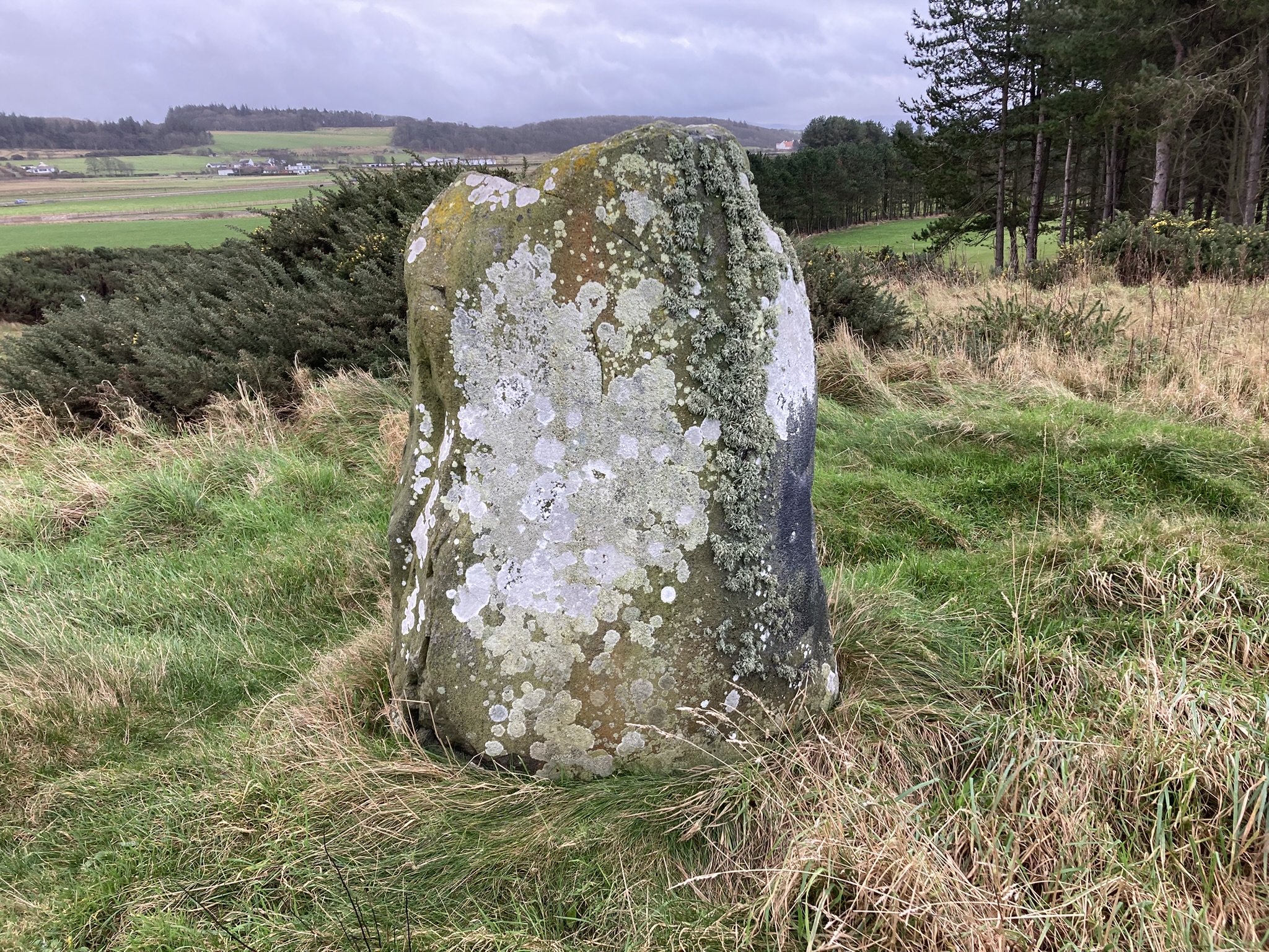
E Face of Bain’s Hill Standing Stone.

S Face of Bain’s Hill Standing Stone.

W Face of Bain’s Hill Standing Stone.


Possible Kerb Stones on N Perimeter of Auchensoul Hill Cairn.

Possible Kerb Stones on W Perimeter of Auchensoul Hill Cairn.

Outlying Stone c. 10 yards SE of Auchensoul Summit Cairn.
There is a possible cairn on the summit of Auchensoul Hill, c. 0.75 miles WNW of Barr, a small village in South Ayrshire. The grassy mound on the summit of Auchensoul Hill is surmounted by an OS Trig Point. Canmore ID 62635 proposes that the mound may be the remains of a prehistoric cairn, The round cairn measures c. 15 feet in diameter by 1 foot high. There are several embedded stones on the N and W arcs which may be kerb stones. There is also an obvious medium-sized stone located c. 30 feet SE of the cairn.

Double Rampart & Ditch of Bailiehill Fort viewed from SW.


Wall of Enclosure of Bailiehill Fort viewed from SW.


Recumbent Stone in Enclosure of Bailiehill Fort.
Directions to Low Airyolland Cairn: Take the W turn to Glenluce off the A75. Turn left for New Luce after 0.2 mile. Stay on this road for c. 3.5 miles to reach a lay-by at a quarry on the right. (Parking is difficult from this point onwards so I chose to park safely and extend the walk.) Walk c. 0.25 mile N along the road to reach a gate into the Southern Upland Way path (SUW). Follow the path down to the footbridge over the Water of Luce. Turn right along the SUW for c. 130 yards to reach a grassy mound dominated by a large mature tree on the edge of the field. Low Airyolland Cairn is best viewed from the N. My walking route is viewable on Low Airyolland Cairn.


Possible Large Kerb Stone on S Perimeter of Low Airyolland Cairn.

Possible Large Kerb Stones on W Perimeter of Low Airyolland Cairn.

Moss Covered Stones in Centre of Low Airyolland Cairn.
Visited 27.10.24
There is a ruined cairn c. 1.5 miles S of New Luce on the W bank of the Water of Luce in Dumfries and Galloway. It is named after Low Airyolland farm which is located c. 400 yards SW of the cairn. Low Airyolland cairn is on a grassy mound sloping from N to S. It is defined by an earth bank up to c. 3 feet high with a c. 60 feet diameter. The cairn is dominated by a tall mature oak tree in the NW quadrant. There are shrubs and ferns on the E, S and W arcs. A large moss covered stone on the S perimeter and 3 large stones on the W perimeter may be displaced kerb stones. The centre of the circle is grassy and irregular with scattered embedded stones.
There is further information on Low Airyolland Cairn in Canmore ID 304998.
This route involves a walk of 0.25 miles along the A747 Port William road. Care should be taken: cars tend to drive fast around a sharp corner. The cross country route is an assault course: It includes crossing 3 dry stane dykes and a burn but no electric fences fortunately. Wellies are essential for this walk due to the burn crossing.
Directions to Culquhasen SE Cairn: Take the A747 Port William turn off the A75 at Glenluce. Follow the A747 for c. 4.1 miles to reach a lay-by at Auchenmalg Village Hall. Park up and walk back up the A747 for c. 0.25 mile to a gateway on the right. Turn right into the field. Follow the margin of the field to a gate in the corner after c. 130 yards. Continue along the margin of the field for c. 300 yards to reach a dry stane dyke. Cross over the dyke and continue E along the margin of the field for c. 230 yards to reach a burn. Walk c. 30 yards from the corner of the field down the burn to reach a obvious path across the burn. The bank sides are steep but you can drop carefully into the shallow water and scramble up the other side to step over a barbed wire fence. Continue E along the edge of the field for c. 200 yards to reach another stone wall. Walk c. 25 yards S down the wall to reach a water tank which makes crossing the wall easier. After another c. 130 yards there is a gate in the corner of the field. Go through the gate and climb over the stone wall into the next field. Walk E then N along the margin of the field for c. 0.3 mile to reach the NE corner of the field. Culquhasen SE Cairn is a stony mound adjacent to the dry stane dyke. My route is viewable on Culquhasen SE.


Dry Stane Dyke bisecting N Arc of Culquhasen SE Cairn.
Visited 11.10.24
Culquhasen SE Cairn is located in the NE corner of a field c. 0.33 mile SE of Culquhasen Farm, c. 4 mile SE of Glenluce in Dumfries and Galloway. Medium-sized clearance stones have been deposited on the S and E perimeter of the round cairn. The ruined stony cairn has been bisected by a dry stane dyke across the N arc. Canmore ID 62247 estimated that the original cairn measured 18m in diameter and 1.8m high. The S half of Culquhasen SE Cairn retains a covering of small stones: The N half has been robbed of stones leaving a grassy surface truncated by the stone wall. The area N of the wall has been populated by long grass and gorse bushes obscuring the original surface of the cairn. The remains of Culquhasen SE Cairn are c. 6 feet high.
Directions to Glenchamber Cairn: Take the Three Lochs turn off Main Street in the centre of Glenluce. Follow the road for c. 4.3 miles to reach the turn off to Glenchamber Farm on the left. There is room for a car to park here. There is a gate into a field opposite the junction. Walk S for c. 200 yards to a natural knoll in the grass field. Glenchamber Cairn is on the summit of the knoll. My walking route is viewable on Glenchamber Cairn.