I was actually trying to get to the Giant’s Grave further down the road and turned off far too early. Another car pulled up shortly after me and a guy got out and put on walking boots which further confused me. After twenty minutes walking along the valley bottom I realised my mistake, but as it turned out there was something to see after all. Shipley Bottom (or Shapely Bottom as I like to refer to it) doesn’t have a huge amount to offer archaeologically, but it does do ‘serene’, which is not surprising considering its proximity to the Ridgeway path less than half a mile to the west and Liddington Castle a mile to the north. There are two or possibly three barrows along the valley bottom, the western one being the more impressive and better preserved. The eastern one(s) are almost flattened or ploughed out, difficult to say as they just looked like a patch of weeds, but at least that shows that somebody made the decision to stop degrading them.

A R Cane

The larger of the barrows further down the valley.
Image credit: A R Cane

The barrow(s) nearest the pull in spot off the B4192 just south of Liddington Castle.
Image credit: A R Cane


Three of the barrows on the western side of the A34 with Beacon Hill lurking in the background.
Image credit: A R Cane

Climbing the southerly barrow with its profusion of wild plants and flowers. These really are monumentally huge mounds.
Image credit: A R Cane

View from the top of the most southerly barrow looking at two further barrows before the group disappears beneath the ghastly A34.
Image credit: A R Cane

Like the face of a giant green golf ball!
Image credit: A R Cane

One of the larger galleries with extensive rubble.
Image credit: A R Cane

At the base of the shaft with some reinforcing of gallery entrances. You can just about make out nodules of flint about 6 foot up, but the good stuff was at the bottom.
Image credit: A R Cane


One of the reinforced columns between galleries.
Image credit: A R Cane

It’s strange where you end up sometimes. We just happened to be up near here collecting a moped from nearby Thetford and decided to pop over to take a look. It was of particular interest to me as living near Cissbury, another flint mining site, it would give an opportunity to actually go down inside a mine, which you can’t do at Cissbury as they’re all filled in. The visitor centre is quite interesting, but you can’t help feeling it’s primary function is to enthuse parties of young school children, not a bad thing, but the real draw is the mine itself.
Living in a safety-conscious and litigious age you have to wear a hard hat, descend the ladder one at a time and listen to the man carefully, though he is very friendly and informative. Unfortunately once you’ve descended the ladder and grown accustomed to the dark you realise that that’s as far as you can go! All the galleries are barred after a few feet, but lit just so you get a tantalising idea of what might lie beyond. Having seen Neil Oliver on TV scrambling around on all fours down here, I imagined that we’d all be allowed to do that. Damn.
The overriding feeling is one of slight claustrophobia and it must have been quite an arduous task bashing pieces of prime flint out of chalk with nothing more than a deer antler and a weak light to guide you, but the lure of those massive layers of shiny black stone was very strong. The other thing that strikes you is how did these prehistoric miners know that this stuff was down here? I can sort of understand it at Cissbury as nearby chalk cliffs east of Brighton have seams of flint running through them, so it would stand to reason that if you dug down through chalk hills you might find unspoilt layers of flint. At Grime’s Graves it seems to be a completely different proposition. It’s mainly flat, forested and the only clue might be the chalk just beneath the turf. Because Cissbury, Harrow Hill, etc. predate Grime’s Graves I wonder if that mining knowledge was passed on to people living in East Anglia. Maybe there were nomadic miners roaming the country searching for tell-tale signs of the treasures beneath their feet?
Later when we arrive at the home of the guy selling the moped, covered in chalk, we explain how we’ve just been down Grimes Graves. He tells us that as a kid he and his friends used to descend the shafts down rope ladders with torches and you could crawl around large areas of the subterranean galleries and ascend from different mine shafts! We should have come here 40 years earlier, or maybe 4000.

Large sarcens in the garden wall of Swan House, Bray Street, Avebury Trusloe. Could these once have been part of the Beckhampton Avenue?
Image credit: A R Cane


A small piece of ceramic found in a mole hill. You can just about make out two parallel grooves running left to right.
Image credit: A R Cane


One of the saucer barrows with a Ridgeway backdrop.
Image credit: A R Cane

Panorama taken from the top of one of the barrows outside the outer ring.
Image credit: A R Cane

The larger bell barrow nearer the centre of the site.
Image credit: A R Cane
This is another (once) local site that I haven’t visited for probably decades, but today I’m here with my sister making our way from Avebury Trusloe the day after we’d been down to Devon for an uncle’s funeral. The weather looks like it’s on the point of raining all afternoon, but today we are lucky and it holds off and the air is suffused with the fresh smell of Spring. Walking through the hamlet the first thing that strikes us is the number of large sarcens in peoples garden walls (particularly Swan house in Bray Street) and, given the proximity of Adam and Eve across the adjacent field, we can’t help wondering if some of these stones came from the Beckhampton Avenue? Maybe not as whole stones, but perhaps pieces from destroyed stones.
Making the gradual climb up to the top of Windmill Hill it seems odd that a hill as low and unremarkable as this seems to have been so important, acting as it were, as a springboard for the whole Avebury ritual landscape. So much activity in quite a small space though, as you begin to take in the faint rings of the inner circles, the lower tumuli beyond the outer circle and, most obviously, the large bell barrows nearer the centre of the monument. The position of the hill is also quite interesting as it affords views down on to Avebury (though you can’t see any stones due to the surrounding trees and vegetation, but maybe you could when it was being built), Silbury Hill to the South, the Ridgeway to the East and Cherhill Down and Oldbury to the South West.
Having walked around the outer ring we discover some recent mole activity and begin to kick over the little spoil heaps. Almost immediately I’m rewarded with a small piece of ceramic about 2.5 x 1.5cm in size and shaped roughly like the Isle of Wight. There are two very faint parallel grooves incised on its outside curve. In addition to this we find two small globules of iron that look like failed castings of musket balls (any ideas?). We sit for a while and contemplate our surroundings before making our way back down across the fields to Avebury and the circle. Just in time for tea.

Interior of the ‘hill fort’ (more like an enclosure really) looking from NW to SE. The barrow is just out of sight behind the low trees on the right.
Image credit: A R Cane

Can’t help thinking that had this not been ruined, it would have been a grander monument than it’s near neighbour up the hill?
Image credit: A R Cane


Almost aerial view! I think this was probably originally the cap stone.
Image credit: A R Cane


Looking North with the curious alignment with the overhead cables.
Image credit: A R Cane
bbc.co.uk/news/uk-scotland-north-east-orkney-shetland-23316621
Archaeologists believe they have discovered the world’s oldest lunar “calendar” in an Aberdeenshire field.
Excavations of a field at Crathes Castle found a series of 12 pits which appear to mimic the phases of the moon and track lunar months.
A team led by the University of Birmingham suggests the ancient monument was created by hunter-gatherers about 10,000 years ago.
An artist’s impression of the site shows burning material in one of the “calendar’s” pits.
The BBC’s Huw Edwards spoke with Professor Vince Gaffney, an expert in landscape archaeology.

Quarried out section truncating the eastern end of the cross dyke.
Image credit: A R Cane


The western end of the cross dyke as it drops over the edge, with Kithurst Hill beyond.
Image credit: A R Cane


View along the South Downs from the ring with three low linear barrows in the foreground.
Image credit: A R Cane

Neolithic dew pond (as mentioned in Neolithic dew-ponds and cattle-ways by AJ & G Hubbard) looking south.
Image credit: A R Cane
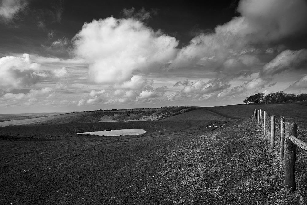
The neolithic dew pond near the eastern cross dykes.
Image credit: A R Cane

Cross dykes/boundary markers south east of the ring (visible on the right). Strange....never noticed them until now, but they complement the cross dyke on the western side.
Image credit: A R Cane

View from the barrows looking south east to Harrow Hill.
Image credit: A R Cane

Pan of the five linear, but diminutive, barrows which run east/west along the ridge.
Image credit: A R Cane


An isolated barrow near the more westerly carpark, looking south west.
Image credit: A R Cane
Prehistoric flints and evidence of early Iron Age industry have been found along the Hastings-to-Bexhill link road under construction in East Sussex.

View from Chantry Hill looking south to the four main Neolithic flint mining areas on the South Downs. From the left Cissbury, Church Hill, Blackpatch Hill and Harrow Hill.
Image credit: A R Cane

Looking east along the line of the South Downs. The dyke is mid picture with Chanctonbury Hill beyond and the Ring just out of view.
Image credit: A R Cane

Long view of Kithurst Hill from the South Downs Way. The barrow group is near the summit, the dyke further down the hill slope to the north, quarry workings in the shadowed area and somewhere up there are the remains of a WW2 Canadian Army Churchill Tank (which I’ve still to locate). A fun day out for all then!
Image credit: A R Cane

Looking north east. The end of the dyke is just visible inside the shadow of the hill. The cut in the shadow higher up indicates the edge of the quarry on the eastern side of the hill.
Image credit: A R Cane

Footpath and bank leading up from the quarry workings.
Image credit: A R Cane