
Interior of the ‘hill fort’ (more like an enclosure really) looking from NW to SE. The barrow is just out of sight behind the low trees on the right.
Image credit: A R Cane
Interior of the ‘hill fort’ (more like an enclosure really) looking from NW to SE. The barrow is just out of sight behind the low trees on the right.

Can’t help thinking that had this not been ruined, it would have been a grander monument than it’s near neighbour up the hill?


Almost aerial view! I think this was probably originally the cap stone.


Looking North with the curious alignment with the overhead cables.

Quarried out section truncating the eastern end of the cross dyke.


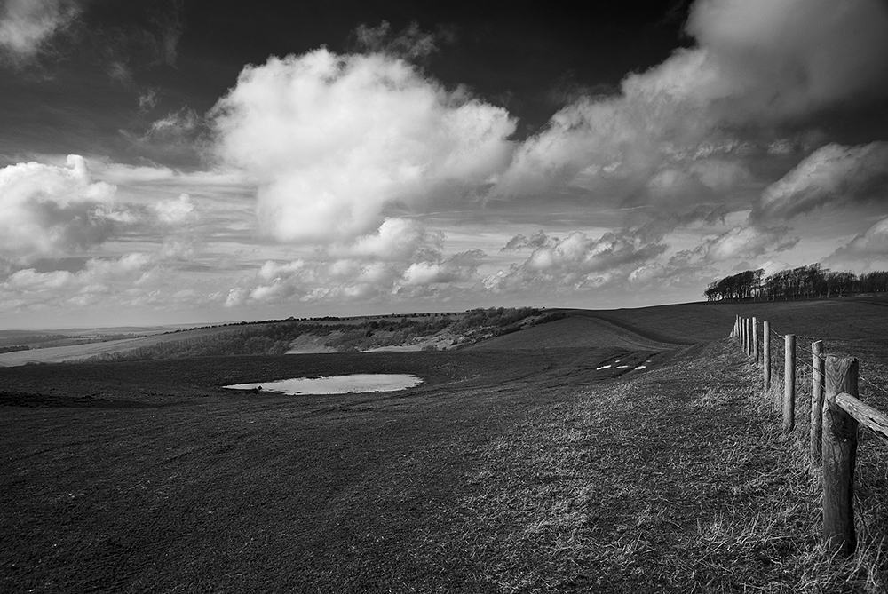
The western end of the cross dyke as it drops over the edge, with Kithurst Hill beyond.


View along the South Downs from the ring with three low linear barrows in the foreground.

Neolithic dew pond (as mentioned in Neolithic dew-ponds and cattle-ways by AJ & G Hubbard) looking south.
The neolithic dew pond near the eastern cross dykes.

Cross dykes/boundary markers south east of the ring (visible on the right). Strange....never noticed them until now, but they complement the cross dyke on the western side.

View from the barrows looking south east to Harrow Hill.

Pan of the five linear, but diminutive, barrows which run east/west along the ridge.


An isolated barrow near the more westerly carpark, looking south west.

View from Chantry Hill looking south to the four main Neolithic flint mining areas on the South Downs. From the left Cissbury, Church Hill, Blackpatch Hill and Harrow Hill.

Looking east along the line of the South Downs. The dyke is mid picture with Chanctonbury Hill beyond and the Ring just out of view.

Long view of Kithurst Hill from the South Downs Way. The barrow group is near the summit, the dyke further down the hill slope to the north, quarry workings in the shadowed area and somewhere up there are the remains of a WW2 Canadian Army Churchill Tank (which I’ve still to locate). A fun day out for all then!

Looking north east. The end of the dyke is just visible inside the shadow of the hill. The cut in the shadow higher up indicates the edge of the quarry on the eastern side of the hill.

Footpath and bank leading up from the quarry workings.

Looking north west towards Storrington and Pulborough.

Three small barrows at the Chantry Post next to the parking space at the top of the bostal.


Showing the barrows relationship with the silvery serpent that is the River Cuckmere as it winds down to the sea.

Panorama on the southern side of the hillfort with that wonderful kink. Got completely soaked five minutes after this!

Interesting but slightly warped panorama of the northern entrance/exit. Just love the complexity of this.


In its surrounding heathland with Poole Harbour, Brownsea Island and Bournemouth in the background.

Another decent sized barrow ruined by idiot golfers.

Apparently there was an anti-aircraft gun emplacement here during WWII. Shame it’s gone, it could have been put to good use!


The most diminutive stone in the circle. We found other larger stones by a footpath near by.

Chesil Beach and Portland in the distance. I think it’s all about the view here.

Strange stitched-together image trying to get the whole, horribly overgrown circle in from the hedge side.

Large stone next to the farm entrance and parking place. Certainly whets the appetite!

Large stone in the hedgerow halfway between the parking space and circle.

One of the larger stones composed of that same strange flint conglomerate found in all the local circles and tombs.


This is Bincombe Down from the sister site ‘barrowcemeteriesfromsupermarketcarparks.wordpress.com’, photographed from a Co-op just outside Weymouth.

First sighting! The rest of the semi-circle is further ahead going towards the fading sunlight.

The displaced stones. The road and lay-by is just beyond.