
The large Cross Dyke on Sutton Down adjacent to Glatting Beacon
Image credit: A R Cane
The large Cross Dyke on Sutton Down adjacent to Glatting Beacon

The Cross Dyke which runs from the top of Glatting Beacon south east bisecting the Monarch’s Way/Stane Street.

The barrow next to the Bignor Hill car park with Glatting Beacon behind

The barrow on the south side of the South Downs Way at the top of Glatting Beacon

One of two barrows that sit astride the South Downs Way near the top of Glatting Beacon.

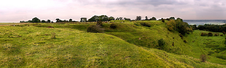
The whole site from the top of the more northerly barrow

The second barrow at the Barkhale site looking to the north west

The enclosure with one of the two quite large, but low round barrows adjacent to it.

The edge of the enclosure looking roughly south east


View from the ramparts looking south east towards Church Hill and the back-filled flint mine-shafts to the right

The crudely made (and wholely unnecessary) cross in the centre of the ring.


Panorama of the ring from the east with a view down the northern side to Washington


Looking to the South West with the constant dim buzz of motorway traffic in our ears.

Looking South East with the ancient trackway behind.

Kit’s Coty looking to the West and without the grim, but probably once stunning, North Kent landscape.

The whole circle at Long Meg looking roughly South West

Long Meg and her circle of daughters looking roughly North East

The stones at the entrance to Long Meg and her daughters

Close-up of Long Meg’s circle marks and accompanying graffiti.

Long Meg showing at least four of the circle marks

Beavis’s Thumb at sunset, including presumably, Beavis’s roller and Beavis’s old car tyre.

View from the car park at the foot of the Trundle looking west, showing the two earth banks end on to the road

Looking from the Trundle to the North showing the two large earth banks adjacent to the road to Singleton

The entrance to The Trundle hill fort from the northern side

Panoramic view of Bincknoll (’bye noll’) Castle from the East.

Towards the back of the long barrow is this curious stone with a small cup at it’s base newly filled with rainwater.

The ‘thoughtfully kerbed’ leat running between the stone rows of Merrivale

One of the many hut circles between the carpark and the two dual stone rows at Merrivale

Inside the ramparts of Highdown Hill. Many of the trees which were planted here in the 19th Century were blown down by the hurricane of 1987 and uprooted Saxon graves.

Approaching the top of Highdown Hill looking west towards Angmering

One of the banks of the enclosure at the top of Harrow Hill looking north east over the South Downs

Close up of one of the many back-filled neolithic flint mines around the top of Harrow Hill

Looking to the summit of Harrow Hill and the enclosure with evidence of pitting from the numerous neolithic flint mines in the foreground


