

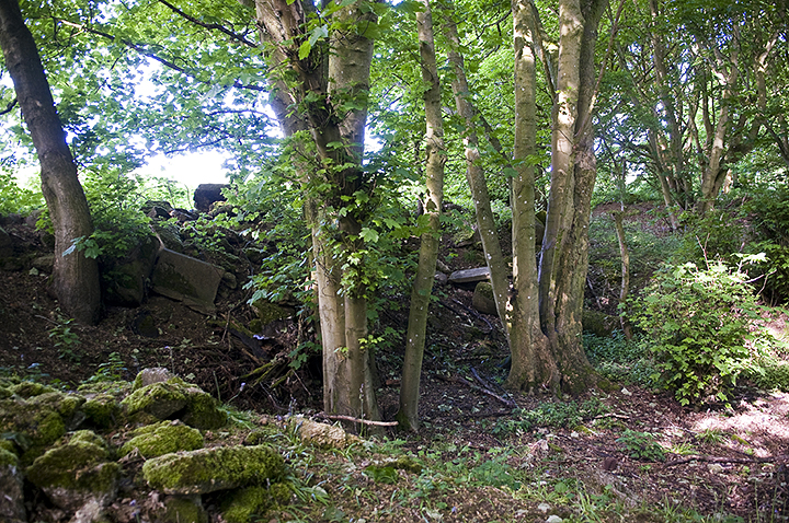
The monolith in its strange churchyard setting at dusk.

Back early the next morning at sunrise.

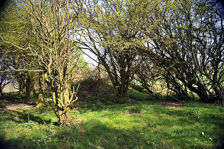
The minilith facing forlornly towards the road to Bridlington.

The white lichen covered minilith with the monolith in the background. I wondered if there was an alignment at the Summer Solstice. This appears to be the only remaining stone in what may have been a circle and the monolith certainly seems to face towards it.

The pathway/boundary(?) which runs North-South between two gates.


In the shadow of the stone in the early morning light.

The banked section which runs SW/NE along the back of the graveyard. Not sure if this is natural or there’s been a bit of human intervention.

Blackpatch Hill from the path down from Church Hill beyond Long Furlong.

Buy one, get two free! Cissbury Rings and Church Hill to the left.

The barrow at the summit of Blackpatch Hill with Cissbury Rings just visible behind the Trig point.

A solitary barrow as you approach from the North West with the echo of Harrow Hill in the background.
Pitting on the edge of the woods. It’s very hard to say if this is due to flint extraction or just a farmer’s hole full of rubbish and if there was ever any evidence in the field behind this it has long been ploughed out.

More disturbance in the undergrowth.

Looking back from the North West. The mines, according to the map, would have been just to the right of the photo over the crest of the hill near the tree line.

The Howe in all it’s glory, though I’d forgotten how flat this part of the world is compared with the North York Moors!

View from the South. Note the dark mark in the middle ground which indicates (I think) where the ditch and bank once ran. It’s more evident on aerial photographs.


Looking back up the hill the cross dyke follows the line of bushes.

Looking at it sideways on as you descend from Duncton Down
Hard to find and partially hidden in bushes but interestingly there’s a drop to one side and the top of the hill is scooped out and quite flat like a large natural(?) paddock.

The ditch stops just the other side of the road where it comes up against a stream and the edge of the grounds of Goodwood House.

Looking west through ‘The Valdoe’ from the main road near Goodwood House.

‘Artemis’ which was installed in June 2010 (why did I not know of this?!) looking south over the Downs towards Chichester.

The ‘Artemis’ sculpture in context to the barrow in the centre of the hill.

The lower earthwork or boundary marker on the northern side.

The ditch/track which is almost a continuation of the road as it swings around the base of The Trundle on the northern side.

Looking back up towards the fortifications at the top of The Trundle


A 360’ panorama within the interior of the fort showing some of the numerous pits left by back-filled Neolithic flint mines.


You only get an idea of just how large these pits are after a bit of scrub clearance.

One of the larger hollows looking West towards Church Hill across Findon Valley.

The rather fabulous model of a flint mine in the Worthing Museum & Art Gallery!


Panorama of the whole circle. It actually seemed a lot foggier than it appears to be here!


The stones which make up the base of the fountain. (See fieldnotes for explanation)

Looking South towards the sea with what looks like faint traces of field systems at the base of the hill and those darned sheep in the foreground.

Long shot of the dimples left by filled in mine shafts and the Bronze Age enclosure on the crest of the hill.

Looking West with that beautiful windswept Hawthorn behind on a very drab and foggy day.


Looking back towards the Hardy Monument (the admiral who allegedly kissed Nelson, not the author and poet!)
