

Lugh’s tumulus in the darkness of a gathering rain-storm.


The highest point of the hill – the trig point has had a facelift.

Down the field towards Aill na Mireann.

Like a great big hunched over hedgehog.


Couldn’t get a good shot of this massive barrow, but the internal fosse is visible in this.


Looking back towards the road (south) and the cairn-like structure.

Cairn-like structure 100 metres from the stone.


A well named after a christian saint, but with a sense of something earlier.
Howth Demesne, with its monstrous capstone, has to be one of the unsung greats of Irish tombs (maybe it’s not all that unsung, but it feels that way). This was my second visit here and I was once again stunned by the absolute madness of it. I struggled to explain to my companion how it was possible to construct it.
If the capstone did come from Muck Rock cliff (and from where else could it?) and was rolled here, they’d have had to have come past the front of the tomb and rolled it up from the back end as the front of the tomb does point directly at the cliff-face (that is if that’s the way portal tombs are constructed). The capstone has been flattened on its underside and at its front, and it’s entirely possible that the stone was rolled from Muck Rock, up a platform/ramp at the front of the tomb, which was then removed once the capstone rested on the portals, doorstone, sidestones and backstone, to reveal it in all its majesty.
You can’t help but wonder when the capstone fell (if a capstone falls and nobody hears it etc...) and also admire the builders who undertook this project all those years ago. The over 2 metres tall portal stones were a job to erect in themselves. Much of the other structural stones seem to have almost exploded under the weight of the collapsing and collapsed capstone. There’s a tiny ‘Dolmen’ signpost at the back of the golf-course that points the way down the path to the tomb – quiet, understated, and completely the opposite of what it leads to. I love this place.
A promontory fort as opposed to a hillfort, there’s very little evidence of any remaining ramparts. The walls of the lighthouse grounds and its facilities seem to have been built in the most obvious position, across the narrowest part of the neck of the promontory. Great sea cliffs and their winged inhabitants make this interesting – otherwise you could take a pass and not really miss anything.
Not exactly the top of the world, and not even the top of Howth (the remains of the cairn on the Ben of Howth are higher), but still as close to floating as I’ve experienced recently without the ingestion of dubious substances. The remains of the cairn are secondary here – that the small cist-like chamber is frequently used as a hearth for boozy campfires seems insignificant given the stunning views all around. As has been noticed elsewhere, Lambay floats above Ireland’s Eye, which in turn seems to float above Howth harbour. The view along the neck of the isthmus, across the lush vegetation below in Howth Demesne is spectacular. The Ben of Howth hides much of Dublin Bay to the south, but the mouth of the Liffey is visible, and the city itself sprawls away to the south-west. Awesome and well chosen spot.
This one was easily spotted from the road as it nestles beside the field boundary. It lives up to the expectation as you cross the field.The slipped capstone is huge, held in a near vertical position by the remaining portal and what appears to be a doorstone. The other portal is missing. Both sidetones and the backstone are still there and this would have been a pretty classic Irish dolmen had the capstone not pushed the backstone outward and fallen onto the back of the chamber. Maybe this happened when some fecker robbed the missing portal.
We spent a while at this one, amused and bemused at its incongruity there, stuck in a time-warp in the middle of some fairly prosaic pastureland.
Maybe there was once a cairn here, but it ain’t here now. Did they really destroy the cairn to build the wall that encloses the site like bawn wonders? Bizarre.
Scant remains on the top of Garret Hill. A long, low line of rubble makes a rampart of about 150 metres, aligned north/south onto the passage tomb over the field wall. There’s another very faint line at right angles on the northern end. There are probably (hopefully) more remains about the hill, but I couldn’t find them. I was happy to be up here anyway – it’s just above the contour line where things start to get wild and untamed and sheep thrive.

Over some bog cotton after another fire on Piperstown hill cairn cemetery/habitation site.

Ashtown ‘barrow’ survived the recent Bloom garden show.
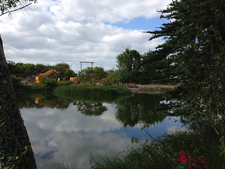
Sutton south artificial mound has 2 excavators/diggers in its vicinity, digging right up to the mound as far as I could see. Wonder if any archaeos are involved.

The worked/flattened plane of the front part of the capstone is well illustrated here.

Plenty of vegetation around the tomb at this time of year.

A fallen sidestone in the foreground with the doorstone and a portal (right).

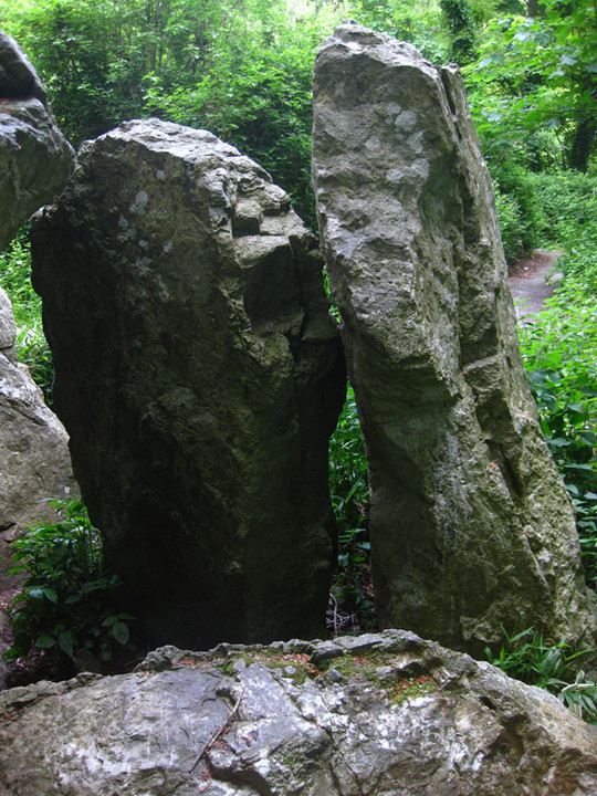
The point at which the capstone touches the leaning portal stone.


The Great Bailey lighthouse, the security wall of which is seemingly built on the ramparts of the promontory fort.
I was expecting a bit more from this given Healy’s notes below. However, most of the souterrains are now backfilled again since his excavations 122 years ago. You can just see the corbelling of one, the second as he describes it.
We had traipsed up the right-of-way lane just off the Johnstown to Freshford road. The rath is enormous, thoroughly overgrown (especially now in mid-June) and utterly compelling. The inner ditch is over 5 metres deep in places, the south-western arc being the most accessible. There is the remnants of an entrance here too. I can’t guess the diameter, 50 metres could be close, but it may be much more. This would, in my estimation, have been a ‘high-status’ (dreadful term) habitation site. It’s yet another of those places that could be marketed (yikes) to joe public as it really is impressive and even held a fascination for my not very interested companion.
We approached this monument from the north via the ‘cairn’ in Clomantagh (Mount Garret). In fact, this is in the same townland. There are no notes that I can find on this passage grave anywhere. No archaeological inventory has been published for Kilkenny, nor has the survey of megalithic tombs emerged for this region. Someone even mentions it as a wedge tomb, but given its situation at the top of Mount Garret, it’s more likely a passage tomb.
There is what looks like a passage semi-exposed down the middle of the mound, aligned roughly east-west. There are also what look to be passage roof-stones, some in situ, some cast aside. Two peculiar stones protrude above the remaining cairn by about .75 of a metre about midway down this ‘passage’. There is much cairn material still here, but you do get the sense that much has been robbed away also. There is, again what seems to be, a subsidiary ‘chamber’ on the south-side of the passage with no roofstone and the chamber filled in and some orthostats visible.
It’s in a great spot with views all around, the best being to the west and south. I doubt if anybody has visited this tomb for prehistorical reasons since bawn was last here.


