
South-south-east towards the cleavage of Slievecorragh and Church mountain. The illusion is the same as at destroyed Whiteleas, half a kilometre to the south.
Image credit: ryaner
South-south-east towards the cleavage of Slievecorragh and Church mountain. The illusion is the same as at destroyed Whiteleas, half a kilometre to the south.


The view through the trees from below the circle: Slievecorragh, at left, is 418 metres high, Church Mountain is 544 metres high, but from here appear to be the same height and are the mother’s cleavage.

Looking south-east towards Slievecorragh and Church Mountain. The trees block the view.


One of the remaining two stones; this is loose and about a metre long.


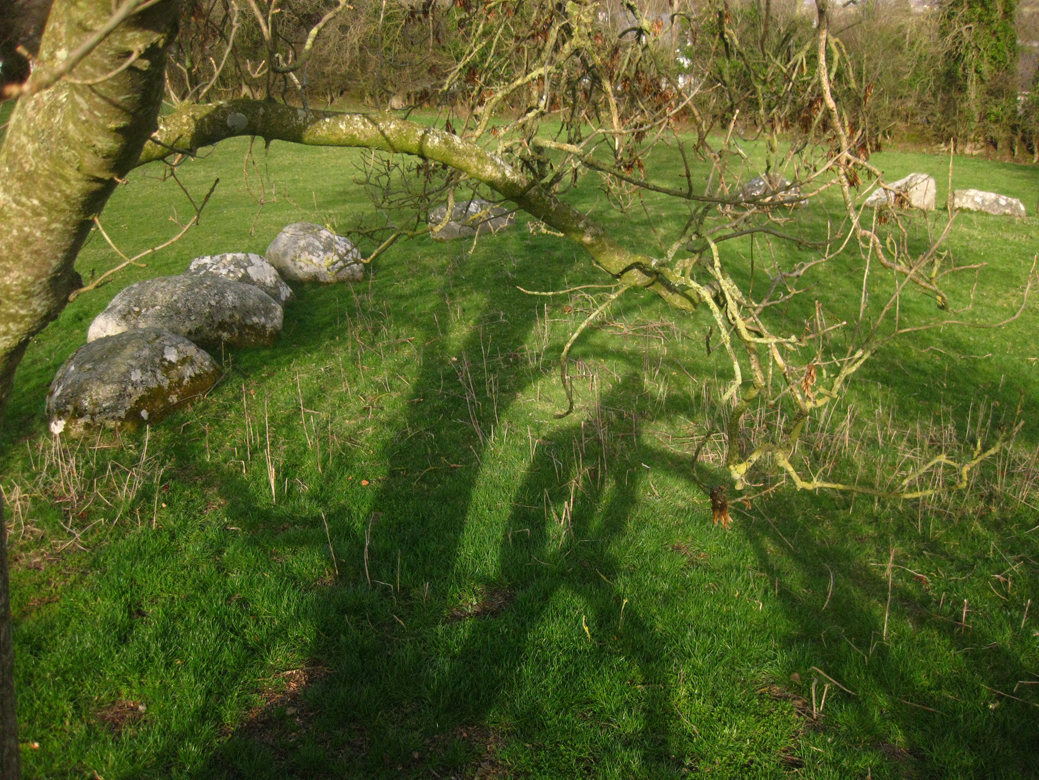
The brownish, raised area is where the circle once stood.
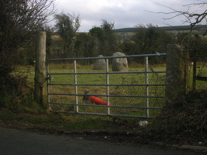
A quick visit to Mullamast, very accessible off the new Dublin to Waterford motorway, three sites in one: a standing stone, a barrow cemetery and a massive rath.
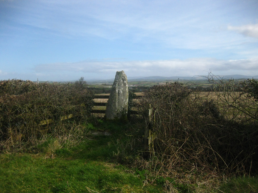
The standing stone is well over a metre-and-a-half tall, with grooves or channels or runnels at its top, very much in keeping with the nearby Carlow examples. It’s right beside the road, moved here from its original position and coralled by a fence.
Directly opposite is a field with the unrecognisable remains of a barrow cemetery. The only remaining visible example of this is the one in the next field to the north, about 20 metres diameter and much disturbed.
The real gem of Mullamast is the massive henge-like rath in the next field again to the north. The bank of this rises to 4 or 5 metres from the bottom of the silted-up ditch and has an entrance at the east.
Normally on most raths that I visit the interior is raised from the surrounding terrain to aid defence, but the interior of this is level, the inhabitants relying on the height of the bank and the depth of the ditch for protection. Very impressive and well worth a visit.
I’ve visited Broadleas at least 5 times before (it’s right beside the road, a small diversion from the N81 thoroughfare down through Wicklow and Carlow) but have never felt the urge to write about my visits. Today, mid-March 2014, is different, mainly because I made a decision to write notes, however slight, for every site I visit, but also because I was rather more enchanted by the place than at any other previous time.
I’ve recently found the exact site of the nearby destroyed Whiteleas circle so I was in the vicinity on a scouting mission. That mission will have to wait for another day, when I don’t have my 5-year-old in tow, but preliminary snooping is quite hopeful.
But back to Broadleas: now is the time to visit. All nettles and other unfriendlies have died right back and the circle is more visually accessible. The eastern arc is crowded out by thorn trees, but standing in the centre of the circle allows one appreciate the ring. The stones are at the edge of a raised platform, probably man-made, and possibly once upon a time the whole was embanked.
I climbed the denuded tree on the western arc and fired off a few shots, but felt a bit too old to be doing that sort of thing.
If you travel south out of Tallaght, this is the first of the four remaining Wicklow/Kildare circles that you come to. Then it’s on to Athgreany, Castleruddery and Boleycarrigeen. I was very struck by the views to the south-east in those circles’ direction: Slievecorragh and Church mountain pull the eye, and I can’t wait to get to the aforementioned Whiteleas to see what, if anything, remains and what views the builders may have noticed.
Large double bullaun stone in the driveway of a house just outside Ballymore Eustace on the Kilcullen road. Quite a nice garden ornament, it was moved here from a field about 300 metres to the north-west by the previous owners of the house.
It’s over a metre tall and of the two bullauns, the eastern is the best, maybe 12 cms deep and with two run-off channels. These look deliberately carved, for what purpose is anyone’s guess. The other bowl is barely carved, wider and very shallow. Thanks to the owners of the property for permission to have a gawk.


Knocklegan standing stone is now no longer standing, collapsed into the hedgerow and overgrown with brambles. I did a quick tidy up and revealed a roughly 2 metre long stone that would have been reasonably impressive when stood up, but now lies forgotten and ignored by the side of a pasture field.
Marked as a bullaun stone on the OS maps, this is a very unlikely candidate for that title. Maybe the hole/bowl is man-made, but I’ve read elsewhere that it goes right through the stone. It is however revered locally and has a rag tree beside it.
North down the hill from Kilree monastic site with its round tower and high cross is this rock outcrop. There may be a bullaun buried under the grass, but the visible bowl-like depressions are very natural looking. The most likely suspect is very deep and seems to go through the stone, a bit like the ‘bullaun’ north of here at Kilmog.

If this is a bullaun stone, the bowl at the very right is the most likely to be the one.

The so-called bullaun stone. I reckon all the ‘bowls’ are natural.


Traces of a ditch on the northern flank, looking south.

The most northerly of a line of 5 barrows and the only one with visible traces on the ground.


Grooves like the nearby Carlow stones.
There is a barrow marked in this field both on the site monuments record and on the OS map. It is, however, on the other side of the field to this mound and I’ve never been able to locate it. That doesn’t mean to say that what I’ve posted here is THE barrow – a lot of the barrows in this vicinity have been ploughed away and are still marked on the records. This little mound though has intrigued me and I made the decision to post it on the grounds that: 1. it exists, 2. it’s right beside the gate and restricts access to the field but has never been removed by the landowners and 3. it looks like a small cairn and has some signs of containing structural stones of some sort. All that doesn’t preclude the possibility that it’s field-clearance but, for the record, it’s oval, 4 metres on its longer axis, aligned roughly north-east/south-west and about 1 metre high.
A large univallate ringfort in this townland, 300 yards from Hazelhatch bridge. This is the first time I’ve seen one of these put to modern use: the owner has, in the past, used it for the rearing of pheasants. It’s now completely overgrown and difficult to access – the large interior (roughly 35 metres diameter) is only slightly raised above ground level. The main defences were the deep ditch, now water-filled after the torrents we’ve been experiencing, said to be 3 metres deep in places and very steep-sided. The causewayed entrance is on the south side – the north side has been cut through by a modern field boundary. Impressive all the same.
Sheep in the field today so we didn’t get out of the car.


