
The Nine Stones, with the track up to Slievebawn. The area is a popular beauty spot.
Image credit: ryaner
The Nine Stones, with the track up to Slievebawn. The area is a popular beauty spot.
This is the entry on archaeology.ie:
Class: Stone row
Townland: COOLASNAGHTA
Scheduled for inclusion in the next revision of the RMP: Yes
Description: Marked ‘The Ninestones’ on the 1839 OS 6-inch map. On the E side of the pass between Slievebawn and the Black Banks and Mount Leinster. Nine low stones set in alignment orientated E-W (L 11.5m; distance between stones 1m-1.2m; H of stones 0.38m – 0.63m). According to OS Field Namebooks, erected to commemorate nine men murdered and buried nearby.
While the extant remains are hardly sufficient to permit classification as a stone row with certainty the remains bear close resemblance to many monuments of this class. In light of the tradition recorded by the OS the interpretation given must be regarded as tentative and a proper elucidation of the monument must await further investigation.
Compiled by: Claire Breen
Date of upload: 19 August 2011

The quartz outcrop again with Mount Leinster, Knockroe, and Blackstairs mountain away to the south.

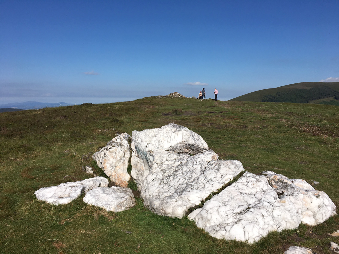
The quartz outcrop west of the cairn that probably gives the mountain its name.

There a quite a few large orthostat-like stones at Slievebawn, and what could be the outlines of a passage.

The wrecked cairn on Slievebawn, with Mount Leinster towering in the distance.


Possibly the most photographed ‘artifact’ in Ireland. How they got planning permission for the barns is anyone’s guess.

The possible limit of the extent of a covering cairn on the eastern side.
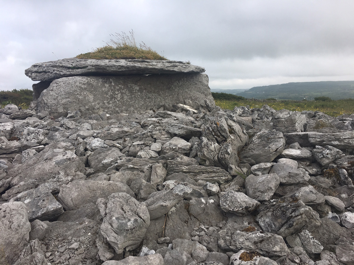
Quite a bit of the cairn is still here on the western side of the tomb.


The eastern slab has beautifully weathered runnels.


Looking south. This does not look at all like the picture in the survey published 58 years ago that shows a fairly typical, if slightly dilapidated, slab-like Burren wedge tomb. It’s possible that I was in the wrong place, but it’s also possible it was smashed. I’m heading back there soon and will check again.


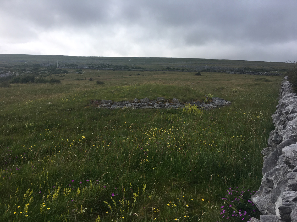
Small cairn, 200 metres or so north of the ring cairn in the same townland

Looking south. There was a cist at the centre, unrecognisable now.

Small roadside ring cairn, looking west at the best side.

The settlement on Turlough Hill is worth checking out, approached from the track to the south-west in the townland of Turlough. It’s not easy going but is very rewarding.

One of the smaller hut sites. There’s a deep gully that bisects the plateau just beyond this site here, with many more hut sites beyond it.

It would be hard to argue with Bergh’s notion that this is a ritual landscape, not an actual settlement, but maybe a seasonal place of ‘worship’. The cairns, both here and very visible, and the one further away on Slievecarran, are impressive constructions.

These stone-lined ones are larger than the bowl-shaped, grass-covered sites. Slievecarran cairn calls from the distance.

I was as puzzled and enthralled here as I was at Mullaghfarna.

Another of the more distant hut sites.

This is the most common type of structure of the 160 hut sites here, the grass and soil making a return to this once barren hilltop.

Another of the better defined hut circles.

Well defined hut circle on Turlough Hill.

Looking east towards Slievecarran over another of the 160 hut structures on the Turlough Hill plateau.

Hut structure, well north-east of the cairn.

Typically the sun came out as we were leaving.

Looking east with the Slievecarran cairn visible in the distance.

Pano of the cliffed peak of Turlough Hill, so reminiscent of Mullaghfarna. The cairn is just beyond the lip of the plateau.


Pano looking north from the cairn over Galway Bay. Ucht Máma is to the right, Abbey Hill in the centre further away.

Our approach from the west slowly revealed an impressive structure. In the distance the cairn on Slievecarran is visible just to the right of this cairn.

The western profile has changed with excavation/robbery, exposing the internal structure, though not as far in as the centre.
A replica of a 2,400-year-old log boat, that lies on the bottom of Lough Corrib, was launched in Co Galway this afternoon.
The prehistoric log boat, built from a single oak timber and some 7.5m long, 0.61m wide and 0.4m deep, has been radiocarbon dated to 754-409 BCE (over 2,400 years ago; the Iron Age).
More: rte.ie/news/connacht/2019/0706/1060564-galway-log-boat/

Kerbstones on the southern arc of the tomb. The chamber has been engulfed in the gorse in front of the stones.


Pano looking north-east over the monument out to Dublin Bay.


Looking east. The stone looks to have been broken on its western side.


Development continues at the barrow, a new outdoor fitness gym built on the right of the shot. What’s next?