
Taken from below the northern tip of the ring. There is no bank in this portion.
Image credit: ryaner

Taken from below the northern tip of the ring. There is no bank in this portion.

Again looking north-east. You can just see Howth behind the tree and Lambay is to its left.

Looking across the monument to the north-east. The tree in the near distance blocks the view to Howth and Lambay.
Marked as a Ringfort (unclassified) on archaeology.ie, this is the nearest monument to my house. I’ve been pondering heading up there for a while now and finally went this morning.
The 2nd left turn after Bohernabreena catholic church leaves you on a road above the field with the ‘ringfort’. Down through two small fields and through the tangle of briars and gorse (I wouldn’t attempt this outside of the winter months), the archaeology.ie placement is fairly accurate.
In his book Glenasmole Roads, Patrick Healy has this to say: “Four hundred yards to the east of Bohernabreena House is a fine ring fort in a field of furze with a spring of water beside it. It is 30 yards in diameter and surrounded by a bank. The area inside is levelled and bears evidence of having been tilled at some distant period.” The photo used in the book is nondescript and shows the top of field, not the ‘ringfort’ as captioned.
So what is this? I would describe it as an embanked enclosure of the mini-henge type. The banks rise to about a metre from the north-east back around to the north-west. The northern part of the circle is open and falls away to a depth of about 2 metres, where lies the aforesaid ‘spring’. The most striking thing about the site is the view across the city towards Howth and Lambay. Was it a ceremonial enclosure, a place to view some solar or lunar event?
The interior of the circle is flattened but slopes from south to north and there’s another gap/opening in the bank on the eastern edge where the views towards Howth would have been best.
Was it a habitation site, a so-called ringfort? Maybe, maybe not.


Hut circle or ring cairn

Hut circle or ring cairn


The pond at the centre of the quarried cairn (Ossian’s Grave)


The curved line of the trees on the distant hill is where Ballyedmonduff wedge tomb resides


Peculiarly, part of this stone has been built over with the wall of the old church


A bit of (probably) amateur archaeology in the top, centre of the mound. Wonder what they thought they might find.

Killabeg Tumulus, with standing stone bottom right


Lovely, forlorn standing stone in a field boundary

This bullaun lies near an old ruined church in this more modern cemetery


A ruined wedge tomb, but a classic of its type. These squat tombs always remind me of some futuristic tank crawling across the landscape. I’d been up at the court tomb and the cashel and felt up for a further little trek down to what’s call a ‘giant’s grave’ on the old OS maps at archaeology.ie.
Approaching the tomb from above it’s hard not to be disappointed as it’s a tangled mess of brambles and briers that you see at first. However, there’s quite a bit of the structure left. The two ‘portal’ stones are massive and there’s some evidence of the double kerbing at the back of the tomb. Standing a little to the north-west of the tomb you get a really good idea of where they came up with the name for this classification of Irish tomb, its wedge shape revealed as the tomb gradually tapers back towards the chamber.
The surrounding terrain in these fields west of Magheraghanrush Deerpark show plenty of signs of earth working and quarrying that seem to have been undertaken by the people who first constructed the court tomb, then the wedge tomb and the cashel.
South-east of the court tomb and north-west of the wedge tomb, about equidistant from both, this site is on private land. There’s a style in the wall that leads down to it. It’s quite a wonderful place, perched above Colgagh Lough and with views west across to Knocknarea. I could imagine this site as a prized and well defended homestead. The souterrain has been uncovered and it’s wonderful to see the passage snake down into a corballed chamber. The cashel is very ruinous but is one of those places that tugs at your heart, steeped as it is in the mysteries of pre-history.


The two massive portals at the front of this classic wedge tomb
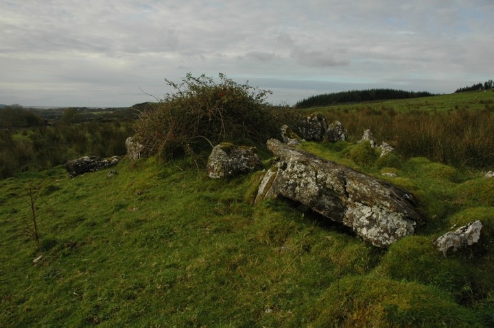


The ruined cashel, looking over Colgagh Lough towards Knocknarea.

From the back of the two eastern galleries. Knocknarea is now visible from the site.


The gravity-defying lintel with Knocknarea off to the left

The massive tomb from the back of the western gallery

Knocknarea, sacred hill, looms large over Sligo town, Saturday evening, 1/11/08

