

ryaner


The barrows are aligned north-west.south-east.
Image credit: ryaner


Bad erosion on the north-west of the largest barrow, with the other prominent barrows over the shoulder to its right.
Image credit: ryaner

The tallest and largest of 7 barrows in this cemetery with Thomas for scale.
Image credit: ryaner

Middle barrow, about 1.5 metres tall.
Image credit: ryaner

The middle barrow to the right and the largest of them all, seeming to slightly mirror the hills in the distance, the Hill of Curry and the Hill of Mael.
Image credit: ryaner


The conjoined barrows, with the other two to the left over the shoulder of the left-hand barrow.
Image credit: ryaner

The conjoined barrows at the east end of the ‘cemetery’, with Lough Lene off to the right.
Image credit: ryaner
The large bowl barrow, again from the north-west, but closer in.
Image credit: ryaner

The largest bowl barrow (3.5 metres tall) is visible from the boreen to its north-west.
Image credit: ryaner


Small (1.32 metres at its tallest point) mound barrow on the north-west of Knocknamonaster Hill.
Image credit: ryaner

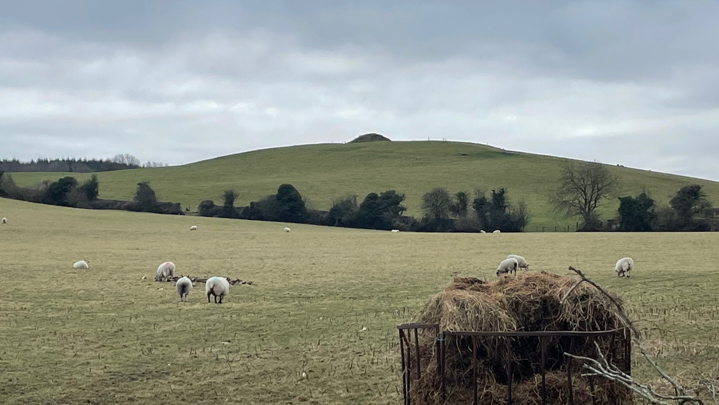
The pond barrow on the summit of Knocknamonaster Hill, with the ruins of Fore Abbey behind to the left.
Image credit: ryaner

The flat-topped Knocknamonaster Hill behind the trees, seen from the eastern entrance to Fore Abbey.
Image credit: ryaner


The massive rath of Teach Cormac looking back towards the King’s Seat and the Lia Fáil.
Image credit: ryaner

Standing stone on the southern side of the cairn that contains the tomb.
Image credit: ryaner

Outer walling incorporated into the field boundary on the northern side of the tomb.
Image credit: ryaner

The small chasm of the gallery is visible to the right of middle of the foreground and is aligned towards the south-west. I think the stone to the left is one of the roofstones.
Image credit: ryaner

It looks fairly trashed but is just run-of-the-mill neglected. Stones are: two facade stones and a septal stone in the foreground; a trig point; and two odd outliers.
Image credit: ryaner

Front on at this wildly overgrown but largely intact wedge tomb.
Image credit: ryaner

Johnny Thornton, the farmer here, was very friendly, though with no clue what he had on his land.
Image credit: ryaner


Unvisited and somewhat unloved, until we arrived.
Image credit: ryaner

Th Long Stone in Longstone, Armagh City.
Image credit: ryaner

“It stands 1.7m high, leaning slightly to the SE and is of the so called ‘Armagh marble’.”
Image credit: ryaner

I was impressed with Haughey’s Fort for the short time I spent here – mystery provoked by imagination.
Image credit: ryaner

The centre of the the enclosure rises towards the south (there’s not much to see here but excavations say it was a multi-period, prehistoric habitation site).
Image credit: ryaner

Two-and-a-half metre tall bank on the northern arc of the pond.
Image credit: ryaner

The mysterious, man-made pond at the King’s Stables.
Image credit: ryaner

Bronze interpretation on the way from the interpretive centre to the site. I don’t know who the artist is but I like it.
Image credit: ryaner


Hadn’t got enough time to try and figure this out, but from the looks of it you could have hours here and still be none the wiser.
Image credit: ryaner

From this angle you can see why stone row instead of possible megalithic tomb.
Image credit: ryaner


Some of this is outcrop, some of it looks just dumped here. The SMR says it’s a possible megalithic tomb. I preferred stone row. We’re both probably wrong.
Image credit: ryaner