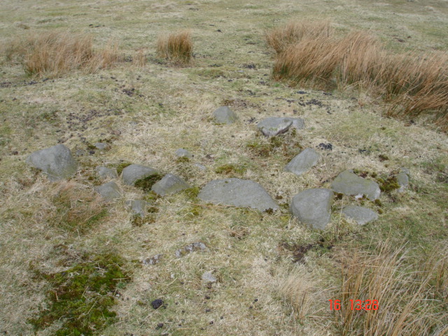
This detail shows the most prominent of the internal structures within the cairn. These upright stones form part of a low, right-angled arrangement that appears to demarcate a specific area in the interior of the cairn.
Image credit: Ellen
This detail shows the most prominent of the internal structures within the cairn. These upright stones form part of a low, right-angled arrangement that appears to demarcate a specific area in the interior of the cairn.

A detail of the stones forming the outer edge of the structure. This circular line of the retaining kerb wall can be easily traced around the perimeter of the site.

The view to the North West, with Two Lads in the distance. This image gives a good impression of the distinctly symmetrical profile of the cairn.


In this picture, viewed to the North East, the typical burial mound structure is quite distinct.

White Brow cairn, viewed directly North, with the familiar view of Winter Hill in the background.
This site is located in a field adjacent to Matchmoor Lane quarry and can be accessed by following the footpath alongside the quarry, heading North West in the direction of Adam Hill. Though there are only a few surface remains left to be seen, the site is nontheless quite impressive (SD663124). The structure that remains forms a circular bank of stones, 10m (NE-SW) x 9.7m (NW-SE) in diameter, and rising 0.5m from the surrounding hilltop. Within the central circle there are a number of internal stone structures that seem to represent the interior arrangement of the cairn. The absence of other, similar surface material in the immediate vicinity of the cairn allows for a quite distinct view of the site, and it gives the observer a good impression of the scale and dimensions of the original burial structure. The cairn itself is positioned on the North Eastern edge of the unnamed hill, which has it’s summit at SD664124, and it would have offered a point of great prominence to it’s Bronze Age builders. In all directions there are stunning views, punctuated by familiar landmarks, and from even the most cursory visit to White Brow cairn it is easy to appreciate why this spectacular location was chosen for the site of a monument of this kind.
It was only within a few days of my first ever visit to Winter Hill that I was already plannning my second trek onto the moors. Having found Winter Hill cairn easily enough, I scanned my map and decided that it’s closest neighbour, Noon Hill cairn, should provide the focus for my next trip. I had found the ancient archaeology on Winter Hill extremely fascinating, though, despite being a teacher of history, I realised that this period of prehistory was quite beyond my previous academic experience.
Throughout the next week at work, during coffee breaks and lunch breaks I unfolded my OS map and tried to find the most accessible route up to Noon Hill. On the day of my first visit I had tried to cross directly from Winter Hill cairn across the hilltop to the black dot in the distance which I recognised as Noon Hill cairn (SD647150). However, having had only limited experience of moor land hiking I made a hasty retreat when the mud reached my knees and the cloud cover obscured my view completely. In the days that followed I considered the route from Rivington Pike (SD 644138) following a North – North Easterly line to Noon Hill, but eventually I abandoned that potentially soggy idea in favour of a more direct approach.
The following Saturday began with a bitterly cold January morning, but the sky was perfectly clear, and at least I could expect the mud to be frozen solid! I drove along Sheep House Lane from Rivington and parked opposite Horden Stoops (SD655158), planning to scale the steep NW slope of Winter Hill diagonally and emerge on the summit of Noon Hill.
No sooner had I begun the ascent from Belmont Road than I realised that my intended route would probably be impassable. The existing pathway cut diagonally away from Noon Hill towards the summit of Winter Hill (SD651153) and I felt sure that to deviate from it, and then scramble up the steep overgrown hillside of Noon Hill Slack would prove extremely difficult and very time consuming. Therefore, rather disappointedly, I followed the seemingly vertical track way up the hillside. When I eventually reached Winter Hill cairn (SD656150) I found myself once again staring across the boggy moor land at the same black dot in the far distance.
However, resolute in failure, I headed off across the wind swept hilltop, determined to reach Noon Hill cairn, and remain undeterred by the icy mud and gathering gloom.
Surprisingly, I succeeded in this second attempt to reach Noon Hill by crossing Winter Hill Spring, with relative ease. After perhaps only 30 minutes I arrived at the cairn site, numb and exhausted, but triumphant! (SD 647150). And I was not disappointed. I found the site incredibly compelling in terms of it’s archaeological significance but also as a deeply evocative link with the ancient past, and despite the biting cold I remained on top of Noon Hill for much of that afternoon. Having researched all the information I could find on this location it was truly fascinating to actually reach and explore it at last, and as with every site I have subsequently visited in this incredible area, it was definitely worth the effort.
Winter Hill Cairn. The view is to the NW, looking towards Anglezarke Moor.

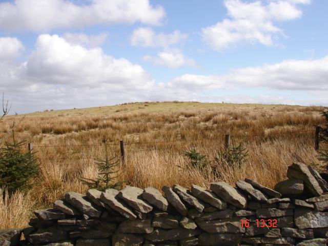
The view from the northern slope of Winter Hill, taken from just above Belmont road and looking up towards the location of the burial site.

A 3m curved section of the outer kerbstone wall which encircled the burial barrow. This section is located approximately 10m SE of the cairn summit.

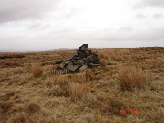
The Winter Hill Cairn site, located approximately 200m from the most northerly TV antenna.


Winter Hill Cairn. Initially excavated in 1958, this Bronze Age Barrow has been dated to c. 1500 BC. The structure is described as being 2.5m in diameter and being encircled by a kerbstone ring approximately 19m in diameter. Though little remains now, fragments of the central barrow, as well as small sections of curved lines of stones can still be traced amongst the tufts of grass.

As with the Winter Hill cairn site, Noon Hill was first excavated in 1958. It was found to consist of two concentric stone circles measuring 10m and 16m in diameter. These features formed the two outer structural walls which were covered with turf, to create the burial barrow. Inside the barrow mound fragments of burnt human bones were found, along with two flint arrowheads and a flint sacrficial knife. The site was subsequently dated to the late Bronze Age, around 1100BC.

Winter Hill bronze age barrow, looking South West across Rivington Moor.


