


This can be found near the village of Ballinacurra which is close to Midleton in Cork. Basically use the OS map to get close to it. I found it without a GPS using the clump of trees show near it on the map. It is behind a farm-house and access is reasonable. If anyone is about it is worth asking for permission.
The height of the tomb is approx 1m-1.5m high, length about 4m.
To the south is a possible barrow or maybe the remains of a ring-fort and there is also a standing stone to the south-west.
There is also a funny looking mound to the west of it, however that could be natural but looks slightly out of place to me in the locality.


Mostly Slievenamon but some folklore on Sheegouna
The cairn on Sheegouna is to the north-east of Slievenamon and at a height of about 550m meaning from Slievenamon you have to climb down to it.
Jim O’Connor in the link on the folklore calls it “The fairy-fort of the magic cow”. He also mentions that there was another cairn on Knockahunna to the north. There is no mention of a passage-grave but this cairn to me seemed to be the more likely of the two to have one.
To the south of the cairn is a rock shelter which may be a megalithic tomb, its not recorded, have a look at the pictures and let me know what you think.
The cairn is smaller than the cairn on Slievenamon so about 2m high by 20m diameter.
The cairn on top of Slievenamon or Mountain of the Woman is at a height of 721m. It is a good walk and there is a path all the way up to the cairn which makes access easy.
Coming from Dublin on the Cashel by-pass N8 take the sign for Fethard then the Kilsheelan road and follow the signs for Ballypatrick and Kilcash. There are signs for the walk in Kilcash.
It takes about an hour to climb up to it.
The cairn itself isnt as impressive as I hoped and the day I climbed it was pretty hazy so couldnt get an idea as to any significant features on the landscape around it. It is mentioned in the link I have that it is thought to be a passage grave, to me it didnt seem big enough but I would love to be proven wrong!. I would think it is approx 3-4m high by maybe a diameter of 20-25m.

The cairn is built up on some of these large natural rocks, the little cave like feature is called “The seat of Fionn”


Cairn with unusual stone marker, this stone seemingly was put up here by a local sculptor.
Right beside the road this is an easy one to find, the most interesting thing about it location is “An Screagan” an hill to the west of it that has some kind of marker on its peak, may just be a trig point as no standing stone is marked but I will investigate.
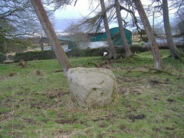

These two Iron Age stone Cashels are on the bank of Lough Gur on a hill called Carraig Aille. Seemingly during excavation a silver hoard was found here.
Both forts are quite low, the wall only maybe 1- 1.5m high. There is an entrance in both of them to the east.
I heard well over a year ago that the state had bought the land that they are on and they were to be made available to the public but have had no further update.
They are located just after the crossroads going to the lake on the left hand side. We parked in front of a nice house on the right hand side of the road and you should be able to see them from the road.


This red/purple sandstone? to me seemed very different to the rest of the stone used here, I know that there is a standing incorporated into the centre of one of the Cairns in Loughcew could this be something similar?
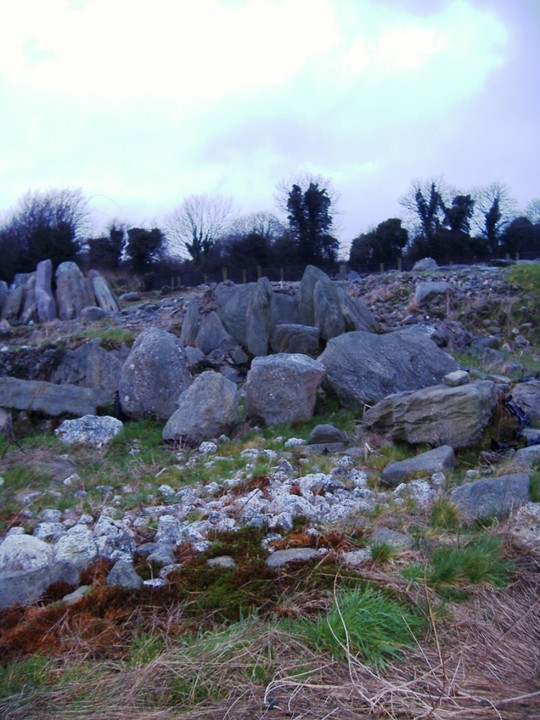
An example of some of the quartz around the site which would may have a similar function to Newgrange (If that function is really understood).
In some good news I read recently that this standing stone has been moved and can now be viewed in Cashel Folk Village.
Coming out of Caher on the road to Clonmel this standing stone is on the first imposing hill on the right hand side. There seems to be a lighting conduction on the hill as well. Part on the right-hand side of the road and access is easy enough thru two fields.
The stone itself is about 2.5m high and I wonder does the look of it and the fact it has a lightning conductor beside it are connected, perhaps it used get hit by lightning regulary!
The views from the top of this hill and panoramic and stunning. On a clear day you can see all the cairns that top the hills around these parts.


I looked on the OS map on this one and thought its positioning close to the road looked funny. This is actually ON the road in a little traffice island.
It is on the road south of Cahir take the road signposted for the Swiss Cottage but ignore the right hand turn for it. The stone is at the junction of the next left-hand turn.

Again there is no sign of this standing stone. Seems to be a regular occurance in the Golden Vale.
This tomb no longer appears to be with us.
With the construction of the M8 the site of this is difficult to get to.
I’ve been up here twice and Im fairly satisfied that it is no longer here. It is in a pine plantation and there is a little mound roughly in the area where I think it may have been.
As they say better men than me are welcome to try!
Well I was wrong about this site, I attended a talk about prehistoric sites in the Suir Valley and this appeared on it with a picture and everything. So this made me even more determined to find it.
It is very tough to find even with the ten digit OS grid ref.
It is in a kind of forest area with loads of different types of trees etc and no paths to it.
There does seem to be various paths through the forest but they dont go to this so it makes it even more confusing.
I believe it is listed as a possible Portal Tomb, Im not sure why that is so. although in fairness its state of repair at the moment is poor. There seems to be only a capstone and one small upright remaining. There is also some quartz stone in the vicinity.
Apologies about the pictures, I will get a few better ones another day, if I can find it again!
Taken from the Irish Folklore Commission 1937/1938 Tipperary Reel 4 pg 85:
Buried treasure near Glenstal Castle
“It is believed that there is gold buried about a mile from Glenstal Castle. The gold is supposed to be buried with a giant. The giants grave is still to be seen”
When people went to dig for the gold water spurted out of the grave.
Another time they tried and the sound of a bull could be heard so they stopped.
This bullaun is right beside a house. I met the farmer and he said the whole house is within an enclosure which I had spotted myself. It is a very deep bullaun and the farmer said he was happy to show it to anyone (although I think I was the first to look at it).

This standing stone is close to the town of Eyrecourt. When you come into the town from Portuma turn left then left and then left again. The stone can be seen on a small hill. Its about 0.5m high.

The stone here is gone. There was noone around to ask what happened to it.

There is meant to be a standing stone here, however there is no sign of it at ground-level. What is here are the remains of a raised rath.
This wedge tomb isnt far from Portuma in Galway. It is situated on a small mound and is aligned west to east. It is approx 6-7m long. On the N65 from Portuma to Killamor take the first left and then left again. You pass a few farmhouses on the right and pull in at a gate just before the next farmhouse on the right.
Follow the track that is inside this gate and it takes you out into a field adjacent to the field with the tomb in it.
You should be able to see a new house in the distance, walk towards it and climb the stone wall and you should be able to see the tomb easily.
Although from the OS Map it looks like there may be some interaction with Church Hill you cant actually see it because of a ditch in the way.


These stones are down as a standing stone on the map. It is easy to find following a track along by the Clare river. It is in a pin for keeping bullocks. They all took a mad run at me, luckily they were well fenced in.
There are two stones here not one, I didnt get up close to really see the details of them. They must be about 0.75m.
This tomb is close to Murroe in Co. Limerick and to Glenstall Abbey. Follow the OS Map past about 2 houses on the left. The map shows a track into the woods. Best to follow this because one track where the break that looks the obvious way on OS map takes you alongside a house and they keep horses.
Follow the track to the end and then it naturally tails left following the tree-line (Not shown on the map). Head North west for about 300m and there is a gap on the right into a field. Once in the field you should be able to see the tomb to the north west in the corner of the field.
When i visited the tomb was water-logged. However it is in good condition, about 5m long and I think that all of the stones are there. To the North West is Sliabh Eibhlinne and the North is Sliabh Kimalta. However both are obscured by the trees.


