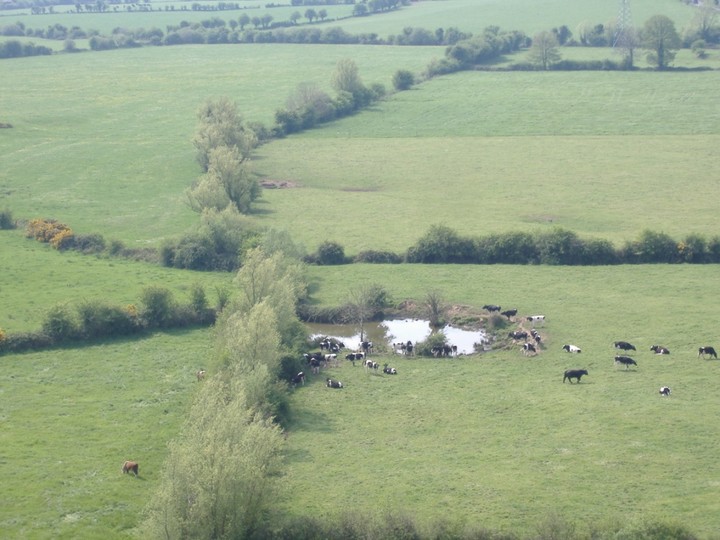
This is very clearly a pretty impressive barrow, however for some reason it doesnt appear on the OS Map.
I was surprised to see this monument and at first I thought this was the hill-fort marked on the map.
However it appears to be some kind of three banked mound. Perhaps a ring-fort or a barrow.
It reminds me of the Tlachtga on the Hill of Ward in Meath.
So perhaps it may have had some kind of ceremonial function?

Impressive round barrow viewed from on top of the hillfort

This Hut Circle is made up of maybe 8-10 stones most of them no more than 200-300mm high.
This is actually a hut circle not a stone circle. My mistake. It is called a stone circle on the information board at Lough Gur.

The Stone Circle looking out on the lake.

The Stone Circle with the Rath to the side.

Stone Circle with Fogra Sign
This fort is marked on the information board as you come into Lough Gur. What is interesting at this time of year is the circular patterns of growth within the Lough itself.
Obviously as one corner of the lake has been reclaimed/ filled in then it is likely that the overall level of the lake has risen. Perhaps there are more sites underwater.
Much of the folklore of the area speaks of an enchanted city beneath its waters.

Looking down on this fort from the slope of Knockfennel.
Notice the circular growth of ferns in the water.
This is a beautiful standing stone to the north of Knockfennel. It is on private land.
It is not shown on the OS Map for some reason (very unusual, I think the OS map for Limerick is missing a lot of stuff) however it is in the Discovery Programme book for the region.
It is about 1.75m high and seems to be carved at the tip into a semi-circular top.
To get there use the pathway that goes up Knockfennel and branch off along the lower northern ridges of it.
It is less than 0.5km from the main path.


Standing stone looking south to Knockfennel
Cnoc Greine is the third fairy hill of North Munster linking in with Cnoc Firinne to the east and Cnoc Aine to the south west. Im curious how and why these particular hills along with Lough Gur/ Knockadoon became so important and what being a fairy hill signifies?
It is just off the main road between Pallas Green and Oola on the Limerick – Tipperary Road. Pallas Green comes from the Irish for Sun.
I have heard that a Cork Historical Society Journel from the 1880s makes reference to the fact there was a “temple of the sun” on its summit. I have not walked the hill yet but the OS map indicates that there are two ringforts/circular enclosures on it.
Perhaps the structure was wooden similar to Dun Ailline in Kildare?


The views up here are amazing. I would suspect that this may have been some kind of passage-grave at one stage. The view to the setting sun is fantastic over some low hills in cork and to the east is the sea around youghal.
I would think that the rising sun coming up out of the sea here would have been amazing. So if there was a passage perhaps it was aligned to a sun-rise. All just conjecture of course.
Also this cairn has great views into the mountains of Tipp/Waterford to the north.
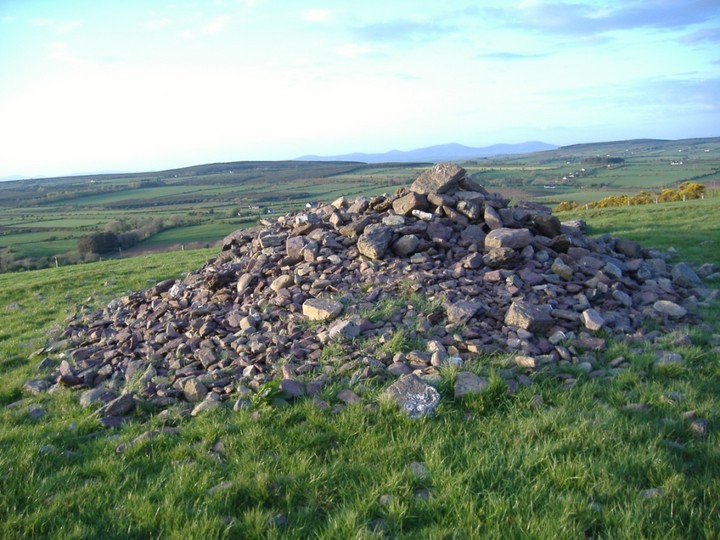


This stone row has 2 large stones and 1 smaller stump. The highest is about 1.25m high. Unusually the axis of the row is aligned north-south.
It is easy to get to from the road. It is down a quiet cul-de-sac. I parked opposite a new stone house and then walked thru two fields to get to it.
Some of the foresty plantation have been cut recently and open some views to the west but nothing too significant.


This standing stone is pretty mathom about 2.2m high by about 1.5m wide.
It is set with great views of the Tipp/Waterford Hills. It looks like a fairly average stone but the edge or narrowest side looking towards the hills is all gnarled and interesting looking.
It is just behind a new house at the edge of a foresty plantation and access to it is easy.


No sign of this standing stone on Slievecorran. There is a huge slab of granite lying in the corner of one of the fields near where it should be, prehaps that is it?
No sign of this standing stone. Used GPS but still could find nothing.
There is a stone about 300mm high in a ditch but it doesnt look significant enough to me.
No sign of these standing stones, the field they should be in is now ploughed and there are a few stones in the ditch that may be field clearance or at least one of them look like they could an original stone.
This Ogham stone is meant to be down a cul-de-sac, no sign of it at the grid ref.
This standing stone is meant to be in behind some houses. As far as I could see its gone.
Finally made it up to see the “Rolling Sun” at Boheh Stone. It is a very interesting expierence. Talking to a local lady that had seen it everytime in the last 36 years she said that this instance was the brightest she can remember. I would recommend bringing some kind of tinted “welders” goggles with you so that you can observe it better. I think I am still seeing sun-spots after it.
The stone is on the Clew Bay Arch trail as Site 2 and can be found by following the signs for Croagh Patrick coming out of Westport and then following the sign for Site 2.
There is a lot of construction going on close to the stone (which is in someones backyard but access is allowed!) and another spot where it is possible to view the “rolling sun” from the road will be gone as another bungalow is built up in front of it.
It happens twice a year on the 18th April and August 24th. However the locals that were there last night agreed that today the 19th April would probably be better so it looks as if it could be slightly either side of this.
More information on “the rolling sun”

Mid-way down from behind the stone itself, people all over it which isnt great considering the age of the rock-art.

At the beginning of the descent down Croagh Patricks Northern Slope


Seconds before “the Rolling Sun” disappears beneath Croagh Patrick

The stone with the Sacred Hill Croagh Patrick in the background