
Tredinney Barrow on Tredinney Common, photographed from the east-south-east on 14 August 2004. © Chris Bond.
Image credit: Chris Bond
Tredinney Barrow on Tredinney Common, photographed from the east-south-east on 14 August 2004. © Chris Bond.

Tredinney Barrow on Tredinney Common, photographed from the south-south-east on 14 August 2004. © Chris Bond.

Tredinney Barrow on Tredinney Common, photographed from the south-east on 14 August 2004. © Chris Bond.

Tredinney Barrow on Tredinney Common, photographed from the east-north-east on 14 August 2004. © Chris Bond.

Tredinney Barrow on Tredinney Common, photographed from the north-north-west on 14 August 2004. © Chris Bond.

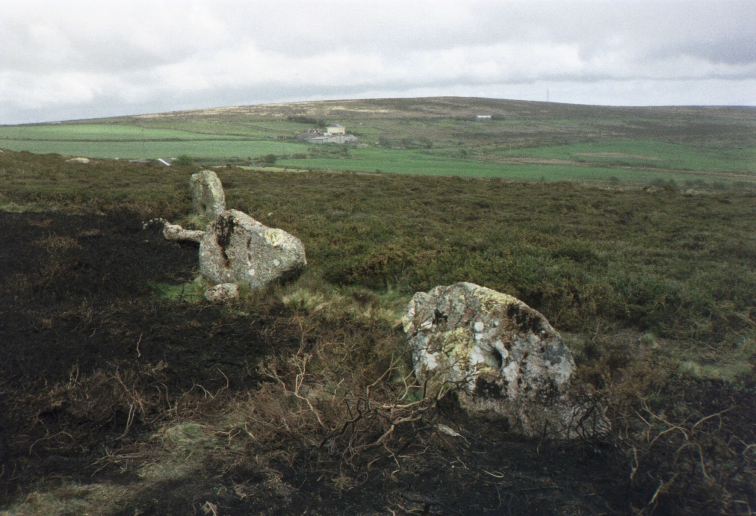
Tredinney Barrow on Tredinney Common, photographed from the north-north-west on 14 August 2004. © Chris Bond.
Part of the row of holed stones on Kenidjack Common, photographed from the north west on 5th of May 2003. © Chris Bond.

Part of the row of holed stones on Kenidjack Common, photographed from the north west on 5th of May 2003. © Chris Bond.

One of the holed stones on Kenidjack Common, photographed from the north west on 5th of May 2003. © Chris Bond.

One of the holed stones on Kenidjack Common, photographed from the north west on 5th of May 2003. © Chris Bond.

One of the holed stones on Kenidjack Common, photographed from the east south east on 5th of May 2003. © Chris Bond.

One of the holed stones on Kenidjack Common, photographed from the east on 5th of May 2003. © Chris Bond.

One of the holed stones on Kenidjack Common, photographed from the north east on 5th of May 2003. © Chris Bond.

Elevation and plan of Pawton Quoit by Nicholas Whitley, from the back pages (opp p88) of the Twenty Second Annual Report of the Royal Institution of Cornwall, 1840.

Tregeseal East Stone Circle, Botallack Common. Cupmark on stone at the north. Photo taken 31 July 2004. © Chris Bond

Tregeseal East Stone Circle, Botallack Common, from the north-north-west. Photo taken 31 July 2004. © Chris Bond

Tregeseal East Stone Circle, Botallack Common, from the south-south-east. Photo taken 31 July 2004. © Chris Bond

Tregeseal East Stone Circle, Botallack Common, from the south-south-east. Photo taken 31 July 2004. © Chris Bond

Tregeseal East Stone Circle, Botallack Common, from the north-north-west. Photo taken 31 July 2004. © Chris Bond

Tregeseal East Stone Circle, Botallack Common, from the east. Photo taken 31 July 2004. © Chris Bond

Tregeseal East Stone Circle, Botallack Common, from the west-north-west. Photo taken 31 July 2004. © Chris Bond

Tregeseal East Stone Circle, Botallack Common, from the north-west. Photo taken 31 July 2004. © Chris Bond

Tregeseal East Stone Circle, Botallack Common, from the west-north-west. Photo taken 31 July 2004. © Chris Bond

Tregeseal East Stone Circle, Botallack Common, from the south-south-west. Photo taken 31 July 2004. © Chris Bond

Tregeseal East Stone Circle, Botallack Common, from the south-south-west. Photo taken 31 July 2004. © Chris Bond

Tregeseal East Stone Circle, Botallack Common, from the south-south-west. Photo taken 5 May 2003. © Chris Bond

Tregeseal East Stone Circle, Botallack Common, from the south east. Photo taken 5 May 2003. © Chris Bond

Tregeseal East Stone Circle, Botallack Common, from the south west. Photo taken 5 May 2003. © Chris Bond

Tregeseal East Stone Circle, Botallack Common, from the north west. Photo taken 5 May 2003. © Chris Bond

Tregeseal East Stone Circle, Botallack Common, from the north west. Photo taken 5 May 2003. © Chris Bond

Tregeseal East Stone Circle, Botallack Common, from the north. Photo taken 5 May 2003. © Chris Bond

In 1929, previous to the Western Morning News report shown in the post above, Dorothy Lidell’s excavation of Hembury Hillfort was announced on p3 of the Proceedings of the Devon Archaeological Exploration Society, Vol 1, Part 1. The following two pages featured an account of the hillfort by Gertrude MacAlpine Woods as well as a larger, clearer version of the plan from A. Hadrian Allcroft’s ‘Earthwork of England’. Image 1 of 3.

In 1929, previous to the Western Morning News report shown in the post above, Dorothy Lidell’s excavation of Hembury Hillfort was announced on p3 of the Proceedings of the Devon Archaeological Exploration Society, Vol 1, Part 1. The following two pages featured an account of the hillfort by Gertrude MacAlpine Woods as well as a larger, clearer version of the plan from A. Hadrian Allcroft’s ‘Earthwork of England’. Image 2 of 3.

In 1929, previous to the Western Morning News report shown in the post above, Dorothy Lidell’s excavation of Hembury Hillfort was announced on p3 of the Proceedings of the Devon Archaeological Exploration Society, Vol 1, Part 1. The following two pages featured an account of the hillfort by Gertrude MacAlpine Woods as well as a larger, clearer version of the plan from A. Hadrian Allcroft’s ‘Earthwork of England’. Image 3 of 3.

Clipping (part 1 of 3) from The Western Morning News, 27th July 1930, regarding early successes resulting from Dorothy Lidell’s excavation of the hillfort which ran from 1930 to 1935.

Clipping (part 2 of 3) from The Western Morning News, 27th July 1930, regarding early successes resulting from Dorothy Lidell’s excavation of the hillfort which ran from 1930 to 1935.

Clipping (part 3 of 3) from The Western Morning News, 27th July 1930, regarding early successes resulting from Dorothy Lidell’s excavation of the hillfort which ran from 1930 to 1935.

Plan of Hembury Fort near Honiton in Devon from p85 of A. Hadrian Allcroft’s book Earthwork of England: Prehistoric, Roman, Saxon, Danish, Norman, and Mediæval (Macmillan, 1908).

Leaflet for “Save Our Quoit”, aiming to raise donations for an excavation and the restoration of Pendarves or Carwynnen Quoit near Camborne in Cornwall, produced by The Sustainable Trust, who purchased the land in 2009. The portal tomb was re-finally re-erected in 2014.

The barrow from the south-south-east, photographed on 15 May 2004. © Chris Bond

Tregeseal Entrance Grave from the south east, photographed on 15 May 2004. © Chris Bond

Tregeseal Entrance Grave from the north west, photographed on 15 May 2004. © Chris Bond

Tregeseal Entrance Grave from the north, photographed on 15 May 2004. © Chris Bond

Tregeseal Entrance Grave from the north-north-east, photographed on 15 May 2004. © Chris Bond

Chapel Carn Brea Cairn and Entrance Grave, Carn Brea. Cairn from the north. Photographed on 24 July 2004. © Chris Bond.

Chapel Carn Brea Cairn and Entrance Grave, Carn Brea. Cairn from the south. Photographed on 24 July 2004. © Chris Bond.

Chapel Carn Brea Cairn and Entrance Grave, Carn Brea. Burial chamber from the south south east. Photographed on 24 July 2004. © Chris Bond.

Chapel Carn Brea Cairn and Entrance Grave, Carn Brea. Burial chamber from the south south east. Photographed on 24 July 2004. © Chris Bond.

Chapel Carn Brea Cairn and Entrance Grave, Carn Brea. Cairn from the north east. Photographed on 24 July 2004. © Chris Bond.

Ballowall Barrow, Carn Gluze (SW 3552 3125). Whole barrow from the north. Photographed on the 5th of April 2003. © Chris Bond.