
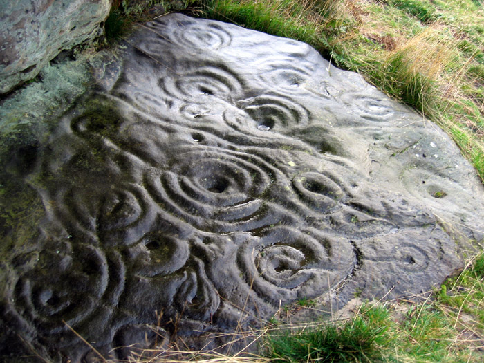
A new find; cup and ring marked boulder near the forest
Image credit: Rockandy
A new find; cup and ring marked boulder near the forest


Simonside artifically illuminated with rock art motifs as part of the ‘Northern Lights’ winter festival.

Northumberland Lights on Simonside. Illuminated rock art motifs.

Simonside artifically illuminated as part of Northumberland Lights winter festival. Design influenced by rock art motifs.

Simonside artifically illuminated as part of Northumberland Lights winter festival.

View S towards Snook Bank farm from new find on the main ridge below Beckensall’s 7d. The remains of a round house lie in the bracken strip about 1/3 from top of the photo between the outcrop and the farm.


A new find at Snook Bank. Double motif on edge of outcrop some 50m further down the ridge from Beckensall’s 7d.


Weetwood Moor 3a; known locally as ‘Billy’s Bicycle’.


The Cheviots, Millfield Plain, Dod Law and Buttony from Weetwood


Photoshopped grainy image from the RAM06 field trip.

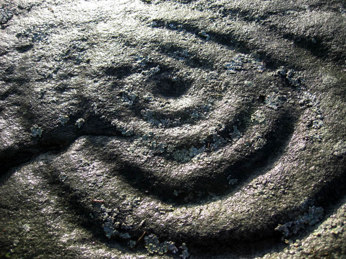
Midtead 1; detail of cup and double ring joined by a curved groove to small cup and single ring.


View SW over the Roughley Wood landscape from the Settlement site, just W of A697. The prominent outline of Coe Crags and Long Crag lie above the southerly part of Thrunton Wood.

Rough Castles 1; cup surrounded by a faint double ring cut through by quarrymen’s chisel holes on steeply-sloping west face of boulder. Another possible cup and ring to its left and two cups above. Grooves and basins on the upper part are probably the result of natural erosion.

Rough Castle 1; west face of boulder showing sharply quarried N side, split S side and chisel marks. View towards A697 and wood behind.

Rough Castles 1; cups and grooves on lower part of west face. Cup and likely double ring near the top are cut by the quarrymen’s chisel marks.

Rough Castles 1; large extensively-quarried boulder from the south. View N down valley of the Coe Burn towards the prominent scarp of Titlington Pike (near Hunterheugh) and Bewick Hill in the far distance.

Rough Castles 4; a large cup in the centre of a flat-topped boulder 1.5 by 1.0m . Smaller cups at S’most end possibly natural.

Rough Castles 4; view to N. The boulder lies 2m NE of a recently erected pylon line and 3.5m W of a marshy watercourse.

Distribution of rock art motifs on Morwick Crag. The illustration was made from the panorama photograph and can be directly compared. The new panel is shown in yellow (lichen-covered overhang). We have had problems locating rock art on panel 1g of the Beckensall archive, and also with 2c.


River Till, Wooler and The Cheviot Hills from Gled Law.
