
The beehive part of the structure from the north
Image credit: Tim Clark
The beehive part of the structure from the north

The original entrance into the ‘beehive’ (left of centre), looking into the original passage (where the ‘new’ SW entrance is). The so-called ‘cupboard’ recess (right of centre) is a modern addition

‘New’ SW entrance to passage

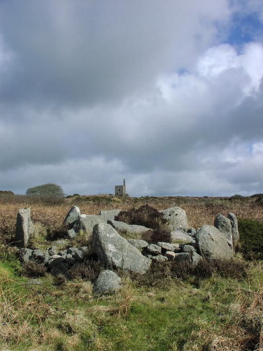
Ocifant approaches the structure from the SW where it is built into fieldwalls
Access my distant memory suggests it was a pleasant and fairly flat walk of no more than about a quarter to half a mile across moorland....
Having looked at the map, today, I reckon the map ref’s more like SX612730.
Sometime in 1995-6
I’d previously posted this under Merrivale because I couldn’t remember where it was but knew it was vaguely near there.
When I finally remembered to ask on the forum if anyone knew it, TMAer greywether suggested it was the Crock of Gold – I recognised the name immediately....
Now I know more (ie a little bit!) about cairns, I’d like to visit again!!

The cist, with remaining kerbstones surrounding


The inside of the cairn and its stones. Often momentarily mistaken on first sight it would seem, for the Nine Maidens. Well, by Mr Cope and me anyway (on my previous visit).


Men Scryfa pictured being given a good talking to.... (For scale Jane is 5’ 9”)


Front view with St Michael’s Mount to the left, Penzance to the right


From the top of the path up the hillside. Oh look, there’s the Ding Dong mine, how unusual....


The view back towards the Hurlers from ‘the entrance bit‘


Jane inspects the tiny entrance to the chamber-y cisty-bit (stop me if I’m getting too technical....)

From the SE – aligned to the entrance, chamber and Ian Cooke’s mid-winter sunrise

Easy to see why Julian recommends the sunsets in the TMA book – ‘Jane from TMA’ stands atop the barrow amid the drama


The multiple stacks, looking back towards the Hurlers

The stack teetering on the edge of its man-made cliff


The Hurlers from Rillaton Barrow (high magnification!)

Illustrating the speed of the weather changing and how localised it is – bright sun on the Cheesewring, and forbidding cloud over the Hurlers


With ever-present DingDong mine in background

Approaching on path from Men an Tol & Men Scryfa – outlier stump in foreground

Friday 12 March 2004
The bank (in the same field but ‘opposite corner’ to Brane Barrow) does have quite a long-barrowy look. Not altogether convinced, but possible! Worth a look if you’re at Brane Barrow.
(Wish I’d taken a photie now!)

From roughly north including a ruined chamber. Photo does just about give an impression of the length of the whole barrow


From the lower slopes of Adam’s Grave. The earthworks are fairly visible in the right light – I just missed the moment, but you can still see em around the centre of the pic....


The barrow (uncut patch, right) is above a wide valley and you can see for miles to the NW, north & NE

Just to try to show how little there is to see – the slight curve on the ‘near’ horizon is all that remains. Jane is at what might have been the ‘entrance’ end

Even more underwhelming from the ‘top’! Can just see some stone surfaces peeping through the soil – doubtful whether these are actually from the ‘monument’? If so, they must be broken up, not in situ.
I had previously entered this circle on this website as ‘Corrie Hill’, having visited a few years ago.
I can’t remember where I got that name from, but it has been pointed out that the site seems to be the same one as this, added by Merrick. And I’m quite happy to go for ‘Druidstones’.
Merrick’s pretty much said it all, all I’d add is that it’s certainly well worth a visit if you’re around!
When I went, I approached the same way as Merrick did in the end.
I had a word with a (slightly eccentric, but very pleasant) woman at the bungalow at the top of the hill, who said that the farmer is quite happy for people to visit the circle.
Obviously, it’d be unwise to approach if it could cause damage to crops and it’d be a REAL shame to abuse this trust.