
Sunday 3 July 2005 Looking roughly north, approaching a little cairn circle at SX561661 from the ‘main’ Ringmoor circle and stone row
Image credit: Tim Clark
Sunday 3 July 2005 Looking roughly north, approaching a little cairn circle at SX561661 from the ‘main’ Ringmoor circle and stone row

Sunday 3 July 2005 Little cairn circle at SX561661 looking SSW. Those china clay works get everywhere....

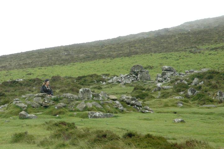
Sunday 3 July 2005 Little cairn circle at SX561661 looking S towards Legis Tor. ‘Main’ circle at end of stone rows is just visible on near horizon

Sunday 3 July 2005 Looking roughly south from little cairn circle at SX551661 to ‘main’ Ringmoor circle at end of stone row

Sunday 3 July 2005 The circle nestling on the hillside, looking roughly south from the direction of Ringmoor

Sunday 3 July 2005 Looking roughly north towards Ringmoor, out of sight at the top of the hill

Sunday 3 July 2005 In the S quadrant of the circle, amongst the ferny undergrowth, there are stumps and fragments of the ‘missing’ stones. You can even see the drillholes on this one – thank goodness they didn’t destroy the whole gorgeous circle....


Sunday 3 July 2005 Looking roughly WSW back towards Brisworthy farm

Sunday 3 July 2005 Looking roughly SW straight towards Shaugh Lake china clay works. What a shame.

Sunday 3 July 2005 Looking roughly south towards the Lee Moor china clay works

Sunday 3 July 2005 Looking roughly SE, Legis Tor on left and Great Trowlesworthy Tor on right horizon. Trowlesworthy Warren circle, stone rows etc are just beyond on the other side of the tor....

Saturday 2 July 2005 In the distance is the weather we’d had all day, but for Scorhill, the sun had burst through in glorious fashion!

Saturday 2 July 2005 Looking roughly north from the lower ground to the south


Saturday 2 July 2005 Looking roughly south, towards Batworthy & Shovel Down

Saturday 2 July 2005 Approaching down the hill from the west, having parked at the parking at the closest point at SX662878 – though is a fairly easy walk from Batworthy corner if you’re seeing Shovel Down too


The stones at the E of the road, looking to the West from the pool. This row was once pretty long, but is so ruined and the remaining stones so small that it takes a while to realise it. Great views over the rolling country at the ‘edge’ of Dartmoor

Along the stones to the E of the road, looking from by the pool towards the E end of the remaining stones (where Jane is standing)

Without the hedgerows etc, this could be quite a lonely & spectacular setting, with views across to the hills of Dartmoor itself to the West


View to SW along the misty hillside with sharp gorge to right


One of the better-preserved huts in horrid weather (which seems par for the course, going by the other photos here!)

Jane huddles in shelter of south(-east?) entrance as the weather threatens to chase us back to the car

Nice hut. Hut 3 in left background & entrance in right background.
Jane takes in the gloomy atmosphere & worsening weather. Makes it seem like it must’ve been a hard life up here, though the climate would probably have been better....
Access seems to be considerably improved compared to most of the posts below! I didn’t have to climb any fences etc. Not easy for those with health problems or limited mobility though, as part of the walk is pretty damn steep!
I parked at the big layby-type car park on the south side of the A57 & walked back down the hill to ‘Cutthroat Bridge’. There’s now a pedestrian gate there which leads to a permissive path (’no dogs’ I’m afraid).
The path goes gently up thru trees for a short distance and across the moor following the bottom line of the ‘Edge’. After mebbe a few hundred yards, there is a fairly small wooded area on the right of the path.
From there, I struck off more or less straight up the steep slope of the ‘Edge’ itself. Unfortunately this steep slope means that mobility could be a serious ‘issue’ and the walk up is quite strenuous.
Reaching the outcrops at the top of the Edge, the circle is around 50 yards onto the moor, maybe less. Where I reached the outcrops, it was slightly to my left, but it shouldn’t be far away if you set off from the path at the trees and go more or less straight up. Though the stones are small, it’s reasonably easy to spot and doesn’t look like it’d get overgrown in the summer.
Sunday 15 May 2005
Bloody gorgeous!!!
Somehow I’d never got round to this one on my several previous trips to Derbyshire – goodness knows why as I always used to be coming from Leeds & this is one of the most northerly sites in the area.... As a result, it’s been nagging me for a while.
Anyway, the Stonehengineers event was going well and I didn’t seem to be essential to proceedings. So, upon discovering that Mr & Mrs Goffik had the requisite OS map with them, I decided I must take advantage of the sunshine (and their map) for a little jaunt.
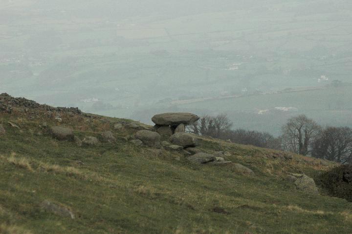
A bit of a drive from Crich (where the Stonehengineers were), I was certainly glad I went for it!!! A lovely characteristic Derbyshire circle with plenty of stones left. A short segment at the north (?) has had the stones broken off at ground level, but this isn’t a really a problem. (Though it’d be better if they were there, obviously.)
And the views are wonderful, particularly towards Ladybower. A great place to sit and chill out in decent weather, though bleak and unwelcoming in wind and rain I guess! Lots of interesting nearby crags to check out too. Unfortunately, I couldn’t stay long, as I was already feeling guilty for ‘bunking off’ from stone moving duties!!


The view from the ‘Edge’ by the circle – towards Ladybower resevoir


Circle has 2 suspicious outlier-type stones (foreground and right) but, to me, they seemed in strange places in relation to each other and the circle. Perhaps someone’s just been standing random stones upright.

From some angles, it really does look like it’s going to tumble down the hillside....


The 1:25,000 map seems to show a standing stone just N of the track to the west, much closer than Cae Coch. could this titch be it?
