
Sunday 17 April 2005 A group of Kerjean menhirs from the woodland path – they may be harder to spot in high summer when there are more leaves
Image credit: Tim Clark
Sunday 17 April 2005 A group of Kerjean menhirs from the woodland path – they may be harder to spot in high summer when there are more leaves

Sunday 17 April 2005 One of the few groups that I could get a ‘shot’ of without too much vegetation in the way

Sunday 17 April 2005 Approaching from the carpark

Sunday 17 April 2005 Looking back between the rows towards the carpark

Sunday 17 April 2005 Some of the stones in the main alignments are mosters that give their neighbours ‘Les Géants’ a run for their money

Sunday 17 April 2005 ‘Les Géants’ – about the tallest stone – it’s a whopper! (I was just about to get about the wettest I’ve ever been....)

Sunday 17 April 2005 ‘Les Géants’ – ‘table of sacrifice’ or altar stone

Sunday 17 April 2005 ‘Les Géants’ from the ‘far’ end – ‘table of sacrifice’ or altar stone on middle right

Tuesday 12 April 2005 The short path from the road – I think the high ground to my left in the pic could even be the beginnings of the original huge mound

Tuesday 12 April 2005 Passage – insanely (and relatively unusually here) invaded by the farm, one side is now formed by an outhouse wall!


Tuesday 12 April 2005 Massive capstone – each of the broken pieces is huge on its own


Tuesday 12 April 2005 Passage stone – probably the most ‘classic’ carvings here but I had to use flash....


Tuesday 12 April 2005 Carving on chamber stone (I think)

Tuesday 12 April 2005 A magnificent surprise the first time I saw it

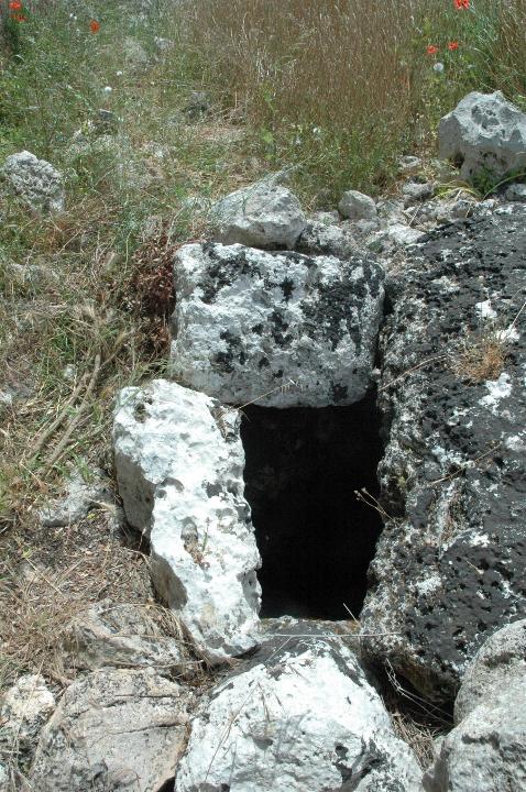
Tuesday 12 April 2005 Entrance

Tuesday 12 April 2005 These curved passages seem to occur in several ‘tumulus’-type tombs

Tuesday 12 April 2005 Curiously carved passage (I think) stone

Tuesday 12 April 2005 Carving faintly visible – at least as chalk lines (tut-tut – it wasn’t us!)....

Tuesday 12 April 2005 Chamber

Tuesday 12 April 2005 Nearby ruined tomb

Tuesday 12 April 2005 Nearby ruined tomb
Approximate long/lat coordinates only, as we were taken (in the end) to the site & Na Comerma by someone who knew where they were!
Access: A walk of a few hundred metres after parking in a ‘back entrance’ to Torre d’en Gaumes a few hundred metres south of the main entrance.
For road directions to here, see Torre d’en Gaumes.
From there, we walked a few metres south down the lane (away from Torre d’en Gaumes). We went through the first gate on the left (east side of the lane). I’m afraid this is where it gets difficult!
From the gate we headed a few hundred yards diagonally right – roughly SSE, and amongst the dry stone walls & scrubby bushes, we found the tomb.
Visited 3 June 2005
A little beauty (actually, not that little!) this is one of the very few more ‘standard’ megalithic tombs on Menorca (only 4, I think I read somewhere!)
It’s the only one we saw, but one of the others is pretty near Torre Llisa Vell. Unfortunately, we couldn’t find it.
Access A walk of 1.5-2km along pretty good gravel & grass tracks. Not steep at any point (except climbing up to what I’ve called Sant Agusti ‘Bonus’ Talaiot, but undulating and rough underfoot in a few places – especially at the site itself!
Detailed directions, as long/lat co-ordinates are best guess
I headed west along the road from Mao to Ciutadella, and took the main left turn towards Sant Tomas. I passed through Es Migjorn Gran and about halfway from there to the little roundabout entering Sant Tomas, there is a dirt verge-cum-layby on the right. I know it’s roughly halfway because I went right past to make sure it was the right place!
This parking place is effectively on a triangular ‘island’ between 2 arms (the second of which was pretty difficult to spot in the vegetation) of a farm lane leading to Sant Agusti Vell.
Setting off on foot up the farm drive (’no vehicles’ sign), I immediately noticed what looked like an overgrown talaiot to the right, on a fairly steep hill. I figured it was probably way too soon for the ‘main’ Sant Agusti stuff, but had to have a stomp up to have a look. Apart from anything else, I didn’t trust the tourist map I had! See Sant Agusti ‘Bonus’ Talaiot – I couldn’t find a real name for it....
From this talaiot, roughly to the south/SSW I could see a couple of very clear talaiots on the horizon a km or 2 away. Target located! (There was yet another really trashed talaiot to the north too!)
So I headed back to the farm track and continued along the blessedly smooth track, but by the time I reached the farm buildings I hadn’t spotted an definite path to get to where the site appeared to be.
Just as I reached the first byre, there was a farmgate on the right, with a nice herd of cattle in close attendance. There looked to be a faint grassy track beyond the gate, heading in the right direction. Once I rounded the west side of the farm buildings, the talaiots were clearly visible.
After about 10-15 minutes, the talaiots were very close, but somewhat obscured by shrubby bushes between them and the path. Here I got a sign that the site’s definitely supposed to be accessible to the public, as it has the familiar ‘official’ Menorca monument litterbin. Approaching the talaiots, I even spotted an info board!
Visited 3 June 2005
Two talaiots in pretty good condition stand in a poblat which is quite scattered and large, but close to them is largely a rolling sea of rubble with remnants of walls poking out. Between the talaiots I could see an oval enclosure with several fairly tall uprights – I took this to be the remnants of a taula-less taula sanctuary.
I’ve since discovered comments on the rather ‘quaint’ (frames!) but useful ‘The Archaeology of Minorca’ website, that this makes sense, and apparently another enclosure is taken to be a second taula(less) sanctuary.
I picked my wobbling way around the edge of the rubble sea to the south of the talaiots, by a (probably) more modern wall, spotting a series of cisterns as I went.
But then, peeping over the wall…the unmistakeable ‘T’ of a complete Taula!!!! How could this not be mentioned in the info we had? I resisted the temptation of elation and having seen several other taulas during the week, I adopted a cynical view – it didn’t seem to be in the ‘right’ place in relation to the other remains & the taula itself didn’t quite look right.
Getting a foothold in the wall where it passes closest to the ‘T’ of the ‘taula’, I peered over. The taula seemed suspiciously close to one ‘corner’ of the only very vaguely oval enclosure. The enclosure seemed unusually ‘open’, not particularly oval and rather ‘plain’ for a taula sanctuary. Not sure it’s the ‘real deal’.
As mentioned above, however, there is meant to be another taula sanctuary here, without a ‘T’. I suppose this could be it, but with a ‘modern’ T....
Also in its ‘favour’, the ‘T’ at Na Comerma is also very much in a ‘corner’ of its enclosure yet seems to be accepted as ‘real’. But the enclosure at Na Comerma is so full of rubble that it’s difficult to tell what’s going on. Overall though, Na Comerma still manages to feel more like other taula sanctuaries than this one does.
And the final thing that makes me think I may be wrong to doubt its authenticity is that according to a taula ‘reconstruction’ diagram I’ve seen, (at least some) taula sanctuaries may have had many smaller ‘T’s on pillars round the edges of the sanctuary. And there is possible evidence of that here.
Have a look & decide for yourself!
The talaiots
The talaiots both seemed relatively small compared with, say, Trepuco or Talati de Dalt.
And to be honest, after a week in Menorca, the one to the west was ‘just another quite nice talaiot’, once I’d established that it wasn’t the one that you can get inside. (It does have what look like a couple of small blocked entrances though.)
But the other is a mindblast! This was the eastern one – nearest the path I described arriving by. From the outside it’s the same, but once you find the actual entrance…(round the ‘side’, facing the ‘dodgy’ taula)…and look in – WOW!!! Suddenly vague thoughts of the vaulting of Orcadian tombs like the Fairy Knowe come stealing in…. (Though without the ultra-classy Orcadian flag stonework and it wasn’t built as a tomb!) It also reminded me a bit of a less claustrophobic Grain Souterrain.
Assuming that talaiots were indeed lookout towers, presumably the inside was used as a shelter for the lookouts or was where they lived. I’ve read that most or many talaiots had an entrance and/or ‘room’ either at the bottom or near the top, but I don’t think I’ve read anything that said anything about the use of the inside.
Well worth the walk!!!
Access Hard work! Steep climb, fairly rough & a little precarious in places. As the talaiot and the way to get to it is overgrown, I got lots of scratches – I was wearing shorts.... For full directions, see Sant Agusti Vell.
Visited 3 June 2005
The talaiot was a little ‘knocked about’ but I got some great views from its top, boosted by its hilltop location.
Views were especially good of some caves across a valley to the west(ish). I’ve so far been unable to find out anything specific about them, but to my eye they looked like a pretty typical Menorcan cave settlement and this area seems to be riuddled with them....
There is also what appears to be an entrance to a likely cave in the outcrop underneath the talaiot!
Roughly to the south/SSW I could see a couple of very clear talaiots on the horizon a km or 2 away. This was Sant Agusti Vell itself.
(There was yet another really trashed talaiot to the north too!)

3 June 2005 View from top of talaiot – note El Toro looming and evidence of other ruined talaiots just discernable


3 June 2005 Possible 2nd taula sanctuary – notice ‘mini-taula’ on pillar by enclosure wall


3 June 2005 Possible ‘2nd’ taula sanctuary as I first glimpsed it over the enclosure wall

3 June 2005 Trashed taula-less taula sanctuary between the talaiots

3 June 2005 Pano inside the eastern talaiot – this makes it look low, but it’s not – it’s a big space! (See previous photo.)

3 June 2005 Inside the eastern talaiot with (not small!) rucksack for scale

3 June 2005 Entrance to eastern talaiot (’working’ entrance at side of talaiot)

3 June 2005 Eastern talaiot showing (I think!) false entrance (the ‘working’ entrance is at left side of talaiot in this photo) – sorry, it was a long time ago now!

3 June 2005 View over main site from top of eastern talaiot

3 June 2005 Approaching along grassy track from nearest farm
Approximate long/lat coordinates only, as we were taken (in the end) to the site & Ses Roques Lisses by someone who knew where they were!
Access: A walk of a few hundred metres after parking in a ‘back entrance’ to Torre d’en Gaumes a few hundred metres south of the main entrance.
See Ses Roques Lisses. From there, we walked roughly south or SSW for another few hundred metres. Hidden on the far side of a fair-sized clump of tangly trees, you may be lucky enough to find the monument(s). Very sorry to not be able to be more helpful!
Visited 3 June 2005
Having asked for directions from the friendly ticket seller at Torre d’en Gaumes, I’d spent a good couple of hours looking for this site and Ses Roques Lisses during the afternoon, with no joy. Perhaps I was unlucky, but I don’t think either site is easy to find!
Fortunately, when I told her I hadn’t found them, the lovely ticket seller said she’d take me & Jane to them if we came back at closing time.
The site is a Taula sanctuary with a strange squat ‘T’ tucked in the corner. This may be another illustration of a taula ‘reconstruction’ diagram I’ve seen, showing that (at least some) taula sanctuaries may have had several smaller ‘T’s on pillars round the edges of the sanctuary.
It is also adjacent to a hypostyle-type arrangement of pillars and lintels.
Featured in The Megalithic European (TME) page 155.
Access: Entry charge. Carpark & good paths all around the complex. In places, the paths are concreted, but on steeper parts feature shallow steps.
The southern section (furthest from the carpark) is so ‘busy’ that you can’t reach all the buildings on the paths. It’s also a walk of a few km to cover the whole site.
To reach the site, take the 721 towards Alaior. Just to the west of Alaior, head south towards Son Bou (Julian says it’s signposted from here). After around 3km, take a turn to the left and you can’t miss it!
Visited 1 June 2005
A showcase site & stunning complex!!! I’d advise visiting early or late, as I bet it’s pretty busy with tourists most days, but I think it closes around 6 or 7pm.


3 April 2006 The more southerly of the 2 langdysser, looking NNWish

3 April 2006 The more southerly of the 2 langdysser, looking SSWish
