

Wednesday 7 October 2009 Possible remains of another allee in trees directly across road. Could well be field-clearance, though a couple of the more ‘interesting-looking’ stones are well rooted in the ground.

Wednesday 7 October 2009 Possible remains of another allee in trees directly across road.


Monday 5 October 2009 Pano created using free beta version of Autostitch autostitch.net

Monday 5 October 2009 Looking roughly south. Beautiful & powerful setting. Pano created using free beta version of Autostitch autostitch.net

Monday 5 October 2009 Looking roughly east. Pano created using free beta version of Autostitch autostitch.net

Monday 5 October 2009 Looking NW. Pano created using free beta version of Autostitch autostitch.net

Monday 5 October 2009 Looking SW. Pano created using free beta version of Autostitch autostitch.net

Monday 5 October 2009 Looking SE through one of the damaged chambers & along its passage


Monday 5 October 2009 From the south-west (bottom) end of the cairn


Monday 5 October 2009 You can really see the capstones in this pic


‘Visited’ Saturday 26 September 2009
We tried to find this using Aubrey Burl’s very basic instructions in ‘Megalithic Brittany’ (Thames & Hudson 1985). To be fair to Dr Burl, he doesn’t recommend only using his instructions but getting a decent map as well. For this one, I’d certainly agree!!
It should be easy using the Googlemap coordinates I’ve provided, based on megalithes-breton.fr
Dr Burl just says go to Ban al Lan near Portsall & that the ‘tomb is st the end of the creek.’ Unfortunately, at Ban al Lan there is a very obvious lovely creek in a beautiful valley, which we spent sometime exploring without megalithic joy!
On returning I’ve done a little research, and the allee couverte seems to be on the headland to the east of the creek. A few hundred yards to the east of the creek on the D27, there is even a road in that direction (north) called Rue de Guilligui!
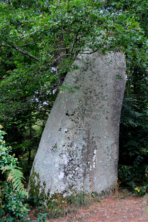
This looks like a nice little rather knocked-about allee, but with a particularly ludicrous christian cross slapped on top. Hope I get another chance to see it for myself!
‘Visited’ Sunday 3 October 2009
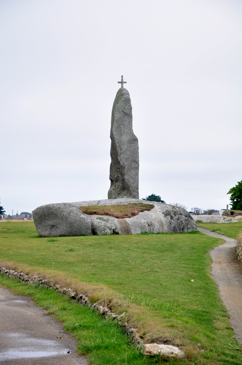
This is a big menhir with a silly christian cross on top, which we tried to find using Aubrey Burl’s very basic instructions in ‘Megalithic Brittany’ (Thames & Hudson 1985). To be fair to Dr Burl, he doesn’t recommend only using his instructions but getting a decent map as well.
Much to our surprise, we couldn’t find it. Burl says it is ‘after the last houses on the NE (R) of the road to Melgven.’ From Googlemaps, this still seems to be true, but what Burl doesn’t mention is that the menhir seems to be on the other side of the road!
Having checked the wonderfully informative & reliable megalithes-breton.fr on our return, the menhir is to the north (west) of the Melgven road in a wood behind some houses.
There are other sites around here, including another menhir (Kergleuhant or Kerdunus) & a dolmen (Loch-Korrigan).
‘Visited’ Sunday 3 October 2009
We tried to find this using Aubrey Burl’s instructions in ‘Megalithic Brittany’ (Thames & Hudson 1985). To be fair to Dr Burl, he doesn’t recommend only using his instructions but getting a decent map as well.
We could see nothing where he describes, which is some way south of this location, nearer the D24 and south of the N165.
The roads & undergrowth etc there may have changed a bit since 1985, which may account for us not being able to find anything there. (We couldn’t even identify the ‘fork in the road’ on the D24 that he mentions.)
But it seems from further reading (’La Bretagne des Megalithes’ by Pierre-Roland Giot and the extremely reliable megalithes-breton.fr for example) that if there is something where Burl descibes, it’s not Coat-Menez-Guen.
The coordinates used to post this page seem to be the correct ones. You can even see what looks like the tomb on Googlemaps.
Burl himself says “there are other but disrupted allees-couvertes” in the area. Perhaps he mixed the locations up? Who knows.
The good news was that in zipping around the area we spotted Coat Luzuen in our road atlas & found that instead, though it’s not as interesting as this ‘semi arc-boutee’ sounds!
Annoyingly, after we’d finished there, I insisted that we should continue north on the little road that passes it. When we reached the farm at the north end, we turned back, but from Googlemaps it looks as if we could have walked to Coat-Menez-Guen from there!


Sunday 4 October 2009 Let’s hope the rest never gets as overgrown as the southside
Sunday 4 October 2009 A bit overgrown at this time of year....


