tiompan


If the site is prehistoric and does have any intentional astronomy it is in this direction .

There are three Lurgans in Scotland all within 14 miles of each other and all above the Tay . Two have rock art close by which is a bit of a problem when it comes to naming . Therefore this new find from last Saturday should not be confused with the more spectacular themodernantiquarian.com/site/10893/lurgan.html .
Hard to believe this has gone unnoticed for what it is , as it is only 6m metres from the farm track and also sports a dynamite hole in the largest cup . The site is midway between a large numbers of marked rocks to the west and smaller but significant numbers to the east ,why this should be has always been a puzzle but the dynamite hole may be a clue ,the immediate area is a wee bit more manicured and has more “sporting ” estates . The day after my visit saw the annual Etape Caledonia cycle race which brings in a fortune for local services and also generates lots of dosh for charities , a couple of years ago it coincided with RAM ‘09 and the organisers were very helpful offering to find spaces in the race to allow us to drive to parking places to access the ornate Lurgan I decided against causing any bother and we went elsewhere but some bright local , who turned out to be a councillor or something similar , decided he wasn’t happy with the road closures and spread tacks on the route ,causing havoc . When he was eventually caught and went to court , he was admonished Sadly it happened again this year , at the nearest point to the route from this stone .


First pic is one after initial clearance of brash a few yers ago the next three are what that section looked like about a year ago .


An area relatively devoid of rock art .
canmore.rcahms.gov.uk/en/site/16049/details/leakin/


Class 2 henge , difficult to get a pic of the entire monument . In surprisingly good shape or at least I was expecting much worse . The bank is just under 2m high and the ditch is a typical broad 10m and shallow 0.5 m.Entrances are within 10-15 degrees north/south in common with a few other Class 2’s like the Bull Ring , Cairnpapple ,Broomend and Ballymeanoch .Fwiw the hill seen over the trees in the last pic is Dollar law which is where the winter solstice sun would be seen to set , an unlikely example of intentionality as it’s a wide target (5 degrees of horizon ) not indicated i.e. entrance or foresight , the sun has to set somewhere and as the horizon is relatively hilly it’s likely to be over a hill , if the hill happened to be notable i.e. pointed it might be a wee bit more salient .Plenty lithics have been found in the area dating from the Mesolithic to Late Neolithic .


Not typical of the island and don’t even know if it is recorded .


Thre new finds from Saturday , in an area with nothing prehistoric recorded for 6 km in either direction along Loch Earn and the marked rocks 3 km across the loch at Ardveich themodernantiquarian.com/site/13680/ardveich.html .
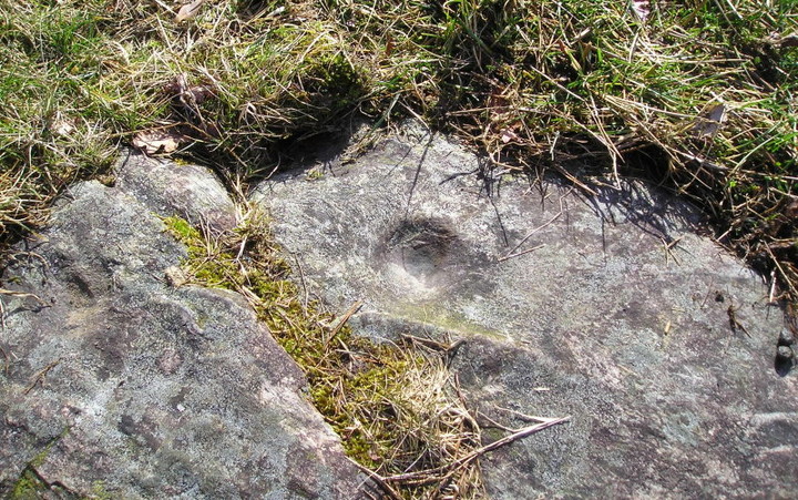
I usually omit posting pics of single cup marks but this one is interesting in that the marked surface is not the usal sandstone but a very hard igneous rock , it must have taken quite a bit longer to make and also has shown much less signs of wear .I’ve also included a “before ” pic of what one of the sites , a marked knoll , looked like before the moss was removed .