

Cairnholy 1 – rear compartment of the chamber.
As there is no access to this compartment from the adjoining compartment, this is thought to have started off as the original stone structure at the site (the protomegalith) and subsequently extended into a fully-developed Clyde cairn.
A protomegalith is a rectangular, largely above-ground and largely-symmetrical burial structure with no architectural feature suggesting any one particular orientation. There was probably no associated cairn.
The next stage would be the addition of the two stones to the E (ie top left of the photo) as portal stones. These, the hypothesis goes, have no architectural or structural purpose (eg they do not support a capstone) but merely serve to mark the E end as ritually important.
Subsequent developments are: (1) creation of another compartment by extending the E portal stones; (2) the cairn; (3) the addition of a more complex entrance and facade.
A similar development from a protomegalith to a fully developed Clyde cairn has been put forward for Cairnholy 2


The reconstructed stone circle represents a number of phases of use.
The latter phases include the insertion of burial cists within the stone circle and after the third of these was inserted (the one next to the square paved area) the whole central area was covered by a cairn.
The ceremonial monuments do not end here.
A ring ditch and ring cairn were built around the time of the stone circle near the Balfarg Riding School sites.


The ground level of the cist with the cup-and-ring marked stone has risen a little over the years.
This old photo shows rather more of the design.


Balfarg Riding School Mortuary Enclosures
Situated between the Balfarg henge and the Balbirnie stone circle, this reconstructed site comprises a sub-rectangular ring of posts with an inner “avenue” of thicker posts.
It has been interpreted as a mortuary enclosure in which the inner posts would hold platforms on which the dead would be laid out to be defleshed before burial.
The reconstruction is one of two similar buildings excavated in the area – the other, almost identical, site being some 70m to the SW.
These monuments went out of use around 3200bce and a henge (earlier than the main henge at Balfarg) was built around the area which now houses the reconstructed mortuary enclosure.


This is a view from the rear of the monument looking E into the chamber with the passage stones visible beyond the capstone.

The stones in the foreground are part of the passage. The fallen chamber capstone lies behind them.
This is one of the few Hebridean Passage Graves to be located on the mainland. It is close to the Isle of Skye so not far away from the usual territory.
The most visible remains are a capstone partly covering the small rectangular chamber. Traces of the E-facing passage can also be seen.
Excavation in 1965 showed that the cairn had been enlarged from a round one to a square one and that a facade had probably been added to the E side of the cairn. An interesting change of design which would bring it closer to a Clyde cairn layout.
Near the roadside just E of Dun Telve and Dun Troddan.
Visited 25 July 2004


There are two Hebridean Passage Graves to be seen in Benbecula – this one and Airidh na h-Aon Oidche. They are within 400m of each other and intervisible.
Stiaraval, which has lost most of its cairn, has a typical layout. A passage entered from the SE leading to a circular chamber.
The stones are impressive. One passage stone is about 3m long and there are chamber stones over 1m tall.
Impressive views to the S. As is the case with many cairns in the area, the builders of Stiaraval chose the slope of a low hill as the location rather than 25m further up on the summit.
Definitely worth a visit.
Access. Drive E at the crossroads at NF805536 and park at the landfill site. A path running alongside the fence heads S in the direction of the cairn. On the way is the Rueval Stone at NF812532.
The cairn can be accessed from the track which runs E from NF805536.
Some of the cairn material has been used to build sheilings.
The nearby cairn mentioned by Billmac is Stiaraval.
Visited 29 July 2004


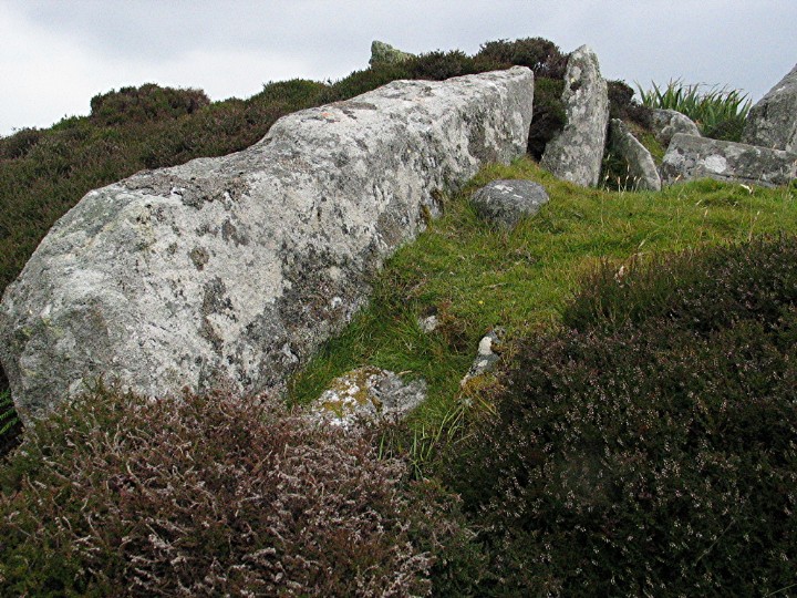
This is a long cairn, its most prominent feature being a 3m stone leaning at a great angle. Other stones are visible in the turf suggesting the line of a chamber.
Interpretation is difficult especially as all but the S end of the cairn has been covered in sheep fanks. The tall stone may be part of a facade linked to the chamber.
In its favour, access is easy. Park at the church then through a gate. But there are a lot more interesting sites than this one to spend time at.
Visited 29 July 2004


View down the chamber and passage looking E.
Rather unusual arrangement of the two – chamber narrower than passage.
Alternatively, the wider “passage” may be a later addition – its use of portal stones is certainly unusual in aHebridean Passage Grave.

This Hebridean Passage Grave sits on a small tidal islet. In the neolithic the three islands were one landmass and the watery landscape which characterises the Uists today did not come into effect until about 2000 bce.
Traces of the passage and chamber on the islet with several peristaliths visible at tide level.
Access. Parking ok on the approach road. Through one gate then over a tricky barbed wire fence to the shore.
Visited 29 July 2004
Another example of where a bit of signposting might demonstrate that the Uist tourist authorities recognised they had some wonderful sites which they might want to share with their visitors.
This 5.3m tall stone looks a little like an arrow head – it narrows near the foot then tapers at the top.
Great views – pity about the weather on our visit though.
Visited 29 July 2004


Close up of the peristaliths on the W side of the cairn. The tallest is about 1.5m.

Another reasonably undisturbed Hebridean Passage Grave with a good many peristaliths visible.
The passage area has been exposed at the top of the cairn but not entered. Like Barpa Langass, the cairn sits on the slope of a low hill rather than some 35m further up on the summit. The passage (ESE) points obliquely towards the hill.
If you only have limited time on the Uists, this would be one to visit.
Access. You can drive up the track which runs N of the cairn. It gets a bit rough but there is room for turning/parking at the gate near the cairn.
Visited 28 July 2004


The chamber area looking SE. A bit of a jumble.
The large stone on the R may mark the end of the passage.

General view looking N.
In the foreground is the passage area with what is possibly the W portal of the passage entrance.
Beyond that, some of the stones marking the curve of the chamber can be seen.

Another Hebridean Passage Grave, this one a bit of a wreck. It sits in a long mound with the passage unusually orientated S.
For access and directions – see Dun Bharpa.
Visited 28 July 2004


Capstone visible on top of cairn. Looking W.
Passage points to the usual E.


