The Modern Antiquarian. Stone Circles, Ancient Sites, Neolithic Monuments, Ancient Monuments, Prehistoric Sites, Megalithic MysteriesThe Modern Antiquarian

Get the TMA Images feed
wideford | Blog

Latest Posts
Previous 5 | Showing 11-15 of 156 posts. Most recent first | Next 5

Weblog

SAND O'WRIGHT & ST MARGARET'S HOPE August 28th 2013


Another grand day in paradise as the Blide group of Out and About folk headed down to South Ronaldsay in a full minibus again, picking up a member in the south isles. The road to Hoxa we used starts in the centre of The Hope by the Smiddy museum which one member expressed an interest in seeing sometime (its actually attached to the bus waiting room, so even in the worst of weather those travelling by public transport have a no-brainer !). Along the way we passed the Oyce of Quindry, a tidal inlet where they used to play the Ba'.
Arrived at the Sand o'Wright aka Sands of Wright. Even though it was only an hour off high tide the beach looked expansive, and at extra-wide I still had to take three shots with my camera to capture it all.between the headlands. Most of the group headed east to the high cliffs at the Roeberry Taing, where they looked like tiny dolls at their foot. I suspect another Groatie Buckie hunt took place, these cowries as emblematic of good luck as their Pacific cousins. A few of us headed over the other direction where a fine swell washed the shore my much lower cliffs (though still too high for those with an aversion to owt much above a man's height). There is meant to be a 'new' track along the low cliffs, but I couldn't make this out from the below. Along the way the sparkling swell sometimes caught me out! Some waves rose glassy green, elsewhere they alternated plain with foam as if designed so. After a while the main body came towards us and we three set off to meet them. Several stranded jellyfish littered the sand, as did a peedie still-living crab missing all legs but one - Kev took pity and threw it into the sea.
Coming up off the beach I was intrigued by a long low mound set against the base of the hillside in the sharp corner of a field and covered liberally with stones. On top an area of sand has been exposed but still with some stone. At the mounds downhill side I thought lines of dark grass might show where walls had been, though I have since read in a Current Archaeology report of "buried ditches forming dark green lines during dry conditions". In June 1871 the sandy knoll called Kirkiebrae was trenched in several places to reveal a likely encampment, with burnt stones forming a hearth and containing a large number of animal bones. On the hearth was found a stone quern ("rubber"), a piece of deer bone and a broken fine toothed iron pin fastened bone comb with a set of concentric circles paralleled in southern England. At one spot a fine red and yellow substance was mixed up with a large quantity of ashes. None of which sounds ecclesiastical, but this is traditionally the site of a St Colm's Chapel established by Columba's disciple Cormac from Iona in the early seventh century (Ladykirk down at Burwick had the same dedication). It seems strange that this building has disappeared completely. Anyway the piece that had attracted my attention is not the one on record. Instead they have a hillock above the beach on the other side of the wall as it - ND49SE 4 at ND42229369 - though Kirk Geo is nearer my candidate. The owner of Roeberry Farm called Kirkie Brae a natural grassy knoll with sand exposed in the top from having been used in the wartime (an aerial photo indicates the putative machine-gun post faced the Dam of Hoxa, though it looks as much a broch to my eyes). The dimensions given are 2.5m high and roughly 17m NW/SE by some 13m on the other axis. It is described as having a modern wall about the north and east edges and at the top of the NE side what might be signs of a former building in an outer face of yard-long foot-high drystane walling.
To the north is the Howe of Hoxa, a long sloping mound near the west end of the Dam of Hoxa with an elevation at the high point hiding the broch just behind the house. Climb all the way up and you see into the broch from top to bottom as put back together by George Petrie after he excavated it. Many years ago since I have been there. Then the interior was full of nettles, and global warming will have made matters worse since. Definitely view from the top.
Traditionally the earl Thorfinn Skullsplitter lies buried in Hoxa, with the mound being identified as the spot. But archaeologists can only find indications of settlement at the lower end. However near the east end of the Dam of Hoxa an empty long cist came to light in the vicinity of Swart(e)quoy/Swartiquoy, and early Christians were wont to re-bury their pagan ancestors. Waters are a little muddied by a reference to the discovery of graves, plural, outside the enclosure excavated in 1871 as no remains are mentioned in connection with the cist (ND49SW 11 at ND43099413). This NNE/SSW aligned cist, came from 2'8" deep inside a mound and mostly formed from slabs. At a distance of 4'6" from it another slab stood parallel to the east side's south end slab, both of which rose to a foot above the mound, and he found a 12" by 9½" whalebone vessel. A strange layout it seems to me. Anyways, Petrie believed the Swartquoy enclosure had been "an earthen encampment" because of its being within a strong rampart of earth and stone. This is undoubtedly the same site as Mayfield (ND49SW 13 at ND 43079416), though as described it may include the cist location too - in 1973 the OS talks of a D ~45m in diameter whereas in 1997 Moore and Wilson give us a sub-circular enclosure 'only' 30m across. But more easily reconcileable as area blocked off by the feature's two semi-circular ramparts though. The inner rampart is the better surviving at a maximum height of 1.3m, especially at the north side where it is 5m across (but 1997 account gives bank dimensions as 1.5m high but only 3m wide). At the widest point of the inner rampart a probable eastern entrance (NE in 1997 account) is indicated by two earthfast slabs 0.8m apart. The outer rampart isn't so obvious, and even then can only be seen in the NE quarter and some of the SE quarter. A 0.6m deep ditch across the middle of the enclosure had been some 2~2.5m wide. The enclosure's western end barely survives but is likely to have extended to where you can now see a boat shed's ruined foundations as rubble and peaty deposits lie in a 2m wide vertical cut at the cliffs. Must go there sometime.

Back on firmer ground, and after taking photos of my candidate for the kirk I realise we would not be going any further. Beyond the toilet block are the large foundations of a wartime camp (the pillbox elsewhere is not in its original position, by the way). Running slowly ahead I think I have spotted the other end of the trail I would have taken them on, except you'd have to negotiate a field-gate.

Once back onboard the minibus I persuaded our leader to go to W. Hourston's smithy museum, as sufficient time remained to do so. In the event a different member came with me to the smithy - the rest went to see a craftshop (where for once Sheena garnered no wool!). Hourston's smithy is in a long low building with the old forge in the central section. Go through to the right and there is a large collection of black-and-white photos. The bus waiting-room is seperate. Its wall is a round sweep at the corner of the road, preserving the original curve made to accomodate horse-driven vehicles. At the back a further, lower, building abuts the central section, continuing the roof line. Alas the garden behind has its gate roped up now because it was bonnie when I went. Entering the middle section there's the forge on your right and a selection of instruments in front of you and overhead. Most obvious are two hand-driven pedestal tools, a drill and a lathe operated by turning a wheel. In the low room behind the forge I saw a
large thin-rimmed metal wheel and a pneumatic bellows operated by a long handle. As I came out of this room the lady in charge showed me a big bellows you work by hand to light an imitation fire on top of the forge, which felt satisfying to operate. Seeing the room full of antique photographs attracted my attention but didn't spike it this particular day.
On leaving I had time to walk towards the Doctors Road, which I remembered fondly from a previous visit (from before all these new roads). Up from the museum above the other side of the road the stone walls of an old (?abandoned) building drew me to it. Small stone slabs making up the roof, with two peedie window-holes, and a knock-down imitation of crow-stepped gables. At the front the stones had more honeyed tones and I saw the usual slop-roofed abutting shed that goes with such Early Modern homes. The doctors hoose, Bankburn, sits at the end of its road and is a small late.mansion house with square gate pillars topped by stepped pyramids of more stone blocks. Directly before Bankburn I took a turn up a footpath running outside the walls. Here along the path I chanced upon a long patch of bonnie pale purple/pink flowers, a member of the Dead Nettle family with toothed lanceolate leaves held on a tall stem. Possibly a garden escape but very we;lcome scattered there.The path ends in what I would have thought could be a small dump except for the 'cabin' there. Could have walked over to the new road if I hadn't born in mind my propensity for a wander too far ! Going back a graceful grey-and-white pusser sat in the road, watching. She had a lovely face, so I took a few photos. As I neared she finally departed without so much as a peep.
Back in the centre again there were a couple of members already back at the Blide bus. No-one else yet, so I went to the sea-front to look at an old slipway, the central portion is built using edgeset slabs just like you see in some of the cathedral arches in the upper section. Its quite a common technique in Orkney and seems to have been used for a long time for various structures - the top of the old Toy Ness pier in Orphir is made in the same way. By what used to be a damn fine place to eat (now up for sale) there is the eye-catching sweep of a row of traditional shorefront houses, now let down by the brash white of the new buildings at the far end. Finally the others came back from a cafe - lucky beggars, I didn't even get into the nearby shop for a look-see - and we were off backski.

Weblog

FINSTOWN TO GRIMESTON April 6th 2013


Took the track down to the start of Binscarth. From outside the wood shining fair with only a few shadowed limbs to make shapes within the mass effect. Though it stayed daybright inside I simply followed the farmtrack winding at the upper edge of the plantation, the uneven track bordered by a ribbon of low grass and the downhill side contained by a border of thin withies. The Loch of Wasdale being the lowest I have ever seen it invited me down to the islet again. The causeway looks simply a compact line of stepping stones. Indeed the larger stone blocks are most noticeable on the shore at the landward side, even given that we can't see down to the loch bottom even here, the opposite of what you'd expect. Or perhaps the precarious nature of the way over misleads me, all those wobbles. At one point the jump takes you onto the edge of an upturned slab rather than a horizontal surface. Despite my damaged ligaments I made it over safely apart from dipping my startled foot accidentally into the loch. Of course on the way back I twisted my foot on some nothing whilst still safely on land ! My self-appointed task this time was to go to the back and take photos of this side. Standing as far out as I could and camera at its widest angle had to deal with the effect of scratches on my lens flaring. A wall section at the back of the mound is the best evidence for this having been an Iron Age structure, other places this end it is difficult to plump for either wall collapse or re-use as being the cause for features. There appears to be a perimeter going around the northern side but it seems a little straight on the ground. Seagulls apear to be nesting on the occasional islet at the loch's northern end, which archaeologists have now plumped for being purely natural (so where is the burial place that should go with the southern islet's kirk ?).

On reaching the Harray Road I continued up to the Stoneyhill Road and turned onto Staney Hill. At the next junction I turned left and then left again, taking me up the other side of the field with the standing stone. A pair of skylarks kept landing in a field by me, and thought I did manage a couple of shots the out-of-focus barbed wire messed up the photo opp'. Still at least I have them on the ground to my own satisfaction. In the field to my right Henge now has the NMRS record no. HY31NW 114 with a grid reference of HY32201565. Which places it much closer to the highest point of Grimeston district than I had realised. The summit is at HY323157 and I had my eye on a very small tump there as prominent. Luck being with me by now the gate just before the first house this side lay open, and I seized the chance for a closer view. What I see is a lot more than is visible than I'd seen from the road before. Which simply affirms that before dismissing a site it is necessary to have been on it, not simply viewed from a distance, however small that distance may be. Rather than a pimple I found a slight but broad rise with noticeable topography. Ah, but from the ground I could not get enough height to take photos of what I found, my images only showed lowly bumps with a few small stones exposed even though there is enough stuff to show darkly on the aerial photo accompanying the Henge record on CANMORE. Certainly there are several types of site around here ; for instance there's Henge, the summit [I believe], Staney Hill Standing
Stone (HY31NW 10 at HY31951567), then at no great distance on the eastern side of the Stoneyhill Road are 'Feolquoy' barrow (HY31NW 20 at HY31761571), a chambered long cairn (HY31NW 51 at HY3164158) and HY31NW 106 at HY318157 consisting of several stones some think either were part of a stone circle or intended to be one. Plus there is something going on with that brood sweep of large stones trailing eastwards from close by the long cairn.

Stopping short of Newark I reversed direction back onto the Germiston Road. On my right a lesser road attracts my attention. The nearest building has one of those peedie bell-towers (I think that's the right term) at the far end of the roof. And before becoming a house this started off life as the Kenwood Congregational Church. An impressive tall drystane wall runs beside the road, and because the kirk sits in one corner rather than centrally it might well pre-date that. On my photos I see that the far end of the wall is in actuality a seperate segment. The corner is curved, so I wonder if this is earlier yet. All of which is pure conjecture as I continued down into Lankskaill. There are several steading buildings at Fursbreck but also the Germiston threshing mill. The mill is by the burn on the right, identifiable by a square green door on one end. Though I took pictures of several of the buildings I didn't know what I was seeing or I would have made a point of photographing the wheellpit at the side of the mill. You have to be careful using a camera near houses if you are a solitaire, so my directions were limited. Down at Vola I turned left again ansd struck out for the south leg of the Germiston Road. There are some lovely views to be had here. There are several interesting bumps at Hindatown, so it is unsurprising there are several mounds and tumuli in the vicinity of Nistaben and West Nistaben. Coming back up towards the main road I saw a long ruin to the north, which must be Stoneywoo. There were two buildings, one with its remaining end towards me and the other across my line of sight with both ends still standing. One of those ends comes with a circular structure which is most likely a corn kiln. Or that whole building was a kiln-barn.

From the junction with the Harray Road the hills of Binscarth follow you down to the main road with a long line of trees even before the wood itself is reached, as if the whole hillside were wooded. Must have been a verly low tide as coming into Finstown the Ouse held my eyes, the sides of the tidal inlet very exposed.

Weblog

HARRAY JUNCTION - WINKSETTER - BINSCARTH July 6th 2013


To save a little time, and perform last August's journey with several reversals, I took the bus to the Harray Road junction. Today's walk I undertook in order to confirm my memory of a couple of things I saw walking the farmroad to Winksetter back then as well as place them more firmly on my map [good job because I had confused two completely different ruins !]. The bog cotton has put on a magnificent display this year. Starting at the Harray junction I could have happily spent several hours simply photographing all the clumps and swathes whitening the countryside with their glossy heads. And then there were the other blooms. Throughout my travel I saw several different species in combinations such that I could go on to take pics of several 'pairings' at each place after
snapping the initial grouping. The first patch lay on the verge ; orchids, daisies, trefoil, kidney vetch and buttercups. Ragged Robin pierced the bog cotton with its pink ribbons sometimes. The WWII structures came further up the Harray Road than I thought, having remembered them as much nearer the stuff by the junction whereas actually they are near the southern end of the Grimeston Road, opposite Duntroon. They're still standing several courses high. There is still no record for them, but knowing their whereabouts I can read their locations from CANMAP as being at HY33741431 and 33801439, by the north side of the track show running around the southern end of the loch and up to the farmtrack.

At the crossroads with the Stoneyhill Road instead of going straight over the Howe road to Winksetter I reversed last August journey by continuing up the Harray Road then turning right onto the Lyde road and thence down the Manse Road to reach Howe and Geroin. Where this straightens out looking to the east I could clearly see what had been a fairly broad farmtrack running through a roadside field alongside the northern fieldwall. It presents like an old farmroad but comes to a halt where it meets other fields at a tear-shaped enclosure. On the map it points meannglessly north of Trattlaquoy, but then I remember the mound I found where the Trattlaquoy road meets the Lyde Road, and that seems a likely fit for a terminus whatever it used to be. From modern Nettletar about half to two-thirds of the way to the Geroin farmtrack if you look NW of road to about halfway between that and Burn of Nettleton there is a cist site, HY31NW 109 at HY3283017460, which contained a crouched inhumation with a calibrated date of 3030~2620. Continuing this line quickly brings you to another cist site, HY31NW 102 at HY32881751, on the southern side of a hillock - one can imagine that this grassy knoll once extended as far as the first cist. The 2004 excavation found the second cist to be made up of four interconnected side slabs with horizontal base slabs at the centre. This dates later, to the Bronze Age (calibrated dates of 1880~1690 and 1740~1530). On the central floor they found copper-alloy, burnt bone and pottery. Where the road bends again a short track leads to Geroin Cottage - in "Harray - Orkney's Inland Parish" the Germiston tunship map places the Fa'an Stane O'How's position prior to break up and removal at the point of the field below the cottage i.e. HY33151705. A track by the western fieldwall goes to the point (and there is/was a nearby well/wellspring, which may be a connection with the stone). I had hoped to find another candidate for the mound Howe had been named for but coming from this direction there are so many possible mounds either side of the road and nothing to the undulating landscape that looks other than natural.

Some rain came to try dampen my spirits. I had opted to take a packamac (rather than my nowadays uncloseable lightest jacket). Which kept the water out only to hold the heat in ! At least full blazing sun never came out this day. Still tempting to cut my walk short at the next junction. However I can be unbelievably stubborn and needed to place things accurately so I didn't make a major boo-boo in the blog. When the showers finally left I then 'hit' clouds of midges, my flailing hands mostly to no account. Became even worse when I turned right at the junction, not stopping until almost at the farm. In a field south of the road are the remains of a large quarry. On the opposite side of the farmtrack a field at HY338167 is associated with the names Howinawheel and Howinalinda in the Harray book. The first element appears to denote a larger mound like the sixty-footer Howana Gruna. Wheel could refer to resting e.g. the pausing of a funeral cortege or a herders rest. Howinalidna, Heuon a Lidna in the 1790's, means 'mound in the slope'. Which is a pity as I can see at least three suspect bumps in the field, no hill-slope in my sight. This hasn't always been a rectilinear field - in the earlier maps a very roughly circular piece of land is shown instead. Could it be that rather than being the name of a mound Howina-wheel refers to a circular enclosure containing Howinalidna ? For some reason my memory had placed my putative unrecorded Winksetter mound where the quarry is, rather than at HY343167 behind Winksetter. This is oh so not a quarry, there are oodles of these depicted on the maps elsewhere and none of them anywhere near - all I could find nearby having been a small triangular body of water. This is a very busy area archaeologically, one of dozens on Orkney Mainland.
From the modern buildings look south to the earlier Winksetter and then some 200 yards to the east of that Howan mound (HY31NW 17 at HY34211652) sits at ~250' OD close to the W end of a prominent ridge. The barrow's grass covers an earthen mound mixed with small stones. Before parts were removed (at the end of the 19thC or start of the 20th) this tumulus was much bigger than its present 39'D and 2.5-3' height. 250-300 yards SW of the farmhouse used to be a very large burnt mound, HY31NW 21, with a bit of a hollow on one side. It sat in a field corner with a dyke running across it and in tight association with a well at its SW side. Of course burnt materials do not only a burnt mound make, pity we don't know what they were. Roughly 500 yards east of Winksetter two mounds 12~15' are reported close together on the hill (and that is all that is known of them). Yet further away there might be settlement remains, HY31NW 19, on a piece of marshy ground periodically damp enough to be called the Loch of Shunan [not to be confused with The Shunan, a full-time loch further north]. The original report is that the scant remains of a stone structure at the foot of a hill were spread over a large area, with flint arrowheads and tools found on adjacent lands. The only stones now found, at HY34191610, don't resemble anything (they are "on a slight eminence" anyway). Going north of the track I was on the south outlier of Knowes of Trotty is no great distance away.at HY34201727 .

Having placed 'my' mound on the map as best I could I turned around to head straight back. I thought I would quickly draw level with a couple coming back from the Knowes of Trotty barrow cemetery. Then Flora called. Several more of those flower groupings, only in miniature. Cinquefoil dominated, then tiny white cross-shaped flowers and almost equally small pale purple flowers with light violet honey-guides and stamens like long eyelashes (a speedwell ?). Spent some time trying for the right shots. On the way back to the Harray Road located and placed on the map the kiln-barn and adjacent mound (HY32931635 and HY330163). Wonder if Bruntquina 'burnt enclosure' field is a reference to (what had been) the 'collection of ancient buildings' that Tufta next door owed its name to. Thought about following the Tufta road up around but opted for the straight deal instead - enough excitement for one day, uncertain weather etc.

Tempted to have another peek at the high point of Germiston. Thought I could add nothing more. Only afterwards, on using CANMAP another time, did I find that Henge now has an NMRS record and an aerial view that shows it to be further upfield than I realised, so that rather than the summit looking westwards over Henge it is almost directly due east !! Because both features are visible. Germiston top is a rough irregular oval whilst Henge is an almost too perfect circle delineated by bright arcs (?water). The photo shows Henge perimeter clipped by the road, but before this road a track ran through the circle. Is it a coincidence that the Sandwick Road formerly ran through the Ring of Brodgar or could there have been a reason to drive animals this way, a fireless Beltane ?? Archaeological research has no finality.

Down at the Refuge junction I turned off into Wasdale. The Slap of Setter was the opening in the boundary dyke seperating Firth from Harray and there are a few interesting erect stones both sides of the road until you get to the end of the Seatter farmroad. Still can't find a name for the ruin at the junction, most annoying. Birds pleeping at me as I neared the loch shore, then one perched on a nearby post. Thought this an over-sized plover at first but soon realsed that it wasnae - something about the beak. Later worked out it were a sandpiper, but even a bird book stuffed full of photos couldn't help me narrow it down and no-one on Orkney Live has said owt. The good thing about the nesting season is that as I walked along the sandpiper let me get quite close before flying off a few more posts away. In fact this was a pair of birds - mostly one parent flirting with me on the roadside fence whilst another one held the shore. Continued in this fashion for a fair while before they left me alone. It seemed to me that the islet was the most exposed I had ever seen it. Remembering that an archaeologist reckoned on there having been an 'apron' it suddenly occured to me that perhaps causeways and 'aprons' go together the way that a broch tower entrance and its guard-cells do. Looking at a photo later the face of a stone in the causeway looked to have moulding. Next photo showed several more, but appearing more geological in appearance, thin strata layers. Not the kind of stones I have come across in Orkney if they are. So are they natural and brought here or are they from the former kirk on the island. Please, oh pretty please.

A gate sits across the next bit of track but the large stone block at the wall end is above this. Obviously meant for a larger, perhaps more ornamental, gate, but could have been re-used from another place it seems to me. Took a few more pictures of the Howe Harper cairn on the hillside above. Still of the opinion that where it is and how it sits very like Cuween or Whiteford Hill tombs. Probably someone else thought that too, hence the ? excavation scar. Though the trail is still deeply rutted at least today the water did not fill them in. Below the low trees there were beautifully underlit clumps of fern with a topping of sunlight. Didn't go through the wood as I had to confirm that there are no signs to prohibit vehicles parking at this end when kie occupy the field by the other. There aren't. Just be sensible. Anyways the farm is a very interesting mix of styles and structiures. From this direction the first thing that hits you is a blue-tinged corrugated iron pyramidion topping a square tower with doorways (I take it) top and bottom. Come to the top of the road and there is another such structure without the blue hue. At the top this one has a small window or slide surmounted by a decorative slab arch. Then comes the long building I noticed before. Below the eaves are two rows of projecting horizontal slabs. Central to these is a blocked-off window, the thin slabs at its bottom 'breaking into' the lower row and having an extra-long lintel across the top. Below all these is a large sliding wood door. Downhill has more normal window spaces and doorways.The downhill end forms part of the entrance into the farm. The end of this building has a a big wide round arched doorway with damn thick walls. And above an oriel window. First thought is stables. The other side of the entrance is a smaller building with a hgh hipped corner which, IIRC, makes it easier for carriages to turn round. Eighteenth or nineteenth century I'd hazard. These are only some of the buildings here. Having taken the edge off my curiosity I continued to the main road and turned left. I reached the bus shelter opposite Baikie's Stores with time to spare.

Weblog

BINSCARTH -WINKSETTER - GRIMESTON August 25th 2012


Alighted at Finstown and headed off down to Binscarth Wood, a plantation like every Orcadian wood except Berriedale on Hoy. You cross into the trees where the millstream exits the wood (having started life from the southern end of the Loch of Wasdale then taken a circuitous route) but can then take a farmtrack above them if in a grand hurry - this has a copse strip running alongside for interest. Fortunately this area was dry, as it does hold a lot of moisture that somtimed turns the track to mud. In times past this wood has been turned ito an ornament by the use of wall-lined paths wending their way hither and thither, and you can still follow these in parts. Right near the beginning in a clear space next the burn a tree stump played host to several large pale mottled toadstools. These are about a handspan and I think they might be beefsteak fungus. Some were turning an inky black as they themselves decomposed after these fruiting bodies had given their all for the great mother below. Next to the stump were further fungi, the yellow of chanterelles but not stuck together, flat-capped and utterly dwarfed by an ash key beside them. Bairns and the child-like enjoy a curve in the burn you can often cross, and where there is water furniture relating to its former use as a millstream. Down here the wood is well wooded and tree limbs can make you scramble. But as I head away from the burn and uphill the top corner is almost regimented, light and airy with trees well-spaced and straight trunked. This almost ornamental stand goes back to the mansion house heyday (there was a seperate greenhouse area east of Binscarth House) as the plants are not native - on the ground beneath there are long soft cones like the tip of a pangolin's tail. Coming out of this wood there is a walled 'garden' set back below the house. When NoSAS were based at Binscarth we would chop wood gathered here, but I'm fairly sure this piece isn't open to the public so I don't go there now - I wonder if the naturalists still rent it from the guv. The track now goes between hedgerows, and since the trail became official this has become rather churned up, forming big muddy puddles after bad weather (not quite as bad as the Seatter track though).

This brings you out into Wasdale, which once hosted a market of sorts. Down in the loch the islet is enchanting as ever, softly curved with an off-centre pimple and having a penumbra of water-loving grass fanned about it like the rings around Saturn. Just relised the profile is like a shield-boss, I knew there was something niggling at me. As I see it there are two ways of looking at this site's watery ring, that the vegetation-less channel about the land is due to suppression by buried stonework or that it represents a stoneless gap between the islet and buried stonework (not wide enough to be outbuildings I feel). This day the causeway is underwater as per usual. It seems to me that the farm has been better in the past - as well as the market there is a disused quarry stretched across the hillside above. I have still been unable to find a name for the steading remains sitting above the Wasdale track at the junction with that going up to Setter. The Dyke of Setter marks the boundary between Firth and Harray, the Slap of Setter being where there was a gap (in Harray only Winksetter tunship lacks slaps).

My next turning point is just beyond Rosebank (which has no age to it). At the junction with the Howe road a ruin on a slight rise is is down on the NMRS as Woodwyn- it isn't named on the 25", so I would place it with Boardhouse ? What isn't on NMRS is a longer building of several parts. further east at HY32931635. I would have thought it had once beem important because rather than drystone places such as the wall corners use carefully carved stone. Possibly the stone came from somewhere else though, or an earlier structure, as its use is a little random in parts. Only one small section of roof remains in place. At the southern end is what seems to have been a kiln - a kiln barn perhaps, or another walkerhouse. I imagine the ruin I believe to be Stoneywoo would have looked like this. This ruin is seperated from Tufta by a field called Bruntquina. IIRC quina is a variant of quoys, which would give Bruntquina as 'burnt enclosure'. Tufta is (I gather) the plural of toft and meant a collection of ancient buildings. Would be nice if the ruin had been the original Tufta but it is equally close to Appiehouse. When I saw stones eposed in a mound south of it in the same field I thought I had found that Howe was named after, only a year later do I know I confused Tufta with Howe, though it is the only mound before reaching Winksetter to show likely evidence for being other than a grass-covered earthen hillock it ain't much.

The level (well, kind of level) piece of my walk ended just beyond Winksetter a little further on from where you start north for the Knowes of Trotty (the seperate mounds of the barrow cemetery almost visible to the unaided eye). At this part you are several metres above the valley floor. I go to the edge of a big bend and below me see another unmarked little ruin, perhaps a shieling for a seasonal farm labourer. This bit of the farmtrack has been cut into the hillside more laterally than vertically. Coming around the corner of the bump/hillock I could see something behind and climbed up over it to investigate. There is a long mound with a stepped profile like a low-backed settee viewed from the front and a bump by one end. Unlike the nearby heathery slopes it has a covering of bright green grass. There are large stones scattered liberally on and in it, a few with square corners. When I went back nearly a year later going by the fences and walls I made it out to be roughly at HY343167 (it lies between one of each). The sceptic in me said it might be an old quarry, but though the area is peppered with disused quarries on the maps it is well away from all the quarries shown on the 1st O.S. and subsequently.

Coming back I decide to extend my walk by going up the Howe road to the Lyde Road, a lovely rolling farmroad, a dark ribbon. Past Manse I turn left over to the main road. That is when my body announced my exhaustion ! The track on the other side goes around the top of the hill and can be used to avoid a tricky corner. Going down the main road there is a single-storey stone building with a slight L-shape, 18th/19thC I would guess by the small roof slabs the size of tiles. This is down as Brough smithy, HY31NW 65 at HY3197917216, described as rubble-built. The L bit at the left has a piece blocked off by red bricks. This was the access to the hearth within this gable end, which has two peedie windows and a broad chimney (this now with a strong-ish lean) as if the ground floor had been taken off of your average two-storey house. What I myself find cute is small rubble-built enclosure abutting the north end, built of stones of much more variable sizes than the smithy - and no mortar either IIRC.

Must have gone down the Stoneyhill Road and across to the north leg of the Grimeston road as I took another picture of the summit (HY323157) of Grimeston tunship. This is in the same field as the standing stone. I have a feeling that what I picked out at the summit relates to the Henge site in the field across the road (now on record as HY31NW 114 at HY32201565). Still looks like a tiny tump from the road, but in April 2013 discovered this to be highly deceptive as well as it's having an even closer association with the henge (rather than simply being up high overlooking the site). Once more back onto the main road, and down the final straight to the junction, I saw again two wartime remains in the corner of a field on the east side of the road. Surely I will have snapped them from roadside before and no energy left to enter for more now. Coming to the junction there are lovely views of Bincarth's wood and hedgerows, strung out with Wideford Hill visible in the far distance. Took a couple of pics of the Bincarth Farm complex and one of the buildings I could see had a strange piece on one side with two parallel lines of horizontal slabs leaving a space as if some long large billlboard had been taken away. So a year later I made a point of examining the farm more closely and thoroughly. And then I took the bus home.

Weblog

Swartland Drovers Road trail, June 20th 2012


The above is the name of this advertised trail, though the section walked only just comes into Swartland itself (and in the end our little party stopped just short at the Burn of Clett, not finishing on the B road). I do not know the start and end points of the full drovers road, thought the southern end would seem to be the Loch of Bosquoy. The only other Orkney drovers road that I know of started at Groundwater in Orphir and ended at Walliwall quarry in St Ola, though being a carters road may not be the same thing (there is a Carters Park in Kirkwall itself - park 'enclosure'). After all this time this blog is all archaeology, as with one exception (proving that day's rule) that is all that I photographed. Flowers there were I'm sure, even pointed one out to the others, but all I have is a vague memory of violets in the track that may be from this.

Heading north to Skaebrae/Skeabrae, first off a reminder of modern times. Very obvious west of the track are the remains of Second World War RAF Skeabrae. Later NATO considered combining what remained of RAF Skeabrae and RAF Tern (Twatt airfield) into one grand new airbase - back in the sixties I believe, perhaps later. All that remains standing of NMRS record no. HY22SE 59 are a couple of perimeter huts, the bomb store and a combined cinema-gym, and several air-raid shelters. The runways survive as distinct entities, as do the dispersal bays (some of these have been converted for agricultural use and others are stripped of their protective banks). Furthest from me is an imposing two-storey rectangular building that I took for a control tower. but that is reduced to only a depression. There are windows, so obviously not the bomb store. That will be the gmnasium-cum-cinema then. Much closer to me are some big squat buildings of brick. Though all records appear to show the airfield only west of this road I did find a solitary building on the east side southwards of the main surviving buildings, a beautiful red brick construction (with a few blue bricks). Not rectangular, either six or eight sides, more likely eight. No sign of there having been a roof. There is a gap in one of the sides and a (now leaning) wall of the same material faces this side, having at the top the remains of a vertical slot six to eight courses deep. All the walls I make to be of the same height at some 24 courses high [good camera].

Where the track meets the modern road the group leader chose to go back, though the 'official' route is not long past this point, finishing level with Swartland Farm. I would like to have checked to see if the marked Burnt Mounds are really gone, but most disappointed not to have been able to look for the Quinni Moan tumulus. At some point the record for this has erroneously attached to itself the 1869 report of a series of excavations that properly belongs not with this Queenamoan (Quinni Moan) in Sandwick but with Quoynamoan in Stenness ('behind' Tormiston) - I take "The Orcadian" over Petrie's Notebook as no-one wrote in to say the parish had been wrong.
Coming back down on the east side a long rectangular field by the 28 on the 1:25,000 map is the Benzieclett site, HY22SE 54 at roughly ~HY279206, where in 1903 an underground passage turned up on the property of Vola owned by a John Kirkness. It is uncertain from the article whether a roof had been removed in the past or this had been done when found. The considerably curved 30' long passage, aligned N/S, looked to have been entered from the south (that end was filled with earth though). It measured roughly 4' high by 2'9"-3' wide and is described as having at least one of the sides built using large stones, with small niches, and having at the other end some edgeset stones. The less substantial side had suffered greatly at someone's hands since finding. In the passage were shaped stones "used for certain purposes". If the airfield extended to both sides of the drovers road could this have been the Skeabrae souterrain, HY22SE 3 at HY27272013, removed in making the aerodrome ?? Thought that would mean the local had it wrong and his location does go nicely with the broch on the airfield (with the Quinni Moan burnt mound as the third member of the trio maybe).

Further along the east side are the remains of Nether Benzieclett. This long house with all its parts is said to be one of the best representations of its type. Unfortunately its appearance has deteriorated since the photos and the roofs have gone. Just a few metres eastward of Nether Benzieclett at HY28152054 is the Sandwick Congregational chapel. This was founded in or before 1812 by George Reid of Lerwick but didn't hold meetings after about 1882. There are two buildings here. The church had four rectangular windows on the side I can see, and at the end a narrow doorway with a semi-circular arch. The smaller building has its entrance facing the far end of the chapel and has a slanting roof, so of its time (in Kirkwall they used slates). Yet further east is the Burn o' Roo boundary dyke, which I could not detect for certain from the road.

Near the sewage works the Burn of Hourston empties into Muckle Water, nowadays known as the Loch of Harray. Where the drovers road meets the burn there are a large footbridge, big enough to have four decent size spans, and a ford. The ford is obviously of late construction. A wide 'path' of long rectangular stones (presumably edgeset) lead down into the water on either side, rather than only embedded in the stream-bed like others I have seen in Orkney - definitely an England-shire feel to it. On the works side the bridge base to the road has a straight wall but on the north side there are two slightly curved offset walls one above the other. Had a look at the west side of the bridge and vertical drystone walls form the banks. Coming back from there I held tight onto the fence and moved carefully along, only for my foot to disappear into a hole. There I fell backwards and hung over the burn whilst a tree root neart the top of the hole held me in an ankle lock. With the others not near took a while for the others to hear me - strangely, though I had no control over my full-blooded screams there was no pain involved ! Eventually after a few attempts they were able to release me. Felt like ten minutes all told but in actuality a little under five minutes between taking photos of the bridge and of Wasum. The ligaments still haven't healed. When I mentioned it to a doctor 11 months later the advice given was "keep on walking, and if it hasn't healed in a while go see a specialist". Like I'm a millionaire !!

South-west of the sewage works, between its legend and the stepping stones one is the former site of a tumulus, HY21NE 50 at HY28841971. Wasum (wass 'water' - don't know the second element and that u to me is simply the a with additional short lines) is in the Orkney Name Book as a burial mound, but even the first 25" map at about the same time merely shows "site of Wasum". Of course like a lot of things labelled as site of Wasum does just about survive (visually near the water's edge), and I could see a few stones in the rise. The record says farming has further reduced what had been a large mound and that ploughing often brings up large edgeset stones

Next I picked out a small unnamed holm that I had spotted lying off the shore on my way up. This is one of several items going under the name Hourston. HY21NE 93 at HY28891957 as an NMRS record only goes back to 2010. It is allocated the site types of causeway and island, though the narrow causeway is shown on maps from 1882 to present as stepping stones. Comparing it on the map with the Wasdale islet ("causewayed island dun") in Firth and it is roughly the same length but only half the width, giving as very approximate dimensions 35m by 12m. It is not anywhere nearly as high and one would assume the site type is interim as it is surely a crannog as much as those recently so listed in the Voyatown and Swannay districts ? I see a level mound or platform occupies the central half, with the sides gradually going down to loch level. On top I can make out inmy photos at least three large stones (one erect) and a couple more at the back (perimeter wall ?). What I take to be the stepping stones seem to start near or at the mound platform. On the old 25" map the stepping stones are running NNW, and following that line it shows what appears to be the remains of a circular stone cairn offshore at HY28881965 (say halfway between this holm and Wasum).

At the farm of Howaback there is a tumulus by the garden wall that goes under that name and Hourston. HY21NE 32 at HY29341955 appears on the present 1:25,000. In 1928 this earth and small stones barrow stood nearly 6' high and 40' across, in 1966 barely 4' in height but only about 5' smaller - either way I didn't (AFAIK) see it. At some time the top and sloping sites were excavated and a mix of partially and wholly burnt bones found in a short cist, small and square, not visible in 1928.
Another barrow I didn't see (hidden on the other side of the Howaback hill, ~130 yards almost due south of the farm) contained a similar cist, found whilst farming. HY21NE 34 at HY29381942 is now much spread out, so only shows as an ill-defined rise (though 1966 report made whilst area under crop). But in 1928 the size was estimated to have been about 45'D, possibly more. This site goes under the names of Hourston and Cogeraback/Gogeraback
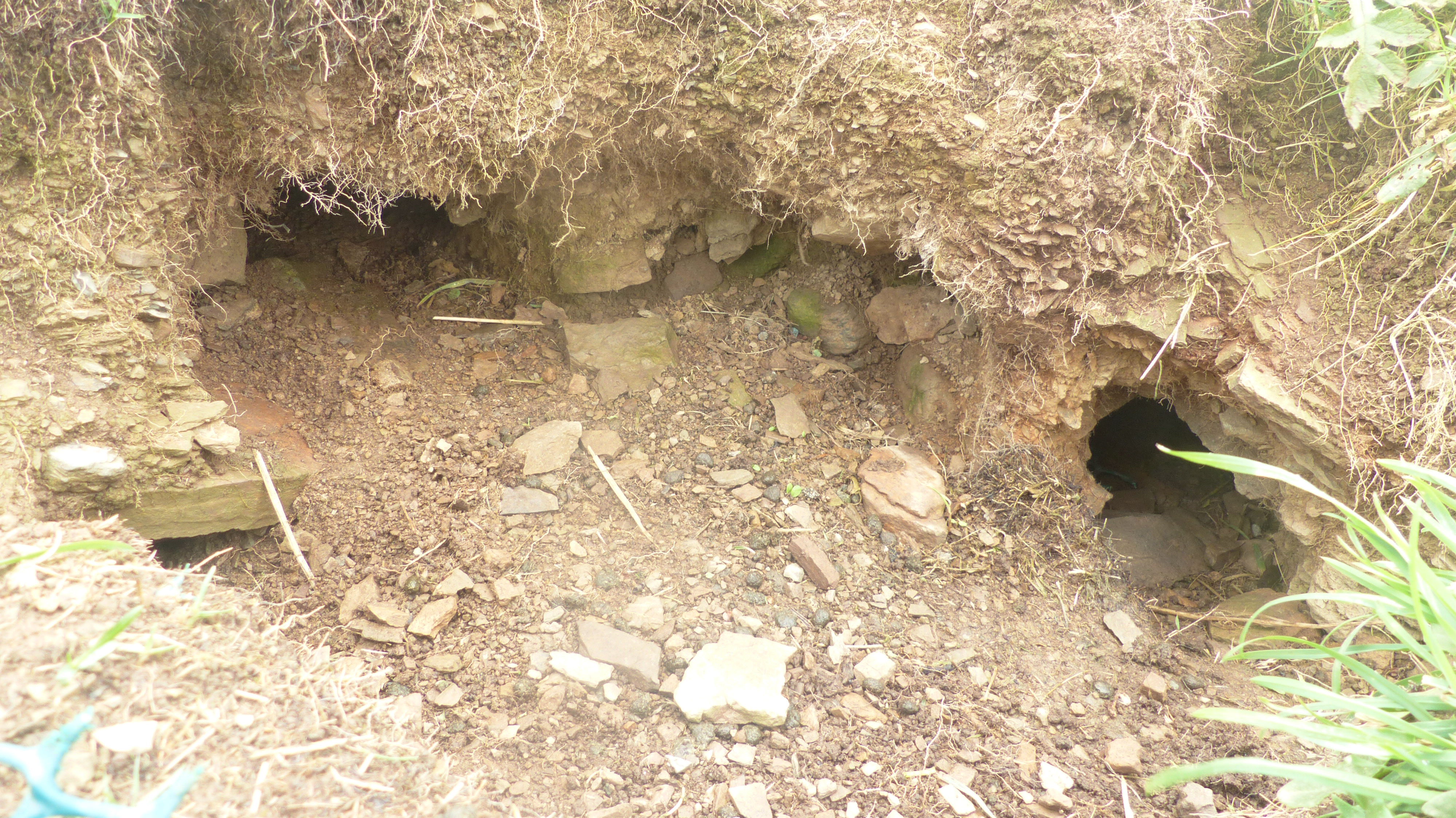
Confusingly another site also bears the names of Howaback and Hourston. HY21NE 33 at HY29551935 is the tumulus marked on the 1:25,000 close to Grut Ness. This grassy barrow sits on a slight rise, stands nearly a yard high and is some ten yards across. My attention was brought to it by twa rabbits running onto it, bringing it into focus whilst also giving me an idea of size. The present record opines that it is a chiefly earthen barrow, with a few protruding stones. But in 1928 RCAMS felt differently, noting a number of rather large stones lying in [sic] the hollowed top and more sticking out of its slopes at intervals, which indicates a more structured composition.

Near the junction with the Russland Road I noticed a few interesting lumps and bumps. Perhaps the Knowes of Coynear do actually exist as a seperate thing from the Conyar mounds east of the main road despite not showing on the 25" maps ?? I must point out neither do those ! We didn't get to do the final stretch to the Merkister Hotel, instead decamping to the Standing Stones Hotel for a proper tea meal.
Previous 5 | Showing 11-15 of 156 posts. Most recent first | Next 5
Unemployed and so plenty of spare time for researching contributors' questions and queries and for making corrections. Antiquarian and naturalist. Mode of transport shanks's pony. Talent unnecessary endurance. I love brochs.

My TMA Content: