“On the Moor above the village (Cotherstone) is a stone called the Butterstone, whereat a market was held once during a time of plague, and near it is a farmstead, once a school whereat Richard Cobden was at one time a pupil. It is said of this village that once upon a time the folk were so irreverent and Godless as to0 christen calves in open contempt of the sacrament of baptism, and that hence sprang up a derisive saying – “Cotherstone, where they christen calves, hopple loups and kneeband spiders.” “To hopple a loup” means to tie the legs of a flea together; “To kneeband a spider” is not so easy of explanation”
From
The Enchanting North by J.S. Fletcher.
Pub 1908
fitzcoraldo
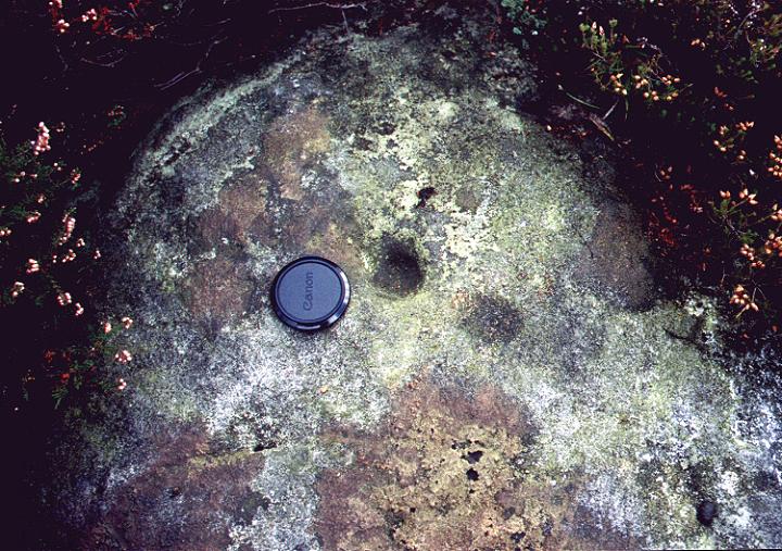
A brief summary from the Record of Scheduled Monuments.
A prehistoric boundary dyke on the western edge of Urra Moor ovetrlooking Bilsdale.
The dyke varies in size along it’s length and in some places has been partially disturbed by small quarries and paths. The bank is up to 3.5m wide and 0.5m high and in places the western flank is revetted with stone. The flanking ditch is in places cut into the bedrock.
“Perhaps the most remarkable example of prehistoric walling, is that known as the Low Bride Stones at an elevation of 825 feet on the slope of Sleights Moor, a little to the west of and below the High Bride Stones. They consist of two groups. In the southerly group I counted twenty six stones, many upright, others fallen over, and all deeply weatherworn. The two tallest are between 4 and five feet high. Their arrangement suggests an alignment or wall straggling in a general north and south direction for seventy yards. In the middle of the line the stones are irregularly clustered and suggest an extremely rude circle, north and south of which they form distinct lines.
One hundred yards north of this group is a more extraordinary series. I counted sixty stones, the majority upright, the tallest 5 feet, and all deeply weatherworn. Their arrangement is decidedly complex. Young, who first described them, thought the foremed the remains of a ‘camp’ 170 feet square, but so “mutilated that we only meet with a great number of straggling upright stones, the remnants of demolished walls.” He compares the site to his Fryup ‘Camps’ which, as we have seen, were fields.
I have carefully examined these stones and can say definitely that they do not form a circle. On the eastern and higher side the stones are arranged in a long irregular line, sometimes single and sometimes double. On the southern side what stones can be observed in the rank vegetation make a line at right angles to the eastern. The southern line descends the slope to the western line which, though badly preserved, is in alignment with the group of twenty six already described. Between the eastern and western lines I counted many stones, some of which seem to form lines parallel to the main lines. Other suggested circles but the whole area is so overgrown with moss and ling that their arrangement cannot be satisfactorily made out. In fact, for a prehistoric site the ground is unusually wet and boggy.
It is thus clear that the Low Bride Stones are the remains of stone walled enclosures, possibly fields.
No doubt they were erected not only as boundaries but as a symbol of a cult to promote the fertility of the crops. In fact the arrangement of the stones vividly recalls that of the menhirs aligned along the paths through the rice fields in Assam where as Mr J.H. Hutton has shown, standing-stones are associated with the dead, crops, and the reproductive powers of nature generally.
Near the stones I found a dry circular hollow and a circular stone pavement, possibly hut-sites. Round barrows are numerous on the moor above where the High Bride Stones formed the sacred site of this settlement. As a long barrow stands close to the Lower Bride Stones it is more than likely that the settlement was continuously inhabited from long-barrow times until the urn period, and that long barrow man was the first to erect stones on the spot.
Frank Elgee
Early Man in North East Yorkshire
1930
Frank Elgee’s assessment of the Blakey Circle from his Book “Early Man in North East Yorkshire” published in 1930.
“Three large standing-stones about 6 feet high on the south-west side of Blakey Topping, that singular hill seven miles north of Pickering, are the remains of a circle about 18 yards in diameter. Two or three hollows in the ground indicate the position of other stones, some of which are serving as gate-posts near by. Others have been broken up to help build a wall. These stones are associated with a large settlement site similar to that on Danby Rigg, not very far from the imposing Bridestones and approached by an ancient trackway known as the Old Wife’s Trod”.
We hit this site this morning. The weather was beautiful, the Pikes had a bit of light cloud around them but apart from that the sky was empty. and the views up and down the valley were breathtaking.
We had the site to ourselves, so the lads went off to explore the fields and I got down on my hunkers and got to grips with the carvings. I’ve found this is the only way to suss out what’s really there. It’s like braille for the seeing – if you know what I mean. The motif on the block to the east, which is mentioned in Stan Beckensalls “Prehistoric Rock Art in Cumbria” showed up quite well in the morning sunshine.
I’m afraid I couldn’t relate the carvings to the map theory, I can be a bit slow at times so maybe I need someone to talk me through it – any offers?.
As we left the site we discovered a large barn owl which was sat motionless on a branch just staring at us at the same time a buzzard flew over us and lazily made it’s way down the valley towards the Pikes.
All in all a crackin’ site, lovely rock art
” A musing stroll across the heath from Studland, brings you to the Aggllestone, the holy stone (Helig – Anglo-Saxon for holy) hurled by the devil on to the crest of a hillock rising above the peaty waste. Fiends often do dress like angels, and it is certainly hard to detect anything of the devil when the Madonna-blue chalices of that visionary flower, Gentiana pneumonanthe, are open on the heath. But devils did traffic with holy stones in archaic England, for devils were once gods themselves fallen from heaven upon evil days, the days when the usurping Celts looked with dread upon the works of their predecessors. For the Agglestone is a menhir”.
Taken from
Downland Man by H.J. Massingham
Pub 1927 by Jonathan Cape


norlonto.net/index.cfm/action/articles.view/itemID/66
The Goddess in Wharfedale by Gyrus.
Well worth a read.
This is a lovely little Yorkshire Henge.
As Stu states, it’s a bit battered and worn but what matters is that it’s still there.
These lovely stones rise up in front of you as you come down the path towards them.
As a four poster they’re a bit jumbled up but the stones themselves are lovely and full of character. The site does not look down into a valley or plain, it lies in the shadow of the limestone scars of Malham Moor.
Significantly the site may be on a trackway from Settle to Grassington. The site also appears to be on the most westerly margin of Wharfedale and its many enclosures, settlements and hut circles.
When I last visited this site I saw two fairly knackered circles. On this visit acompanied by the mighty Stubob and his most excellent gps I saw a different circle which was far more defined, though still pretty knackered, than the ones I saw last time.
I looked for my two wrecked circles but couldn’t locate them this time.
I thought that I had read that there were two sites up here but when I got home and checked I discovered that Burl has 3 sites listed up here so maybe I’ve now seen them all. Not sure tho‘
There are two ways into this area. You can walk along Black Hill Road from the B6265 or you can do as we did and park at Middle Skyreholme and walk up Skyreholm Bank. A GPS would be very useful to help you finding the rocks, many of which are in the fields around the track. As you march up the bank you will come to a fork in the road. The rock art posted by myself and Stu is all from the area surrounding Black Hill Road.
The stones with the most complex motifs have views into the Skyreholme valley and beyond. The rocks with simpler motifs tend to be on the lower north facing slopes looking towards the B6265 and Grimwith Fell.


the more obscure carving looking towards the main motif


Me and Stu ventured up here after a visit to Yarnbury Henge. The landscape changes once you’ve past the henge. You are now in the mining zone and part of a desolate but not unattractive industrial wasteland. There are tips, shafts and the remains of the mine buildings everywhere.
We parked up at the top of the lane and this bloke comes up all friendly like, and asked us what we were up to. We told him that we were looking for circles, he reckon he’d been coming on the moor for 15 years and had never seen a circle. I showed him the map and he told us which way to go. He then asked us if we liked watching lapdancers. I asked him what he was doing on the moor he said that he was off to kill some rabbits and then shoot a porn film. At that point all his mates turned up in 4X4’s and they drove off in convoy across the moor.
From the top of the lane you should take the right hand track and head for the chimney. Once you’ve crossed the dam and are heading up to the chimney you pass through a gate. Walk up the bank to about halfway between the gate and the chimney and then turn sharp left and charge across the beck on to the far bank. The two circles should be a dozen or so meters in front of you.
These are not stone circles, they are circles of stone – ring cairns with the banks composed of earth and small rocks. The most southerly of the pair is a lovely looking thing the more northerly one is a bit wrecked but recognizable.
These two monuments are in the zone between the track and the beck. To return don’t bother charging back across the beck, just follow it downhill and you’ll come to the gate. Check out the mineshaft capped with a rough corbelled roof. It’s a lovely relatively recent example of modern practical megalithic masonry.
I was up at this fella today.
The views down the lower Esk Valley to the sea are absolutely crackin’.
There is also a modern memorial stone close by.
The are definitely worse places to spend eternity.
Description of the site.
I was up at this fella today. It’s quite easy to find and is just visible from the parking area. The circle is now a sort of elongated “D” shape as a good portion has been chopped off by the old turf road. It’s a decent size with some large stones.
Its pretty wrecked and definitely not the best looking circle, but we ain’t got many so we love ‘em all.
For all your earthly needs check the village store in Gillamoor, it’s a happy place.

This lovely rock is a bit of an oddity.
Most of the other carved rocks on the moor have the carvings on their southerly face and so you view the carvings whilst looking over the escarpment edge and into the valley and the landscape beyond. This rock contradicts that. Many of the carvings are on the north face and so look back into the moor, the carvings on the ridge can only be viewed by climbing onto the rock itself. This would indicate that this rock may have had a different function from many of the other carved rocks on the moor.

Parts of the walls of this enigmatic enclosure are really fresh. The facing stones and the rubble in-fill show that dry stone wall building techniques have changed very little in the past 3 thousand years.
Well worth a visit.
“Known as the backstone Beck enclosure, this prehistoric site consists of extensive low rubble walling encompassing a small ridge that runs north towards the Backstones Beck ravine. It is now known that the walling belongs to the later bronze Agre (800-500 BC) but there is clear evidence that this area was a favourite camp-site for about two thousand years or more before that. many flints, some small fragments of pottery, pert of a shale bangle and the rim of a jet cupo have been unearthed during excavations on this site. Charcoal from four deposits on the site indicates sporadic use of the site from about 2,500 BC.”
From “Find The Past on Ilkley Moor”
Pub. Bradford Metropolitan Council.
Gotta go with Stu and Chris on this one.
The name builds up a level of anticipation that this badly weathered stone fails to live up to.
This is a beautiful stone with three distinct sets of cups. The cups are lovely and deep and are totally enclosed within an outer groove.
This is a crackin’ stone which affords the weary walker the only bit of shade on the moor.
The diagram posted by Haus doesn’t seem to be completely accurate. Stu and I traced out a number of interconnecting channels which conected up most of the features on the left hand side of the stone.
Stu put forward a credible interpretation that the carvings on the left half of the stone represented a map of the landscape beyond the stone.
I have to disagree with Chris on the siting of the bench. The stone is set looking out into the landscape, you look at the carvings then you look at the Wharfe valley beyond. The bench serves the same purpose – it’s all about the location.
” The walling is about one hundred years old and has been used for sheepfolding in living memory. At the back, however, are the remains of a rectangular building which was probably a dynamite store for the small quarry behind the fold. The tall, pointed stone and outlying smaller standing stones are thought to have prehistoric origins but a full excavation would be necessary to substantiate this”.
from “Find The Past on Ilkley Moor”
A booklet published by Bradford Metropolitan Council
available from the Cow & Calf Tea kiosk
This is a crazy place and almost defies interpretation – we had a go anyway!
What puzzles me is, why did the folk who built the structures around these stones not remove them? they must have hindered them.
There is a possible ditch and embankment.
Stu and I came up with the following possiblilities;
A complete fake
Stones that were placed there when the structure was built and served some sort of pratical purpose.
A robbed cairn with part of the kerb still in situ
A fourposter
A horse shoe with central stone.
A circle – we found two different possible routes for the circle.
The site appears to be on a similar contour and looks across the valley to the Backstone Beck enclosure.
” in 1865 a visitor to Ben Rhydding Hydro, a Mr Terry, was watching men prepare for quarrying, when he noticed some fine rock carvings in danger of being destroyed. He informed Dr. McLeod at the Hydro who appealed to Squire Middleton to stop the quarying. The carvings cover 17m & are of an unusual design. There are many cups, rings & grooves, 3 larger than usual.”
From “Walks Around Cup & Ring Stones”
A booklet published by Ilkley Tourist Information Centre
Available at the Cow & Calf tea kiosk for 50 new pence.
After spending the hottest day of the year traipsing all over the moor, I was started to become a little jaded. We had passed a path down to the Cow and Calf Pub and my mind was on the prize – a pint.
This was to be our last site of the day and to be honest with you I just wanted to get it done and head for the pub.
When we got to the quarry site I stopped for a rest but Stu assured me that it was just up a wee hill and then we were done, so once again I dragged my weary arse up the path. At the top of the path the first carving came into view and then as I looked around.......JESUS! I just wasn’t prepared for this.
During the day Stu and I had discussed the many possible interpretations of the various motifs on the rocks of the moor. Stu had even identified a possible map on one stone. But these are beyond interpretation and the only thing we could come up with was ...shamanic.
Stu had christened one of the carvings ‘the waterboatman’ which fits it perfectly.
If you only have time to visit one set of carvings make sure these are the one.
We only got to this stone thanks to Stubob’s GPS so if you’re GPS-less you’ll have to keep your eyes open or go in winter when the grass is low.
It’s a great stone and is well suited to it’s name.


The Mighty Timmo stands upon the modern exploded chariot burial on top of the barrow.
The picture illustrates the intervisibilty of the site with Eston Moor and it’s barrows which can be seen in the background (the moor not the barrows). The Eston Nab hillfort is the promontary in the background on the left.
Airy Hill (1) NZ 6425 1675
Previous to 1966, when it was ploughed out, the Ordnance Survey records that this burial mound wads 13.5m from east to west and 10m from north to south.
It is now only visible as a slight swelling in the field.
The mound situated close to Airy Hill Farm was prominantly placed on a west facing slope at 215m O.D. It was opened by Atkinson who uncovered two cremations; one was accompanied by a few scraps of burnt flint, the other wasd unaccompanied, but was enclosed in a clay dome like structure.
Airy Hill (2) NZ 6443 1675
This is situated 200m west of the firdst, and is prominently sited on the south-west facing slope. The two mounds would have been intervisible.
This mound is of earth and stone construction, 12.5m in diameter and 0.6m high. A possible kerbstone was discovered on the fence line in 1975 and was found to bear 6 cups.
Atkinson’s excavation yeilded no results.
Taken from “Bronze Age Burial Mounds in Cleveland”
G.M. Crawford
1980