
F
FARMERDODDS


LiDAR IMAGE.

Image credit: FARMERDODDS

Image credit: FARMERDODDS

Image credit: FARMERDODDS

Looking south along a the ridge to the second barrow from the Maiden’s Bower.
Image credit: FARMERDODDS

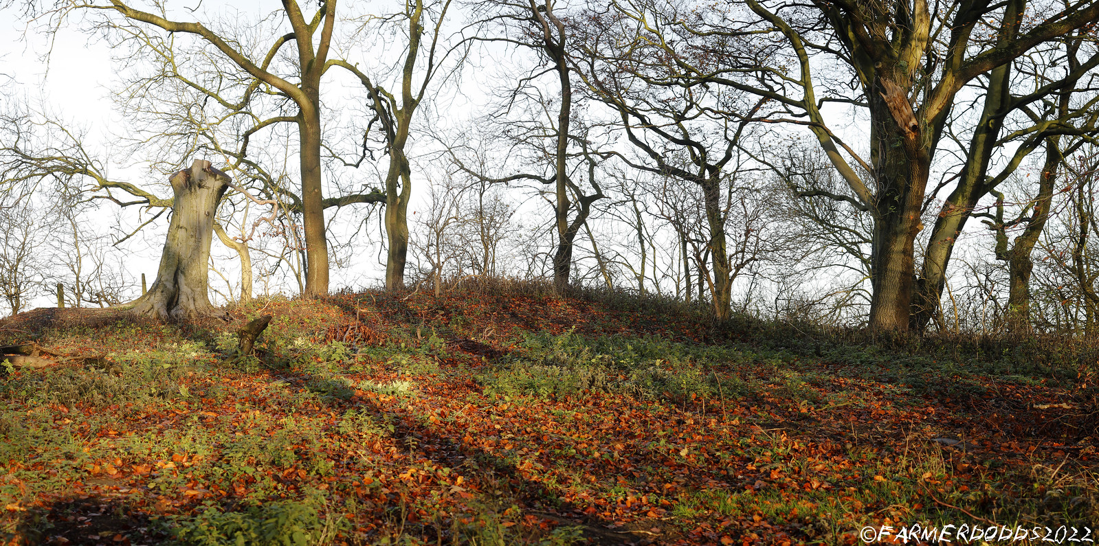
A view of the second barrow which lies to the south of the main barrow. The barrow looks like it has been quarried out at some point, the middle of the top of the barrow is missing and there is a deep trench like hole on the eastern side, which almost looks like it have sunk.
Image credit: FARMERDODDS
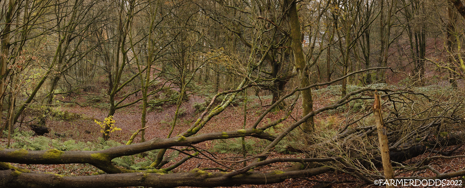
This images shows the Maiden’s Bower to the left with the footpath snaking up the it’s summit. To the right there is a second barrow hidden under the bramble’s and partially destroyed. The trees in the foreground are victim’s of Storm Arwen which hit just over a year ago.
Image credit: FARMERDODDS


A small round hole in the center of the barrow.
Image credit: FARMERDODDS


LiDAR image which shows that it not alone, it is part of a larger complex that stretchers south with at least one more possible barrow. There are two springs the merge together at the eastern end of the complex that may also have had some relation the sacred set up.
Image credit: FARMERDODDS


A probable Neolithic long barrow is preserved as a slight rise of a ground on a ploughed field. The area of the mound is considerably more stony than its surrounding. The monument is located on a gentle slope which descends towards the south.
Image credit: FARMERDODDS


A Bronze Age round barrow is located on the summit of a low knoll, few metres north of the Neolithic long barrow. It has 14m in diameter and reaches up to 1.2m of height, it is easily distinguishable.
Image credit: FARMERDODDS

Image credit: FARMERDODDS

Looking north west from Hasting Hill towards Penshaw Hill, with Carr Hill to left and Finton Hill to the right, past Penshaw Hill in the distance you can make out the TV mast on Pontop Pike.
Image credit: FARMERDODDS


The hill is in very poor condition, vandalized to the extreme, rubbish, fires, diggings and a large volume of motor bikes cutting a deep trench right across the middle of the barrow, this is exposing the hill to erosion and destroying anything that still might lay under the soil. Well that’s Sunderland for you.
Image credit: FARMERDODDS

Looking south from Hasting Hill, the cursus is located to the fields below, not a lot to see really, Warden Law is the hill top center.
Image credit: FARMERDODDS

The view from Hasting Hill looking east towards the sea. The hill to the left is Humbledon Hill, once a defended settlement of Iron Age date which developed from a Later Bronze Age palisaded enclosure, surviving as the buried remains of its ditches and partially surviving banks. The east, the settlement has been compromised by housing development, gardening activities and the construction of a Victorian reservoir.
To the right are the Tunstall Hills, Twin conical hills south of the city of Sunderland, with views over the city and the sea. The twin peaks gave this site its older name of Maiden Paps. There have been a number of archaeological finds, on each hill. Flints, scrapers, cores and limpet shells, a bronze axe head, and cists.

The hill is in very poor condition, vandalized to the extreme, rubbish, fires, diggings and a large volume of motor bikes cutting a deep trench right across the middle of the barrow, this is exposing the hill to erosion and destroying anything that still might lay under the soil. Well that’s Sunderland for you.
Image credit: FARMERDODDS

Looking south at Hasting hill. The hill can be seen driving north on your right hand side from the A19.

COPT HILL ROUND BARROWS #1 & #2 [from right to left]
Looking west down hill.


LiDAR IMAGE SHOWING THE ORIGINAL EXTENT OF THE BARROW.
ALSO SHOWING TWO BARROWS TO THE SOUTH AND A POSSIBLE TWO OTHERS.
Image credit: FARMERDODDS

