Looking northeast towards Brown Willy and Rough Tor from the summit.
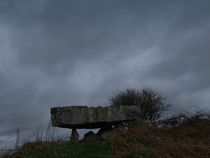
Thi is another of those sites in Cornwall that I have past many times but never bothered to explore.....and another that after you make the effort you ask yourself why you have never done it before.
Castle-an-Dinas is LARGE!
Easy to reach just off the A30...which will shortly be closer to it when the new road opens...there is a handy carpark so that even those who do not want to walk far can access the site.
The whole place is full of history, not just the Iron Age fortress but also the 20th century wolfram mine buildings that flank the car park.
But it is the prehistory that will entice those who read this...
Fingerposts now guide you around the castle to preserve banks that have been badly eroded over the years by those who head straight for the top. Follow the posts, its worth it, you get to see far more of the site...in fact I would reccommend walking around in circles until you have done them all....
Once in the centre of the fort you will notice at least two mounds, all that remain of earlier tumuli, and a pond and eveidence of excavation, from a later period. I am sure the views on a good day are fantastic, it was a little hazy when I was there....good excuse to return!
Was this THE Iron Age castle of Cornwall?, I think it’s the biggest...and being central between both coasts I think it must be. The hill fort at St Dennis is just across Goss Moor where evidence of Bronze Age tin streaming has been found. Beyond St Dennis the China Clay waste tips have obliterated any other prehistory many years ago but to the north the Nine maidens and Pawton Quoit are not far away....
But I waffle....make a detour when heading west..climb to the top and take in Cornwall...its worth it.

Showing the result of recent work to infill the erosion around the stones.


If you want a nice cliff walk with plenty of changing scenery then the one out to The Rumps is worth choosing. From Wadebridge follow signs to Polzeath..then New Polzeath. Turn off right before you reach the village and take narrow lane out to a NT carpark at the old lead mines...(don’t go on any further, it’s not worth it, theres only space for a couple of cars and they charge you!). From the lead mines take the path going east towards the cliffs. here join the SWCP and turn left heading out towards the Rumps. On a clear day you will get good views towards Tintagel and beyond...you might even be able to see Lundy (not sure about this). Follow the path as it skirts above the cliffs until you reach the headland. Branch off here and walk out passing through the huge ramparts as you go. I chose the left ‘Rump’ to explore but I am sure the other one is just as interesting. Can’t say I spotted any hut circles.
On leaving the Rumps turn right on the SWCP and continue on around the headland as it climbs amongst rocky outcrops. After a while you will pass a footpath leading off on the left to the farm, ignore this and carry on around eventually gaining a view right up the Camel estuary.
Follow the path until you nearly reach Polzeath where you will find a narrow valley causes you to turn inland. Follow the path up the valley to the farm, here turn right and follow the track back to the car park. Walk should take about 2 to 3 hours.

You will need a map to find this beast...or some friendly locals. I had both. After driving up the lane to the farmhouse at the top I turned around and asked the owners where the quoit was and where I could park. They advised me to drive back down the land and park at the first gateway on the left. The field in which the quoit stands is not theirs, so they said they could not give me permission to go in...but as the gate was open and there was only grass growing I went for it.
It is quite a long walk from the bottom corner to the quoit which is at the top of the field. It is also quite muddy..in fact the quoit has a shallow moat around it at the moment.
With all the brambles and whatever else died down it is easy to make out the surrounding mound, made up of quartz stones. Being that this is the common rock around here...is the whole pile made out of them? Are they only on the top? or have they been thrown there by farmers clearing the field over the ages?
The Quoit is not tall by the standards of others in Cornwall but it is the great thick capstone that makes it standout...such a shame that it is in a field with views of a huge modern farm just to the west...somewhat spoils the setting......I would think on a sunny day in times long ago this would have been a fantastic place to be buried.
After viewing the Men Gurta I was dissapointed that I could not get close to this stone. The double row of barbed wire fencing makes it clear that entry to the field is not encouraged! I did think about going in via the gate into the windfarm but it would have then meant a walk down the whole length of the field to reach the stone. There are what looks like a couple of barrows in the field plus one just to the east. This is the eastern end of a row of them that runs past the Nine Maidens and includes around 50 barrows in a seven mile stretch.
What a lump!..and I love this North Cornwall quartz seamed stone. As someone has allready said it is a shame about the rubbish strewn about the site...and I would guess it is a local landowner judging by the type of rubbish.
I waited patiently for the sun to come out from behind the clouds to get some decent photos...not sure if I succeded yet..will look later. Very windy and wet underfoot, I want to return on a drier day!
From here it is not far as the crow flies to Pawton Quoit or the Nine Maidens...but legal rights of way are few and far between and I ended up getting in the car and driving to the others. Perhaps on a nicer day I would have persevered and found a route.
Having just visited the Nine Maidens today I would advise not going after rain! The field was more water than earth.
Could I make a request...Please do not make for the stones by hopping over the hedge by the lay by. You will notice that some new fencing has been erected to stop this but people have obviously decided to go around this. If you walk down the road a short distance there is a nice new stile beside a gate leading into the field. You can then follow the official track across the field to the opposit side where the stones are.
Sadly today was not the best day to take photos..very gray cloudy day...until I got home and as I sit here now the sun is out and there is hardly a cloud in the sky...
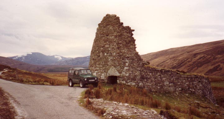
These two cairns lie high in the Cambrian Mountains to the South east of Tregaron. They can be reached by walking up an old drove road from a remote chapel at Soar y Myndd on the mountain rd heading towards Builth Wells. As you reach the summit of the track there are several finger like mounds on the left hand side. The cairns lie at the far end of these alongside a sheep fold. Soon after the hillside drops away into a steep sided valley.
My Welsh speaking friend tells me Saith Wraig translates to Seven Women.


Could not get close to this stone that I spotted across a very damp field. I would think it is about 5ft high and quite broad. It is in a triangular field bounded on all sides by minor roads just to the north of Aberporth.
It is marked on the map as Pillar Stone and a bit of searching on the web came up with the facts that it was ‘discovered’ in the early 1800s when a tumulus was removed including a heap of stones. The stone was re-erected and an urn and several supposedly Roman coins were found. These were given to Colchester Museum... who now have no record of them!
The inscription reads ‘Corbalengi Iacit Ordovs‘

Taken with telephoto from gateway. Inscription can just be made out on left side of stone.
My latest issue of the Cornwall Archeological Societys newsletter has a nice feature on the work of the Cornish Ancient Sites Protection Network. cornishancientsites.com/index.html
They have a number of site clearence days coming up througout the year (see website) which I might try to make and are also working to erect boulders at the entrances to sites with engraved phone numbers on them to ring to report vandalism or damage and also info about respecting sites.
Full marks to them!
The ‘graveyard’ can be seen from the coast path as you walk west towards Cataclews Point. It is little more than a bumpy field and I didn’t even bother to take a photo.


This is a replacement for the earlier image that I have now deleated...taken in 1990. see notes below.
27 Nov 2006
After trudging around trying to find anything that might resemble a fogou to a shortsighted Ordnance Surveyor, I made my way to the top of High Moor. There sat two nice little cairns, which as soon as I approached resulted in me being attacked by huge flies.
Determined to capture the cairns on film..or whatever you call a digital image..I swiped about with my stick before snapping away. It made no difference of course but strangely as soon as I moved away from the cairn they left me alone.
So, not much in the way of fieldnotes about the cairns, I will go back next summer and have another look..and take some deet!
18 September 2009
Three years on from my last visit I find myself on the top of High Moor again...and the flies are still here! This time they are not so much a problem and I am able to inspect the easterly cairn, larger but lying lower than the summit cairn. It is also flooded with the central cairn appearing as a small island inside a circular sea.
This is a wild bit of moorland overshadowed by the hills all around, why it is known as HighMoor I do not know!

Back in the summer I finally made it up onto High Moor. Despite scouring the hillside I could find very little that looked fogou like. The photo shows one of many hollows left by the stone cutters. In winter I would imagine these holes fill with water...perhaps someone imagined a flooded passage running underneath...who knows!


This cairn can be found north of St Bellarmins Tor (near the dissused quarry) At first it looks like just another ransacked cairn but on closer inspection you will notice it has a bank around it..more feelable underfoot than visual!


12.11.06 late afternoon
Not the easiest place to photograph...which is why there is a delay of about 4 years since my fieldnotes! This is the view from the north looking up at the settlement. The cliff drops away just beyond the bushes on the skyline. When I had walked the coast path previously I had not noticed the bank on the hillside, perhaps it was the light.
The tor, and the area around it, is still very much closed off to the public...and will be for the foreseeable future as the owner is not prepared to budge on allowing access.
The tor itself can still be seen, and is a fine lump of rock which changes shape as you view it from different angles (as most things do!). Some say it looks like a witch’s head from one side and this ties in with the legend of Vixanna.
In the good old days I regularly climbed to the top, a tight squeeze up a gap in the middle of the tor. From the summit you could look out over the surrounding moorland , just like the witch used to do.

Northern row, flat on my belly (well as flat as I can get!) in the damp grass, stunning end to the day.

Yet again I get to visit a site that I have driven past hundreds of times but never stopped. To make up for it I spent most of the day in the Merrivale area on Nov 6, starting at 10 with the sun climbing high in the sky, slowly burning the fog away... and finishing at 4.30 as the sun sunk into Cornwall.
I had been told that there is a theory that one of the rows points directly to the Rillaton Barrow on Bodmin Moor, sadly the day was to hazey to pin point the barrow, although I could make out Stowes Hill.
Part of the day was spent with a National Park guide and several young ladies from Cornwall College who had never walked on the moor before. The guide pointed out that the rows run east to west (so!?). From my experience of stone rows I would say that is just coincidence, but there may be something in it.
I find it interesting that someone should have driven a leat right down the middle of the two rows. They obviously had no fear of superstition connected with pagan sites, or did they not realise what the rows were?
I thought that I would have to leave before sunset, but the gods were with me and provided a fantastic sky to end the day. I could post at least a dozen photos, but I won’t. Maybe a couple though.


Two stones at the western end of the row.
Just to the south of the two rows stands the lovely menhir. between it and the rows is a circle of a decent size although none of the stones are of much more than a foot or two tall.
Around the menhir there are possibly the remains of another circle/row. A small cairn and what is thought to be a fallen menhir.
Is this all part of the settlement and stone row complex? the cairn is similar to the one found in the middle of the southern stone row, only really big enough for ashes, but if they do all date from the same time what is the realtionship between them all?