
Mr Hamhead


One of the barrows dotted around the tor. This one has been dug into and rusty sheets of corrugated iron litter the centre.

Natural rock basins on Carey Tor. A source of fresh water in the days before taps!

The tor itself showing fallen top stone. It shows that natural cups in the surface where made before the last Ice age as they could have not formed at such an angle (either that or someone has tipped it over...which I doubt)


Clitters Cairn as seen from the southwest whilst approaching Nine Stones from Basstreet road.

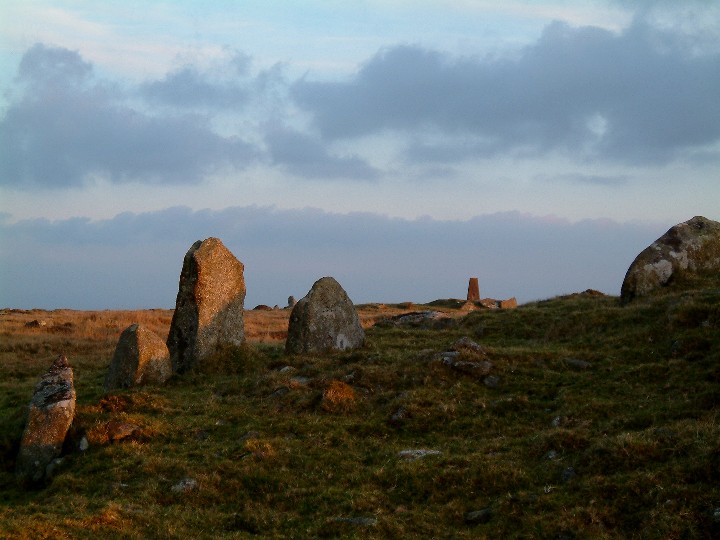
Looking north, note blocking stone of East Moor stone row just left of centre

Two cairns just north of Rushyford gate, both dug into and overgrown with gorse.

I am calling this the Jumbo rock....just one of many interesting features on Trewortha Tor.

The western end of Trewortha Tor is where you will find King Arthur’s Bed, to give it its proper name. Photo looking northwest.

Looking southeast towards Kilmar Tor (one of the finest ridges in the country)


I have often stood at the quoit and wondered why it was positioned in such a place. With the surrounding trees, hedges and houses it is hard to make out the landscape.
Yesterday I was out walking a footpath to the west of the quoit and took this shot. It shows that it sits atop a small hill, take away the surrounding modern day objects and build a mound over it and ....
The two stones in the field in the foreground are possibly rubbing posts....I could not get close to look.

Still trying to get a shot that shows this thing off...this was taken early morning 13th Jan 2005.
....anybody got a helicopter?

Leskernick Hill as aproached from Jamaica Inn


This cairn on top of Great Care Hill looks like it could have once been a ring cairn...very knocked about, just outside of firing range danger zone. St Bellarmins Tor in distance on left.


Late afternoon, 2nd December 2004. View of Roughtor and Showery tor from Bray Down.


Found this on Ebay...dont know the date...what are those bands round the stones? Also look where the cars are parked.


