
the ramparts of Little Solsbury Hill on a misty day – 23.1.2004
Image credit: Martin Bull
the ramparts of Little Solsbury Hill on a misty day – 23.1.2004

One of the lansdown barrows – 29.12.2003. My other pic came out even flatter!

the top of Tolborough Tor Cairn – 28.3.2004 – Looking north towards the Brown Willy area. Note – Catshole Long Cairn is in the distance, straight over the gorse bush (can’t really be made out in the pic though!).

Council Barrow – 28.3.2004 – From behind some abandoned farm machinery, towards tracks that go up and over the barrow! Taken from the north west side.
Castle Canyke Hill Fort – 28.3.2004 – South west section of the hill slope fort as it arcs around to the south

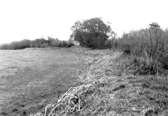
Stantonbury – 30.12.2003. Part of Wans dyke, on the north side of the hill.

Stantonbury – 30.12.2003. From the road on the north east side. The hill looks a bit like a beached whale.

Stantonbury – 30.12.2003. An entrance seems to partly survive on the north east corner of the top of the hill.

Piuc 35 – A possible for the ‘Chambered Stone Dwelling’ – 30.3.2004. This is the dwelling mentioned in the field notes, and the more I think about it, the more this is not the stone dwelling. I’ve included it here to show you what I saw, and to give any future visitors an idea of where it is.

Ackland’s Moor Cairns (North) – 30.3.2004. This is the cairn at SS13234478, with the quarry pit in the foreground.

Ackland’s Moor Standing Stone (West) – 30.3.2004.

Possible pic of the ‘Ackland’s Moor Hut Circle & Enclosure’ – 30.3.2004. Not easy to photograph! I was definately in the right area.

Pic 30 – a possible for the ‘Ackland’s Moor Cairn Stones’ – 30.3.2004. For want of a better name, the penis and scrotum stone, at it’s end.

a possible for the ‘Ackland’s Moor Cairn Stones’ – 30.3.2004. For want of a better name, the penis and scrotum stone is the one on the right!

a possible for the ‘Ackland’s Moor Cairn Stones’ – 30.3.2004.

Pic 27 – Ackland’s Moor Standing Stone (north) I think – 30.3.2004. At this point the recording of my pics was going astray.

Ackland’s Moor Standing Stone (south) I think, form a different angle, looking out to sea? – 30.3.2004. At this point the recording of my pics was going astray.

a possible for the ‘Beacon Hill Stones’ – 30.3.2004. This is more like likely to be the stone in question (compared to another pic I took in the area – unpublished) because it fits the description better and has stones propping it up.

South West Field Stone & Cairn – 30.3.2004 – I think I found this site. A small standing stone with a cairn behind it. Looking north.

Lower Longbeak Barrow – 29.3.2004 – Barely visible on camera. Widemouth Bay in the background. towards the south

Higher Longbeak Barrow – 29.3.2004 – from a distance, with the coastal path leading up to it. It looks a bit like the satellite station is sitting right on top of it, but really it is far beyond.

Brown Willy Settlement – 28.3.2004 – remains of one of the settlement huts, looking north west up to Brown Willy.

Brown Willy Cairns – 28.3.2004 – South cairn on Brown Willy, from a slight distance. Mist prevented better views.

Brown Willy Cairns – 28.3.2004 – Within a few minutes of the first pic, the mist was clearing and this shows a different angle of the North cairn on Brown Willy, with clearer views over to Rough Tor

Brown Willy Cairns – 28.3.2004 – A misty North cairn on Brown Willy, with Rough Tor barely visible in the background

The west cairn on Catshole Tor – 28.3.2004 – this one is basically flattened but you can make out the circular shape and probably flanking stones. Ironically the clitter of stones around the area are more ‘obvious’ and larger than the actual cairn. The lump on the hill in the distance is the Tolborough Tor Cairn

Catshole Downs Long Cairn – 28.3.2004 – From the north

Tolborough Tor Stone Row – 28.3.2004 – Very small stone row on top of Tolborough Tor. The final stone (that in the foreground) is now broken. Even on the original pic it is barely possible to see it, so the scanned version is almost impossible. Barrow in background.

Ackland’s Moor Standing Stone (south) – 30.3.2004. With sheep and lamb in the foreground – aaah

Beacon Hill Settlement – 30.3.2004. hut circle. Looking out to sea.

Tent Field Fives Stones Monolith – 30.3.2004

Lower Innisidgen Carn – St.Mary’s, Isles of Scilly – looking North East up a shingle bar that juts out into the sea – 3rd October 2003

Lower Innisidgen Carn – St.Mary’s, Isles of Scilly – 3rd October 2003

Brean Down from the beach at Weston-Super-Mare – 28.12.2003

Brean Down from the beach at Weston-Super-Mare – 28.12.2003

Notgrove Long Barrow – 26.10.2003 – the side of the infill, towards the turnip field on the south east side

Notgrove Long Barrow – 26.10.2003 – Looking South east (it’s not very photogenic!)


Belas Knap – 26.10.2003 – Looking out from inside of the west chamber

Belas Knap – 26.10.2003 – Entrance to the chamber on the east side (the one nearest the false entrance), looking up the side of the longbarrow

Uley Bury Hill Fort – 27.12.2003 – the south entrance, trying to ignore the rain

Uley Bury Hill Fort – 27.12.2003 – Across the south east slope and edge, from the west side, trying to ignore the rain

Nympsfield Long Barrow – 27.12.2003 – two of the inner stones (similar though to the entrance stones) from the inside outward

Nympsfield Long Barrow – 27.12.2003 – the two entrance stones, from the outside

Uley Long Barrow / Petty Hegler’s Tump – 27.12.2003 – the whole of the barrow, from a short distance away

Uley Long Barrow / Petty Hegler’s Tump – 27.12.2003 – the entrance from the inside

The Whispering Knights (The Rollright Stones) – 25.10.2003 – from up close – spot the ‘face’ in the furthest stone; very spooky

The King’s Men (The Rollright Stones) -25.10.2003 – holed / cracked stone on the East side of the circle

The King’s Men (The Rollright Stones) – 25.10.2003 – most of west and north sides

Higher Innisidgen Carn – St.Mary’s, Isles of Scilly – from the back of the carn, looking across to the natural outcrop that resembles the carn – this is where I swear I saw someone move in the outcrop! – 3rd October 2003