Kammer

Kammer

All posts expand_more 401-450 of 1,860 posts
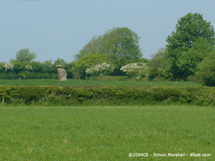
Image of Budloy Stone (Standing Stone / Menhir) by Kammer

Budloy Stone

Standing Stone / Menhir

Taken 21st June 2004: Interesting marks on the western side of the stone.

They almost look like plough marks, but that would suggest that the stone had been re-erected. While they could be damage from farm machinery scraping the stone, I’d have expected this type of damage to produce horizontal grooves.

Image credit: Simon Marshall

Maen-y-Parc 'A'

Visited 21st June 2004: Following a disappointing Summer Solstice dawn at Gors Fawr this was the first bit of prehistory to get me excited. There is no public right of access, but at the time of our visit the field in which the stone stands was empty of livestock. The stone can be seen from the road, but not very clearly.

I spotted no attractive horses, but there are a couple of interesting lumps of stone in the hedgebank. If Maen-y-Parc was a stone row then perhaps these were once part of it.

Image of Maen-y-Parc 'A' (Standing Stone / Menhir) by Kammer

Maen-y-Parc 'A'

Standing Stone / Menhir

Taken 21st June 2004: These relatively large lumps of stone are in the hedge bank in the south east corner of the field where Maen-y-Parc ‘A’ stands. They’re probably nothing special, but given the number of sites that once stood in the area there’s the possibility that they represent the remains of a megalith.

Image credit: Simon Marshall

Miscellaneous

Maen-y-Parc 'B' and 'C'
Standing Stones

The description in the NMR for Maen-y-Parc (available through Coflein) includes three stones, imaginatively labelled A, B and C:

Heights are between 1.6 – 2.3m. B and C are built into field walls.
Local placename, Clyn Saith Maen, refers to seven standing stones.

Collectively all three stone appear to be called the ‘Gate Standing Stones’, presumably after the farm to the south. The eight figure grid reference given for Maen-y-Parc ‘B’ is SN11173022 and for Maen-y-Parc ‘C’ is SN11173020.

Miscellaneous

Maen-y-Parc 'A'
Standing Stone / Menhir

The description in the NMR for Maen-y-Parc (available through Coflein) includes three stones, imaginatively labelled A, B and C:

Heights are between 1.6 – 2.3m. B and C are built into field walls.
Local placename, Clyn Saith Maen, refers to seven standing stones.

Not exactly a detailed description of the site. Presumably Maen-y-Parc ‘A’ is the stone that’s 2.3 metres high. Collectively all three stone appear to be called the ‘Gate Standing Stones’, presumably after the farm to the south. The eight figure grid reference given for Maen-y-Parc ‘A’ is SN11133032.

Link

Carn Meini
Rocky Outcrop
Trefach Campsite: Panorama

This page is from the Trefach Campsite web site and contains amongst other things a panorama of the view from Carn Meini (the page calls it Caermeini or Carn-Meynen depending on the mood of the author!).

This is by no means an excellent example of a panorama, but it’s the only one of Carn Meini I’m aware of. Java support is necessary if you want to see the view.

Gors Fawr

Visited 20th and 21st June 2004: After Moel Drygarn we went to pay our respects to Gors Fawr with some good friends who’d not been before. It was fun showing them round in the sunshine, collectively anticipating the Solstice dawn.

We spent the night in a static caravan at Trefach Campsite and headed back to Gors Fawr to see the Summer Solstice sun rise. There were a handful of people there, including two women who appeared to have spent the night in the circle in sleeping bags (madness!). Sadly it was not to be. Clouds obscured the view to the east, but it was good to be there so early and get a feel for the site in the eerie dawn light. Then it was back to the caravan for a celebratory fry up breakfast!

Image of Moel Drygarn (Cairn(s)) by Kammer

Moel Drygarn

Cairn(s)

Taken 20th June 2004: The eastern cairn, as viewed from the trig-point on the middle cairn. In the distance is the outlying Preseli peak of Frenni Fawr (of course cairn topped).

Image credit: Simon Marshall

Moel Drygarn

Visited 20th June 2004: Having come close to visiting Moel Drygarn in April 2003 on our way back from Bedd Arthur (William was far too tired after the 4 mile walk) we finally made it on the eve of Summer Solstice 14 months later.

Ironically, William pegged it up the hill leaving the rest of us a long way behind him. At first we were tickled by his fell running, but then as he got smaller and smaller it got a bit alarming. Lou had to run to catch up with him while I plodded after with Alfie on my back.

Near the top, just beyond the Iron Age defences I found Lou (looking exhausted) and Will looking bored. The three Bronze Age cairns in within the defences of the fort are blinking enormous! We made our way to the trig point (insensitively placed in the centre of the middle cairn) and were rewarded with beautiful panoramic views. To the west Carn Meini dominates the horizon, but you could be equally transfixed looking in any direction.

After a snack in the lea of the trig point and some exploring, we headed back down towards the car. On the way back we met our friends who, by coincidence had been passing, and the run up to the Solstice began early! Bonza!

Carreg Hir

Visited 18th June 2004: This was a sneaky visit on my way back from a conference, so time was short. As it turned out, good weather was running short as well. Having approached cross country in beautiful sunshine, I arrived in ominous gloom.

No sign of an ‘ovine choir’ on this visit. I could smell the rain, and I had no coat, so I ran to the stone. As you can see from the photos, there was plenty of sunshine, just not over me!

Before the heavens opened I rattled off some photos. The sheep (although absent on this visit) are eroding the soil around the stone, and polishing it up by rubbing on it. The end result, a sort of grubby brown sheen, isn’t what I’d call aesthetically pleasing. Access is pretty good though. You could feasibly get a wheelchair up to the stone with some help from a lackey.

Miscellaneous

Burfa Bank
Hillfort

The NMR record (available through Coflein) describes the fort:

A substantial and irregular hilltop enclosure, 579m by up to 187m, defined by a bank and ditch above steep slopes, except to the W, where there are three-four banks and ditches, incorporating a torturous entrance approach.
RB material of the l.1st-2nd C. has been found here.

Cwmere Farm Stone

Visited 2nd June 2004: Just wanted to check on the stone as I’d not been to see it for two years. It was a lunctime dash, and my mate from work tagged along for the ride (hence the shirt and tie).

Mynydd Llangynderyrn Burial Chambers

We did a circular walk, parking just off the B4306 to the south east of the burial chamber (SN486123) and following an extremely overgrown footpath onto the common.

With an eight figure grid reference from Coflein (SN48541328) I used the GPS to navigate. There were a lot of brambles and general undergrowth in the way, and Lou was wearing sandals, so we ended up hopping from boulder to boulder. We eventually arrived at the spot where the GPS thought we should find the chambers – the top of a large rocky outcrop. Of course there were no burial chambers on top of the outcrop. It eventually dawned on me that the site was directly below us, a short distance as the crow flies, but a long way down (here’s the view we got).

The climb down to the chambers was laborious because of the brambles, but on the flat the foliage was a little less daunting. There’s a mess of rubble and vegetation at the base of the cliff, some of which is clearly cairn material or collapsed chamber. The two capstones are really easy to spot, as are some of the remaining orthostats (the easterly chamber still has one apparently in place). The cliff next to the chambers dominates them, and presumably blocks out quite a bit of sunlight (not for us thankfully). The landscape surrounding the chambers is very distinctive, with another outcrop to the north east, similar to the one by the chambers. This must have been pretty poor agricultural land when the chambers were built.

On the way back to the car we had a go at finding the cairns to the north west of the chamber, but the bumps on the ground weren’t convincing. We did meet some friendly horses though. From the summit of Mynydd Llangynderyrn we walked back to the main road, rejoining it near the milestone (SN481127). This was a lot easier than our route in!

NB. The chambers are easy to get at from any direction other than the south east (the way we approached them). Visit in the winter for a less bramble orientated experience.

Gwempa

Visited 23rd May 2004: This is a fantastic stone. It’s slap bang underneath a load of power cables and standing in the shadow of an enormous pylon, but that’s part of the charm.

There’s no public right of way near Gwempa. The stone is just about visible from the road, but we decided to take a closer look (the field didn’t have any crops or livestock in it). Parking is a considerable problem because the lanes are so narrow.

Once we got to the stone Louise was less than happy about the drone of electricity from the cables above us. I just marvelled at the arrogance of the people who strung them right above the stone. Amazing! It reminded me a bit of Tinkinswood.

Gwempa has survived the rigours of modern agriculture, and the insult of almost being stomped on by a pylon, so pay it a visit if you’re passing; It needs some respect.

Maen Llwyd (Llangendeirne)

Visited 23rd May 2004: Not really a visit, but we did spot Maen Llwyd from the road that passes to the south east of it. It’s not a very good view (as you can see from the photos).

Modern Art – Ancient Inspiration

From an article by David Prudames, published on www.24hourmuseum.org.uk on 19th November 2004:

Written in Stone?, on show at the Museum of Antiquities in Newcastle until January 8 2005, presents a series of colourful contemporary cast glass sculptures on display alongside fragments of ancient rock carvings.

Taking their inspiration from their Northumbrian ancestors, the modern work was created by a group of young people from Greenfield School, Newton Aycliffe.

“This is a really unusual project which has reaped enormous benefits, both for the schoolchildren and for the museum,” explained Lindsay Allason-Jones, Director of Archaeological Museums at Newcastle University.

“We jumped at the opportunity to get involved, because we saw this as a way of engaging people all around the region with our collections, and it has also enabled us to creatively display this exciting new work alongside our existing exhibits, giving them a new dimension too.”

Read the full article...

Image of Gwempa (Standing Stone / Menhir) by Kammer

Gwempa

Standing Stone / Menhir

Taken 23rd May 2004: Gwempa viewed from the west. There’s something tainting the ambience of this standing stone, and I can’t quite put my finger on what it is. Oh yes I remember now, it’s the enormous overhead power cables!

Image credit: Simon Marshall

Meinillwydion (Llandyfaelog)

Visited 23rd May 2004: Not really a proper visit. We were pressed for time, and I decided not to try and get access to this site. I’m guessing that the stones stand on land belonging to Llechdwnni Manor House. At the very least, this would be a good place to start making enquiries.

Otherwise, take a pair of binoculars and view the stones from the road to the east.

Motorbike Ban on Prehistoric Road

From an article published on the BBC News web site on 12th November 2004:

Motorbikes and 4x4 vehicles which were damaging one of Britain’s oldest roads have been banned from the area.

The temporary order has been imposed by a number of district councils on parts of the Ridgeway National Trail in south Oxfordshire during winter months.

In previous years the 6,000-year-old trail has been churned up by trail bikers and off-road riders.

Read the full article...