
Taken 9th November 2003: Another shot in the morning sunshine, this time from the east.
Image credit: Simon Marshall
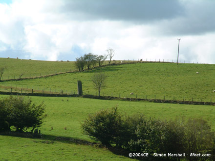
Taken 9th November 2003: Another shot in the morning sunshine, this time from the east.

Taken 9th November 2003: Mynydd March in the morning sunshine on my way to work. This view is from the north east.

Taken 9th November 2003: The stones viewed from the north east, lit up by the morning sunshine. I took this photo on my way to work.

Taken 11th October 2003: The stone viewed along it’s edge.

Taken 11th October 2003: Louise demonstrating how darned small the stone is, through the combined mediums of mime and modern dance (I think I may have promised not to publish this one).

Taken 11th October 2003: Taken with the museum behind me.

Taken 23rd September 2003: Looking into the ‘donut’ with the the enormous stone lodged inside.

Taken 23rd September 2003: Showing the central stone, and the largest of the stones that lie just outside the earthwork (in the foreground).

Taken 23rd September 2003: From close-up, here is a slice of the site.

Taken 23rd September 2003: Carreg-y-Bwci viewed from the north. This is the best shot I could get of the overall site (not an easy place to photograph).

Taken 23rd September 2003: The cairn, looking east (or thereabouts).

Taken 23rd September 2003: Possible kerb stone or remains of a cist? Either that or a just a large stone incorporated into the cairn.

Taken 23rd September 2003: Bryn Goleu viewed from the south west (the direction of the road).
Taken 23rd September 2003: The stone in its surroundings, viewed from the south east.

Taken 23rd September 2003: The dynamite holes described by Cope after his visit in 1997. You can’t help but wonder why the stone is still standing after all that work went into drilling these.

Taken 23rd September 2003: The shark-like tip of the Hirfaen Gwyddog, complete with gills. Viewed from the south west.

Taken 23rd September 2003: The stone viewed from the north east (the Ceredigion side of the fence).

Taken 23rd September 2003: Hirfaen Gwyddog viewed from the south east. The fenceline running left to right is the county boundary between Ceredigion and Carmarthenshire.

Taken 28th August 2003: Here’s a close-up of one of my photos, with arrows indicating apparent cup marks corresponding with those shown in the 1927 photo. If these are the missing cupmarks, then the National Monument Record is not correct, because it states that the marks are “buried in the soil beneath the concrete plinth”. I’ve contacted English Heritage, and they are looking into it.

Taken 28th August 2003: The top of the stone with vertical grooves caused by weathering/sacrificial blood/arrow sharpening (delete as applicable).

Taken 28th August 2003: The stone viewed from the east. In the background is Booker Avenue.

Taken 28th August 2003: Robin Hood’s Stone viewed from the south east. This is the side of the stone that originally faced south.

Taken 20th September 2003: Looking north east, down the relatively modern hedge bank, towards the barrow. William is on top of it waving a stick (for some reason).

Taken 20th September 2003: Viewed from the west, with William giving some indication of scale (he was 4 years and 4 months old at the time).

Taken 21st September 2003: This shot is intended to show one of the hut platforms within the defenses of Castell Bwa-Drain, in this instance being used for a picnic. This platform is cut into the slope on the eastern of the highest outcrop, presumably placed here so that it would be sheltered from the prevailing wind (also the case at Pendinas).
In the foreground is Richard, William and the two babies (Alfie and Felix) plus Bob the dog. In the distance is Banc Bwa-Drain, with it’s little windfarm (a very good place to view Castell Bwa-Drain from). The buildings above everyone’s heads are Bwa-Drain farm.

Taken 27th August 2003: Viewed from the south east.

Taken 27th August 2003: William sitting inside the circle. Not a fantastic photo, but the only one I have that gives an indication of the size of the thing (the circle I mean, not William).

Taken 27th August 2003: One of the stones on the southern side of the circle.

Taken 27th August 2003: Louise and William standing behind (and ‘on’) some of the enormous stones on the north western side of the circle.

Taken 27th August 2003: The Arragon ‘circle’ viewed from the north east. Obscured behind the burial mound (but clearly visible from the site itself) is the strange headland of Langness.

Taken 27th August 2003: Cronk ny Merriu viewed from Port Grenaugh (looking approximately east). The little black dot on the cliff top is a man visiting the fort.

Taken 27th August 2003: Looking down from the rampart into the fort and the bay beyond (approximately south west). In the foreground are the foundations of the Viking house, with earthen banks and some remaining stones.

Taken 27th August 2003: Cronk ny Merriu viewed from the east, with Port Grenaugh behind it. The defensive bank appears to join on to a natural rocky outcrop on this side of the promontary.

Taken 27th August 2003: The site viewed from the south west, with the chamber to the left.

Taken 27th August 2003: The site viewed from the south, with ‘prone slabs’ in the foreground.

Taken 27th August 2003: The rectangular chamber, viewed from the south east.

Taken 26th August 2003: The cist viewed from north east, with Port St Mary (to the left) and Strandhall (to the right) in the background.

Taken 26th August 2003: The cist viewed from above. The top of the photo is the south western end of the cist (I think).

Taken 26th August 2003: The stone viewed from the south.

Taken 26th August 2003: The stone viewed from the nort (or north, north, west to be precise). The road is visible behind the stone, with Port St Mary on the other side of it.

Taken 26th August 2003: The Giant’s Quoiting Stone viewed from the south east.

Taken 26th August 2003: The foot of the Giant’s Quoiting Stone, viewed from the north west, with the road just visible in the background (to the right of the stone). This shot shows the possible packing stone in the foreground, and also gives a good indication the depth of the stone.

Taken 26th August 2003: Looking south west, with the ‘wall’ of Cronk Karran in the foreground. This site is not one to visit in dense fog.

Taken 26th August 2003: This is a close-up of the north (east?) side of Cronk Karran, clearly showing how the ‘wall’ is made up of two layers of stones.

Taken 26th August 2003: The site viewed from the south, with the big cliff behind the circle.

Taken 26th August 2003: This is how you’re likely to first see Cronk Karran, from the cliff-top directly to the north.

Taken 17th January 2004: The original carved stone from Bryn Celli Ddu, now installed in the National Museum and Galleries of Wales in Cardiff and replaced with a copy. BrigantesNation is pondering the display case in the background.

Taken 17th January 2004: The original carved stone from Bryn Celli Ddu, now installed in the National Museum and Galleries of Wales in Cardiff and replaced with a copy.

Taken 26th August 2003: Meayll from the north east (or thereabouts) with Alfie, Lou and Will on the far side.

Taken 26th August 2003: With the central stone in the foreground, looking approximately north east. I’ve no idea whether the central stone is an original feature or a modern addition.