


Only sheep in the field today, and at the far end, so no being chased by bullocks as per Hamish! There’s a very convenient layby and the stile is great!
The south face of the stone is marked by diagonal grooves, I assume they are weathering but very reminiscent of Tuilyies. Quite a dramatic stone, over 2 m tall.


Right by the roadside, and a bit of difficulty parking – fortunately the lady who runs the B&B just up the road from here was very nice about letting me park in her driveway! This is another stone just by the roadside, about 1.5 m tall and no distinguishing marks on it.


The undergrowth here has been trimmed back withing the past couple of weeks, by the freshness of the stumps. The road’s not busy, and it’s a lovely peaceful little spot.


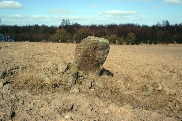
One of the Scottish Megaraks, George Currie, mentioned this stone to me. It’s not marked on the OS Landranger map, but it’s most definitely there. 200 m or so in from the road, just off a rough track. About 1.7 m tall, and 0.7 m wide, it stands proud with a terrific viewpoint north, west and south, just on the SW shoulder of Drumderg. It’s obviously a great favourite with the sheep, too, as the eroded area round the base and traces of wool on the shaft show. From one angle it looks a bit like an upright axe-head.
Forwarded for info:
From: Sigurd Towrie
Subject: Neolithic Structures unearthed at Brodgar
A suspected Neolithic house on the Ness of Brodgar in Stenness was uncovered at the weekend but subsequently reburied.
Unearthed by Beverley Ballin-Smith and Gert Peterson of Glasgow University’s archaeological research division, the site at Brodgar Farm lies half-way between the Ring of Brodgar and the Standing Stones of Stenness.
But although the find is another exciting one for Orkney, the visiting archaeologists had no remit to excavate. Because the site is within Orkney’s World Heritage Site, a decision must first be made on how best to deal with it.
The round structure is much like the ones at nearby Barnhouse and last year’s geophysics survey of the area suggests that there are at least three in the area – which is also halfway between the waters of the Stenness and the Harray Lochs, on an area of high ground in line with the entrance to the Brodgar ring.
I visited the site today and will be writing up a complete article for The Orcadian (and Orkneyjar) later this week.
--
Sigurd Towrie
Blackhall – Kirbister – Stromness – Orkney
Heritage of Orkney: orkneyjar.com


This stone is set on a N-S axis, and stands around 7 feet tall. It is of local red sandstone, and there are some possible cup marks on the top – not clearly defined in the photograph I took!


No sign of the boulders Landells mentioned, though the cup marks are very prominent if rather badly weathered. The farmer here leaves a really wide space around the stone unploughed, which is a good thing to see.


This stone is a slab of red sandstone, around 4-1/2 feet tall, and lies on a NNW-SSE axis. It was apparently dislodged by ploughing many years ago but replaced in situ. The ENE face has a ‘girdle’ across it approximately half-way up, but doesn’t show too clearly in the photograph. No other markings appear.


This stone is a block of sandstone, around 4-1/2 feet tall, oriented approximately E-W. There are no visible cup marks on it.
This is the standing stone featured on the Time Team dig at Leven, where they uncovered a Bronze Age burial site with 9 cists.
This is the nearest standing stone to where I live, and I didn’t know of its existence until a week ago, when fellow Scottish Megarak George Currie asked if I knew about it....
The stone stands around 1.2m tall, oriented E-W and has no significant markings on it. It is situated near the west gate of Camperdown Park, just west of the first green on Camperdown Golf Course (which is named Druid, funnily enough). I have noted that golfers have little or no imagination – almost every golf course with a standing stone on it names the hole either ‘Druid’ or ‘Witch’ whatever....


