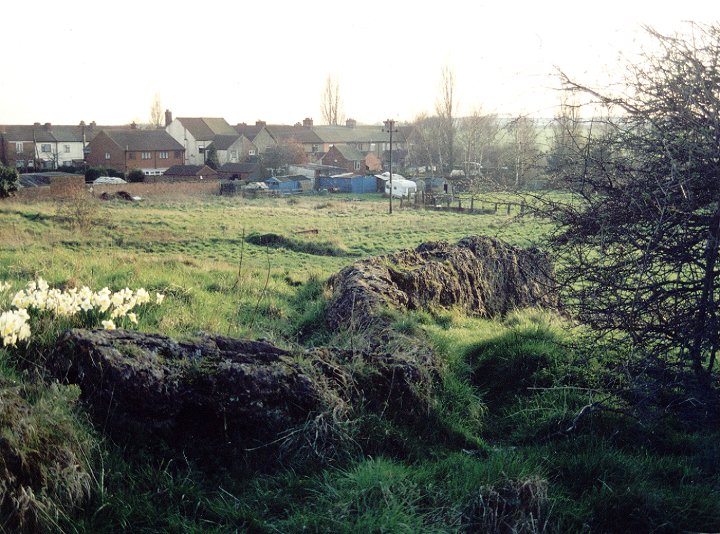
In another version of the story, the man on the ass is Jesus (see link)
In his book ‘Hidden Lincolnshire’ ISBN 1-85306-299-5 Adrian Gray records the ‘stone’ as three stones and reports that they were broken up in 1917. He gives their position as TA123033

Chris Collyer
A pair of long barrows whoes position and size seems to mirror the nearby Giant’s Hills on the other side of the A1028.
The best way to get here is to take the turning from the main road and drive to the tiny hamlet of Claxby. Take a left turn and follow the winding road until you reach a trackway leading up a hill, just before a farm house.
The grid reference I have given is for the barrow that stands half way along this track, the second barrow is some distance to the south-east across the field.
After a little research I found out that due to the damage to the mound, Stukeley believed this site was a row of round barrows!
To the south-east of Ulceby and on the west of the Roman road now known as the A1028 are the remains of one of the Giant’s Hills long barrows. Parking is difficult, but there is a small opening into a farmers field in a gap in the hedgerow that may take a few drive pasts to find. From here the barrow is a short walk down the hillside, and an excellent place to pass a peaceful hour or so.
It was excavated by a C. W. Phillips between 1933 and 1934, who found a large wooden enclosure which contained a small platform of chalk blocks. Laid out on these blocks were the remains of 7 adults and a child – interestingly there was a line of 8 posts across the north-west end of the barrow – were they linked to the number of burials?
In the same way that many southern barrows have large blocking stones at their entrances, this barrow had a façade of huge split timbers arranged in a crescent at its south-east, it has even been suggested that these may have been carved or painted. From this frontage, two lines of posts ran almost the entire length of the barrow and parts of it seem to have been divided up with a hurdling fence.
To the south there was another barrow that has now sadly been destroyed by ploughing.
From the A16, take the turning to Haugham then bear right along the road to Tathwell. In a field to the right is a linear round barrow cemetery along a hillside ridge, six stand close together with one further away to the North-east. Travel a little further down the road to get an excellent view of them along the horizon.
As far as I’m aware, these barrows have never been excavated but I recieved an email from a guy who had a conversation with an old man who had lived nearby. The old farmer described that as a young man he witnessed his father being involved in digs to find out what was in the mounds saying that they found no objects but that they revealed that a lot of burning had taken place on every mound and presumed they were used as beacons.
Little is known about this long barrow although it is one of the best preserved in the area, probably due to its position within Beacon Plantation spinney and the fact that it stands next to a main road. Constructed as a trapezoid mound that originally measured around 78 metres by 19 metres which has been truncated at the southern end. This end still stands to a height of 2 metres and it is probable that it is actually a later round barrow that was built into the long barrow – it is also believed to have been used as a medieval beacon – hence the name.
Unlike many other barrows in the area, it traverses the contours of the landscape, but is similarly oriented in a southeast to northwest direction standing below the crest of a high ridge that overlooks the valley of Great Eau
An easy barrow to find, Beacon Plantation is right next to the A16 between Walmgate and White Pit. – parking is now easy as there a new layby just to the west.
There is no access to this badly dug into barrow, but it can be seen across the fields on the left of the A16 from Partney to the circle at Ulceby cross. It is some distance away though and is difficult to spot if there is a crop in the field!


View looking up the hill to the barrows. Number 1 is to the left, number 2 to the right. When the field is full of rape seed, barrow 1 is barely visible from the road.

Barrow number 1. Picture taken when there was no crop in the field.


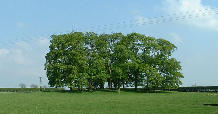
Is it a barrow, or a is it a man-made rabbit warren. The jury is still out on this one.


Ash Hill stands on private land on the Swinhope estate behind some industrial buildings. On my one and ony visit I think I met the original ‘Farmer Palmer’, the conversation went something like this-
Farmer “You can’t come in here it’s private land”
Me “OK, but would it be possible just to have a quick look at the long barrow?”
Farmer “There’s no long barrow here”
Me “Err, but it’s marked on the map”
Farmer “There’s no long barrow here”
Me (shows him the map) “Look, it’s marked on the map”
Farmer (after a short silence) “You can’t come in here it’s private land”
I quite possibly thanked him warmly for his kind assistance. Or maybe I didn’t....
In terms of sheer size Mayburgh Henge is an awesome monument.
However, whereas the nearby King Arthurs Round Table is next to the main road through Eamont Bridge and at the centre of the daily hubub, Mayburgh stands just metres away from the motorway yet is alone and abandoned. This is a real shame as it is a mind-boggling construction, containing an estimated 5 million cobblestones in a bank that stands nearly 6 metres high. At it’s centre is a single standing stone, one of an original four, there were also four others inside the entrance to East that looks across to the round table.
I don’t know when it was, or who it was, but at some point in time some idiot decided to build a road through the edge of this monument.
There were originally two entrances, only the one to the South East remains leading in through the banks, across a raised walkway over the ditch into the central enclosure.
This can only be some kind of gathering place- we can only wonder what went on here. Interestingly the entrance to Mayburgh Henge can easily bee seen from the centre of circle – how and why were these two monuments linked?
This is marked on the OS map as ‘Long Cairn’.
The ‘cairn’ part I might argue with, but ‘long’, well there’s no disputing that one. It is hard to judge the size of the mound as it extends and tails off into the trees, the eastern end looks a little too truncated and its base appears to have been cut into.
If you’re visiting the nearby falconry centre, give it a look and see what you think.


Just out of camera-shot the mothership beams down a ray of light on Meg


Looking East. The hill on the left is Great Mell Fell. To the right is Clough Head.

The entrance at the north of the circle. In the distance is the peak of Lonscale Fell

When the visitors go home the billy-ba’s have the place to themselves. These lambs were joined by a couple of friends and performed an improptu aerobatics display.

This circle is said to consist of seven stones and be the kerb of a wrecked stone cairn. I couldn’t verify this as it stands on forestry commision land and the entrance is blocked by a large set of locked gates with signs warning of prosecution and general unpleasantries to any trespassers.
It wasn’t until I got home and rechecked the map that I noticed a public right of way passing through the plantation, just a little furthur along the road.
Damn....

Picture taken from the bank. The entrance to Mayburgh Henge is to the top right.


The OS map marks this as a Long Barrow. Opinions are divided as to whether it is or not.
Dragonby is a small village to the North of Scunthorpe just off the A1077 to Winterton. About half way down the only road through the village there is a gap in the houses on the right hand side – a track leads out onto some open ground and you will see the dragon on your right winding its way up the hill.
It is a natural rock formation caused by a limestone spring but local legend says it is the body of a dragon that was turned to stone by a wizard. Another story claims that it is the top of a church that sank into the earth with the congregation still inside and that once a year the ghostly bells can still be heard ringing.
The village name Dragonby is only fairly recent, it was changed by local land owners, the Elwes family, from Conesby Cliff in honour of the dragon!

Looking up the hill. The notch that runs along the spine of the rock is clearly visible