Just across the road from St. Margaret’s church in Ilkley in an iron fenced enclosure are 3 cup and ring marked rocks know as the Panorama Stone. Originally the stone stood less than a mile away to the west around SE105470 but it was found to be ‘in the way’ of the development of 19th century Ilkley and was cut into 4 pieces, 3 of these being moved to their present positions in 1890 or 1892, depending on which account you read. Where the fourth part went I do not know.
Over the years the carvings on the rocks have badly deteriorated due to weather and vandalism and the marks shown in the web link are not easy to make out, but include cups with between 3 and 5 rings, some with connecting ladder motifs.

Chris Collyer
It’s been a while since I visited the Pancake Rock, perched precariously on the edge of Green Crag Slack, and I had forgotten how steep the climb up the hillside from below the stone was – but what a reward – some outstanding views across Wharfedale. The last time I was here I climbed onto the rock to look at the cup marks, this time I was a little wary as a chap had been killed a few days before in this area in a rockfall. I didn’t fancy ending my days careering down a hillside on the back of 100 tons of rock surfboard.
Mindyou, it would have been a great way to go.....
A few days after a wrote the preceding fieldnotes I returned to Bradup after a space of 3 or 4 years. The boulders I had seen before were still there but this time the heather had been burned back, I knew these stone were not the circle, and that only one stone remained within an earth embankment. However the area of the field where Paul Kenyon said that the stone stood has recently been completely ploughed – there is no stone left. All I could find was a patch of roughly circular soil that was a slightly lighter colour than the surrounding land, and a pile of boulders at the field edge. These all showed deep gouge marks from the bucket of some kind of earth mover. Whether one of these stones is from the circle or not, I don’t know, but it looks like the sad end to yet another monument.
I hope I’m wrong.

The 3 sections of the Panorama stone in their iron prison.


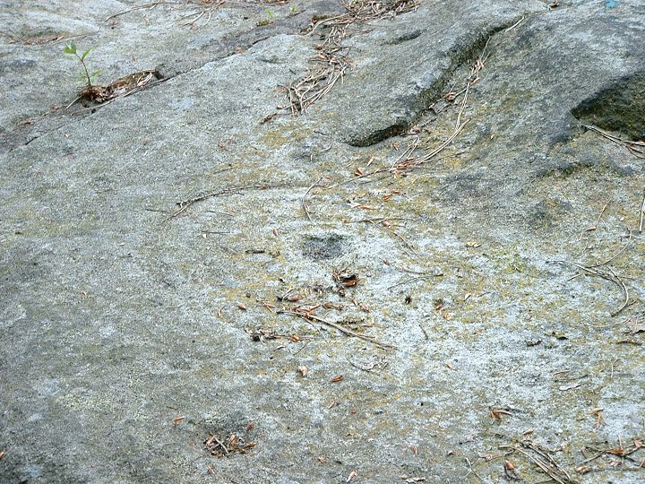

A diagram of one of the motifs on the Panorama Stone. Looks to me like a boggle eyed-open mouthed monster riding a push bike. However my theory could be wrong....

An almost 180 degrees panorama from just behind the Panckage Rock


One of these boulders could be the last remaining Bradup stone. All seem to have scars from being JCB’d out of the ground.

The field where Paul Kenyon says the last stone should be – sadly it now seems to be gone.
Virtual Reality walkthroughs of the sanctuary by Jennifer Garofalini. Link taken from Mike Pitts Hengeworld book.
The grid reference given here is only a rough guide as it is several years since I visited the stone and I don’t remember where I heard about it, it certainly isn’t marked on the OS map. Use the map to find the road that runs south of The Chevin (I think the road is also known as The Chevin). Park in the pub west of the Chevin Lodge Hotel and follow a footpath behind the pub and head south. Pass through a gate and turn left then continue south alongside a drystone wall. At some point further along you will see the six foot high highly weathered Bull Stone on the other side of this wall.

I never managed to find the elusive Bradup circle. At the time I visited it a few years ago the area where I thought it was was covered with a thick carpet of heather. Rooting around in this heather I uncovered several large boulders, some of the 12 remainig stones that my guide book told me remained of an original 18 – aha! I had found it.
Unfortunately these stone were not part of the circle, I had made the same mistake that Paul Kenyon first made when he visited, but at least he found the correct location of the site and the one remaining stone. Check his website for more information.
As Julian says this must have been an important place once – the name, the views, the Roman road and both the Beacon and Argham cursus aligned on it. Sadly this fact doesn’t seem to be recognised by the farmer who owns the land as he/she is steadily ploughing away the summit of the beacon.
After the disappointment of Rudston Beacon, Southside Mount is a real joy. Although badly ploughed over the years it is still an instantly recognisable barrow. It would be an ideal place to while away some time on a sunny summers day – there are some great views – however when I visited it, it was grey and raining and the trudge across the field (mind the pea crop!) certainly christened my new pair of baseball boots. Despite being soaked in rain and covered with mud I returned to the car with a broad smile and glad heart. Southside Mount – what a place :-)
As usual Julian seems to have all the info, where he gets it from I don’t know but anyway he says the barrow was originally around 9 feet high and 100 feet across. It was contained within an encircling ditch that has now been filled in, with a further square ditch beyond that.


Perhaps not the quickest or easiest way to get to Kell Well, but certainly the most picturesque, is to follow the trackway along the top of Trent Bank from Julian’s Bower. Immediately on you left will be the west bank of Countess Close. Continue walking for around fifteen minutes until you get to the signpost for Walcott. A short distance further on you will see the land on your right drop away sharply beyond a wire fence, the well is now directly below you. Climb the fence and clamber down the bank carefully – in damp weather you are liable to be pitched headlong into the spring – as I nearly was today ;-)

This group was excavated by J R Mortimer between 1860 and 1892.
A barrow at SE829556 covered 2 concentric rings of wooden posts, 6.5 and 8.5 metres across, with a surrounding 30 metre ditch. Grave finds included a crouched skeleton, food vessel and large stone axe.
Finds from the other barrows, which contained a mixture of inhumations and cremations, included more vessels and collared urns, a jet necklace and jet and faience beads.
On my first visit here I failed dismally to find any of the barrows, second time round I got hold of the OS map beforehand and it still took me a while to find them!
Take the road from Pocklington to Millington then continue until it splits into two (both roads join the A166 a mile or so further on). This triangle of land contains 3 remaining barrows of an original 18 of the Callis Wold group, 2 are badly ploughed down, but the northern one with it’s nearby mystery earthworks is well preserved. Continue on to the A166 and turn left, there are several further barrows beside the road, but take care – car drivers and motorcyclists treat this road like a racetrack…
This must once have been an important part of the Gypsey Race landscape, but plough damage means there is now nothing to be seen at ground level – just how do you plough out an entire henge?
Anyway, while you are at Rudston, take a look for yourself. Follow the road north out of Rudston village towards Burton Fleming, the field where the henge stood is on the right, a short distance after the second right turn.
This mesolithic lakeside settlement, dated to around 7500BC was investigated by Professor Grahame Clark (Excavations at Starr Carr: An Early Mesolithic Site at Seamer near Scarborough, Yorkshire -Cambridge University Press 1954), while Jacquetta Hawkes calls it ‘the most informative Middle Stone Age site in Britain‘
Starr Carr has since been reburied.
Edit: New evidence suggests the site dates from 8700BC and was seasonally occupied over a course of 200-300 years

Site of the ploughed out henge. Little Argham farm is the white spot below the hill on the mid-right of picture.


Picture taken in early spring before the mound vanishes in the undergrowth


Proof that the sun does indeed shine on the monolith, despite the church.


The sun dappled ‘other’ side of the minilith. (See Porkbeast’s fieldnote)


