
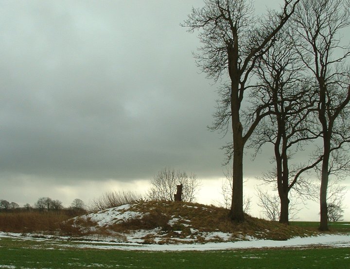
The natural crossroads on the track to Folkton Barrow. The picture doesn’t really do the feature justice – you’ll just have to see it for yourself!
The barrow stood on the hill to the top left, beyond the edge of the picture.

The natural crossroads on the track to Folkton Barrow. The picture doesn’t really do the feature justice – you’ll just have to see it for yourself!
The barrow stood on the hill to the top left, beyond the edge of the picture.
Geophysics survey of the area around the barrow – the side ditches show up really well on the data plots.
Geophysical Survey of the site -
“The aim of the survey was to help gain a greater understanding of the monument and the activity that had occurred within it; to inform the future management of the site, particularly in relation to its repair and maintenance; and to attempt to reveal any trace of a former stone circle.”
Article mentions the possibility of a buried stone but notes-
“The magnetic survey has unfortunately been severely affected by modern disturbance, possibly through the use of the ditch as a dumping area”
It’s a shame the way it’s been treated.
Results of geophysics survey at Stanton Drew.


As I was short of time I only had the chance to look at three of these barrows but what corkers they are. An ancient east-west trackway across the top of Towthorpe Wold forms the modern boundary between Humberside and North Yorkshire and is the site of a narrow plantation of young conifers and 5 bowl barrows. The 3 I looked at were all large and well preserved – the largest near the B1248 is between 35-40 metres wide and 3 metres high. The next 2 are around 20 metres wide and a still respectable 2 metres tall. This is another site that I will have to return to and spend more time investigating – parking is easy on the verge just before the county boundary sign.
These three barrows were all excavated by JR Mortimer between 1870-1884. The first one at SE881639 contained the bones of a child above a primary burial of an extended male skeleton. Grave finds consisted of a pot sherd, flint fragments, 2 saws, a black flint scraper, a hammer stone, a black flint knife and a fine bronze dagger blade. Mortimer noted that the barrow was constructed of alternating layers of local red soil and clay brought from Duggleby.
At the second barrow at SE884641 he found the cremated remain of an adult inside an oak coffin as well as 3 knives, 2 parts of knives, many flint flakes and fragments, 10 scrapers and 2 sling stones. Again, clay had been brought in from Dugglby for part of the construction of the mound. The third barrow at SE885641 contained a male skeleton as well as some other pieces of human bone in an oval grave. The skeleton was accompanied by a bronze dagger, the only other grave goods being the crushed remains of a food vessel. Yet again clay from Duggleby had been partly used for the covering mound.
Info from English Heritage.
Note – In Dyer’s ‘Discovering Prehistoric Britain’ the map reference of 879638 does not refer to the barrow in his text – the correct reference is 881639.

Barrow at SE835637 looking north. Not sure what the raised land around it is though.
The name Wharram Percy is most often associated with the DMV of the same name, but a short distance to the south-west is a collection of at least a dozen round barrows. Most of these, especially the barrows on the plateau of land between Toisland Farm and Wharram Percy farm, have been ploughed away but one survives as a slight bump next to a field boundary that leads north from SE837633. Others are marked on the OS Map running in a roughly east-west line to the north of the crest of Birdsall Brow but as this is private land (?) and someone was shooting game nearby I was reluctant to venture further to investigate. I did however get a picture of what is marked as a barrow as SE835637 although I’m not sure if the raised land it stands on is natural or man-made. There are some spectacular views from the crest of the Brow to the north – those Bronze Age people certainly knew how to site their cemeteries – and the whole area could do with some further investigation.
According to Dyer in ‘Discovering Prehistoric England’ some of these barrows follow the line of a possible ancient trackway close to Bridsall Brow. Some were dug into by JR Mortimer in 1866 who found – inhumations, cremations (some in the same barrows) food-vessels, a bone pin, flint knife and punch, collared urns and jet ear plugs.


You can stand at Hanging Grimston and look around you at three and a half thousand years of prehistoric history. There’s the long barrow, the earth works, the round barrows and finally the Roman road. Add to this the probable ancient trackway under the road and you could go back even further.
The long barrow is badly ploughed, standing less than a metre high and doesn’t look like it will last too many more years, many of the round barrows are hard to make out as well although one to the north of the group is still in good condition. What still remains however are the stunning views to the west as the land drops away dramatically down Open Dale and out to the Derwent valley. These views must have been all-important to the people who farmed the area over this vast timespan.
This group of monuments consists of a long barrow, a line of later round barrows, some earthworks and a Roman road. The long barrow is aligned east-west and was excavated in the 1868 by JR Mortimer who recorded a burned wooden mortuary house and traces of a timber crescent façade at the eastern end. Burials included pig jaws without the tusks, bowls and a human leg bone. The remains have since been dated to about 3450BC. Estimates of the original size of the barrow are around 24 metres long by 15 metres wide with 8 metre wide side ditches. Later the barrow became part of a linear earthwork now known as Queen Dyke, thought to date from the middle bronze age.
The round barrows follow the line of what could be an ancient trackway over Hanging Grimston Wold that later became a Roman Road. Many of them are ploughed out but some were excavated and recorded by Mortimer who found beakers, remains of a funeral pyre, oak coffins, collared urns and jet buttons. The most interesting barrow at SE806613 was found to contain a limestone ring of six stones with the remains of 11 burials inside.
Info source – Dyer, Hawkes, English Heritage

The two bowl barrows mentioned in the fieldnotes at roughly SE796623
This group has been badly plough damaged since the 19th century when 17 barrows were recorded and excavated by the Yorkshire Antiquarian Club in the middle of the century and by JR Mortimer in the 1870’s. All the barrows were found to contain either cremations or several inhumations of men, women and children. Grave goods found included an 18.5 centimetre white flint dagger, a 12.7 centimetre bronze dagger, beakers, jet buttons, amber buttons and a jet ring.
Info from – James Dyer, Jacquetta Hawkes, English Heritage/NMR
Not much to see at this site anymore, most of the barrows are long gone – indeed while I was there a tractor was doing it’s business in the fields. There are two reasonably well preserved bowl barrows behind some farm buildings though, one is around 40m in diameter and about a metre and a half high and stands on the highest point of Acklam Wold. Close by, the other barrow is about half the size and height and now has a triangulation pillar on top of it.
The site is probably one for barrow anoraks only but there are some fantastic views just a little further on. Following the road to Acklam the land drops away to reveal Leavening Brow to the northwest and views to the Derwent in the west.
Just to echo Pure Joy’s notes, I tried to visit the site a few years ago and could find no trace of any footpath either. As it was nearing the end of the day and I had a friend and her two kids in tow it didn’t seem fair dragging them over the hillside to see ‘some more old stones’. I think they had enough of stones that day to last them a lifetime.
Then the same thing happened to us as PJ – we got lost on the roads too...


The most plough damaged of the three henges, but the bank is still in reasonable condition as is the northwest entrance. The henge now stands in its own fenced and wired enclosure and is an easy walk across grassland and past a ploughed barrow, from the road beside the central henge.
This reminds me a lot of Mayburgh henge, it’s in a similar state of disrepair and has the same air of abandonment. The entrances are still well defined but the bank is badly damaged and the internal ditch has just about gone. Apparently it is thought that the banks of this henge and its two siblings were covered in gypsum crystals, echoing the chalk earthworks of the south of England. The henge also stands over an earlier mile long cursus which ran in a northeast to southwest direction and later more than 2 dozen round barrows were constructed in this area, so it was obviously an important place for some considerable length of time.
Have to agree with Fitz about this henge, while the centre and south henges are derelict and abandoned this one is alive and well, even in the depths of winter and with a frosting of snow. The bank is huge, as is the berm (does my berm look big in this?) and the 2 entrances to the northwest and southeast are both clearly defined and lead over the deep ditch to the centre. Must be a wonderful place in the summertime.


Found this in a booklet about carved rocks -
“In 1890 Dr. Fletcher Little, medical officer at Ben Rhydding Hydro bought the stones for £10 from the owner of the land at Panorama Rocks. The land was due to be developed. Whilst being removed the largest, known as the Panorama Stone was broken in two pieces.”
This is a nice round cairn that is a fair size and still in reasonable condition despite having the centre dug out. Finding it is a bit tricky, travel southeast from the Cow and Calf car park and take the path that follows the edge of Green Crag Slack for about a mile. To your right you should be able to see a shed on the crest of the hill about half a mile away and halfway between you and it should be the pile of boulders of the cairn.
GPS Reading SE1383045197

This is a badly damaged cairn that has been heavily dug into and now has various bits of rubbish dumped into it There is a large stone that could be a boundary marker or milestone (I couldn’t read the inscription) that has been pitched into the middle of it and it also has what could be grouse buts built on one side although these could just be rocks thrown out from the inside. Just to the southeast there is another smaller but just as badly robbed cairn.
Directions are similar to those for the Grubstones – head in a southerly direction across the moor from the Cow and Calf carpark until you see a shed on a hillside ahead. When you get to this turn left along the track and walk for about 5 minutes or so until you pass the Lower Lanshaw damn on your left. The cairn should now be on your right hand side, not far from the track.
GPS – SE1406244550


A picture of the stones with no bracken covering.
Horncliffe circle is a strange beast and a real bugger to find. In late September 2002 it was badly overgrown with bracken and frequented only by sheep and looked like nobody had been there for a long time. It was so overgrown that I had to walk around it for several minutes trying to figure out if the jumble of rocks was indeed the circle of stones I had seen in a picture (see link). It is hard to work out exactly what the outer ring of stones and the central square stone setting were, many stones are set side by side, in other places stones are missing. It could be that outer stones were the kerb for a central cairn, although I read somewhere that the whole thing may be some kind of iron age settlement building.
Directions to the circle are similar to the Grubstones – set off southwards from the Cow and Calf car-park until you see a hut in the distance. Head towards this, but veer off to the rock outcrop about 20-30 metres to the north. From here a decent track leads south past several grouse-shooting outposts to the right with a fence to your left. After about 20 minutes you will see a dip in the track and a stream a short distance ahead of you. To your left will be an old stone by the fence with the name Thos. Pulleyn engraved on it. From this point you should see a patch of bracken about 30 metres beyond the fence – the stones are hidden deep in this bracken. Walking time from the Cow and Calf if about an hour by the most direct tracks.
GPS Reading SE1333943532

Looking east from the edge of the stones. Those to the right are buried under the bracken. The square central setting is at the bottom of the picture.


Known as Grubstones circle, it is very unlikely that it is a stone circle in the traditional sense. More likely it is a ring cairn or the kerb of a round cairn, although there are a couple of largish fallen stones in the centre there is very little sign of stone/rubble infill. I estimate the ring is around 20 paces across with about a dozen stones visible, others may well be hidden under a thick growth of heather.
The key to finding the ring is ‘head for the shed’ – a large wooden building that can be seen for quite a distance on the moor. Leaving the Cow and Calf car-park travel in a southwards direction by whatever paths are available, after about half a mile the shed can be seen a further half a mile to the south. Once you get there continue into the heather for a short distance – the photo should give an indication of how far.
The ring may be difficult to spot, and not much to look at when you get there but it is peaceful and sitting in the dip in the centre gives some welcome relief from the ever present wind of the moor.
GPS reading SE1365044727


Whereas Normanton Down is a vast sprawling complex of barrows, Winterbourne Stoke is much smaller and more compact. Park in the lay-by on the A303 that is just east of the roundabout junction with the A360 and wander through the trees to the barrows. The first large bell barrow after the woods gives a good vantage point of the western half of the site which include a nice pair of disc barrows as well as bowl, bell, pond and saucer barrows. Right next to the roundabout is a well preserved long barrow aligned along a northeast – southwest axis, most of the rest of the barrows follow this northeast axis.
Not a lot to see, that’s for sure – but hugely important nonetheless. The best time to see the white blobs that represent the post holes is early in the morning, not sure what time the carpark opens, but I got there before 9.30am when the ‘henge opens for business. Just a quarter of an hour later and you risk getting run over by tourist coaches. The place shuts at 6.00pm(?), after that you’ll have to ask the security guard nicely – don’t know if he will let you wander round ‘his’ carpark though…
Visited 2nd Sept 2002-09-09
A nice set of barrows between Stonehenge and the roundabout that leads off to Durrington and Woodhenge. The first time travelling west I completely missed them, then on the way back east they loomed out of the trees to the left of the road causing me to pull up sharply (not recommended on this road!). The barrows extend northwards as far as The Avenue while the Old Kings barrows continue on the other side of it.
While I was there I met a couple with their kids looking for a good place to watch the sun go down beyond ‘thee stones’. Hope they enjoyed it, I know I did.
Gives a rundown of the items found at the barrow as well as photo’s of one of the lozenges. Then goes into two pages of mathematical and technical info that ‘proves’ that it was used for all sorts of celestial and calendrical observations.
Just a short distance from the hustle and bustle of Stonehenge is the barrow cemetery of Normanton down. Although you can see the stones and the tourists in the distance, if you come here you’ll probably have the place to yourself – the only other person I saw was looking for a crop circle and the only thing to spoil the peace and quiet was the distant hum of military transport planes.
As for the barrows, there’s long barrows, bowl, bell, disc and saucer barrows including the famous Bush Barrow excavated in 1808 by Sir Richard Colt Hoare.
