Rhiannon

Rhiannon

All posts expand_more 1,051-1,100 of 4,457 posts

Miscellaneous

Alfred’s Castle
Hillfort

Above the Head of the River Ock, is Ashbury-park, near which is a Camp of about 100 Paces in Diameter, but the Works are almost entirely defaced, by digging for Stones to build Lord Craven‘s House in the Park, which was a very magnificent one, but was unhappily burnt down.

From The Natural History of England by Benjamin Martin (1759).

Folklore

Wearyall Hill
Sacred Hill

My Curiosity having led me twice to Glastonbury within these two Years, and inquiring there into the Antiquity, History and Rarities of the Place, I was told by the Inn-keeper, where I set up my Horses,who rents a considerable Part of the Inclosure of the late dissolved Abbey, “That St. Joseph of Arimathaea landed not far from the Town, at a Place, where there was an Oak planted in memory of his landing, called the Oak of Avalon: That he and his Companions march’d thence to a Hill, near a Mile on the South side of the Town, and there being weary rested themselves, which gave the Hill the Name of Weary all Hill [...]”

and in the very Place where they rested there sprung up a miraculous Thorn Tree, which every Year at Christmas in the coldest Year and Weather, Frost, Snow or what ever else, never failed budding forth Leaves and Flowers [...]

The Holy Thorn of Glastonbury, mentioned [..] to bud and blow Yearly upon Christmas Day, grew on the South Ridge of Weary all Hill, at present called Werrall Park, a Ground now, or lately belonging to William Stroud, Esq. Whether it sprung from St. Joseph of Arimathaea’s dry Staff, stuck by him on the Ground, when he rested there, I cannot find; but, beyond all dispute, it sprung up miraculously.

It had two Trunks or Bodies till the Reign of Queen Elizabeth, in whose days a Saint like Puritan, taking offence at it, hewed down the biggest of the two Trunks, and had cut down the other Body in all likelyhood, had he not bin miraculously punished (saith my Author) by cutting his Leg, and one of the Chips flying up to his Head, which put out one of his eyes.

Though the trunk cut off was separated quite from the Root, excepting a little of the Bark, which stuck to the rest of the Body, and laid above the Ground above thirty years together; yet it still continued to flourish, as the other Part of it did which was left standing; and after this again, when it was quite taken away and cast into a Ditch, it flourished and budded as it used to do before. A Year after this, it was stolen away, not known by whom or whither; as many old Persons affirmed to Mr. Broughton, who went on purpose to Glastonbury to see this, and the other Curiosities and Antiquities of the Place.

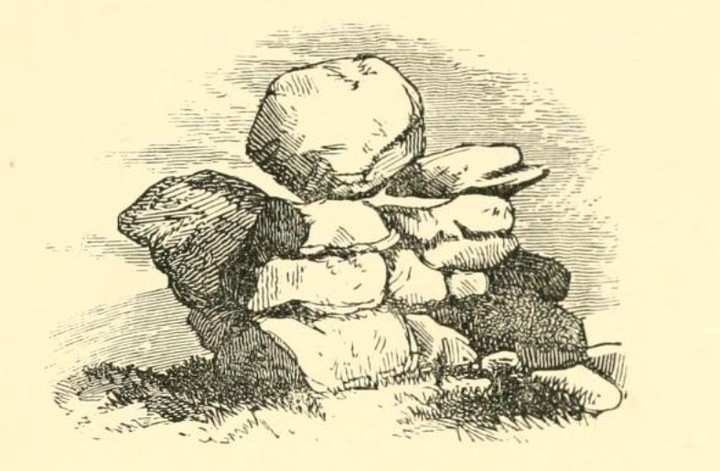
The remaining Trunk and the Place where it grew Mr. Broughton describes, and says, “That it was as great as the ordinary Body of a man; That it was a Tree of that kind and species, in all natural respects, which we term a White Thorn; but it was so cut and mangled round about in the Bark, by engraving Peoples Names resorting thither to see it, that it was a wonder, how the Sap and Nutriment should be diffused from the Root to the Boughs and Branches therof, which were also so maimed and broken by Comers thither, that he wondred, how it could continue any Vegetation, or grow at all, yet the Arms and Boughs were spread and dilated, in a circular Manner, as far or farther, than other Trees, freed from such Impediments of like Proportion, bearing Hawes (Fruit of that kind) as fully and plentifully as others do. In a word, That the Blossoms of this Tree were such Curiosities beyond Seas, that the Bristol Merchants carried them into Foreign Parts; That it grew upon (or rather neer) the Top of an Hill, in a Pasture bare and naked of other Trees, and was a Shelter for Cattle feeding there, by reason whereof, the Pasture being great and the Cattle many, round about the Tree the Ground was bare and beaten as any Highway, Floor, or any continued trodden Place: yet this Trunk was likewise cut down by a Military Saint, as Mr. Andrew Paschal calls him, in the Rebellion which happened in King Charles the first’s time;

however, there are, at present, divers Trees from it by grafting and Inoculation preserved in the Town and Countrey adjacent. Amongst other Places, there is one in the Garden of a Currier named [blank] living in the principle Street; a second at the White Hart Inn; and a third in the Garden of William Strode, Esq. There is a Person about Glastonbury, who has a Nursery of them, who (Mr. Paschal tells us, he is informed) sells them for a Crown a peece, or as he can get.

From The History and Antiquities of Glastonbury p1, 7 and 109, published by Thomas Hearne (1722) (and written by Richard Rawlinson?).

Glastonbury also had a famous walnut tree, which always flourished for St Barnabas’s day, 11th June (details of this are on p112).

Miscellaneous

Treryn Dinas
Cliff Fort

In the Parish of St. Levin, in this County, there is a Promontory, called Castle-Treryn. This Cape consists of three distinct Groupes of Rocks. On the Top of the middle Groupe of Rocks, (which we climbed with some Difficulty and Hazard) we there observed the most wonderful Logan-stone, perhaps, in the World; one of our ingenious Companions took the Dimensions of it, and computed the solid Content, which amounted to about 95 Tons; the two inclined Sides somewhat resemble the two Roofs of a House, meeting in a sort of obtuse Ridge upon the Top. The lower Part of the Stone is a large plain Base, near the Middle of which, projects a small Part on which it rests, which Part seemed to be of a round Form, and not to exceed more than 18 or 20 Inches in Diameter. The lower Part of this too, was somewhat convex’d, by which Means, as it was equally poised on this Part, it became easily moveable upon the large Stone below, the Position of which was most of all wonderful, as the Surface on which the Logan-stone rested was considerably inclined; so that at first Sight, it seemed as it were easy to heave the Logan-stone off, but on Tryal, we found, that we could produce no other Motion than that of Libration, the Power of one Man being only sufficient to move it up and down about half an Inch. It is so high from the Ground, that no one who sees it, can conceive it could be lifted up to the Place where it now rests. It makes a natural Part of the Crag on which it at present stands, and always seems to have belonged.

From The Natural History of England by Benjamin Martin (1759).

Image of Men Amber (Natural Rock Feature) by Rhiannon

Men Amber

Natural Rock Feature

archive.org/stream/ancientcrossesot00blig#page/n146/mode/1up

“This stone is in the parish of Sithney, on the property of C.W. Popham, Esq., of Trevarno. It was formerly a logan-stone, but was thrown off its balance in the time of Cromwell, by Shrubshall, then governor of Pendennis. – The stone is 11 feet long from east to west; depth 4 feet. Men Amber is a corruption of Men-an-bar, which signifies, the top stone.”

Image credit: J T Blight - Ancient Crosses and other antiquities in the west of Cornwall.

Miscellaneous

Men Amber
Natural Rock Feature

In the Parish of Sithney, stood the famous Logan-stone, called Men-amber, which is 11 Feet long from East to West, 4 Feet deep, and 6 Feet wide. This top Stone was so nicely poised, that, “a little Child, as Mr. Scawen in his M.S. says, could instantly move it;” but in the Time of Cromwell, when all monumental and curious Pieces of Antiquity, that Ignorance and fiery Zeal deemed superstitious, not only grew into Contempt, but which it was reckoned a Mark of Piety to deface or destroy, one Shrubsall, Governor of Pendennis, with much ado, caused it to be undermined and thrown down, to the great Grief of the Country.

From The Natural history of England by Benjamin Martin (1759).

Miscellaneous

Bwlch y Gistfaen
Burial Chamber

It is usually believed that stone cromlechs are entirely absent from Montgomeryshire. The remains of what seems to have been a fine example of a cromlech, with perhaps a long “creep” entrance, are to be seen a few yards east of a deserted cottage called Pen y Parc. A neighbouring cottage, marked upon the Ordnance sheet as ‘Pen y mynydd,’ is still known to the old inhabitants of the district by the name which it bears in the Tithe Schedule (no. 1105), ‘Bwlch y Gistfaen.’ The stones forming one side of the structure, and the covering stones, have been broken to furnish the material for the adjacent walls, and fragments still lie strewn around. The right or southern side of the avenue and chamber has also been too much disturbed to permit of accurate measurements being taken. The entire structure would appear to have measured about 21 yards in length, and to have been aligned to east and west (magnetic) – Visited, 14th April, 1910.

Who knows what it might have been or what’s still there. It’s not been included on the current Coflein map. But this is the right place as old maps show the right names. From An inventory of the ancient and historical monuments of the county of Montgomery (1911).

Folklore

Carreg-y-tair Eglwys
Standing Stone / Menhir

... a few are inclined to believe that the [cairn] on the mountain above the Church must be Carnedd Illog, owing to its proximity to Illog’s Well, and other names connected with [the saint’s] name; while others point to the one on the highest eminence on Croes-forwyn, as the identical one. This is known as “Y garn”, the cairn, the chief of the cains, near which is a stone called “Carreg y tair Eglwys”, the stone of the three churches, from which the old people of the neighbourhood were wont to assemble on a Sunday morning, to know which of the three church bells, Llanwddyn, Llanfihangel, or Hirnant, could be heard most distinctly on the occasion, and to obey the call of such a one, by attending Divine Service at that particular church.

It is customary, to this day, to ring the church bells of the above parishes at 9 o’clock, an hour before commencement of the service, and formerly there were three ringings, at intervals of an hour.

From Collections historical and archaeological relating to Montgomeryshire and its borders (1868).

Coflein calls it “A stone, 1.4m long, inclined at an acute angle to the ground, in a hollow by a mounain track.”

Folklore

Carnedd Gerrig
Cairn(s)

The few small stones now remaining of this carnedd stand on the boundary between the farms of Bwlch sych and Ty Croes, the present wire fence which divides the lands passing over the stones. – Visited, 7th September, 1910.

In the year 1880, this carnedd was described as being “about 82 feet in circumference, worked very irregularly with stones pitched on edge in the inner course, while the outer one was evidently built of stone and mould intermixed for a certain height” (Mont. Coll. 1880, xiii, 53). The father-in-law of the present occupier was for some weeks engaged in carting the stones from this carnedd for building purposes. While so engaged he came across “an old kettle, or an urn, containing a quantity of ashes, with something like cinders.” nothing is now known of this receptacle. The writer of the above article continues: “One side of this cairn was opened about half-a-century ago [circa 1830], when a stone chest was discovered, which was robbed of its contents during the time that intervened between the first discovery and the time it was removed.”

“It was always believed in the neighbourhood that vast booty was stored up in this huge cairn; and treasure hunters, from time to time, had made fruitless attempts to discover the same, for the more they worked, and the nearer they went, as it was supposed, to the spoil, invariably, a most terrific thunderstorm came on, and this was also the case when the chest was discovered, which was the cause of its being partly exposed for several days, before the late Thomas Jones of Cwmfedw took a pair of horses, and with the aid of strong chains contrived to remove the slab, and had it taken to cover the culvert by the old Methodist Chapel, where it still lies, doing a most serviceable work under the main road” (Mont. Coll., 1880, xiii, 54).

From An inventory of the ancient and historical monuments of the county of Montgomery (1911).

Folklore

Hackpen Hill (Wiltshire)

Fairy fans will find this quoted around the internet, although I don’t think it’s particularly clear what Aubrey means, or that most of it particularly relates to Hackpen Hill:

That the Fairies would steale away young children and putt others in their places; verily believed by old woemen of those dayes: and by some yet living.

Some were led away by the Fairies, as was a Hind riding upon Hakpen with corne, led a dance to ye Devises. So was a shepherd of Mr. Brown, of Winterburn-Basset: but never any afterwards enjoy themselves. He sayd that ye ground opened, and he was brought into strange places underround, where they used musicall Instruments, violls, and Lutes, such (he sayd) as Mr. Thomas did play on.

Just to be on the safe side though, keep a eye out up here. From Remains of Gentilisme and Judaisme by John Aubrey (1686-7), edited by James Britten and published 1881.

Folklore

Yellowmead Multiple Stone Circle
Stone Circle

[In the village] we vainly endeavoured to procure a guide to what a good woman we talked with called “Piskie House,” on the side of Sheep’s Tor. Piskie House is a natural fissure, or narrow cavern amongst the rocks, where Elford the royalist [...] was said to take shelter for a considerable time, to avoid the pursuit of Cromwell’s troopers. One little boy told me he was afraid to go there; and his mother truly said “That it was a critical place for children.”

[...] Aloft amidst the most confused masses of rock, that looked as if they had been tossed about by the fiends in battle, in a place which seemed (so it appeared to me at least) as if inaccessible to any mortal creatuer, there was seen a somewhat projecting stone like a pent-house. Beneath was a cleft between two low rocks. This is the entrance to the palace of the Pixies, and the cavern where Elford is said to ahve found a retreat from persecution [...] How Elford could live there; how food could be conveyed to him, or how any living thing but a raven, a crow, or an eagle could make his home in such a spot, is to me, I confess, a puzzle; and had not the paintings on the interior sides of the rocks, executed by Elford, been really seen in these latter days to bear witness to the fact, I should have doubted the tradition altogether.

[... an excerpt from Mr Bray’s diary of 1802] On reaching the little hamlet of Sheepstor, we were informed by the matron of it, whom from her age and appearance we denominated the Septuagenarian Sibyl, that we might easily find out the ‘pixies’ house, where we should be careful to leave a pin, or something of equal value, as an offering to these invisible beings; otherwise they would not fail to torment us in our sleep. After thanking the good dame for her advice and information, we proceeded in search of it. [...] With a little boy for our guide, we again ascended the mountain. Leaving our horses below, we followed our conductor over some rugged rocks, till he came to one in which was a narrow fissure. On telling us this was the entrance we laughed, and said none but the pixies and himself could enter it; but, on his assuring us it was the spot, I resolved to make the attempt. With great difficulty I succeeded, and found a hollow about six feet long, four wide, and five feet high. It was formed by two rocks resting in a slanting position against another in a perpendicular direction. The cavity was certainly singularly regular, and had somewhat the form of a little hovel. A rock served for a seat, and the posture of sitting was the only one in which I could find myself at ease. A noise occasioned by the dripping of water is distinctly heard; and as the cause of it is out of sight, it produces at first a sensation somewhat approaching to surprise, till reflection tells us the occasion of it: which might possibly have prepared the mind to imagine it the resort of invisible beings.

The Rev. Mr. Polwhele, in his Devon, notices it, and in a note gives the following extract from a correspondent. “Here, I am in formed, Elford used to hide himself from the search of Cromwell’s party, to whom he was obnoxious. Hence he could command the whole country; and having some talents for painting, he amused himself with that art on the walls of his cavern, which I have been told (says Mr. Yonge of Puslinch) by an elderly gentleman who had visited this place, was very fresh in his time. The country people have many superstitious notions respecting this hole.” None of the paintings now remain on the sides of the rock.

From p v3 102, 108 and v1 p233-5 of ‘Traditions, legends, superstitions and sketches of Devonshire..’ by Anna Eliza Stothard (Bray), 1838.

Mark Beeson at Dartmoor Resource has some more information on Mr Elford, and you can see a carving said to be by him at the local church.
Dartmoor Cam shows you where it is (complete with infuriating tupperware), and The Faery Folklorist has some nice bright shots of the entrance.

Folklore

Burnswark
Sacred Hill

Like many other works whose origin is obscured in the dim and distant past, Birrenswark Hill was regarded with something of superstitious awe. An old man brought up in the vicinity told the writer that in is boyhood the hill was regarded as an uncanny place. Few were bold enough to stroll there on Sundays or after sun-down, and against such practices his mother frequently gave him solemn warning. Some, he said, thought the ancient Britons or the Romans had something to do with these inexplicable earthworks; but the common belief was that another potent influence had a hand in the matter, who, desirous not to have his part detected, visits with elemental manifestations of displeasure such as come there to howk for hidden treasure.

The profound present-day scepticism makes no allowance for such wanderings in superstition as these, but some measure of excuse is properly due in circumstances unusual which may sometimes occur. The writer having occasion to visit the hill for the purpose of conferring with an officer of the Society of Antiquaries of Scotland, on reaching the south camp, found the place wholly enveloped in a desne fog, and no one could be seen. Shortly, however, conversation was overheard, and the desired meeting ensued. The effect of the mist was curious and interesting. Normal dimensions disappeared, and the ramparts, ditches, and other details loomed hugely, gigantic and undefined. The writer seemed to perceive also fitful movements of something without shape or substance, and, whether preceding, accompanying or following, the motion had some sort of relation to his own – a rare phenomenon which arose from a quick flash of light from the sun casting trembling and uncertainshadows on the yet partially dense body of the mist. When the mist quickly unrolled, the sun broke out, and the whole place was bathed in the bright sunlight of the fully opened day.

And I think that’s as close as he’ll come to admitting he was a little freaked out. From James Barbour’s account of Agricola’s Well on Birrenswark Hill, in the 1911/12 Transactions and Journal of the Proceedings of the Dumfriesshire and Galloway Natural History and Antiquarian Society.

Folklore

Foel Cairn
Cairn(s)

This little area near Foel and Garthbeibio has / had quite a few stoney and watery things of interest.

The cairn is where the Afon Banwy and the Afon Twrch converge. I’m guessing it’s the one mentioned here. A couple of pages on another cairn is mentioned (Cae’r Dentyr Cairn) which was very nearby, and the stones from that were taken for the nearby bridge.

Also close by was an immense stone, ‘Y Maen Llwyd’ (the story is told at Llymystyn Camp, where it was apparently thrown from), but this was regrettably broken up in the early 19th century to help make a wall.

There are three wells: Ffynnon Ddu (on the lane on the way to St Tydecho’s church); Ffynnon Rhigos (‘formerly of repute “in healing the eyes.” The water, sweetened with sugar, used to be drunk by the parishioners upon certain feasts‘); and St Tydecho’s Well itself: ‘This is now filled up, and the water diverted to a drain which runs down to the high road below St. Tydecho’s church. “There was once an image of the saint’s head, in stone, placed at the northern side of the well; but some vandals, having no regard for remains of antiquity, nor even respect for common decency, threw it away; and the last heard of it was a plaything on the side of the river among some children, who, in the end, threw it in, and no more was heard of it” (Mont. Coll. 1873, vi, 13). Parishioners yet survive who remember persons coming to bathe in this well, which was of reputed efficacy for the cure of rheumatism.‘

Standing stone, celtic christianity, holy water, cairns, a confluence, a disembodied head? It’s tempting to put all these romantic notions together and conclude this was quite a special location. (and maybe make 2+2=5 of course).

Miscellaneous

Garreg Lwyd (Fronwen)
Natural Rock Feature

A monolith, not noticed upon the Ordnance sheet, placed about half a mile south of Llanwrin, on a field belonging to Fronwen farm, just above Cwm Ager. Tithe Schedule, No. 40, where the field is called Cae y garreg lwyd. The stone is 40 feet in girth, the highest point being 7 feet 6 inches above ground, and sloping due east to 3 feet 6 inches above the surface. – Visited 27th April, 1910.

In An inventory of the ancient and historical monuments of Montgomeryshire (1912). It sounds huge. Can it still be there??

I’ve now spotted it on a 1970s large scale map. It’s at SH78600258 (and is indeed pretty much where that blob is on the 1:25000, tsc).

Folklore

Cradle Stone
Rocking Stone

At Crieff, in Perthshire, there occurs a series of low hills running parallel to the Grampians. These hills consist of old red sandstone and greywacke. On one of them, the Cnock, the village of Crieff is built. Upon the south-east side of this hill, towards the southern extremity, not far from the summit, there are deposited a number of boulder stones of syenitic granite. The largest of these is called the cradlestone. It is nearly spherical, quite smooth on the surface, and 29 feet in circumference. It has been split in two by lightning, (according to the tradition of the place,) and one of the fragments has made one complete revolution down the hill and then stopped. The weight of this boulder is about 30 tons. The nearest mountains of syenitic granite, are those in the neighbourhood of Bennevis, distant more than 60 miles north-west [...]

In Thomas Thomson’s ‘Outlines of mineralogy, geology and mineral analysis‘ volume 2, 1836.

Folklore

Uamh Bheag
Cairn(s)

Ua-var, as the name is pronounced, or more properly Uaighmor, is a mountain to the north-east of the village of Callender in Menteith, deriving its name, which signifies the great den, or cavern, from a sort of retreat among the rocks on the south side, said, by tradition, to have been the abode of a giant. In latter times, it was the refuge of robbers and banditti, who have been only extirpated within these forty or fifty years. Strictly speaking, this stronghold is not a cave, as the name would imply, but a sort of small enclosure, or recess, surrounded with large rocks, and open above head. It may have been originally designed as a toil for deer, who might get in from the outside, but would find it difficult to return. This opinion prevails among the old sportsmen and deer-stalkers in the neighbourhood.

From an appendix to ‘The lady of the lake in six cantos‘ by Walter Scott (1835). Uamh Mhor is marked just to the south of Uamh Bheag.

Folklore

Simonside
Sacred Hill

[The previous poem’s description] of the Duergar corresponds exactly with the following Northumbrian legend, with which i was lately favoured by my learned and kind friend, Mr. Surtees of Mainsforth, who has bestowed indefatigable labour upon the antiquities of the English Border counties. The subject is in itself so curious, that the length of the note will, I hope, be pardoned.

“I have only one record to offer of the appearance of our Northumbrian Duergar. My narratrix is Elizabeth Cockburn, an old wife of Offerton, in this county, whose credit, in a case of this kind, will not, I hope, be much impeached, when I add, that she is, by her dull neighbours, supposed to be occasionally insane, but, by herself, to be at those times endowed with a faculty of seeing visions, and spectral appearances, which shun the common ken.

“In the year before the great rebellion, two young men from Newcastle were sporting on the high moors above Elsdon, and after pursuing their game several hours, sat down to dine in a green glen, near one of the mountain streams. After their repast, the younger lad ran to the brook for water, and after stooping to drink, was surprised, on lifting his head again, by the appearance of a brown dwarf, who stood on a crag covered with brackens, across the burn.

This extraordinary personage did not appear to be above half the stature of a common man, but was uncommonly stout and broad-built, having the appearance of vast strength. His dress was entirely brown, the colour of the brackens, and his head covered with frizzled red hair. His countenance was expressive of the most savage ferocity, and his eyes glared like a bull.

It seems he addressed the young man first, threatening him with his vengeance, for having trespassed on his demesnes, and asking him if he knew in whose presence he stood? The youth replied, that he now supposed him to be the lord of the moors; that he offended through ignorance; and offered to bring him the game he had killed. The dwarf was a little mollified by this submission, but remarked, that nothing could be more offensive to him than such an offer, as he considered the wild animals as his subjects, and never failed to avenge their destruction. He condescended further to inform him, that he was, like himself, mortal, though of years far exceeding the lot of common humanity; and (what I should not have had an idea of) that he hoped for salvation. He never, he added, fed on anything that had life, but lived, in the summer, on whortle-berries, and in winter, on nuts and apples, of which he had great store in the woods.

Finally, he invited his new acquaintance to accompany him home, and partake his hospitality; an offer which the youth was on the point of accepting, and was just going to spring across the brook, (Which if he had done, says Elizabeth, the dwarf would certainly have torn him in pieces,) when his foot was arrested by the voice of his companion, who thought he had tarried long: and on looking round again, ‘the wee brown man was fled.’ The story adds, that he was imprudent enough to slight the admonition, and to sport over the moors on his way homewards: but soon after his return, he fell into a lingering disorder, and died within the year.”

This is from one of the appendices in ‘ The Lady of the Lake in Six Cantos‘ by Walter Scott (1835) but I believe it’s also told in volume 4 of Surtees’ History of Durham.

Folklore

Hamdon Hill
Hillfort

A curious superstition (says a Somersetshire correspondent) has come to light in Mid-Somerset. It seems that the labouring classes in that locality, like those of most other rural districts in England, hold or held sacred certain supposed prophecies of “Mother Shipton,” whose topographical knowledge, if we are to believe all that is said of her, must have been little less marvellous than her insight into the future.

Of these prophecies the most widely believed in had reference to the fate of Ham Hill, a large stone quarry in the neighbourhood of Yeovil, and a prominent feature of the landscape for miles around. It was to the effect that at twelve o’clock on the Good Friday of 1879 Ham Hill should suddenly be swallowed up by an earthquake, and that at the same time Yeovil should be visited by a tremendous flood. With such real anxiety was last Friday looked forward to, in consequence, that people actually left the locality with their families and went to stay with their friends in other parts of the county until the dreaded “visitation” should be over; others, whose faith was less robust, nevertheless thought it advisable to remove their pots and pans from the shelves of their cupboards and to stow away their clocks and looking-glasses in places where they were not likely to be shattered by the shock of the earthquake; others, again, suspended gardening operations for a day or two, thinking it mere waste to commit good seed to the earth that was likely to behave so treacherously.

On the morning of Good Friday itself large numbers of people – many of them from a distance – flocked to the spot, or as near to the spot as they dared venture, to await, half incredulous and half in terror, the stroke of twelve and the fulfilment of the prophecy. When, however, the appointed hour had passed, and Ham Hill still stood unabashed, they began to look sheepishly into each other’s faces and to move away. At present in Mid-Somerset Mother Shipton and her prophecies are somewhat “at a discount.”

Those crazy provincials. From the Pall Mall Gazette for April 14th, 1879.

Folklore

Oxfoot Stone
Natural Rock Feature

... the ox foot stone, which lies in a meadow, so called: it is a large stone of the pebble kind, on which is the fair impression of an ox’s foot, which seems to be natural. The tradition or fable is, that in a great dearth, (nobody knows when,) there came a cow constantly to that place, which suffered herself to be milked, (as long as the dearth lasted,) by the poor people, but when that decreased, she struck her foot against that stone, which made the impression, and immediately disappeared. This wonder however, is evidently the exuvial mark of some bivalve shell, once imbedded in the fossil.

From A General History of the County of Norfolk volume 2, by John Chambers (1829).

Folklore

The Cow Cloot Stone
Natural Rock Feature

On the farm of Upper Arvie, now Ken-Ervie, “There is,” says the Rev. Mr. Crosbie, in the Statistical Account, “a flat stone about three feet in diameter, on which are the marks of what might be supposed a cow’s foot, a horse shoe, the four nails on each side being very distinct, and the impression which might be made by a man’s foot and knee while he was in the act of kneeling, the knot of the garter being quite evident. The tradition connected with this remarkable stone, commonly called the ‘Cow Clout,’ is, that the proprietor, in order to get up arrears of rent, ‘drave the pun,’ or, in other words, carried off the hypothecated stock, while a fierce resistance was made by the people, and that over this stone, on which a man had just been praying for relief against his enemies, the cattle passed, followed by an officer on horseback, and that it remains as a memorial to posterity of the cruel deed.”

This rock, with the ‘Cow’s Clout,’ etc., on it, [...] stands about 100 yards to the north of the march dyke betwixt Upper Ervie now Ken-Ervie and Nether Ervie. There is little to indicate its whereabouts, but the visitor coming from Kenmure Bridge, and leaving the road on the left, opposite Ringour and Bennan farms, on the opposite side of Loch Ken, would come upon it without much trouble by following the march dyke half a mile up.

From Rambles in Galloway by Malcolm McLachlan Harper (1876). Unfortunately the sketch of the stone isn’t included in the scan. Harpur also recounts a similarish story about St Ninian in which a bull impresses its footprint on a rock.

Folklore

Drumcarrow Craig
Broch

Giant’s Stone. St. Andrews.

About two miles west of St. Andrews, on the estate of Mount Melville, there is a conglomerate boulder 8 by 6 by 3 feet, pretty well rounded. It has been lodged on the bank of a valley, which bank faces the west... The nearest conglomerate rock is distant many miles to the north-west. There is a legend connected with this boulder as follows:

At the time St. Regulus built the Four Knockit steeple at St. Andrews, there lived a giant at Drumcarro Crags, a hill situated about five miles to the west; he was enraged at seeing this building rising up, and he resolved to demolish it, – so, having found a large stone, he borrowed his mother’s apron to use it as a sling for the stone in order to hurl it against the new building. But when in the act of throwing it, the apron burst under the weight of the stone, and it fell short of the object at which it was aimed and rested on the bank where it now lies.

This legend receives geological confirmation in the circumstance that Drumcarro Crags bear about W.N.W. from the boulder, and judging by the situation of the nearest conglomerate rock, that was the direction from which the boulder must have come.

(Mount Melville is at NO483147, though I don’t know if the hurled stone is still there). The story is collected in ‘County Folklore VII – Fife‘ (1914).

Folklore

Lady Mary’s Wood
Hillfort

The stones in the story fell very close to the fort here. They’re not even mentioned on the 25” map. But you’d like to hope one might survive yet.

The De’il’s Stane. Waltonhill.

Once upon a time, so runs the legend, Samson challenged the devil to match him at boulder throwing. As challenger, Samson stood on the West Lomond; Satan stood on the East. The signal was given; two mighty rocks whistled through the air. “The De’il’s stane” fell where it now lies, on the road-side about a quarter of a mile west from Waltonhill Farm. Samson, though handicapped by three miles greater distance, flung his stone fully four hundred yards beyond that of Satan, and with such force that it split into three parts; which parts are now built into Waltonhill barn.

From the Fife Herald and Journal 1st November 1905, but collected here in the Folklore Society’s collection from Fife.

Folklore

Devil’s Blue Stane
Natural Rock Feature

The Blue Stone of Crail.
This large blue stone, measuring about four feet in diameter, lies in the open space in front of the now disused east school, at the corner of the street, and about thirty yards south from the churchyard gate.

The legend runs that the arch-fiend, bearing some especial grudge against the church of Crail, took his stand upon the Isle of May, and thence threw a huge rock at the building. The missile, however, split during its flight into two pieces, of which the smaller one (bearing the impress of his satanic majesty’s thumb) kept its intended course, falling but a few yards short of the church, while the other larger portion slanted off to the east and lit upon Balcomie sands – both fragments remaining to this day (thumb mark and all), to give ocular demonstration of the truth of the story.

Collected by John Ewart Simpkins in County Folklore vVII – Fife (1914). He also mentions this snippet in ‘The Fringes of Fife‘ by John Geddie (1900):

At the corner of the high-way is the ‘Blue Stone of Crail’. It is the local fetish; and Crail bairns used to kiss it in leaving the old town, in pledge of their return.

Folklore

West Lomond Hill
Cairn(s)

“Carlin Maggie” and “The Devil’s Burden.”

The narrow gorge of Glenvale between West Lomond Hill and Bishop Hill was formerly the haunt of witches, of whom “Carlin Maggie” was the chief. Seeing Satan approach bearing a burden of rocks she took her stand upon the Bishop’s Hill and “flyted” him. He let fall his load upon the hill side, pursued her, and turned her to stone on the precipitous slope overlooking Lochleven, where the monolithic rock of Carlin Maggie and the scattered Devil’s Burden are prominent objects in the landscape to this day. The legend is told in verse in Gulland [’The Lomond Hills’ 1877].

In ‘County Folklore volume VII – Fife‘ collected by John Ewart Simpkins (1914).

Folklore

Gallowstone
Cairn(s)

He’s probably making it up but a stone with this name needs an explanation.

The “Gallowstone” on the top of Cultra Hill marks, no doubt, the place of execution for those condemned to death in the court of the proprietor of Cultra or Balmerino, and in that of the Abbot’s Bailie of later times...

Some years ago this stone was greatly injured in an attempt by some persons in the neighbourhood to find treasure under it. It is said to have been previously twice its present size, and to have rested on several smaller blocks of stone; in fact, to have resembled a cromlech. Perhaps its later name disguises its earlier use.

The RCAHMS record says that this is a ‘much reduced’ cairn, and the gallowstone is probably the capstone of a chamber. The stone is a massive 1.8 x 1.3m.

From Balmerino and its Abbey by James Campbell (1867).

English Heritage analysis of 3D scanning

english-heritage.org.uk/about/news/stonehenge-solstitial-function/

“The laser scan has revealed significant differences in the way the stones were shaped and worked. These differences show that Stonehenge was not only aligned with the solstices, but that the view of the monument from the Avenue, its ancient processional way to the north east, was particularly important. ”

Also they have discovered 71 ! new carvings of axes.

Folklore

Ardross
Souterrain

The souterrain here is right on top of the hill. The RCAHMS record says it has 10 steps down to a sandy floor. The walls and ceiling are pieces of sandstone, with no mortar. There is a carved stone ‘6” square, marked by thin concentric lines, with a circular hollow in the centre, 3” in diameter and 1 1/4” deep’, but it’s said not to be in the cup-and-ring ‘class’, so make of that what you will.

Supposedly, the souterrain was discovered in 1878, although ‘1200’ is said to be engraved on a stone, with the implication made that this was a date of previous discovery. Whatever, this spot is surely the place of the following folklore (the hill is now ‘Coalyard Hill’ on the map) and maybe a dim awareness of the souterrain added to its strange reputation.

Calliard Hill – A gradually rising eminence betwixt St Monance and Elie, reported in tradition as the principal arena where warlocks, witches, kelpies, and other imaginary beings, hold their midnight revels, and carry on their incantations, seizing the benighted travellers, dragging them off their course, or tossing them in the air like feathers in the whirlwind. Even in the nineteenth century, a man was taken from that enchanted eminence and carried nine times round Kilconquhar Loch, without the use of any of his locomotive faculties. Such is stated to have been the declaration of the spell-bound individual himself.

From An Historical Account of St. Monance Fifeshire by John Jack, 1844.

There was also supposed to be another souterrain, now gone, at NO 5027 0094.

Folklore

La Pierre-Levée (Poitiers)
Burial Chamber

In the quaint dirty tumbledown City of Poitiers, Dr. Veryard detected a marvel which escaped my observation. It consisted in a stone, twenty-five feet high, sixty in compass, and supported by five small ones. ‘Some will needs have S. Aldegonde to have brought it hither on her shoulders, with the five supporters in her apron, and that, letting one fall by the way, the devil took it up, and following her to the place where she erected the stone on four pillars, set the fifth in the middle; but, cunning artificer as he is, he could not make it touch the great stone by an inch, nor does it to this day‘.

Quoted in Devon and Cornwall Notes and Queries, but originally in notes from the start of the 18th century. Twenty five feet high is somewhat of a misremembering / massive exaggeration!

Folklore

Carn Fadryn
Hillfort

About fifteen miles to the westward of Crickaeth there is a lofty hill, called Carn Madryn, which is noted for having been a strong hold of Roderick and Maelgwyn, the sons of Owen Gwyneth.

There are many remains of fortifications upon it, from which may be ascertained what was the state of architecture at an early period among the Welsh. “the bottom, sides, and top are filled with cells, oblong, oval, or circular, once thatched, or covered from the inclemency of the weather: many of them are pretty entire. The chieftains resided on the top; the people of the country, with their cattle, in times of invasion, occupied the sides and bottom.” (Pennant).

The stones of the walls are not connected by cement, but are thrown roughly together, and with infinitely less attention to neatness and arrangement than would be observed by a Briton of the present day in the construction of a pig-sty.

A pig-sty? a bit harsh, it is thousands of years old. It’s hard to know from this if the Owain Gwynedd (a prince of North Wales) connection is a folk story or something dreamt up by historian types.
From “A voyage round Great Britain, undertaken in the summer of the year 1813..” by Richard Ayton and William Daniell.

Folklore

St Govan’s Well and Chapel
Sacred Well

A steep and narrow path leads down to the sanctuary, but the descent is facilitated by a flight of steps cut in the rocks; fifty-two steps a man would say who went boring to work by the ordinary rules of calculation, but it is very well known in these parts, that you might as well attempt to count the grains of sand on the sea-shore as to tell the number of these mystic steps.

... Our guide, anxious to witness the full confirmation of our faith, accompanied us into the interior [of the chape], where we beheld, suspended from the walls, several crutches, which had supported the crippled and credulous to the well, and which were hung up here in testimony of their cure, and as offerings of gratitude to their gracious deliverer.

With this strong hold upon our minds, our guide ventured to bring our belief to new trials, and leading us to a small doorway in the east wall of the chapel, pointed out a circular cavity in the rock, large enough to hold the body of a man. Into this we were to creep, and then to form what wishes were most agreeable to ourselves, which were certainly to be granted, providing that they did not prove disagreeable to the saint.

This little cell was formed by a miracle; the saint was once pursued by some barbarous pagans, and was running wildly about his cave, not knowing whither to turn for safety, when the rocks suddenly opened to receive him, and thus preserved his valuable life.

The two adventurers then meet a girl and a boy who have been drinking the charmed water from the well (regrettably with no benefit). From A voyage round Great Britain, undertaken in the summer of the year 1813 by Richard Ayton and William Daniell.

The authors also mention Bosherton Mere, an amazing natural spectacle very close to the chapel. You can see Sid Howells’ picture here on geograph:
https://www.geograph.org.uk/photo/1581454