Another Cumbrian site chopped in half for the sake of a few feet...
There is a path to this circle altho’ very overgrown (July). I could only count 5 stones, in the remaining arc but it’s still well worth a visit.
stubob

Follow the path ‘marked to the stone circle’ SK242963( space for a few cars ). An enormous earthwork stretches for about a mile onto the skyline. It follows roughly the line of the stone wall that you see on your left. A little further on the path forks, take the right one and look for a wooden post in the undergrowth on your right, circle is here. The local parish council try to keep the site from becoming too overgrown.


Park at the car park at Redmires Plantation SK269858. From here follow the path for about 300m up the bank thru’ the trees onto the moor, then turn off away from the wall on your left. Bash thru’ the heather for 100m or so and have a good look round, it’s small and tricky to spot. Probably best seen in winter.

Located half a mile or so from Hob Hurst’s House along Harland Edge..Look for the two large boulders outcrops visible from some distance around halfway along the edge, the cairn is just below these.
This is an interesting cairn. Oval shaped the cairn has a kerbed banana shaped passage with portal stones at each end, two remain upright.
It wouldn’t surprise me if the two outcrops were a factor in the siting of the cairn they are such a prominent feature of Harland Edge.
Excellent views south over the remaining band of the Eastern Moors and into the White Peak.
Now the area is under “Right to Roam” it’s well worth the short walk along the edge, among the old quarries, to visit the cairn.

This cup marked stone sticks out of a robbed cairn, sections of the rubble ring can still be seen.


Built into a wall on the side of the road...I drove passed this 3 times looking for it!?

A massive enclosure wall 1.5m high in places with around 7 entrances, along its 500m length. It was called ‘Megs Walls’ when first discovered after moorland fires, around 60 years ago.
The enclosure has been dated to the neolithic and was later overlaid with bronze and iron age cairns, boundaries and field systems.
After many years of excavation the site is now thought of as a neolithic trade centre. And the enclosure was not built for either occupational or defensive purposes. Stone axes and numerous flint tools have been found, the flint is thought to be from the Yorks and Lincs Wolds.
J.Barnatt also suggests the site could have been used for excarnation of the dead and ritual feasting, with the site being used seasonly.

There’s a handy map of what’s where on Gardoms Edge on the website.(see links)
Free parking in public car park next to Robin Hood public house.
Gardom’s Edge is named after Thomas Gardom a mill owner from Calver.
From the ‘Rock Art Boulder’ follow the enclosure wall for a short way the stone can easily be seen in the trees. Great weathering on its top.

The Three Men are 18th century additions to a Neolithic oval barrow, the outer rim still quite visible. This is the only burial found within the Meg’s Walls enclosure.
The 3 cairns are said to commemorate 3 shepherds who died on the moor or, and the more believable story, 3 drunken priests returning from a funeral.

About twenty yards East of the enclosure wall lies this fibreglass replica of a boulder. The original has been reburied. Hmmm.


Maen Pres..The Smooth Stone
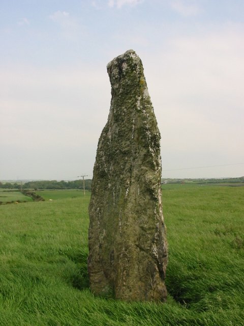
An impressive tall stone near Bodewryd, in a field full of dodgy sheep.

A real strange looking stone, small compared to Angleseys other standing stones. It stands on top of a steep roadside verge behind a hedge and can be tricky to spot........worth hunting out.

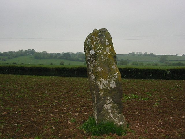
Large stone easily spotted from the B5109 Pentreath-Llangefni road.
A little way along the A5025 out of Menai Bridge. Turn right at the first crossroads, parking tho’ is impossible on the road.

The remaining bank and ditch of a henge, a farm has been built on the rest....monstrous views into Snowdonia

When following the A4080 down from Llanfair PG instead of turning into the Plas Newydd estate car park (NT sign posted) take the turn just before it. This lets you get right up to the stones.

A short walk from the A4080 thru long grass, follow the hedgerow down to these 2 amazing stones. Thought to be the remains of a large stone circle.


05/02 These 2 big stones are on the approach to Carl Wark. Rampart in background.

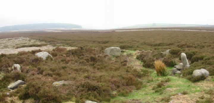


Easy access from the ‘Surprise View’ car park.
The stone marks the Mid-Winter full moon rise minimum when viewed from ‘Wet Withers’. Several books mention that fires may have been lit behind the stone to help with the alignment.